Ballantrae Bay

Bay in Ayrshire

Scotland

Ballantrae Bay

Ballantrae Spit Shingle spit at the mouth of River Stinchar with Downan Hill to South
Ballantrae Spit Credit: Mary and Angus Hogg

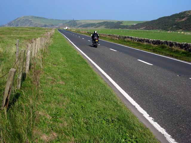
Ballantrae Bay is a picturesque coastal area located in Ayrshire, Scotland. Situated on the western coast of the country, it offers stunning views of the Irish Sea and is surrounded by rugged cliffs and rolling hills. The bay is known for its natural beauty and tranquility, making it a popular destination for tourists and locals alike.

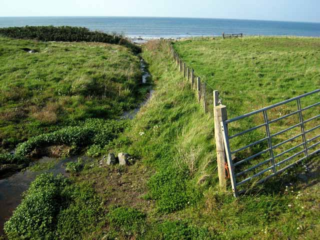
The bay itself is a sandy beach that stretches for approximately 2 miles, providing ample space for visitors to relax and enjoy the peaceful atmosphere. The sand is soft and golden, making it ideal for sunbathing or taking leisurely walks along the shore. The clear blue waters of the Irish Sea are perfect for swimming, and various water sports such as kayaking and paddleboarding are also popular in the area.

Ballantrae Bay is nestled within a designated Area of Outstanding Natural Beauty, offering breathtaking scenery and abundant wildlife. The surrounding cliffs are home to a variety of seabirds, including puffins, guillemots, and razorbills, making it a haven for birdwatchers. The bay is also known for its diverse marine life, with seals often spotted basking on nearby rocks.

Surrounding the bay are several walking trails and coastal paths, providing opportunities for hikers and nature enthusiasts to explore the area's natural wonders. The nearby villages of Ballantrae and Dunure offer amenities such as cafes, restaurants, and accommodations, ensuring visitors have everything they need for a comfortable stay.

In conclusion, Ballantrae Bay is a stunning coastal gem in Ayrshire, Scotland, offering a perfect blend of natural beauty, tranquility, and outdoor activities. Whether it's relaxing on the sandy beach, exploring the surrounding cliffs and wildlife, or simply enjoying the breathtaking views, this bay has something to offer for everyone.

If you have any feedback on the listing, please let us know in the comments section below.

Ballantrae Bay Images

Images are sourced within 2km of 55.107106/-5.0115347 or Grid Reference NX0783. Thanks to Geograph Open Source API. All images are credited.

Ballantrae Spit Shingle spit at the mouth of River Stinchar with Downan Hill to South
Ballantrae Spit
Shingle spit at the mouth of River Stinchar with Downan Hill to South
Kinnegar Beach Shingle beach and enclosed lagoon on the south side of the mouth of the River Stinchar. In the summer, this is an important breeding site for little terns.
Kinnegar Beach
Shingle beach and enclosed lagoon on the south side of the mouth of the River Stinchar. In the summer, this is an important breeding site for little terns.
Offshore rocks at Ballantrae A small outcrop of tidal rocks outside Ballantrae Harbour just falls into this square. The square also includes a small portion of shingle beach further south.
Offshore rocks at Ballantrae
A small outcrop of tidal rocks outside Ballantrae Harbour just falls into this square. The square also includes a small portion of shingle beach further south.
Bungalows at Garleffin
Getting ready for firework night, Ballantrae Beach A bonfire in construction on the shingle beach at Ballantrae.
Getting ready for firework night, Ballantrae Beach
A bonfire in construction on the shingle beach at Ballantrae.
Breakwater at Ballantrae This breakwater provides some shelter, but hardly qualifies as a harbour.
Breakwater at Ballantrae
This breakwater provides some shelter, but hardly qualifies as a harbour.
A77 north of Ballantrae This busy main road which carries the traffic from Central Scotland down to the Irish ferries at Cairnryan and Stranraer is a bit of a racetrack here where it crosses the raised beach just to the north of Ballantrae. Unfortunately, the position of this road next to the coast means that the whole fine 18 km length of coastline between Ballantrae and Girvan is effectively inaccessible to walkers and cyclists.
A77 north of Ballantrae
This busy main road which carries the traffic from Central Scotland down to the Irish ferries at Cairnryan and Stranraer is a bit of a racetrack here where it crosses the raised beach just to the north of Ballantrae. Unfortunately, the position of this road next to the coast means that the whole fine 18 km length of coastline between Ballantrae and Girvan is effectively inaccessible to walkers and cyclists.
A77 south of Ballantrae This busy main road carries the bulk of traffic from central Scotland to the Irish ferries at Cairnryan and Stranraer.
A77 south of Ballantrae
This busy main road carries the bulk of traffic from central Scotland to the Irish ferries at Cairnryan and Stranraer.
South Lodge, Laggan House A 2 km driveway runs up the Stinchar valley from here to Laggan House.
South Lodge, Laggan House
A 2 km driveway runs up the Stinchar valley from here to Laggan House.
Rocky shore at Ballantrae A few scraps of tidal rock on the seaward side of the breakwater at Ballantrae falls into this square.                                                                       Bennane Head <a href="https://www.geograph.org.uk/gridref/NX0986">NX0986</a> in the distance on the far side of Ballantrae Bay.
Rocky shore at Ballantrae
A few scraps of tidal rock on the seaward side of the breakwater at Ballantrae falls into this square. Bennane Head NX0986 in the distance on the far side of Ballantrae Bay.
Kinnegar, Garleffin
Kinnegar, Garleffin
Stream north of Ballantrae A narrow strip, one field wide and traversed by this stream, separates the A77 from the beach just north of Ballantrae.
Stream north of Ballantrae
A narrow strip, one field wide and traversed by this stream, separates the A77 from the beach just north of Ballantrae.
Laggan At the lower end of the Stinchar valley.
Laggan
At the lower end of the Stinchar valley.
Road out The hill in the distance has a wee cairn on top, road heads back to Ballantrae
Road out
The hill in the distance has a wee cairn on top, road heads back to Ballantrae
Remains of Sailing Ship Richard on shore N of Ballantrae All that is left of the Danish four masted Sailing Ship Richard III which was blown ashore in 1926. For further information contact photographer.
Remains of Sailing Ship Richard on shore N of Ballantrae
All that is left of the Danish four masted Sailing Ship Richard III which was blown ashore in 1926. For further information contact photographer.
Net covered remains of Sailing Ship Richard III Foundered on shore in 1926 on way back to Denmark from Ireland. Amount of wreck showing depends on the wind shifting the sand.For more information contact photographer.
Net covered remains of Sailing Ship Richard III
Foundered on shore in 1926 on way back to Denmark from Ireland. Amount of wreck showing depends on the wind shifting the sand.For more information contact photographer.
Flood in 1982 at Ballantrae The line of trees is on the normal river bank.
Flood in 1982 at Ballantrae
The line of trees is on the normal river bank.
High Tide meets flooded River Stinchar Heavy rainfall combined with high winds and tides caused severe problems around Christmas 1982 and early January 1983
High Tide meets flooded River Stinchar
Heavy rainfall combined with high winds and tides caused severe problems around Christmas 1982 and early January 1983
Show me another place!

Ballantrae Bay is located at Grid Ref: NX0783 (Lat: 55.107106, Lng: -5.0115347)

Unitary Authority: South Ayrshire

Police Authority: Ayrshire

What 3 Words

///oils.fidgeted.digress. Near Cairnryan, Dumfries & Galloway

Nearby Locations

Ballantrae Bay

Related Wikis

Ballantrae

Ballantrae is a community in Carrick, South Ayrshire, Scotland. The name probably comes from the Scottish Gaelic Baile na Tràgha, meaning the "town by...

Ballantrae Windmill

The Ballantrae Windmill, on Mill Hill was a late 17th or early 18th century vaulted tower windmill, the ruins of which are located above the old raised...

River Stinchar

The River Stinchar ( STIN-shər) is a river in South Ayrshire, Scotland. It flows south west from the Galloway Forest Park to enter the Firth of Clyde at...

Glenapp Castle

Glenapp Castle, formerly the family seat of the Earl of Inchcape, is now a luxury hotel and restaurant located about 1+1⁄2 miles (2.5 kilometres) southeast...

Nearby Amenities

Located within 500m of 55.107106,-5.0115347
Source: Landsat photo
Lat/Long: 55.1035668/-5.0092666
Source: Landsat photo
Lat/Long: 55.1041192/-5.0101893
Source: Landsat photo
Lat/Long: 55.1042297/-5.0099532
Source: Landsat photo
Lat/Long: 55.1044018/-5.008213
Source: Landsat photo
Lat/Long: 55.105168/-5.0065668
Source: Landsat photo
Lat/Long: 55.1059728/-5.0044601
Source: Landsat photo
Lat/Long: 55.1072125/-5.003709
Cafe
Trae Bakes
Opening Hours: Tu-Su 10:00-16:00
Lat/Long: 55.1041137/-5.0057852
The data included in this document is from www.openstreetmap.org. The data is made available under ODbL.

Have you been to Ballantrae Bay?

Leave your review of Ballantrae Bay below (or comments, questions and feedback).