Camas na Craoibhe Crotaich

Bay in Inverness-shire

Scotland

Camas na Craoibhe Crotaich

Clear-felled forestry above Inchree
Clear-felled forestry above Inchree Credit: Steven Brown

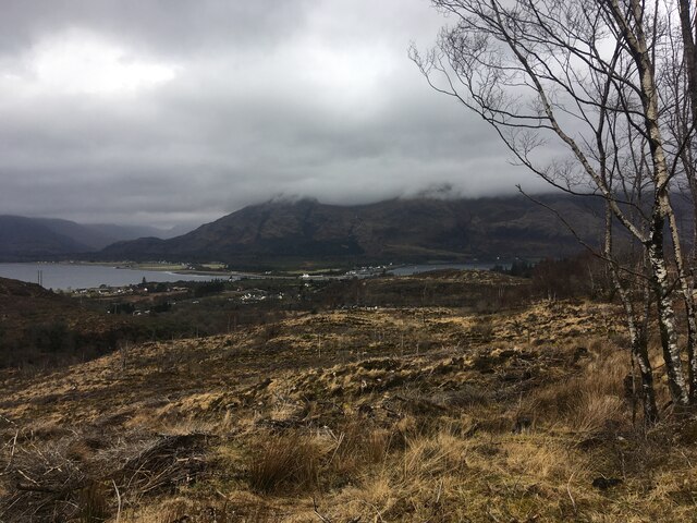
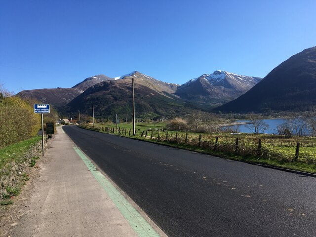
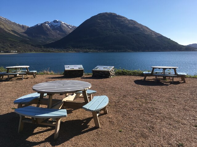
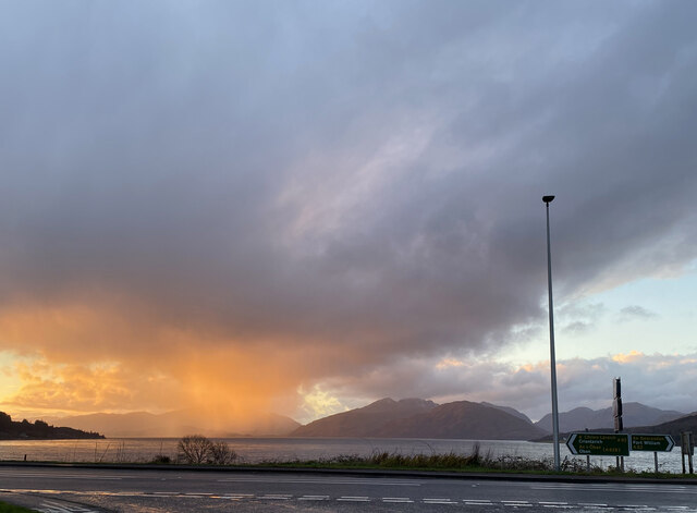
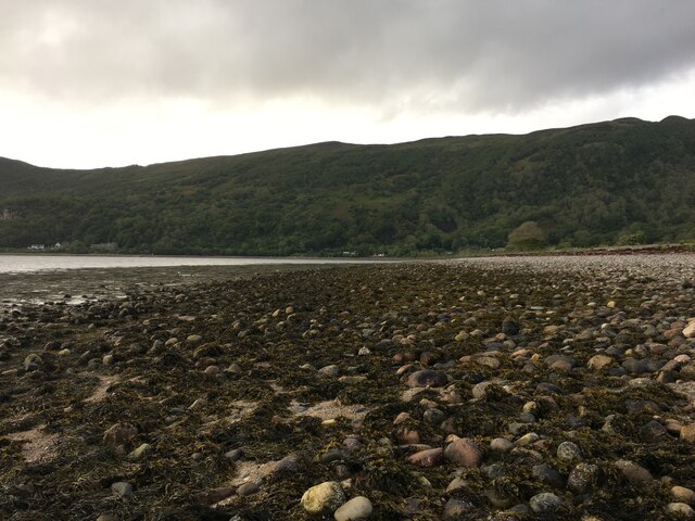
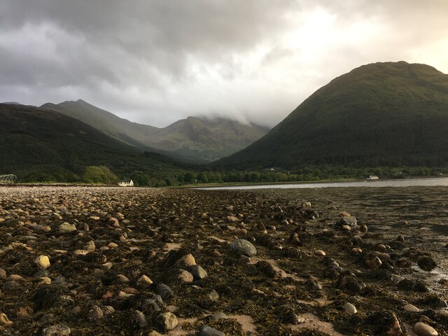
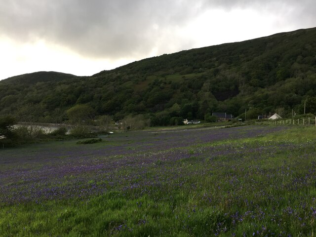
Camas na Craoibhe Crotaich is a picturesque bay located in Inverness-shire, Scotland. Nestled along the scenic west coast of Scotland, this bay offers breathtaking views of the surrounding landscape and a tranquil atmosphere for visitors to enjoy.

The bay is known for its pristine sandy beach, which stretches for approximately 3 kilometers. The beach is backed by rugged sand dunes and offers stunning vistas of the clear blue waters of the North Atlantic Ocean. It is a popular spot for beachcombing, sunbathing, and picnicking, attracting both locals and tourists alike.

Camas na Craoibhe Crotaich is also a haven for wildlife enthusiasts. The bay is home to a diverse range of bird species, including oystercatchers, curlews, and sandpipers. Visitors can often spot these birds along the shoreline, adding to the area's natural charm.

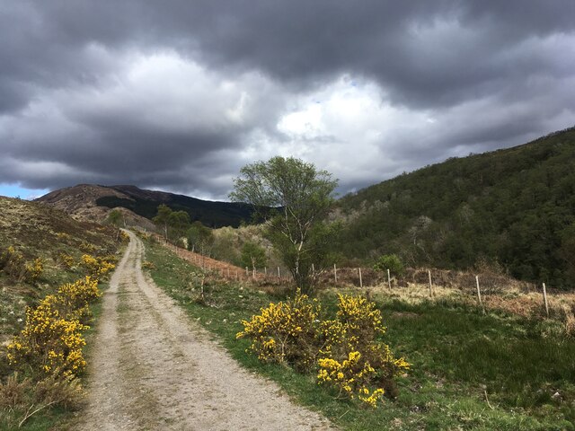
For those interested in history and archaeology, the bay is located near several ancient sites. Just a short walk from the beach, you will find the remains of a prehistoric settlement, which includes stone structures and burial cairns. Exploring these historic sites offers a glimpse into the lives of the people who once inhabited the area.

Overall, Camas na Craoibhe Crotaich is a hidden gem in Inverness-shire, providing visitors with a tranquil beach experience and an opportunity to connect with nature. Its stunning scenery, diverse wildlife, and historic significance make it a must-visit destination for anyone exploring the Scottish Highlands.

If you have any feedback on the listing, please let us know in the comments section below.

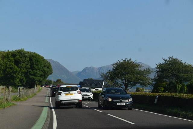
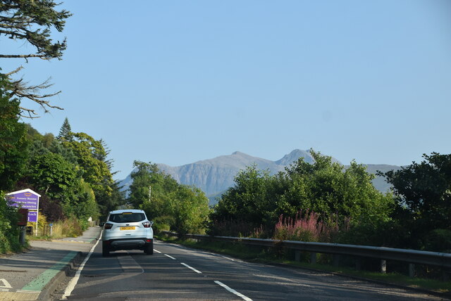
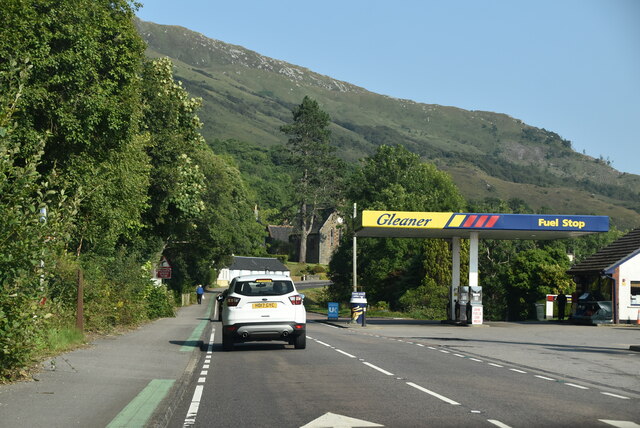
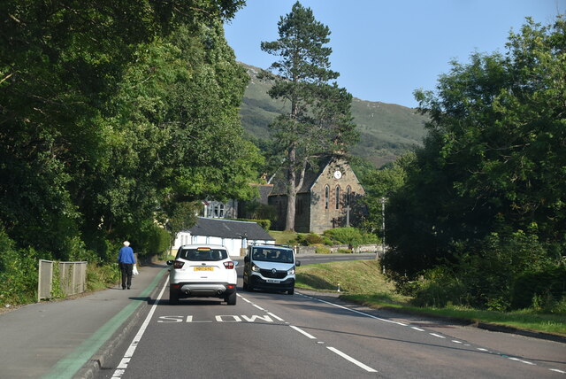
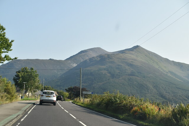
Camas na Craoibhe Crotaich Images

Images are sourced within 2km of 56.701853/-5.2064599 or Grid Reference NN0361. Thanks to Geograph Open Source API. All images are credited.

Clear-felled forestry above Inchree
Track junction above Inchree
A82, North Ballachulish
Picnic benches adjactent to Onich Filling Station
Track from Onich to Glen Righ
Road junction North Ballachulish
Shoreline at North Ballachulish
Bluebell laden fields, North Ballachulish
Entering Onich, A82 The A82 is a trunk road in Scotland. It is the principal route from Lowland Scotland to the western Scottish Highlands, running from Glasgow to Inverness, going by Loch Lomond, Glen Coe, Fort William and the Great Glen. It is 167 miles long.
<span class="nowrap"><a title="https://www.sabre-roads.org.uk/wiki/index.php?title=A82" rel="nofollow ugc noopener" href="https://www.sabre-roads.org.uk/wiki/index.php?title=A82">Link</a><img style="margin-left:2px;" alt="External link" title="External link - shift click to open in new window" src="https://s1.geograph.org.uk/img/external.png" width="10" height="10"/></span>
Entering Onich, A82
The A82 is a trunk road in Scotland. It is the principal route from Lowland Scotland to the western Scottish Highlands, running from Glasgow to Inverness, going by Loch Lomond, Glen Coe, Fort William and the Great Glen. It is 167 miles long. LinkExternal link
A82, southbound The A82 is a trunk road in Scotland. It is the principal route from Lowland Scotland to the western Scottish Highlands, running from Glasgow to Inverness, going by Loch Lomond, Glen Coe, Fort William and the Great Glen. It is 167 miles long.
<span class="nowrap"><a title="https://www.sabre-roads.org.uk/wiki/index.php?title=A82" rel="nofollow ugc noopener" href="https://www.sabre-roads.org.uk/wiki/index.php?title=A82">Link</a><img style="margin-left:2px;" alt="External link" title="External link - shift click to open in new window" src="https://s1.geograph.org.uk/img/external.png" width="10" height="10"/></span>
A82, southbound
The A82 is a trunk road in Scotland. It is the principal route from Lowland Scotland to the western Scottish Highlands, running from Glasgow to Inverness, going by Loch Lomond, Glen Coe, Fort William and the Great Glen. It is 167 miles long. LinkExternal link
A82, Onich The A82 is a trunk road in Scotland. It is the principal route from Lowland Scotland to the western Scottish Highlands, running from Glasgow to Inverness, going by Loch Lomond, Glen Coe, Fort William and the Great Glen. It is 167 miles long.
<span class="nowrap"><a title="https://www.sabre-roads.org.uk/wiki/index.php?title=A82" rel="nofollow ugc noopener" href="https://www.sabre-roads.org.uk/wiki/index.php?title=A82">Link</a><img style="margin-left:2px;" alt="External link" title="External link - shift click to open in new window" src="https://s1.geograph.org.uk/img/external.png" width="10" height="10"/></span>
A82, Onich
The A82 is a trunk road in Scotland. It is the principal route from Lowland Scotland to the western Scottish Highlands, running from Glasgow to Inverness, going by Loch Lomond, Glen Coe, Fort William and the Great Glen. It is 167 miles long. LinkExternal link
A82 The A82 is a trunk road in Scotland. It is the principal route from Lowland Scotland to the western Scottish Highlands, running from Glasgow to Inverness, going by Loch Lomond, Glen Coe, Fort William and the Great Glen. It is 167 miles long.
<span class="nowrap"><a title="https://www.sabre-roads.org.uk/wiki/index.php?title=A82" rel="nofollow ugc noopener" href="https://www.sabre-roads.org.uk/wiki/index.php?title=A82">Link</a><img style="margin-left:2px;" alt="External link" title="External link - shift click to open in new window" src="https://s1.geograph.org.uk/img/external.png" width="10" height="10"/></span>
A82
The A82 is a trunk road in Scotland. It is the principal route from Lowland Scotland to the western Scottish Highlands, running from Glasgow to Inverness, going by Loch Lomond, Glen Coe, Fort William and the Great Glen. It is 167 miles long. LinkExternal link
Nether Lochaber Village Hall The A82 is a trunk road in Scotland. It is the principal route from Lowland Scotland to the western Scottish Highlands, running from Glasgow to Inverness, going by Loch Lomond, Glen Coe, Fort William and the Great Glen. It is 167 miles long.
<span class="nowrap"><a title="https://www.sabre-roads.org.uk/wiki/index.php?title=A82" rel="nofollow ugc noopener" href="https://www.sabre-roads.org.uk/wiki/index.php?title=A82">Link</a><img style="margin-left:2px;" alt="External link" title="External link - shift click to open in new window" src="https://s1.geograph.org.uk/img/external.png" width="10" height="10"/></span>
Nether Lochaber Village Hall
The A82 is a trunk road in Scotland. It is the principal route from Lowland Scotland to the western Scottish Highlands, running from Glasgow to Inverness, going by Loch Lomond, Glen Coe, Fort William and the Great Glen. It is 167 miles long. LinkExternal link
A82 The A82 is a trunk road in Scotland. It is the principal route from Lowland Scotland to the western Scottish Highlands, running from Glasgow to Inverness, going by Loch Lomond, Glen Coe, Fort William and the Great Glen. It is 167 miles long.
<span class="nowrap"><a title="https://www.sabre-roads.org.uk/wiki/index.php?title=A82" rel="nofollow ugc noopener" href="https://www.sabre-roads.org.uk/wiki/index.php?title=A82">Link</a><img style="margin-left:2px;" alt="External link" title="External link - shift click to open in new window" src="https://s1.geograph.org.uk/img/external.png" width="10" height="10"/></span>
A82
The A82 is a trunk road in Scotland. It is the principal route from Lowland Scotland to the western Scottish Highlands, running from Glasgow to Inverness, going by Loch Lomond, Glen Coe, Fort William and the Great Glen. It is 167 miles long. LinkExternal link
A82, Onich Services The A82 is a trunk road in Scotland. It is the principal route from Lowland Scotland to the western Scottish Highlands, running from Glasgow to Inverness, going by Loch Lomond, Glen Coe, Fort William and the Great Glen. It is 167 miles long.
<span class="nowrap"><a title="https://www.sabre-roads.org.uk/wiki/index.php?title=A82" rel="nofollow ugc noopener" href="https://www.sabre-roads.org.uk/wiki/index.php?title=A82">Link</a><img style="margin-left:2px;" alt="External link" title="External link - shift click to open in new window" src="https://s1.geograph.org.uk/img/external.png" width="10" height="10"/></span>
A82, Onich Services
The A82 is a trunk road in Scotland. It is the principal route from Lowland Scotland to the western Scottish Highlands, running from Glasgow to Inverness, going by Loch Lomond, Glen Coe, Fort William and the Great Glen. It is 167 miles long. LinkExternal link
A82 The A82 is a trunk road in Scotland. It is the principal route from Lowland Scotland to the western Scottish Highlands, running from Glasgow to Inverness, going by Loch Lomond, Glen Coe, Fort William and the Great Glen. It is 167 miles long.
<span class="nowrap"><a title="https://www.sabre-roads.org.uk/wiki/index.php?title=A82" rel="nofollow ugc noopener" href="https://www.sabre-roads.org.uk/wiki/index.php?title=A82">Link</a><img style="margin-left:2px;" alt="External link" title="External link - shift click to open in new window" src="https://s1.geograph.org.uk/img/external.png" width="10" height="10"/></span>
A82
The A82 is a trunk road in Scotland. It is the principal route from Lowland Scotland to the western Scottish Highlands, running from Glasgow to Inverness, going by Loch Lomond, Glen Coe, Fort William and the Great Glen. It is 167 miles long. LinkExternal link
A82, North Ballachulish The A82 is a trunk road in Scotland. It is the principal route from Lowland Scotland to the western Scottish Highlands, running from Glasgow to Inverness, going by Loch Lomond, Glen Coe, Fort William and the Great Glen. It is 167 miles long.
<span class="nowrap"><a title="https://www.sabre-roads.org.uk/wiki/index.php?title=A82" rel="nofollow ugc noopener" href="https://www.sabre-roads.org.uk/wiki/index.php?title=A82">Link</a><img style="margin-left:2px;" alt="External link" title="External link - shift click to open in new window" src="https://s1.geograph.org.uk/img/external.png" width="10" height="10"/></span>
A82, North Ballachulish
The A82 is a trunk road in Scotland. It is the principal route from Lowland Scotland to the western Scottish Highlands, running from Glasgow to Inverness, going by Loch Lomond, Glen Coe, Fort William and the Great Glen. It is 167 miles long. LinkExternal link
Show me another place!

Camas na Craoibhe Crotaich is located at Grid Ref: NN0361 (Lat: 56.701853, Lng: -5.2064599)

Unitary Authority: Highland

Police Authority: Highlands and Islands

What 3 Words

///nesting.elevate.conqueror. Near Glencoe, Highland

Related Wikis

Onich

Onich (; Gaelic: Omhanaich, 'abounding in froth, frothy place'), also spelled Ounich, is a village in the historic county of Inverness-shire on the east...

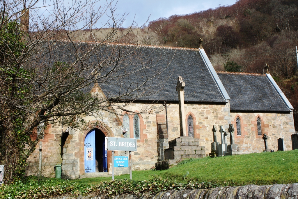
St Bride's Church, Onich

St Bride's Church (alternatively, Saint Brigid of Kildare Church) is an Episcopal parish church in North Ballachulish in the Scottish Highlands, within...

Nether Lochaber

Nether Lochaber ( NEDH-ər lokh-AH-bər) in Lochaber, Highland, Scotland, is the modern (1950s) name for the Parish of Ballachulish and Onich. This Parish...

Ballachulish House

Ballachulish House is a restaurant located in Ballachulish, Highland, Scotland. As of 2008, the restaurant holds one star in the Michelin Guide. ��2�...

Ballachulish Ferry railway station

Ballachulish Ferry was a railway station on the south shore at the narrows of Loch Leven at South Ballachulish in Highland region, Scotland. It was on...

Glenachulish

Glenachulish (Scottish Gaelic: Gleann a' Chaolais: valley of the narrows; pronounced Glen – ah – hoolish) is a hamlet and glen which lie close to the village...

Inchree

Inchree (Scottish Gaelic: Innis an Ruighe) is a small hamlet, situated at the northern end of the village of Onich. It is 7 miles south of the town of...

Corran Ferry

The Corran Ferry crosses Loch Linnhe at the Corran Narrows, south of Fort William, Scotland. == Description == Operated by Highland Council, the Corran...

Nearby Amenities

Located within 500m of 56.701853,-5.2064599
Source: PGS
Lat/Long: 56.7019126/-5.2142824
Source: PGS
Lat/Long: 56.7019735/-5.2125785
Source: PGS
Lat/Long: 56.7020221/-5.2112719
Source: PGS
Lat/Long: 56.7018165/-5.2082778
Source: PGS
Lat/Long: 56.7019085/-5.2078702
Source: PGS
Lat/Long: 56.7020704/-5.207367
Source: PGS
Lat/Long: 56.7021969/-5.2066349
Source: PGS
Lat/Long: 56.7021339/-5.2056764
Source: PGS
Lat/Long: 56.7018114/-5.2046152
Source: PGS
Lat/Long: 56.7016689/-5.2033607
Source: PGS
Lat/Long: 56.7014054/-5.2023902
Source: PGS
Lat/Long: 56.7012259/-5.2014825
Source: PGS
Lat/Long: 56.7010834/-5.2005752
Source: PGS
Lat/Long: 56.700643/-5.1993515
Bus Stop
Lodge on the Loch
Naptan AtcoCode: 670010029
Naptan Bearing: W
Naptan CommonName: Lodge on the Loch
Naptan Indicator: opp Lodge on the Loch
Naptan Landmark: Lodge on the Loch
Naptan NaptanCode: 45323867
Naptan PlusbusZoneRef: FRTWLM
Naptan Street: A82
Naptan Verified: no
Shelter: no
Source: naptan_import
Lat/Long: 56.7014192/-5.2019459
Power: pole
Source: Bing
Lat/Long: 56.703785/-5.2057243
Power: pole
Source: Bing
Lat/Long: 56.7036353/-5.2036711
Power: pole
Source: Bing
Lat/Long: 56.7041099/-5.2099375
Power: pole
Source: Bing
Lat/Long: 56.7042365/-5.2116377
Power: pole
Source: Bing
Lat/Long: 56.7034381/-5.2011226
Source: OS_OpenData_StreetView
Tourism: hotel
Lat/Long: 56.7013837/-5.199478
Source: OS_OpenData_StreetView
Tourism: hotel
Lat/Long: 56.702049/-5.2023369
Power: pole
Source: Bing
Lat/Long: 56.7033227/-5.1997643
Power: pole
Source: Bing
Lat/Long: 56.7038409/-5.2065747
Power: pole
Source: Bing
Lat/Long: 56.7039413/-5.2078378
Post Box
Lat/Long: 56.7014239/-5.2013076
The data included in this document is from www.openstreetmap.org. The data is made available under ODbL.

Have you been to Camas na Craoibhe Crotaich?

Leave your review of Camas na Craoibhe Crotaich below (or comments, questions and feedback).