Camas na Làirich

Bay in Inverness-shire

Scotland

Camas na Làirich

Clear-felled forestry above Inchree
Clear-felled forestry above Inchree Credit: Steven Brown

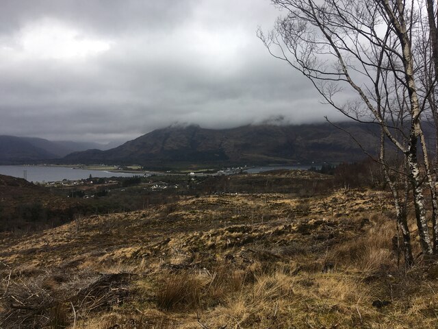
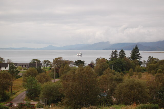
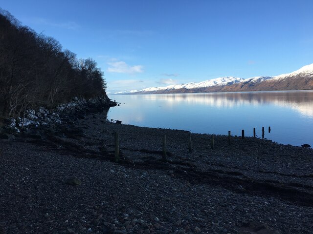
Camas na Làirich, located in Inverness-shire, Scotland, is a picturesque bay renowned for its natural beauty and historical significance. Situated on the western coast of Scotland, this bay offers stunning views of the surrounding rugged landscape and the vast Atlantic Ocean.

The bay is characterized by its pristine sandy beach, which stretches for approximately one kilometer. The beach is backed by rolling sand dunes and grassy areas, providing a serene and tranquil atmosphere for visitors. The clear, turquoise waters of the bay are perfect for swimming, kayaking, and other water activities.

Camas na Làirich holds great historical importance in the region. It is believed to have been a Viking port in ancient times, and remnants of their presence can still be found in the area. The bay was also a popular spot for smugglers during the 18th and 19th centuries.

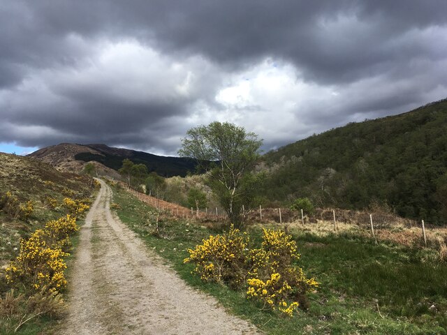
Nature enthusiasts will be captivated by the diverse flora and fauna that call Camas na Làirich home. The bay is surrounded by heather-covered hills and is a haven for birdwatchers, as it attracts a variety of seabirds and waders.

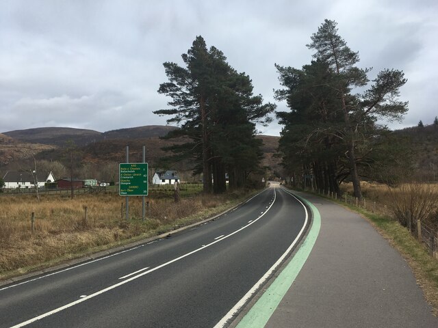
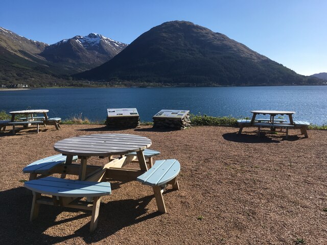
Visitors to Camas na Làirich can take advantage of the nearby facilities, including parking, picnic areas, and public toilets. The bay is easily accessible by car, with a short walk from the parking area to the beach.

Overall, Camas na Làirich offers a perfect blend of natural beauty, historical significance, and recreational opportunities, making it a must-visit destination for anyone exploring Inverness-shire.

If you have any feedback on the listing, please let us know in the comments section below.

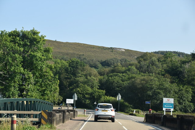
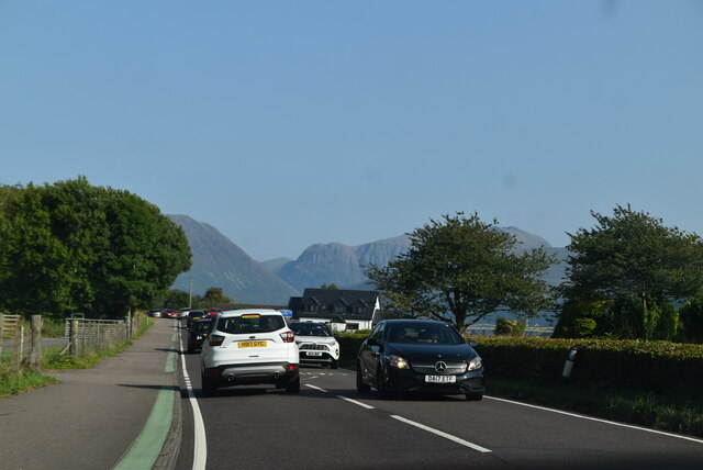
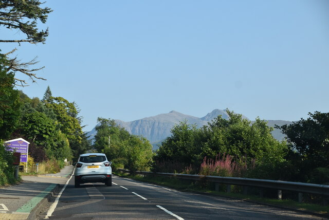
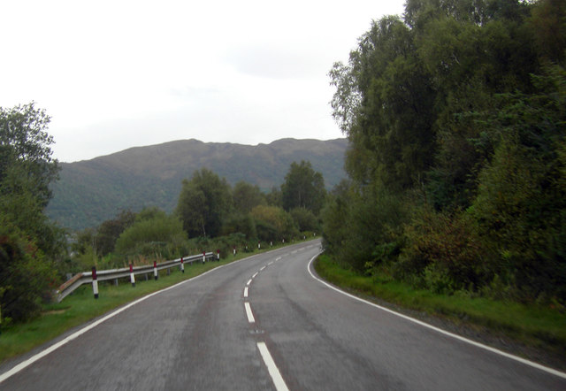
Camas na Làirich Images

Images are sourced within 2km of 56.701919/-5.2188845 or Grid Reference NN0361. Thanks to Geograph Open Source API. All images are credited.

Clear-felled forestry above Inchree
Track junction above Inchree
A82 with no traffic Photo taken during the initial Covid pandemic lockdown.
A82 with no traffic
Photo taken during the initial Covid pandemic lockdown.
Picnic benches adjactent to Onich Filling Station
Track from Onich to Glen Righ
Loch Linnhe from Inchree Looking from Inchree over Bunree towards Loch Linnhe.
Loch Linnhe from Inchree
Looking from Inchree over Bunree towards Loch Linnhe.
Shoreline of Loch Linnhe at Bunree
Track and shed near Onich
A82, southbound The A82 is a trunk road in Scotland. It is the principal route from Lowland Scotland to the western Scottish Highlands, running from Glasgow to Inverness, going by Loch Lomond, Glen Coe, Fort William and the Great Glen. It is 167 miles long.
<span class="nowrap"><a title="https://www.sabre-roads.org.uk/wiki/index.php?title=A82" rel="nofollow ugc noopener" href="https://www.sabre-roads.org.uk/wiki/index.php?title=A82">Link</a><img style="margin-left:2px;" alt="External link" title="External link - shift click to open in new window" src="https://s1.geograph.org.uk/img/external.png" width="10" height="10"/></span>
A82, southbound
The A82 is a trunk road in Scotland. It is the principal route from Lowland Scotland to the western Scottish Highlands, running from Glasgow to Inverness, going by Loch Lomond, Glen Coe, Fort William and the Great Glen. It is 167 miles long. LinkExternal link
A82, Bunree The A82 is a trunk road in Scotland. It is the principal route from Lowland Scotland to the western Scottish Highlands, running from Glasgow to Inverness, going by Loch Lomond, Glen Coe, Fort William and the Great Glen. It is 167 miles long.
<span class="nowrap"><a title="https://www.sabre-roads.org.uk/wiki/index.php?title=A82" rel="nofollow ugc noopener" href="https://www.sabre-roads.org.uk/wiki/index.php?title=A82">Link</a><img style="margin-left:2px;" alt="External link" title="External link - shift click to open in new window" src="https://s1.geograph.org.uk/img/external.png" width="10" height="10"/></span>
A82, Bunree
The A82 is a trunk road in Scotland. It is the principal route from Lowland Scotland to the western Scottish Highlands, running from Glasgow to Inverness, going by Loch Lomond, Glen Coe, Fort William and the Great Glen. It is 167 miles long. LinkExternal link
Entering Onich, A82 The A82 is a trunk road in Scotland. It is the principal route from Lowland Scotland to the western Scottish Highlands, running from Glasgow to Inverness, going by Loch Lomond, Glen Coe, Fort William and the Great Glen. It is 167 miles long.
<span class="nowrap"><a title="https://www.sabre-roads.org.uk/wiki/index.php?title=A82" rel="nofollow ugc noopener" href="https://www.sabre-roads.org.uk/wiki/index.php?title=A82">Link</a><img style="margin-left:2px;" alt="External link" title="External link - shift click to open in new window" src="https://s1.geograph.org.uk/img/external.png" width="10" height="10"/></span>
Entering Onich, A82
The A82 is a trunk road in Scotland. It is the principal route from Lowland Scotland to the western Scottish Highlands, running from Glasgow to Inverness, going by Loch Lomond, Glen Coe, Fort William and the Great Glen. It is 167 miles long. LinkExternal link
A82, southbound The A82 is a trunk road in Scotland. It is the principal route from Lowland Scotland to the western Scottish Highlands, running from Glasgow to Inverness, going by Loch Lomond, Glen Coe, Fort William and the Great Glen. It is 167 miles long.
<span class="nowrap"><a title="https://www.sabre-roads.org.uk/wiki/index.php?title=A82" rel="nofollow ugc noopener" href="https://www.sabre-roads.org.uk/wiki/index.php?title=A82">Link</a><img style="margin-left:2px;" alt="External link" title="External link - shift click to open in new window" src="https://s1.geograph.org.uk/img/external.png" width="10" height="10"/></span>
A82, southbound
The A82 is a trunk road in Scotland. It is the principal route from Lowland Scotland to the western Scottish Highlands, running from Glasgow to Inverness, going by Loch Lomond, Glen Coe, Fort William and the Great Glen. It is 167 miles long. LinkExternal link
A82, Onich The A82 is a trunk road in Scotland. It is the principal route from Lowland Scotland to the western Scottish Highlands, running from Glasgow to Inverness, going by Loch Lomond, Glen Coe, Fort William and the Great Glen. It is 167 miles long.
<span class="nowrap"><a title="https://www.sabre-roads.org.uk/wiki/index.php?title=A82" rel="nofollow ugc noopener" href="https://www.sabre-roads.org.uk/wiki/index.php?title=A82">Link</a><img style="margin-left:2px;" alt="External link" title="External link - shift click to open in new window" src="https://s1.geograph.org.uk/img/external.png" width="10" height="10"/></span>
A82, Onich
The A82 is a trunk road in Scotland. It is the principal route from Lowland Scotland to the western Scottish Highlands, running from Glasgow to Inverness, going by Loch Lomond, Glen Coe, Fort William and the Great Glen. It is 167 miles long. LinkExternal link
A82 The A82 is a trunk road in Scotland. It is the principal route from Lowland Scotland to the western Scottish Highlands, running from Glasgow to Inverness, going by Loch Lomond, Glen Coe, Fort William and the Great Glen. It is 167 miles long.
<span class="nowrap"><a title="https://www.sabre-roads.org.uk/wiki/index.php?title=A82" rel="nofollow ugc noopener" href="https://www.sabre-roads.org.uk/wiki/index.php?title=A82">Link</a><img style="margin-left:2px;" alt="External link" title="External link - shift click to open in new window" src="https://s1.geograph.org.uk/img/external.png" width="10" height="10"/></span>
A82
The A82 is a trunk road in Scotland. It is the principal route from Lowland Scotland to the western Scottish Highlands, running from Glasgow to Inverness, going by Loch Lomond, Glen Coe, Fort William and the Great Glen. It is 167 miles long. LinkExternal link
Nether Lochaber Village Hall The A82 is a trunk road in Scotland. It is the principal route from Lowland Scotland to the western Scottish Highlands, running from Glasgow to Inverness, going by Loch Lomond, Glen Coe, Fort William and the Great Glen. It is 167 miles long.
<span class="nowrap"><a title="https://www.sabre-roads.org.uk/wiki/index.php?title=A82" rel="nofollow ugc noopener" href="https://www.sabre-roads.org.uk/wiki/index.php?title=A82">Link</a><img style="margin-left:2px;" alt="External link" title="External link - shift click to open in new window" src="https://s1.geograph.org.uk/img/external.png" width="10" height="10"/></span>
Nether Lochaber Village Hall
The A82 is a trunk road in Scotland. It is the principal route from Lowland Scotland to the western Scottish Highlands, running from Glasgow to Inverness, going by Loch Lomond, Glen Coe, Fort William and the Great Glen. It is 167 miles long. LinkExternal link
A82 The A82 is a trunk road in Scotland. It is the principal route from Lowland Scotland to the western Scottish Highlands, running from Glasgow to Inverness, going by Loch Lomond, Glen Coe, Fort William and the Great Glen. It is 167 miles long.
<span class="nowrap"><a title="https://www.sabre-roads.org.uk/wiki/index.php?title=A82" rel="nofollow ugc noopener" href="https://www.sabre-roads.org.uk/wiki/index.php?title=A82">Link</a><img style="margin-left:2px;" alt="External link" title="External link - shift click to open in new window" src="https://s1.geograph.org.uk/img/external.png" width="10" height="10"/></span>
A82
The A82 is a trunk road in Scotland. It is the principal route from Lowland Scotland to the western Scottish Highlands, running from Glasgow to Inverness, going by Loch Lomond, Glen Coe, Fort William and the Great Glen. It is 167 miles long. LinkExternal link
A828 heading towards Ballachulish
A828 by Ardno House
A828 by Ardno House
Show me another place!

Camas na Làirich is located at Grid Ref: NN0361 (Lat: 56.701919, Lng: -5.2188845)

Unitary Authority: Highland

Police Authority: Highlands and Islands

What 3 Words

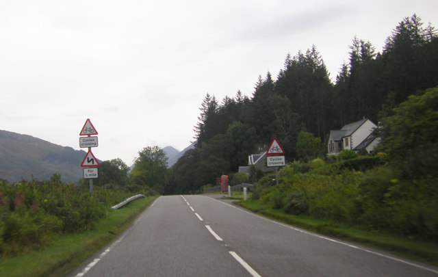
///befitting.card.submit. Near Glencoe, Highland

Related Wikis

Onich

Onich (; Gaelic: Omhanaich, 'abounding in froth, frothy place'), also spelled Ounich, is a village in the historic county of Inverness-shire on the east...

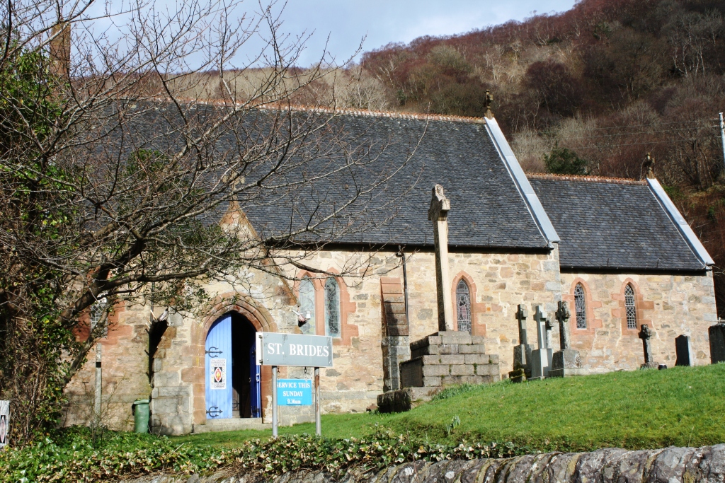
St Bride's Church, Onich

St Bride's Church (alternatively, Saint Brigid of Kildare Church) is an Episcopal parish church in North Ballachulish in the Scottish Highlands, within...

Nether Lochaber

Nether Lochaber ( NEDH-ər lokh-AH-bər) in Lochaber, Highland, Scotland, is the modern (1950s) name for the Parish of Ballachulish and Onich. This Parish...

Loch Linnhe

Loch Linnhe ( lokh LIN-ee) is a sea loch on the west coast of Scotland. The part upstream of Corran is known in Gaelic as An Linne Dhubh (the black pool...

Corran Ferry

The Corran Ferry crosses Loch Linnhe at the Corran Narrows, south of Fort William, Scotland. == Description == Operated by Highland Council, the Corran...

Ballachulish House

Ballachulish House is a restaurant located in Ballachulish, Highland, Scotland. As of 2008, the restaurant holds one star in the Michelin Guide. ��2�...

Inchree

Inchree (Scottish Gaelic: Innis an Ruighe) is a small hamlet, situated at the northern end of the village of Onich. It is 7 miles south of the town of...

Glenachulish

Glenachulish (Scottish Gaelic: Gleann a' Chaolais: valley of the narrows; pronounced Glen – ah – hoolish) is a hamlet and glen which lie close to the village...

Nearby Amenities

Located within 500m of 56.701919,-5.2188845
Source: PGS
Lat/Long: 56.7010118/-5.2263719
Source: PGS
Lat/Long: 56.7008499/-5.2248175
Source: PGS
Lat/Long: 56.7007832/-5.2242358
Source: PGS
Lat/Long: 56.7007057/-5.2236152
Source: PGS
Lat/Long: 56.7008933/-5.2228354
Source: PGS
Lat/Long: 56.7009974/-5.2224871
Source: PGS
Lat/Long: 56.7011077/-5.2220876
Source: PGS
Lat/Long: 56.7013385/-5.2220541
Source: PGS
Lat/Long: 56.7016697/-5.2213997
Source: PGS
Lat/Long: 56.7021304/-5.2210038
Source: PGS
Lat/Long: 56.7027362/-5.2196318
Source: PGS
Lat/Long: 56.702702/-5.2190285
Source: PGS
Lat/Long: 56.7026779/-5.2182125
Source: PGS
Lat/Long: 56.7026016/-5.2178913
Source: PGS
Lat/Long: 56.7023055/-5.217177
Source: PGS
Lat/Long: 56.7017286/-5.2160218
Source: PGS
Lat/Long: 56.7019126/-5.2142824
Source: PGS
Lat/Long: 56.7019735/-5.2125785
Source: PGS
Lat/Long: 56.7020221/-5.2112719
Onich
Name Gd: Omhanaich
Place: village
Population: 122
Wikidata: Q7093884
Wikipedia: en:Onich
Lat/Long: 56.7031482/-5.222812
Check Date: 2022-10-20
Disused Shop: convenience
Old Name: Onich Stores
Lat/Long: 56.7032641/-5.2210891
Post Box
Post Box Mounting: telegraph_pole
Post Box Type: lamp
Ref: PH33 72
Source: survey
Lat/Long: 56.7031103/-5.2208766
Telephone
Booth: KX100
Covered: booth
Operator: BT
Source: survey
Lat/Long: 56.7031003/-5.2208815
Bus Stop
Onich
Naptan AtcoCode: 670010028
Naptan Bearing: N
Naptan CommonName: Onich
Naptan Indicator: opp Post Office
Naptan Landmark: Post Office
Naptan NaptanCode: 45323869
Naptan PlusbusZoneRef: FRTWLM
Naptan Street: A82
Naptan Verified: no
Shelter: yes
Source: naptan_import
Lat/Long: 56.7029949/-5.2209896
Bus Stop
Onich
Naptan AtcoCode: 670086297
Naptan Bearing: S
Naptan CommonName: Onich
Naptan Indicator: o/s Post Office Southbound
Naptan Landmark: Post Office
Naptan NaptanCode: 45323868
Naptan PlusbusZoneRef: FRTWLM
Naptan Street: A82
Naptan Verified: no
Shelter: yes
Source: naptan_import
Lat/Long: 56.7029768/-5.220083
Power: pole
Lat/Long: 56.7040961/-5.2203916
Power: pole
Lat/Long: 56.7039991/-5.222922
Power: pole
Lat/Long: 56.7039414/-5.2246803
Power: pole
Lat/Long: 56.7041725/-5.2189632
Power: pole
Lat/Long: 56.7042913/-5.2158962
Power: pole
Source: Bing
Lat/Long: 56.7043902/-5.2136527
Lag nam Morag
Place: locality
Lat/Long: 56.7059611/-5.2189963
Onich Hotel
Addr Postcode: PH33 6RY
Source: OS_OpenData_StreetView
Tourism: hotel
Lat/Long: 56.7025381/-5.2159518
Camus House
Tourism: apartment
Lat/Long: 56.7030661/-5.2188354
Power: pole
Lat/Long: 56.7031443/-5.2250203
Power: pole
Lat/Long: 56.7035677/-5.224807
Power: pole
Lat/Long: 56.7036376/-5.2226499
Power: pole
Lat/Long: 56.7041265/-5.2185775
Power: pole
Lat/Long: 56.7036558/-5.2173365
Power: pole
Lat/Long: 56.7032787/-5.2164086
Defibrillator
Access: yes
Booth: K6
Covered: booth
Defibrillator Location: inside red phone box on front of building in Onich
Emergency: defibrillator
Man Made: telephone_box
Ref GB The Circuit: 1E1EED9B-53B2-4EB3-9B47-AAE100AD3C75
Lat/Long: 56.7031725/-5.2207787
Clach-a-charra
Historic: stone
Lat/Long: 56.7016864/-5.2262667
Bench
Lat/Long: 56.7030496/-5.2204799
Natural: spring
Lat/Long: 56.7031792/-5.2148825
The data included in this document is from www.openstreetmap.org. The data is made available under ODbL.

Have you been to Camas na Làirich?

Leave your review of Camas na Làirich below (or comments, questions and feedback).