Inverscaddle Bay
Bay in Argyllshire
Scotland
Inverscaddle Bay

Inverscaddle Bay is a picturesque bay located in Argyllshire, Scotland. Nestled along the western coast of the country, this bay offers breathtaking views of the surrounding landscape and a tranquil atmosphere for visitors to enjoy.
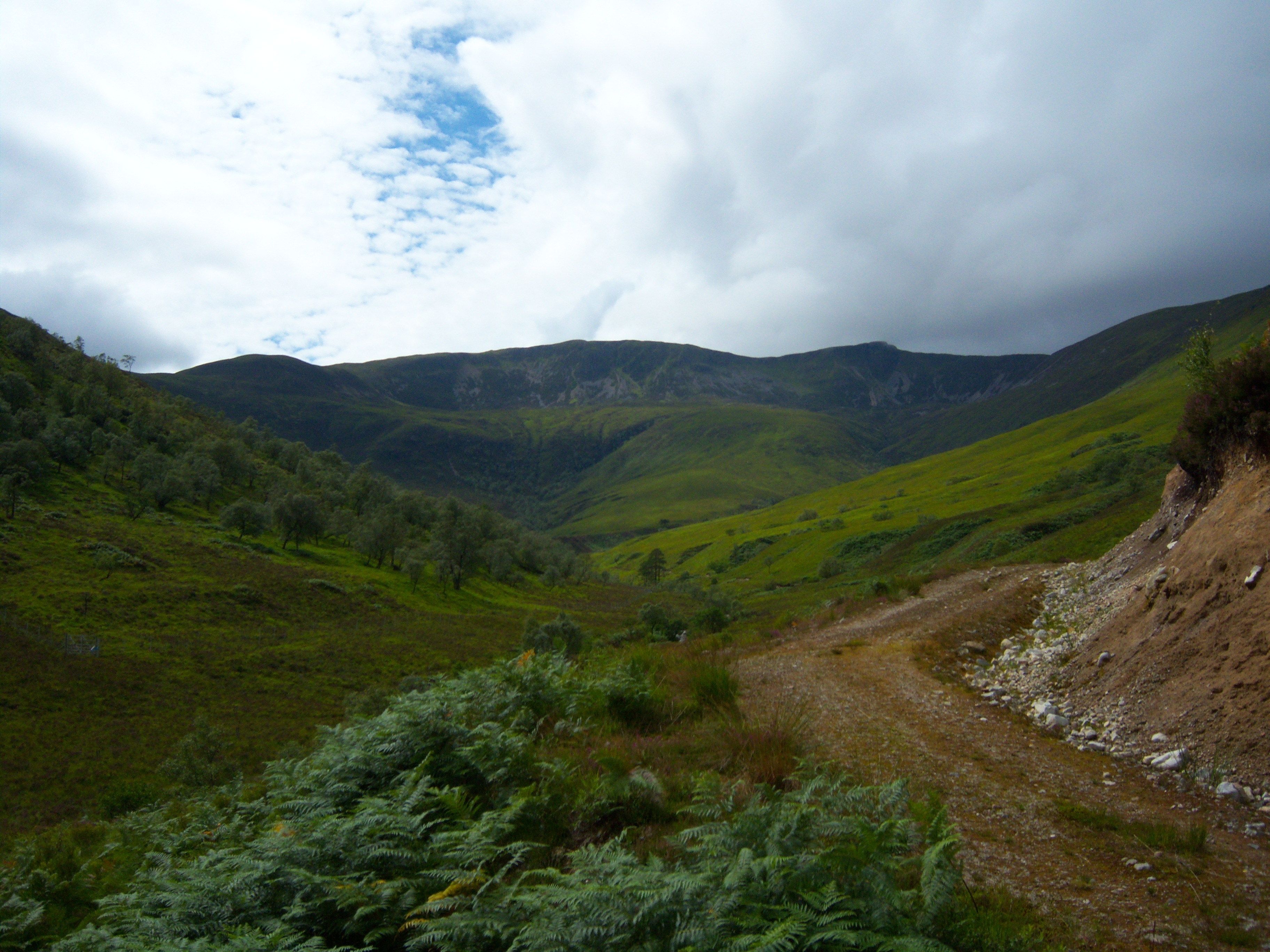
The bay is characterized by its pristine sandy beach, which stretches for approximately one mile and provides a perfect spot for leisurely walks or picnics. The crystal-clear waters of the bay are ideal for swimming, kayaking, or other water activities, attracting both locals and tourists seeking a refreshing dip or aquatic adventures.
Surrounded by rolling green hills and rugged cliffs, Inverscaddle Bay offers a stunning backdrop for nature enthusiasts. The bay is home to a diverse range of wildlife, including seabirds, seals, and occasionally even dolphins, making it a popular destination for birdwatchers and wildlife photographers.
Inverscaddle Bay is also known for its rich history and cultural heritage. The nearby village of Inverscaddle boasts a few charming cottages and historic buildings, giving visitors a glimpse into the region's past. Additionally, the bay is situated close to several archaeological sites, such as ancient standing stones and burial mounds, adding to its historical significance.
For those seeking a tranquil escape from the bustling cities, Inverscaddle Bay offers a serene and idyllic retreat. Whether it's enjoying the beauty of the bay, exploring the surrounding nature, or delving into the local history, visitors to Inverscaddle Bay are sure to be captivated by its natural splendor and cultural allure.
If you have any feedback on the listing, please let us know in the comments section below.
Inverscaddle Bay Images
Images are sourced within 2km of 56.763996/-5.2276701 or Grid Reference NN0268. Thanks to Geograph Open Source API. All images are credited.


Inverscaddle Bay is located at Grid Ref: NN0268 (Lat: 56.763996, Lng: -5.2276701)
Unitary Authority: Highland
Police Authority: Highlands and Islands
What 3 Words
///templates.lyricist.language. Near Fort William, Highland
Nearby Locations
Related Wikis

Inchree
Inchree (Scottish Gaelic: Innis an Ruighe) is a small hamlet, situated at the northern end of the village of Onich. It is 7 miles south of the town of...

Beinn na Gucaig
Beinn na Gucaig (616 m) is a mountain in the Grampian Mountains of Scotland, located south of Fort William in Lochaber. The peak takes up much of the eastern...
Stob Coire a' Chearcaill
Stob Coire a' Chearcaill (771 m) is a mountain in the Northwest Highlands, Scotland. It lies west of Loch Linnhe in Lochaber. The peak is a familiar sight...

Corran, Lochaber
Corran (Scottish Gaelic: An Corran) is a former fishing village, situated on Corran Point, on the west side of the Corran Narrows of Loch Linnhe, in Lochaber...

Corran Ferry
The Corran Ferry crosses Loch Linnhe at the Corran Narrows, south of Fort William, Scotland. == Description == Operated by Highland Council, the Corran...
Druimarben
Druimarben (Scottish Gaelic: Druim Earbainn) is a hamlet on the east shore of Loch Linnhe in Inverness-shire, Scottish Highlands and is in the Scottish...
Stronchreggan
Stronchreggan (Scottish Gaelic: Sròn a' Chritheagain) is a scattered coastal hamlet, on the north eastern shores of Loch Linnhe, and is situated directly...

Onich
Onich (; Gaelic: Omhanaich, 'abounding in froth, frothy place'), also spelled Ounich, is a village in the historic county of Inverness-shire on the east...
Nearby Amenities
Located within 500m of 56.763996,-5.2276701Have you been to Inverscaddle Bay?
Leave your review of Inverscaddle Bay below (or comments, questions and feedback).