Poll a' Phloid

Bay in Inverness-shire

Scotland

Poll a' Phloid

Loch Linnhe and shoreline from the picnic site
Loch Linnhe and shoreline from the picnic site Credit: Steven Brown

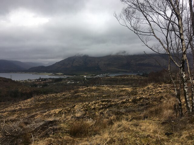
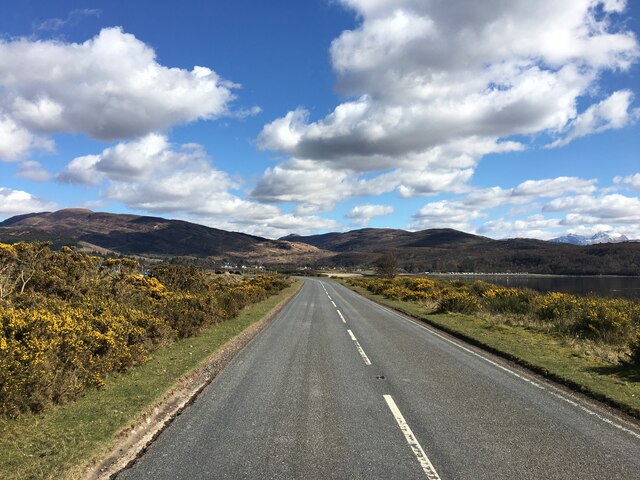
Poll a' Phloid is a picturesque bay located in Inverness-shire, Scotland. Situated on the country's west coast, the bay is surrounded by stunning natural beauty and offers visitors a peaceful and serene atmosphere.

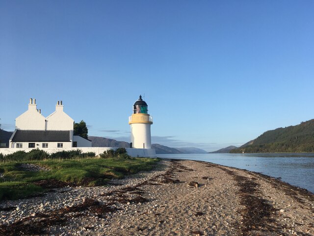
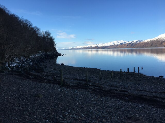
The bay is characterized by its pristine sandy beach, which stretches along the coastline for approximately half a mile. The beach is backed by rolling sand dunes, providing a natural barrier and adding to the bay's charm. The crystal-clear waters of the bay are perfect for swimming, and visitors can enjoy a refreshing dip or simply relax on the beach while taking in the breathtaking views.

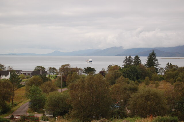
Surrounded by lush greenery and rugged cliffs, Poll a' Phloid is a haven for nature lovers. The bay is home to a diverse range of plant and animal species, making it an ideal spot for wildlife enthusiasts and birdwatchers. Visitors may catch a glimpse of seals, otters, and a variety of seabirds, such as gannets and puffins.

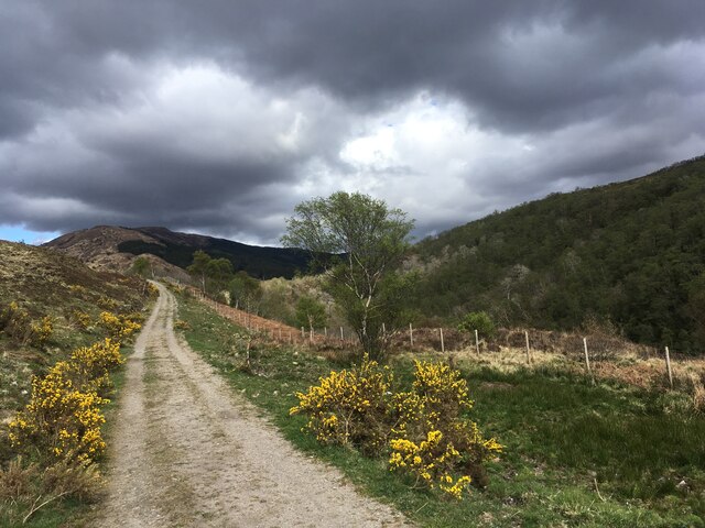
For those interested in outdoor activities, Poll a' Phloid offers ample opportunities for walking and hiking. The bay is located within close proximity to several scenic trails, including the famous West Highland Way. These trails allow visitors to explore the surrounding countryside, taking in panoramic views of the bay and its surroundings.

Poll a' Phloid is a hidden gem in Inverness-shire, offering visitors a chance to escape the hustle and bustle of city life and immerse themselves in the beauty of Scotland's west coast. Whether it's a relaxing day at the beach, wildlife spotting, or exploring the nearby trails, this bay has something to offer for everyone.

If you have any feedback on the listing, please let us know in the comments section below.

Poll a' Phloid Images

Images are sourced within 2km of 56.725779/-5.2326817 or Grid Reference NN0264. Thanks to Geograph Open Source API. All images are credited.

Loch Linnhe and shoreline from the picnic site
Clear-felled forestry above Inchree
Snow covered path near Inchree
Clear-felled forestry, Inchree
Track junction above Inchree
A82 with no traffic Photo taken during the initial Covid pandemic lockdown.
A82 with no traffic
Photo taken during the initial Covid pandemic lockdown.
Track from Onich to Glen Righ
Quarry in the forestry near Inchree
Corran Lighthouse and shoreline at Corran Narrows
Loch Linnhe from Inchree Looking from Inchree over Bunree towards Loch Linnhe.
Loch Linnhe from Inchree
Looking from Inchree over Bunree towards Loch Linnhe.
Forestry road and evidence of harvesting, Inchree
Old water tank, Corran
Shoreline of Loch Linnhe at Bunree
Corran Ferry at Ardgour
A861 past Clovullin
A861 past Clovullin
New house by the ferry queue, Nether Lochaber There has been a lot of development here in the past few years.
New house by the ferry queue, Nether Lochaber
There has been a lot of development here in the past few years.
A861, Corran The long way round, just north of the ferry pier.
A861, Corran
The long way round, just north of the ferry pier.
Ronja Harvester in Loch Linnhe A fish carrier serving the fish farming industry. It appears to operate out of Mallaig.
Ronja Harvester in Loch Linnhe
A fish carrier serving the fish farming industry. It appears to operate out of Mallaig.
Show me another place!

Poll a' Phloid is located at Grid Ref: NN0264 (Lat: 56.725779, Lng: -5.2326817)

Unitary Authority: Highland

Police Authority: Highlands and Islands

What 3 Words

///neater.eclipses.wishes. Near Glencoe, Highland

Related Wikis

Inchree

Inchree (Scottish Gaelic: Innis an Ruighe) is a small hamlet, situated at the northern end of the village of Onich. It is 7 miles south of the town of...
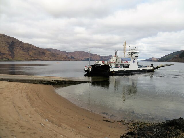
Corran Ferry

The Corran Ferry crosses Loch Linnhe at the Corran Narrows, south of Fort William, Scotland. == Description == Operated by Highland Council, the Corran...

Corran, Lochaber

Corran (Scottish Gaelic: An Corran) is a former fishing village, situated on Corran Point, on the west side of the Corran Narrows of Loch Linnhe, in Lochaber...

Onich

Onich (; Gaelic: Omhanaich, 'abounding in froth, frothy place'), also spelled Ounich, is a village in the historic county of Inverness-shire on the east...
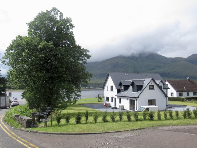
Loch Linnhe

Loch Linnhe ( lokh LIN-ee) is a sea loch on the west coast of Scotland. The part upstream of Corran is known in Gaelic as An Linne Dhubh (the black pool...

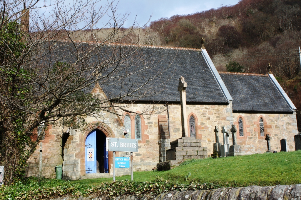
St Bride's Church, Onich

St Bride's Church (alternatively, Saint Brigid of Kildare Church) is an Episcopal parish church in North Ballachulish in the Scottish Highlands, within...

Beinn na Gucaig

Beinn na Gucaig (616 m) is a mountain in the Grampian Mountains of Scotland, located south of Fort William in Lochaber. The peak takes up much of the eastern...

Nether Lochaber

Nether Lochaber ( NEDH-ər lokh-AH-bər) in Lochaber, Highland, Scotland, is the modern (1950s) name for the Parish of Ballachulish and Onich. This Parish...

Nearby Amenities

Located within 500m of 56.725779,-5.2326817
Source: PGS
Lat/Long: 56.729583/-5.2287458
Source: PGS
Lat/Long: 56.729459/-5.2290236
Source: PGS
Lat/Long: 56.7292034/-5.2293153
Source: PGS
Lat/Long: 56.7287465/-5.2295869
Source: PGS
Lat/Long: 56.7283741/-5.2300411
Source: PGS
Lat/Long: 56.7279472/-5.2305838
Source: PGS
Lat/Long: 56.7276331/-5.2309457
Source: PGS
Lat/Long: 56.7270216/-5.2316531
Source: PGS
Lat/Long: 56.7267616/-5.2317632
Source: PGS
Lat/Long: 56.7263472/-5.2318823
Source: PGS
Lat/Long: 56.7261553/-5.2318047
Source: PGS
Lat/Long: 56.7255114/-5.232347
Created By: dmgroom_coastlines
Source: PGS
Lat/Long: 56.725209/-5.232611
Source: PGS
Lat/Long: 56.7248977/-5.2330498
Source: PGS
Lat/Long: 56.7247048/-5.232788
Source: PGS
Lat/Long: 56.7243819/-5.2332047
Source: PGS
Lat/Long: 56.7242716/-5.233256
Source: PGS
Lat/Long: 56.7235672/-5.2335819
Source: PGS
Lat/Long: 56.7231564/-5.2337966
Source: PGS
Lat/Long: 56.7225688/-5.2339468
Source: PGS
Lat/Long: 56.72229/-5.2344846
Source: PGS
Lat/Long: 56.7219803/-5.2351085
Source: PGS
Lat/Long: 56.7218223/-5.2352228
Bus Stop
Slipway
Bus: yes
Local Ref: AT
Naptan AtcoCode: 6700713267
Naptan Bearing: E
Naptan CommonName: Slipway
Naptan Indicator: at
Naptan Landmark: Corran Ferry
Naptan NaptanCode: 45325269
Naptan Street: Ferry Slipway
Public Transport: platform
Shelter: yes
Source: naptan_import
Lat/Long: 56.7214274/-5.2346715
Gobhlan Illeach
Place: locality
Lat/Long: 56.7290561/-5.2301515
An Dulan
Place: locality
Lat/Long: 56.7233784/-5.2344466
Sgeir Chomnard
Place: locality
Lat/Long: 56.723959/-5.2346489
Telephone
Booth: KX100
Covered: booth
Source: survey
Lat/Long: 56.7222178/-5.2325146
Seamark Light Character: Fl
Seamark Light Colour: white
Seamark Light Height: 4
Seamark Light Period: 5
Seamark Light Range: 4
Seamark Light Reference: A 4133
Seamark Light Sequence: 0.5+(4.5)
Seamark Type: light_minor
Source: US NGA Pub. 114. 2011-05-26.
Lat/Long: 56.7269/-5.2315667
Power: pole
Lat/Long: 56.7262285/-5.2314189
Power: pole
Lat/Long: 56.7232684/-5.2281967
Power: pole
Lat/Long: 56.7225398/-5.2277031
Ferry Terminal
Corran Ferry
Ferry: yes
Phone: +44 1855 841243
Public Transport: station
Website: https://www.highland.gov.uk/homepage/62/corran_ferry
Lat/Long: 56.7214329/-5.2348018
The data included in this document is from www.openstreetmap.org. The data is made available under ODbL.

Have you been to Poll a' Phloid?

Leave your review of Poll a' Phloid below (or comments, questions and feedback).