Port Isaac Bay
Bay in Cornwall
England
Port Isaac Bay

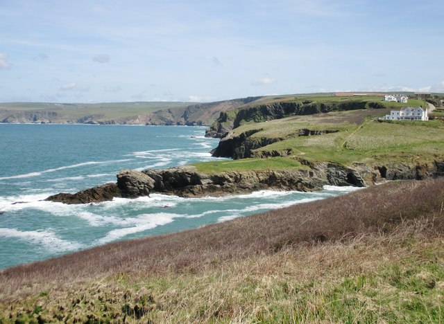
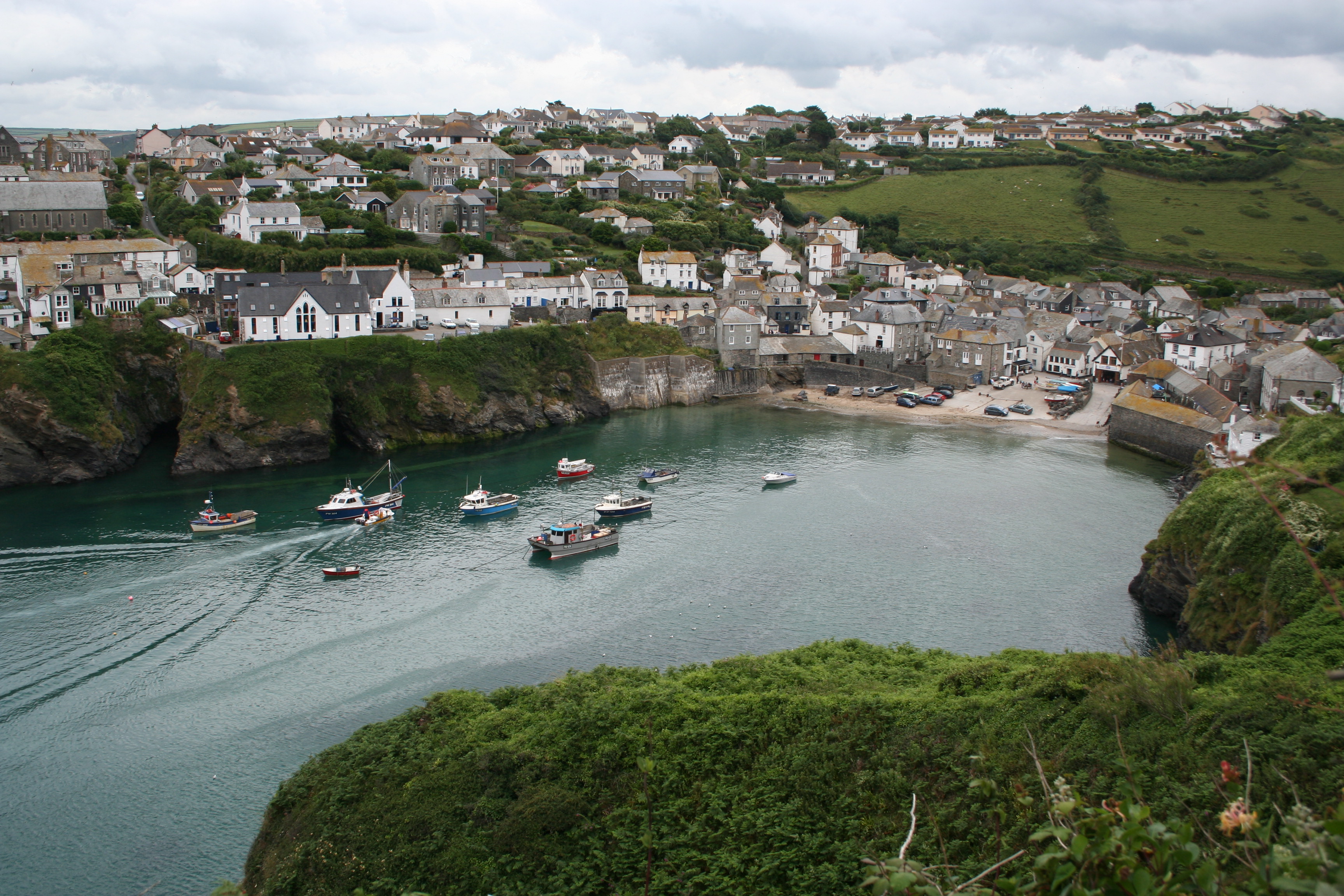
Port Isaac Bay, located in the picturesque county of Cornwall on the southwestern coast of England, is a small yet enchanting bay renowned for its natural beauty and charming fishing village. Nestled between towering cliffs and rolling green hills, the bay offers visitors a tranquil and idyllic setting.
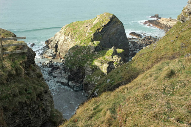
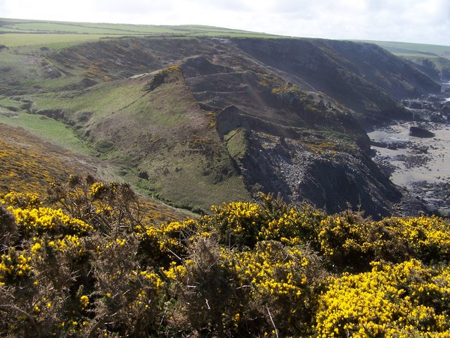
The bay itself is a horseshoe-shaped inlet, with crystal-clear turquoise waters that gently lap against a sandy shoreline. The beach is relatively small but boasts a pristine and unspoiled beauty, perfect for relaxing walks or sunbathing. During low tide, the bay reveals hidden rock pools teeming with marine life, providing a fascinating opportunity for exploration.
Port Isaac, the village that lends its name to the bay, is a picturesque fishing village that exudes charm and character. Its narrow, winding streets are lined with whitewashed cottages, many of which date back to the 18th century. The village is famous for being the filming location of the popular television series "Doc Martin," adding to its allure.
Visitors to Port Isaac Bay can indulge in a range of activities, from exploring the village's quaint shops and art galleries to enjoying fresh seafood at one of the local restaurants. For those seeking adventure, the bay offers excellent opportunities for fishing, kayaking, and paddleboarding.
With its breathtaking coastal scenery and a rich maritime heritage, Port Isaac Bay is a must-visit destination for nature lovers and those seeking a true taste of Cornwall's coastal charm.
If you have any feedback on the listing, please let us know in the comments section below.
Port Isaac Bay Images
Images are sourced within 2km of 50.610564/-4.8050858 or Grid Reference SX0182. Thanks to Geograph Open Source API. All images are credited.


Port Isaac Bay is located at Grid Ref: SX0182 (Lat: 50.610564, Lng: -4.8050858)
Unitary Authority: Cornwall
Police Authority: Devon and Cornwall
What 3 Words
///establish.self.furniture. Near Delabole, Cornwall
Nearby Locations
Related Wikis
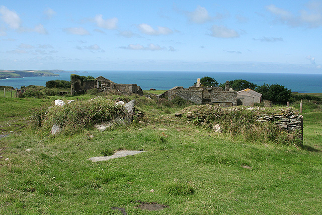
Dannonchapel
Dannonchapel is a ruined farm in Cornwall, England. It is about two miles southwest of Delabole. Dannonchapel was a farm in Domesday Book (1086) occupied...

Port Gaverne
Port Gaverne is a hamlet on the north coast of Cornwall, England, UK, about 0.5 miles (0.80 km) east of Port Isaac and part of St Endellion parish. Although...

Restaurant Nathan Outlaw
Restaurant Nathan Outlaw is a two Michelin star restaurant owned and operated by Nathan Outlaw. It has previously been located in Marina Villa Hotel in...
Tregardock and Treligga
Tregardock (Cornish: Tregaradek, meaning homestead of Caradoc) is a coastal hamlet and beach in the civil parish of Delabole in north Cornwall, England...
Port Isaac
Port Isaac (Cornish: Porthysek) is a small fishing village on the Atlantic coast of north Cornwall, England, in the United Kingdom. The nearest towns are...
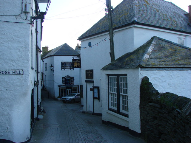
Golden Lion, Port Isaac
The Golden Lion is a public house on Fore Street in the English fishing village of Port Isaac, Cornwall. Believed to date from at least the early 19th...

Fern Cottage
Fern Cottage is a Grade II listed building in the English village of Port Isaac, Cornwall. Situated on the south side of the harbour, its address is 4...
Trewetha
Trewetha is a hamlet in the parish of St Endellion, Cornwall, England, United Kingdom. There was a mine at Trewetha known as Wheal Boys. == References ==
Have you been to Port Isaac Bay?
Leave your review of Port Isaac Bay below (or comments, questions and feedback).