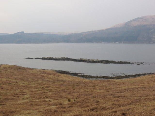
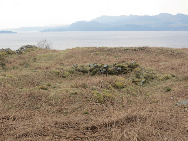
Crarae Bay

Bay in Argyllshire

Scotland

Crarae Bay

Crarae Garden Run by the National Trust for Scotland.
Crarae Garden Credit: Andrew Abbott

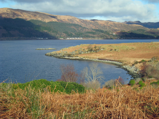
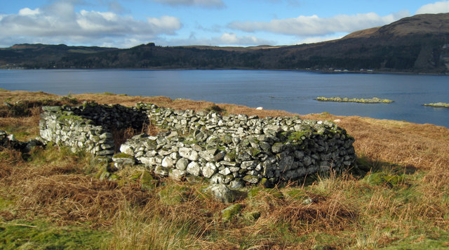
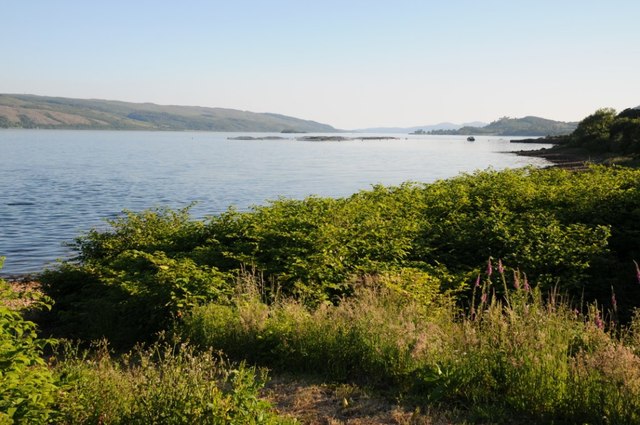
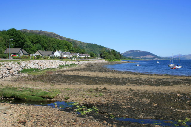
Crarae Bay is a picturesque bay located in Argyllshire, Scotland. Nestled on the west coast of the country, it offers stunning views of the surrounding landscape and the sparkling waters of the bay itself. The bay is situated near the village of Inveraray and is easily accessible by road.

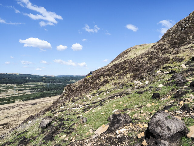
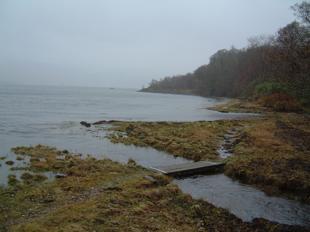
The bay is known for its natural beauty and tranquility. It is surrounded by lush greenery, with rolling hills and dense forests providing a stunning backdrop. The bay itself is a haven for wildlife, attracting a variety of bird species and marine life. Visitors can often spot seals, otters, and a variety of seabirds in the area.

One of the main attractions of Crarae Bay is the Crarae Gardens, which are located on its shores. These magnificent gardens were created in the 20th century and feature a wide variety of exotic plants from around the world. The gardens are renowned for their rhododendrons, azaleas, and magnolias, which create a riot of color during the spring and summer months.

Crarae Bay also offers opportunities for outdoor activities. There are several walking trails in the area, including the Crarae Gardens Woodland Walk, which takes visitors through the forest and offers breathtaking views of the bay. Fishing is also popular in the bay, with anglers trying their luck at catching salmon and trout.

Overall, Crarae Bay is a hidden gem in Argyllshire, offering a perfect blend of natural beauty, wildlife, and recreational opportunities. Whether one is looking for a peaceful retreat or an outdoor adventure, this bay has something to offer for everyone.

If you have any feedback on the listing, please let us know in the comments section below.

Crarae Bay Images

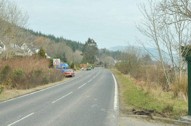
Images are sourced within 2km of 56.128356/-5.2340396 or Grid Reference NR9997. Thanks to Geograph Open Source API. All images are credited.

Crarae Garden Run by the National Trust for Scotland.
Crarae Garden
Run by the National Trust for Scotland.
A83 near Crarae
A83 near Crarae
Detached bungalows at Minard Properties at the north-west side of the A83 having a view beyond the road across Loch Fyne.
Detached bungalows at Minard
Properties at the north-west side of the A83 having a view beyond the road across Loch Fyne.
Stony beach with trickling stream The beach at Minard with the Alltan Tosdach crossing in the foreground.
Beinn Ghlas is the sunlit mountain above the village.
Stony beach with trickling stream
The beach at Minard with the Alltan Tosdach crossing in the foreground. Beinn Ghlas is the sunlit mountain above the village.
Rough ground within enclosure beside hill road The enclosure is bounded by a rickety-looking wall.
The hill rising beyond is Beinn Ghlas.
Rough ground within enclosure beside hill road
The enclosure is bounded by a rickety-looking wall. The hill rising beyond is Beinn Ghlas.
Slump in vicinity of Cnoc na Craoibh-fearna Cnoc na Craoibh-fearna translates from Gaelic as Oak Tree Hill and refers to part of the southern slope of Beinn Ghlas.
The small slump at the centre of the image is a mass of peat and vegetation that has ruptured from the slope above where stony ground is now exposed; it appears to have been a recent event. Another, rather larger slump was discovered elsewhere on Beinn Ghlas.
Slump in vicinity of Cnoc na Craoibh-fearna
Cnoc na Craoibh-fearna translates from Gaelic as Oak Tree Hill and refers to part of the southern slope of Beinn Ghlas. The small slump at the centre of the image is a mass of peat and vegetation that has ruptured from the slope above where stony ground is now exposed; it appears to have been a recent event. Another, rather larger slump was discovered elsewhere on Beinn Ghlas.
Peat banks close to summit of Beinn Ghlas Peat banks just south-east of the trig point on Beinn Ghlas.
The distant view is to mountains beyond Loch Fyne with Beinn Bheula at the centre. The peaks to the left of that include those of the 'Arrochar Alps'.
Peat banks close to summit of Beinn Ghlas
Peat banks just south-east of the trig point on Beinn Ghlas. The distant view is to mountains beyond Loch Fyne with Beinn Bheula at the centre. The peaks to the left of that include those of the 'Arrochar Alps'.
Landslip debris on steep hill face Boulders, stones and peat blocks are strewn over a wide area having swept down the steep west face of Beinn Ghlas from a relatively small slump above. A hill walker traversing the slope can be seen at the centre of the image.
Another, much more contained slip was seen on the same day on the south face of the hill - <a title="https://www.geograph.org.uk/photo/7465348" href="https://www.geograph.org.uk/photo/7465348">Link</a> .
Landslip debris on steep hill face
Boulders, stones and peat blocks are strewn over a wide area having swept down the steep west face of Beinn Ghlas from a relatively small slump above. A hill walker traversing the slope can be seen at the centre of the image. Another, much more contained slip was seen on the same day on the south face of the hill - Link .
Kilbride Island, Loch Fyne
Remains of sheiling Looking past Kilbride Island towards Crarae on the far shore
Remains of sheiling
Looking past Kilbride Island towards Crarae on the far shore
A83 at Blackstone Bay
Blackstone Bay Blackstone Bay, part of Loch Fyne near Sandhole, south of Furnace.
Blackstone Bay
Blackstone Bay, part of Loch Fyne near Sandhole, south of Furnace.
Houses on the A83 Houses overlooking the A83 near Sandhole south of Furnace.
Houses on the A83
Houses overlooking the A83 near Sandhole south of Furnace.
A83 past Blackstone Bay
Public phonebox beside the A83
Kilbride Island Loch Fyne
Remains of Kilbride Chapel
Wall down to the shore of Loch Fyne
Show me another place!

Crarae Bay is located at Grid Ref: NR9997 (Lat: 56.128356, Lng: -5.2340396)

Unitary Authority: Argyll and Bute

Police Authority: Argyll and West Dunbartonshire

What 3 Words

///screening.preparing.jumpy. Near Inveraray, Argyll & Bute

Nearby Locations

Crarae Bay

Related Wikis

Crarae

Crarae is a settlement in Argyll and Bute, Scotland, on the shore of Loch Fyne. It lies on the A83, north of Lochgilphead. The location is known for the...

Minard, Argyll

Minard is a remote village on the western shore of Loch Fyne, situated between Inveraray and Lochgilphead. Minard is 13+1⁄2 miles (21.7 km) southwest of...

Achagoyle Bay

Achagoyle Bay is coastal embayment, on a chord of 0.75 miles, on a 114° orientation, on the western coast of the longest sea loch in Scotland, Loch Fyne...

Crarae Reservoir

The Crarae Reservoir is located 2.5 kilometres north west of the village of Crarae, on the west side of Loch Fyne. The concrete dam is 13.7 metres high...

Nearby Amenities

Located within 500m of 56.128356,-5.2340396
Source: PGS
Lat/Long: 56.1242767/-5.2369996
Source: PGS
Lat/Long: 56.1244778/-5.2368794
Created By: dmgroom_coastlines
Source: PGS
Lat/Long: 56.126556/-5.237005
Created By: dmgroom_coastlines
Source: PGS
Lat/Long: 56.127068/-5.237035
Created By: dmgroom_coastlines
Source: PGS
Lat/Long: 56.127844/-5.236621
Created By: dmgroom_coastlines
Source: PGS
Lat/Long: 56.128364/-5.236193
Created By: dmgroom_coastlines
Source: PGS
Lat/Long: 56.128496/-5.235971
Created By: dmgroom_coastlines
Source: PGS
Lat/Long: 56.128777/-5.234611
Created By: dmgroom_coastlines
Source: PGS
Lat/Long: 56.128909/-5.23439
Created By: dmgroom_coastlines
Source: PGS
Lat/Long: 56.129041/-5.234168
Created By: dmgroom_coastlines
Source: PGS
Lat/Long: 56.129173/-5.233947
Created By: dmgroom_coastlines
Source: PGS
Lat/Long: 56.129305/-5.233724
Created By: dmgroom_coastlines
Source: PGS
Lat/Long: 56.129586/-5.232365
Created By: dmgroom_coastlines
Source: PGS
Lat/Long: 56.129718/-5.232144
Created By: dmgroom_coastlines
Source: PGS
Lat/Long: 56.12985/-5.231921
Created By: dmgroom_coastlines
Source: PGS
Lat/Long: 56.130122/-5.23102
Created By: dmgroom_coastlines
Source: PGS
Lat/Long: 56.130267/-5.230111
Created By: dmgroom_coastlines
Source: PGS
Lat/Long: 56.130783/-5.229912
Created By: dmgroom_coastlines
Source: PGS
Lat/Long: 56.130915/-5.22969
Created By: dmgroom_coastlines
Source: PGS
Lat/Long: 56.131047/-5.229469
Created By: dmgroom_coastlines
Source: PGS
Lat/Long: 56.131179/-5.229247
Created By: dmgroom_coastlines
Source: PGS
Lat/Long: 56.131311/-5.229026
Locality: Crarae
Source: OS_OpenData_StreetView
Lat/Long: 56.1273273/-5.2389778
The data included in this document is from www.openstreetmap.org. The data is made available under ODbL.

Have you been to Crarae Bay?

Leave your review of Crarae Bay below (or comments, questions and feedback).