Achagoyle Bay

Bay in Argyllshire

Scotland

Achagoyle Bay

Crarae Garden Run by the National Trust for Scotland.
Crarae Garden Credit: Andrew Abbott

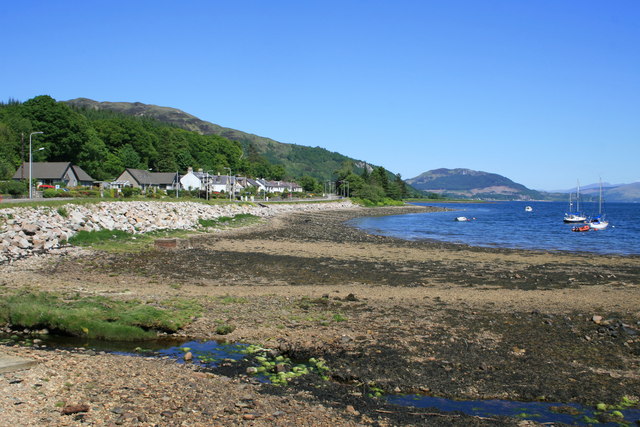
Achagoyle Bay is a picturesque bay located in the region of Argyllshire, Scotland. Nestled along the western coast of Scotland, this bay is renowned for its stunning natural beauty and tranquil atmosphere. It is situated within close proximity to the village of Glendaruel and is easily accessible by road.

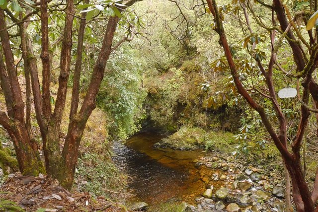
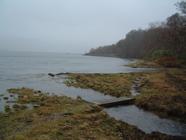
The bay is characterized by its pristine sandy beaches, crystal-clear waters, and surrounding lush green hills. It offers breathtaking panoramic views of the surrounding landscape, with rolling hills and dense forests providing a captivating backdrop. The bay is also home to a diverse range of flora and fauna, making it an ideal spot for nature lovers and wildlife enthusiasts.

Achagoyle Bay is a popular destination for outdoor activities such as swimming, kayaking, and fishing. The calm waters of the bay make it perfect for water sports enthusiasts of all levels. Fishing enthusiasts can also enjoy angling for a variety of fish species, including mackerel and sea trout.

The bay is also a haven for birdwatchers, as it attracts a wide variety of bird species throughout the year. Visitors can spot birds such as herons, oystercatchers, and even the elusive golden eagle in the surrounding areas.

Achagoyle Bay offers a serene and tranquil environment, away from the hustle and bustle of city life. Its natural beauty and diverse range of activities make it a must-visit destination for those seeking a peaceful retreat in the heart of Argyllshire, Scotland.

If you have any feedback on the listing, please let us know in the comments section below.

Achagoyle Bay Images

Images are sourced within 2km of 56.115013/-5.2515847 or Grid Reference NR9796. Thanks to Geograph Open Source API. All images are credited.

Crarae Garden Run by the National Trust for Scotland.
Crarae Garden
Run by the National Trust for Scotland.
A83 approaching Minard
A83 near Minard
A83 near Minard
Detached bungalows at Minard Properties at the north-west side of the A83 having a view beyond the road across Loch Fyne.
Detached bungalows at Minard
Properties at the north-west side of the A83 having a view beyond the road across Loch Fyne.
Stony beach with trickling stream The beach at Minard with the Alltan Tosdach crossing in the foreground.
Beinn Ghlas is the sunlit mountain above the village.
Stony beach with trickling stream
The beach at Minard with the Alltan Tosdach crossing in the foreground. Beinn Ghlas is the sunlit mountain above the village.
Rough ground within enclosure beside hill road The enclosure is bounded by a rickety-looking wall.
The hill rising beyond is Beinn Ghlas.
Rough ground within enclosure beside hill road
The enclosure is bounded by a rickety-looking wall. The hill rising beyond is Beinn Ghlas.
Chambered Cairn, Crarae Within the National Trust for Scotland's garden.
Chambered Cairn, Crarae
Within the National Trust for Scotland's garden.
Pond, Crarae Gardens The yellow skunk cabbage is emerging.
Pond, Crarae Gardens
The yellow skunk cabbage is emerging.
Crarae Burn Within the garden and its collection of rhododendrons and other mountain plants.
Crarae Burn
Within the garden and its collection of rhododendrons and other mountain plants.
Bridge, Crarae Garden
Woodland, Crarae Outside the National Trust for Scotland's garden.
Woodland, Crarae
Outside the National Trust for Scotland's garden.
Path, Crarae Garden A collection of mostly mountain and high rainfall area plants, now in the care of the National Trust for Scotland.
Path, Crarae Garden
A collection of mostly mountain and high rainfall area plants, now in the care of the National Trust for Scotland.
Rhododendron in flower, Crarae Carrie Gardens.
Rhododendron in flower, Crarae
Carrie Gardens.
Eilean Aoghainn Looking across the headland to Eilean Aoghainn
Eilean Aoghainn
Looking across the headland to Eilean Aoghainn
The beach at Minard With a bench to sit and watch activity on Loch Fyne.
The beach at Minard
With a bench to sit and watch activity on Loch Fyne.
Farm track near Garvachy, Minard
Gate across the track which runs from Garvachy Farm to Feorlin
Brainport Bay stone row A prehistoric stone comprising two boulders and two upright stones. This photograph shows the two eastern upright stones (Scale 1m).
<span class="nowrap"><a title="https://stonerows.wordpress.com/gazetteer/region/argyll-and-isles/brainport-bay/" rel="nofollow ugc noopener" href="https://stonerows.wordpress.com/gazetteer/region/argyll-and-isles/brainport-bay/">Link</a><img style="margin-left:2px;" alt="External link" title="External link - shift click to open in new window" src="https://s1.geograph.org.uk/img/external.png" width="10" height="10"/></span>
Brainport Bay stone row
A prehistoric stone comprising two boulders and two upright stones. This photograph shows the two eastern upright stones (Scale 1m). LinkExternal link
Show me another place!

Achagoyle Bay is located at Grid Ref: NR9796 (Lat: 56.115013, Lng: -5.2515847)

Unitary Authority: Argyll and Bute

Police Authority: Argyll and West Dunbartonshire

What 3 Words

///enough.fondest.oasis. Near Lochgilphead, Argyll & Bute

Nearby Locations

Minard Achagoyle Bay

Related Wikis

Achagoyle Bay

Achagoyle Bay is coastal embayment, on a chord of 0.75 miles, on a 114° orientation, on the western coast of the longest sea loch in Scotland, Loch Fyne...

Minard, Argyll

Minard is a remote village on the western shore of Loch Fyne, situated between Inveraray and Lochgilphead. Minard is 13+1⁄2 miles (21.7 km) southwest of...

Tullochgorm

Tullochgorm is an old township parish which lies one mile south of Minard in the county of Argyll and Bute in Western Scotland and today comprises only...

Crarae

Crarae is a settlement in Argyll and Bute, Scotland, on the shore of Loch Fyne. It lies on the A83, north of Lochgilphead. The location is known for the...

Related Videos

Old Castle Lachlan Ruins, Cowal Peninsula, in Argyll and Bute, Scotland - Ramble with Gamble

Gary Gamble walk about at The Old Castle Lachlan, Cowal Peninsula, in Argyll and Bute, on the shores of Loch Fyne, Scotland ...

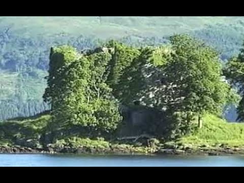
Old Castle Lachlan On Visit To Loch Fyne Argyll And Bute Scotland

Tour Scotland wee travel video, with Scottish music, of Old Castle Lachlan, also known as Castle Lachlan, a ruined 15th century ...

Crarae Gardens - Autumn - Minard, Argyll & Bute, Scotland

A spectacular 50-acre woodland garden in a dramatic setting. Crarae has a wonderful collection of woody plants centred on the ...

Old Lachlan Castle and kilmorie Chapel (Drone Footage)

Old Lachlan Castle Histor: Old Castle Lachlan, also known as Castle Lachlan, is a ruined 15th-century castle on the shore of Loch ...

Nearby Amenities

Located within 500m of 56.115013,-5.2515847
Source: PGS
Lat/Long: 56.1114153/-5.2558831
Source: PGS
Lat/Long: 56.1119409/-5.2557131
Source: PGS
Lat/Long: 56.1122124/-5.2557131
Source: PGS
Lat/Long: 56.1126217/-5.2554581
Source: PGS
Lat/Long: 56.1131646/-5.2551413
Source: PGS
Lat/Long: 56.113772/-5.2548399
Source: PGS
Lat/Long: 56.1142201/-5.2544999
Source: PGS
Lat/Long: 56.1145863/-5.2539667
Source: PGS
Lat/Long: 56.1148534/-5.2535495
Source: PGS
Lat/Long: 56.1151076/-5.2529699
Source: PGS
Lat/Long: 56.1151765/-5.252684
Source: PGS
Lat/Long: 56.1153661/-5.2524522
Source: PGS
Lat/Long: 56.1155901/-5.2522976
Source: PGS
Lat/Long: 56.1157926/-5.2521276
Source: PGS
Lat/Long: 56.1159219/-5.2518958
Source: PGS
Lat/Long: 56.1160253/-5.2516872
Source: PGS
Lat/Long: 56.1161459/-5.2516253
Source: PGS
Lat/Long: 56.1162751/-5.2516176
Source: PGS
Lat/Long: 56.1164216/-5.2517413
Source: PGS
Lat/Long: 56.1165508/-5.2517258
Source: PGS
Lat/Long: 56.1171152/-5.2512003
Source: PGS
Lat/Long: 56.1174469/-5.2507908
Source: PGS
Lat/Long: 56.1177011/-5.2503967
Source: PGS
Lat/Long: 56.1179423/-5.2500644
Source: PGS
Lat/Long: 56.1181276/-5.2497321
Source: PGS
Lat/Long: 56.1183343/-5.2492453
Source: PGS
Lat/Long: 56.1185196/-5.2487894
Source: PGS
Lat/Long: 56.1187608/-5.2481094
Traffic Signals
Lat/Long: 56.1152537/-5.2536731
Traffic Signals
Lat/Long: 56.11438/-5.2554463
Minard
Name Gd: Mionaird
Place: village
Wikidata: Q24993503
Wikipedia: en:Minard, Argyll
Lat/Long: 56.1170491/-5.2527742
Turning Circle
Lat/Long: 56.1171448/-5.2563118
Telephone
Booth: KX100
Covered: booth
Lat/Long: 56.1158913/-5.2522777
Post Office
Village Store
Shop: convenience
Lat/Long: 56.1162454/-5.2527592
Post Box
Post Box Type: lamp
Ref: PA32 19
Royal Cypher: scottish_crown
Lat/Long: 56.1161979/-5.2527015
Bus Stop
Naptan AtcoCode: 60709364
Naptan NaptanCode: 54723724
Shelter: yes
Lat/Long: 56.1158645/-5.2523314
The data included in this document is from www.openstreetmap.org. The data is made available under ODbL.

Have you been to Achagoyle Bay?

Leave your review of Achagoyle Bay below (or comments, questions and feedback).