Pen-y-Holt Bay
Bay in Pembrokeshire
Wales
Pen-y-Holt Bay

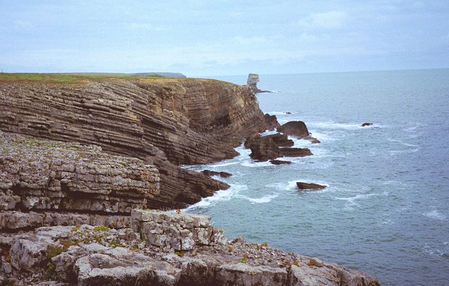
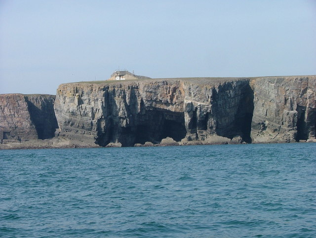
Pen-y-Holt Bay is a picturesque coastal area located in Pembrokeshire, Wales. It is situated on the southwestern side of the country and is part of the Pembrokeshire Coast National Park. This bay is known for its stunning natural beauty, with its rugged cliffs, sandy beaches, and crystal-clear waters.
The bay is surrounded by lush greenery and offers breathtaking views of the Irish Sea. It is a popular destination for nature lovers, hikers, and beachgoers who seek tranquility and a connection with the great outdoors. The bay is accessible by foot or car, with parking facilities available nearby.
The beach at Pen-y-Holt Bay is a hidden gem, often less crowded than other popular beaches in the area. It boasts soft golden sands, perfect for sunbathing, picnicking, or simply taking a leisurely walk along the shore. The clear waters provide an opportunity for swimming and various water sports such as surfing, kayaking, and paddleboarding.
The surrounding cliffs offer excellent vantage points for birdwatching, as the area is home to a variety of seabirds, including gulls, cormorants, and puffins. Visitors can also explore the nearby coastal paths, which offer stunning panoramic views of the bay and the rugged coastline.
For those interested in history, Pen-y-Holt Bay has a rich maritime heritage. The bay was once a hub for fishing and smuggling activities, and remnants of old fishing huts and boatyards can still be seen along the shoreline.
Overall, Pen-y-Holt Bay is a tranquil and scenic destination that offers a perfect blend of natural beauty, recreational activities, and historical charm. It is a must-visit spot for anyone exploring Pembrokeshire's coastal wonders.
If you have any feedback on the listing, please let us know in the comments section below.
Pen-y-Holt Bay Images
Images are sourced within 2km of 51.618838/-5.04219 or Grid Reference SR8995. Thanks to Geograph Open Source API. All images are credited.


Pen-y-Holt Bay is located at Grid Ref: SR8995 (Lat: 51.618838, Lng: -5.04219)
Unitary Authority: Pembrokeshire
Police Authority: Dyfed Powys
What 3 Words
///blotchy.majors.page. Near Castlemartin, Pembrokeshire
Nearby Locations
Related Wikis

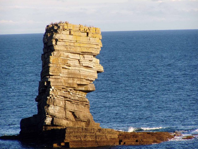
Crow Rock
Crow Rock is a rock located off of Linney Head, Pembrokeshire, in west Wales. It is considered to be a good diving location, because of its deep gullies...
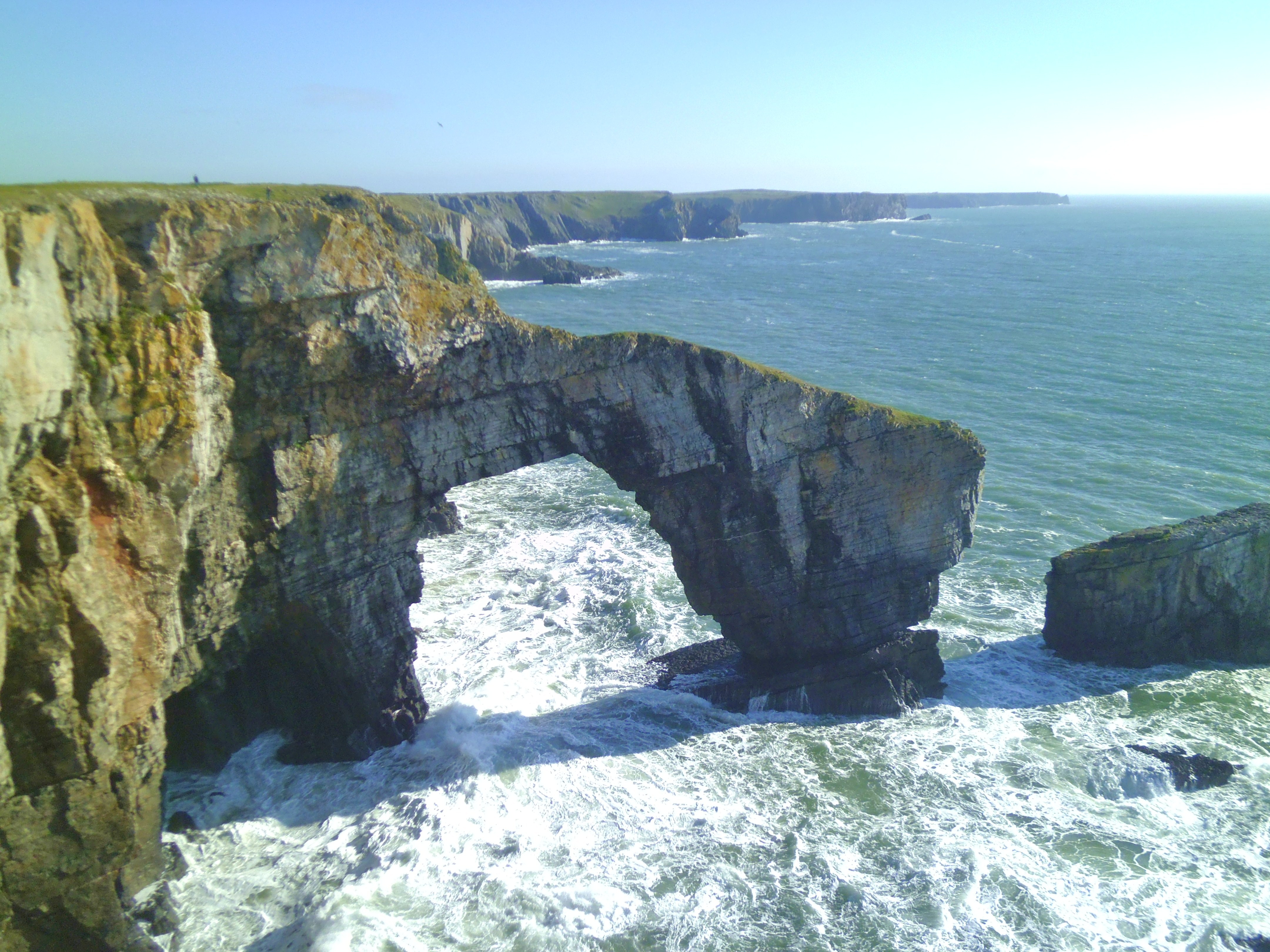
Green Bridge of Wales
The Green Bridge of Wales (Welsh: Pont Werdd Cymru) is a natural arch formed from Carboniferous Limestone within the Pembrokeshire Coast National Park...

Church of St Michael and All Angels, Castlemartin, Pembrokeshire
The Church of St Michael and All Angels, Castlemartin, Pembrokeshire, Wales is a redundant church dating from the 13th century. A Grade I listed building...
Castlemartin, Pembrokeshire
Castlemartin (Welsh: Castell Martin) is a village and parish in the community of Stackpole and Castlemartin, Pembrokeshire, Wales, in the Pembrokeshire...
Nearby Amenities
Located within 500m of 51.618838,-5.04219Have you been to Pen-y-Holt Bay?
Leave your review of Pen-y-Holt Bay below (or comments, questions and feedback).