Tollie Bay

Bay in Ross-shire

Scotland

Tollie Bay

Track to Tollie Farm
Track to Tollie Farm Credit: Peter Moore

Tollie Bay is a picturesque coastal area located in the region of Ross-shire, Scotland. Situated on the eastern shore of Loch Ewe, it is known for its stunning natural beauty and tranquil atmosphere. The Bay is surrounded by rolling green hills and offers breathtaking views of the surrounding landscape.

The area is rich in history, with evidence of human settlement dating back thousands of years. The nearby Inverewe Garden, a renowned botanical garden, attracts visitors from all over the world. Its unique collection of plants and flowers thrives in the mild climate brought by the Gulf Stream.

Tollie Bay is also a popular destination for outdoor enthusiasts. The calm waters of Loch Ewe offer opportunities for sailing, kayaking, and fishing. The surrounding hills provide excellent hiking and walking trails, allowing visitors to explore the area's diverse wildlife and enjoy panoramic vistas.

The Bay is home to a small community, with a scattering of houses and cottages. The residents are known for their warmth and hospitality, welcoming visitors to experience the charm of rural Scotland. A local inn offers accommodation and traditional Scottish cuisine, while a small shop provides essential supplies.

Tollie Bay's remote location and peaceful ambiance make it an ideal retreat for those seeking a break from the hustle and bustle of modern life. Its unspoiled natural beauty and rich history truly make it a hidden gem in the heart of Ross-shire.

If you have any feedback on the listing, please let us know in the comments section below.
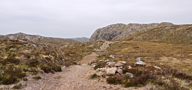
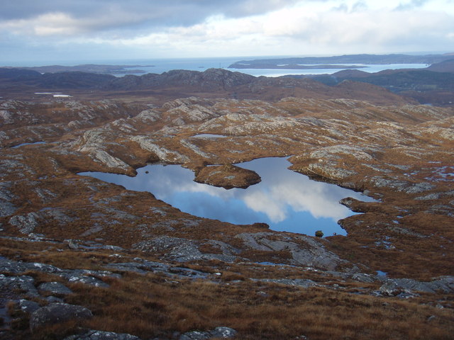
Tollie Bay Images

Images are sourced within 2km of 57.742224/-5.5803036 or Grid Reference NG8778. Thanks to Geograph Open Source API. All images are credited.

Track to Tollie Farm
View towards Loch Maree From the start of the Slattadale path. Beinn Airigh Charr is the mountain in the centre, one of the few tops not in cloud on this dullish but dry day.
View towards Loch Maree
From the start of the Slattadale path. Beinn Airigh Charr is the mountain in the centre, one of the few tops not in cloud on this dullish but dry day.
The view towards Tollie Farm and Loch Maree Taken from a layby on the A832.
The view towards Tollie Farm and Loch Maree
Taken from a layby on the A832.
Tollie Farm With Loch Maree in the distance.
Tollie Farm
With Loch Maree in the distance.
Minor road leading to Tollie Farm The road to Tollie Farm is a short one ending at the head of Loch Maree not far beyond the farm. The foot of the north side of Creag Mhòr Thollaidh, an immensely rocky if relatively low mountain, can be seen beyond the road.
Minor road leading to Tollie Farm
The road to Tollie Farm is a short one ending at the head of Loch Maree not far beyond the farm. The foot of the north side of Creag Mhòr Thollaidh, an immensely rocky if relatively low mountain, can be seen beyond the road.
Moorland track near to A832 The moorland road or track here runs close to the A832 between Gairloch and Poolewe; the view is towards Poolewe with the A classified road visible to the right of a boulder, itself at the right side of the image.
Moorland track near to A832
The moorland road or track here runs close to the A832 between Gairloch and Poolewe; the view is towards Poolewe with the A classified road visible to the right of a boulder, itself at the right side of the image.
Boulders and rocks south-east of Croft Hill Croft Hill is a minor feature south of Poolewe. The image shows rocks just north of the A832.
Boulders and rocks south-east of Croft Hill
Croft Hill is a minor feature south of Poolewe. The image shows rocks just north of the A832.
Stream with heathery knolls A fine path connects the A832 east of Loch Tollaidh with Slatterdale, heading south close to the Allt an Leth-chreige. The stream seen here is a tributary of that stream entering it from the south-west.
Stream with heathery knolls
A fine path connects the A832 east of Loch Tollaidh with Slatterdale, heading south close to the Allt an Leth-chreige. The stream seen here is a tributary of that stream entering it from the south-west.
Perched boulders on rock outcrop of Creag Mhòr Thollaidh Creag Mhòr Thollaidh is an immensely rocky mountain, particularly when viewed from the north. From its summit (a modest 343m), a series on knolls of decreasing height heads south, many of them rocky and many having perched sandstone boulders upon their native pale grey rock. The distant mountain is Beinn Airaigh Charr which lies on the far side of Loch Maree.
Perched boulders on rock outcrop of Creag Mhòr Thollaidh
Creag Mhòr Thollaidh is an immensely rocky mountain, particularly when viewed from the north. From its summit (a modest 343m), a series on knolls of decreasing height heads south, many of them rocky and many having perched sandstone boulders upon their native pale grey rock. The distant mountain is Beinn Airaigh Charr which lies on the far side of Loch Maree.
Path connecting Poolewe with Slatterdale In truth the path connects the A832 near to Poolewe with Slatterdale but the route is a fine one and the path gives easy walking. The view is from the highest point on the crossing looking towards Poolewe with Creag Mhor Thollaidh the peak in view.
Path connecting Poolewe with Slatterdale
In truth the path connects the A832 near to Poolewe with Slatterdale but the route is a fine one and the path gives easy walking. The view is from the highest point on the crossing looking towards Poolewe with Creag Mhor Thollaidh the peak in view.
River Ewe Looking upstream.
River Ewe
Looking upstream.
Lochan by Creagan Dubha A very still day compared to many others recently, even saw the sun during the course of the walk.
Lochan by Creagan Dubha
A very still day compared to many others recently, even saw the sun during the course of the walk.
Tollie and Loch Maree
Lochan at end of Meall an Spardain North ridge There are many lochans in this area, with lots of small ridges, it makes enjoyable walking.
Lochan at end of Meall an Spardain North ridge
There are many lochans in this area, with lots of small ridges, it makes enjoyable walking.
River Ewe
River Ewe
Moorland by Creagan Dubha
The A832 near Poolewe
Above Tollie Farm and Loch Maree
Show me another place!

Tollie Bay is located at Grid Ref: NG8778 (Lat: 57.742224, Lng: -5.5803036)

Unitary Authority: Highland

Police Authority: Highlands and Islands

What 3 Words

///families.increased.indulges. Near Gairloch, Highland

Related Wikis

Poolewe

Poolewe (Scottish Gaelic: Poll Iù) is a small village in Wester Ross in the North West Highlands of Scotland, about 75 miles (120 kilometres) northwest...

Poolewe Stone

The Poolewe Stone is a Class-I Pictish stone discovered in 1992 in the cemetery at Poolewe (Poll Iùbh) in Wester Ross. The stone carries the common Pictish...

Londubh

Londubh (Scottish Gaelic: An Lòn Dubh) is a village on the south shore of Loch Ewe in Poolewe, Ross-shire, Scottish Highlands and is in the Scottish council...

Inverewe Garden

Inverewe Garden (Scottish Gaelic: Gàradh Inbhir Iù) is a botanical garden in Wester Ross in the Scottish Highlands. It is located just to the north of...

Nearby Amenities

Located within 500m of 57.742224,-5.5803036
Power: pole
Lat/Long: 57.74655/-5.5803121
Power: pole
Lat/Long: 57.7456729/-5.5813486
Tollie Bay
Natural: bay
Lat/Long: 57.7421712/-5.579613
The data included in this document is from www.openstreetmap.org. The data is made available under ODbL.

Have you been to Tollie Bay?

Leave your review of Tollie Bay below (or comments, questions and feedback).