Porth Glastwr

Bay in Pembrokeshire

Wales

Porth Glastwr

Entrance to the bay Choppy waters at the entrance to the narrow sheltered bay of Abercastle.

See <a title="https://www.geograph.org.uk/photo/2018024" href="https://www.geograph.org.uk/photo/2018024">Link</a> for a comparative view (2010) at a lower tide level.
Entrance to the bay Credit: E Gammie

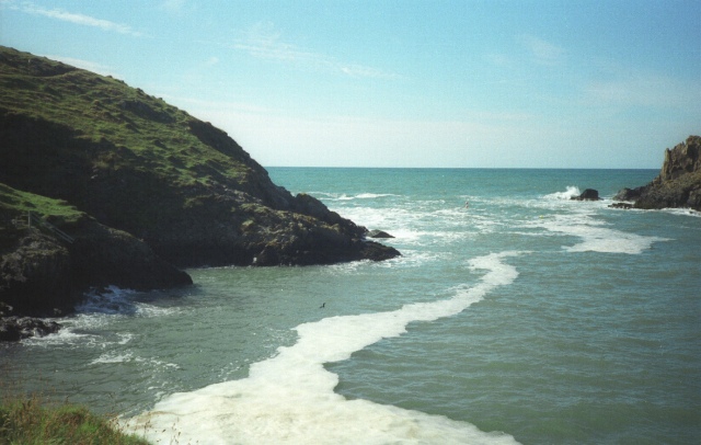
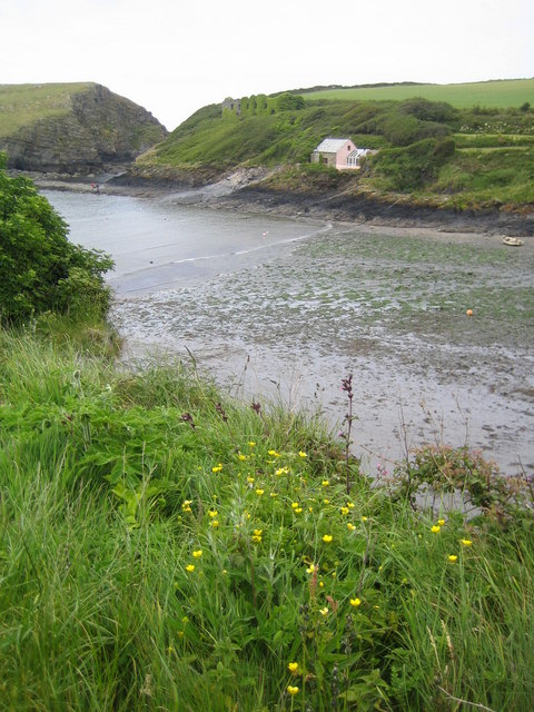
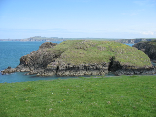
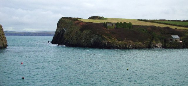
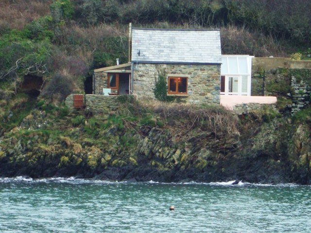
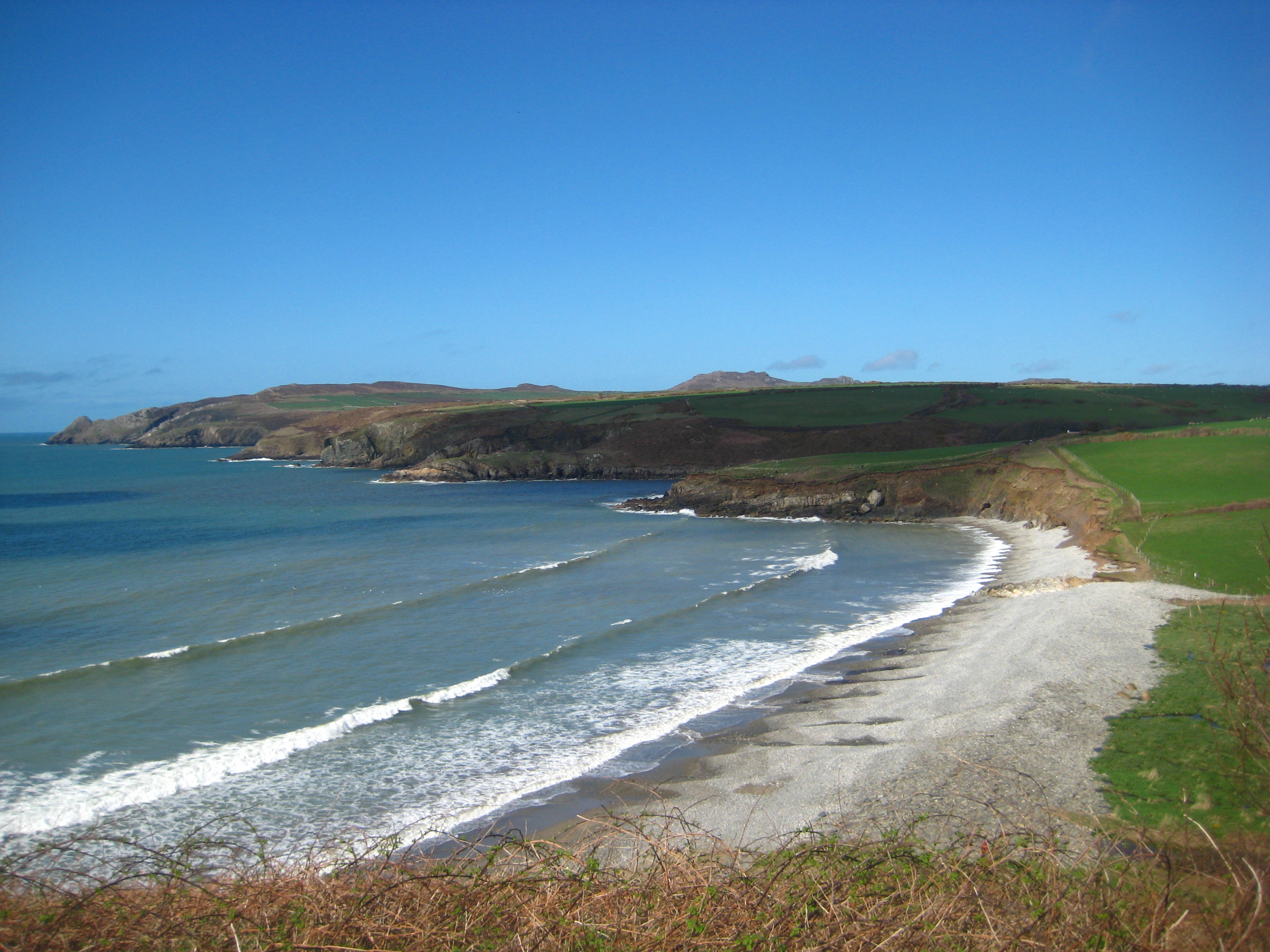
Porth Glastwr, also known as the Blue Lagoon, is a stunning coastal bay located in Pembrokeshire, Wales. Situated near the small village of Abereiddy, this natural wonder has gained popularity due to its breathtaking beauty and unique features.

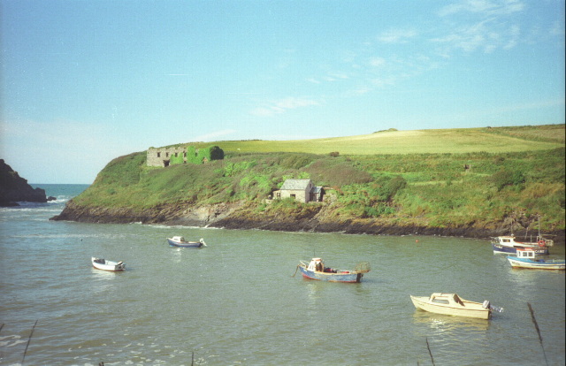
The bay is characterized by its dramatic cliffs, which surround a deep, clear-blue water-filled quarry. The vivid hue of the lagoon is a result of the quarry's former use as a slate quarry, with minerals from the surrounding rocks seeping into the water. The contrast between the blue water and the rugged cliffs creates a mesmerizing sight that attracts both locals and tourists alike.

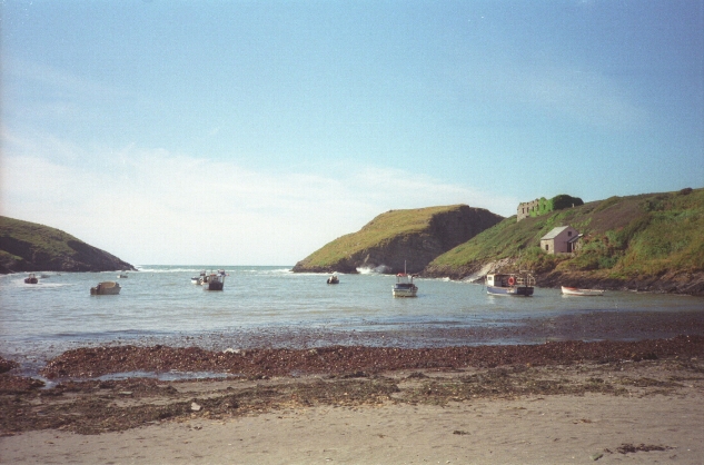
Porth Glastwr offers a range of activities for outdoor enthusiasts. The lagoon itself is a popular spot for diving, with its crystal-clear waters providing excellent visibility for exploring the underwater world. The cliffs surrounding the bay are a haven for climbers, offering various routes of different difficulty levels. Additionally, the bay is a great spot for kayaking and wild swimming.

The area surrounding Porth Glastwr is also home to diverse wildlife, making it an ideal location for nature lovers. Seabirds, such as razorbills and guillemots, nest on the cliffs, and seals can often be spotted lounging on the rocks or swimming in the bay.

Overall, Porth Glastwr, or the Blue Lagoon, is a remarkable natural attraction in Pembrokeshire. Its stunning beauty, outdoor activities, and diverse wildlife make it a must-visit destination for those seeking adventure and natural wonders.

If you have any feedback on the listing, please let us know in the comments section below.

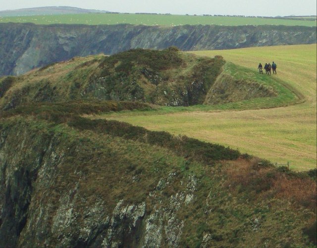
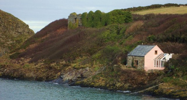
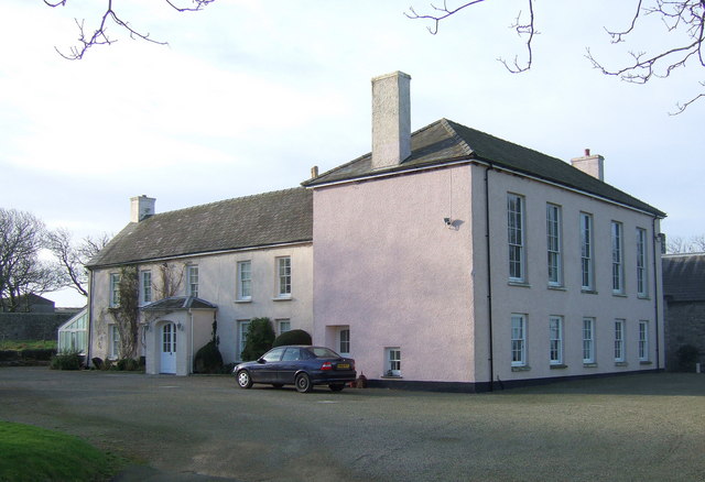
Porth Glastwr Images

Images are sourced within 2km of 51.965894/-5.103278 or Grid Reference SM8634. Thanks to Geograph Open Source API. All images are credited.

Entrance to the bay Choppy waters at the entrance to the narrow sheltered bay of Abercastle.

See <a title="https://www.geograph.org.uk/photo/2018024" href="https://www.geograph.org.uk/photo/2018024">Link</a> for a comparative view (2010) at a lower tide level.
Entrance to the bay
Choppy waters at the entrance to the narrow sheltered bay of Abercastle. See Link for a comparative view (2010) at a lower tide level.
Aber Castle Boats moored in the narrow bay of Aber Castle with Ynys y Castell on the right, at the mouth of the bay.
Aber Castle
Boats moored in the narrow bay of Aber Castle with Ynys y Castell on the right, at the mouth of the bay.
Cottages by the bay Cottages on the north side of the head of the bay at Abercastle.
Cottages by the bay
Cottages on the north side of the head of the bay at Abercastle.
Boats in the bay Boats moored in Aber Castle with Ynys y Castell to the left, viewed from the Pembrokeshire Coast path.
Boats in the bay
Boats moored in Aber Castle with Ynys y Castell to the left, viewed from the Pembrokeshire Coast path.
Pebble Beach, Aberbach, 1989 View from Carreg Golchfa of the pebble bank at Aberbach on a hot and sunny day in 1989.
Pebble Beach, Aberbach, 1989
View from Carreg Golchfa of the pebble bank at Aberbach on a hot and sunny day in 1989.
Aber Bach
Aber Bach
Abercastle
Abercastle
Ynys y Castell A small tidal island guarding the entrance to Abercastle harbour.
Ynys y Castell
A small tidal island guarding the entrance to Abercastle harbour.
Narrow road to Felin Dwarch Beyond the entrance to Morfa Farm, is the narrow single track road with high hedge banks heading for Felin Dwarch and Duffryn Dwarch, which is unsuitable for long vehicles.
Narrow road to Felin Dwarch
Beyond the entrance to Morfa Farm, is the narrow single track road with high hedge banks heading for Felin Dwarch and Duffryn Dwarch, which is unsuitable for long vehicles.
Footpath junction near Abermawr A footpath junction near Abermawr. The way to the right is the official Pembrokeshire Coast Path heading for Penmorfa. The way to the left was part of a road from Tregwynt and Abermawr to Abercastle, but is now a narrow path.
Footpath junction near Abermawr
A footpath junction near Abermawr. The way to the right is the official Pembrokeshire Coast Path heading for Penmorfa. The way to the left was part of a road from Tregwynt and Abermawr to Abercastle, but is now a narrow path.
Penmorfa View of the cliffs on the south side of Trwyn Llwynog below the Pembrokeshire Coast Path near Porth Glastwr. Garn Fawr and Garn Fechan can be seen in the distance.
Penmorfa
View of the cliffs on the south side of Trwyn Llwynog below the Pembrokeshire Coast Path near Porth Glastwr. Garn Fawr and Garn Fechan can be seen in the distance.
Abercastle The sound between Ynys y Castell and the mainland, looking to Pwllcrochan. At low tide it is linked by a causeway.
Abercastle
The sound between Ynys y Castell and the mainland, looking to Pwllcrochan. At low tide it is linked by a causeway.
Harbour cottage What an amazing place to live
Harbour cottage
What an amazing place to live
Path out of Abercastle Heading for Pwllcochran
Path out of Abercastle
Heading for Pwllcochran
Grain Store Ruin overlooking the Harbour Cargoes out of Abercastle included grain, limestone, butter, honey, corn, and coal. All that now remains of Abercastle's industrial past are limekiln remnants and the ruined grain store seen here above the cottage
Grain Store Ruin overlooking the Harbour
Cargoes out of Abercastle included grain, limestone, butter, honey, corn, and coal. All that now remains of Abercastle's industrial past are limekiln remnants and the ruined grain store seen here above the cottage
Aber Bach A steep pebble beach and a calm blue sea. I guess it's not always like this!
Aber Bach
A steep pebble beach and a calm blue sea. I guess it's not always like this!
Aber Mawr Looking over the pebble beach of Aber Mawr and the valley behind.
Aber Mawr
Looking over the pebble beach of Aber Mawr and the valley behind.
The Western Cliffs of Penmorfa Beyond the promontory of Penmorfa there is a view of the landscape across the bay and several miles to the north.
The Western Cliffs of Penmorfa
Beyond the promontory of Penmorfa there is a view of the landscape across the bay and several miles to the north.
Show me another place!

Porth Glastwr is located at Grid Ref: SM8634 (Lat: 51.965894, Lng: -5.103278)

Unitary Authority: Pembrokeshire

Police Authority: Dyfed Powys

What 3 Words

///wording.tucked.straws. Near Mathry, Pembrokeshire

Related Wikis

Abermawr

Abermawr is a stretch of coastline and is regarded as a Site of Special Scientific Interest in Pembrokeshire, Wales. Abermawr is a mostly shingle beach...

Abercastle

Abercastle (Welsh: Abercastell) is a village in Pembrokeshire, Wales. Abercastle has a working harbour which is managed by Abercastle Boat Owners Association...

Tregwynt Hoard

The Tregwynt Hoard is a mid-17th-century hoard of coins found at Tregwynt Mansion near Fishguard in Pembrokeshire, Wales, in 1996. The hoard is now in...

Tregwynt Mansion

Tregwynt Mansion is a house in the parish of Granston in Pembrokeshire, Wales. The Tregwynt Hoard was found during renovations in 1996. == Location... ==

Have you been to Porth Glastwr?

Leave your review of Porth Glastwr below (or comments, questions and feedback).