Òb Mheallaidh
Bay in Ross-shire
Scotland
Òb Mheallaidh

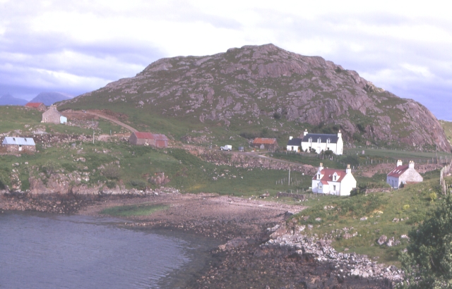
Òb Mheallaidh, also known as Bay of Meallaidh, is a picturesque coastal area located in Ross-shire, Scotland. Situated on the western coast of the Highlands, this bay offers breathtaking views and a tranquil atmosphere for visitors to enjoy.
The bay is nestled between the small village of Poolewe and the larger town of Gairloch, making it easily accessible for tourists and locals alike. The sandy beach stretches for approximately one mile, offering a peaceful place to relax and take in the stunning scenery. The crystal-clear waters of the bay are ideal for swimming, kayaking, and other water-based activities during the warmer months.
The area is home to a diverse range of wildlife, attracting nature enthusiasts from far and wide. Birdwatchers will delight in the variety of species that can be spotted in the bay, including herons, oystercatchers, and terns. Dolphins and seals are also known to frequent the waters, providing a wonderful opportunity for wildlife enthusiasts to observe these majestic creatures in their natural habitat.
For hiking enthusiasts, Òb Mheallaidh offers a number of scenic trails that wind through the surrounding hills and forests. The most popular route is the Meallaidh Mor trail, which takes hikers to the summit of Meall Mòr, offering panoramic views of the bay and the surrounding countryside.
Overall, Òb Mheallaidh is a hidden gem on the Scottish coast, providing visitors with a perfect blend of natural beauty, tranquility, and outdoor recreational opportunities.
If you have any feedback on the listing, please let us know in the comments section below.
Òb Mheallaidh Images
Images are sourced within 2km of 57.525928/-5.6268837 or Grid Reference NG8254. Thanks to Geograph Open Source API. All images are credited.


Òb Mheallaidh is located at Grid Ref: NG8254 (Lat: 57.525928, Lng: -5.6268837)
Unitary Authority: Highland
Police Authority: Highlands and Islands
What 3 Words
///birthdays.tiptoes.snap. Near Lochcarron, Highland
Nearby Locations
Related Wikis
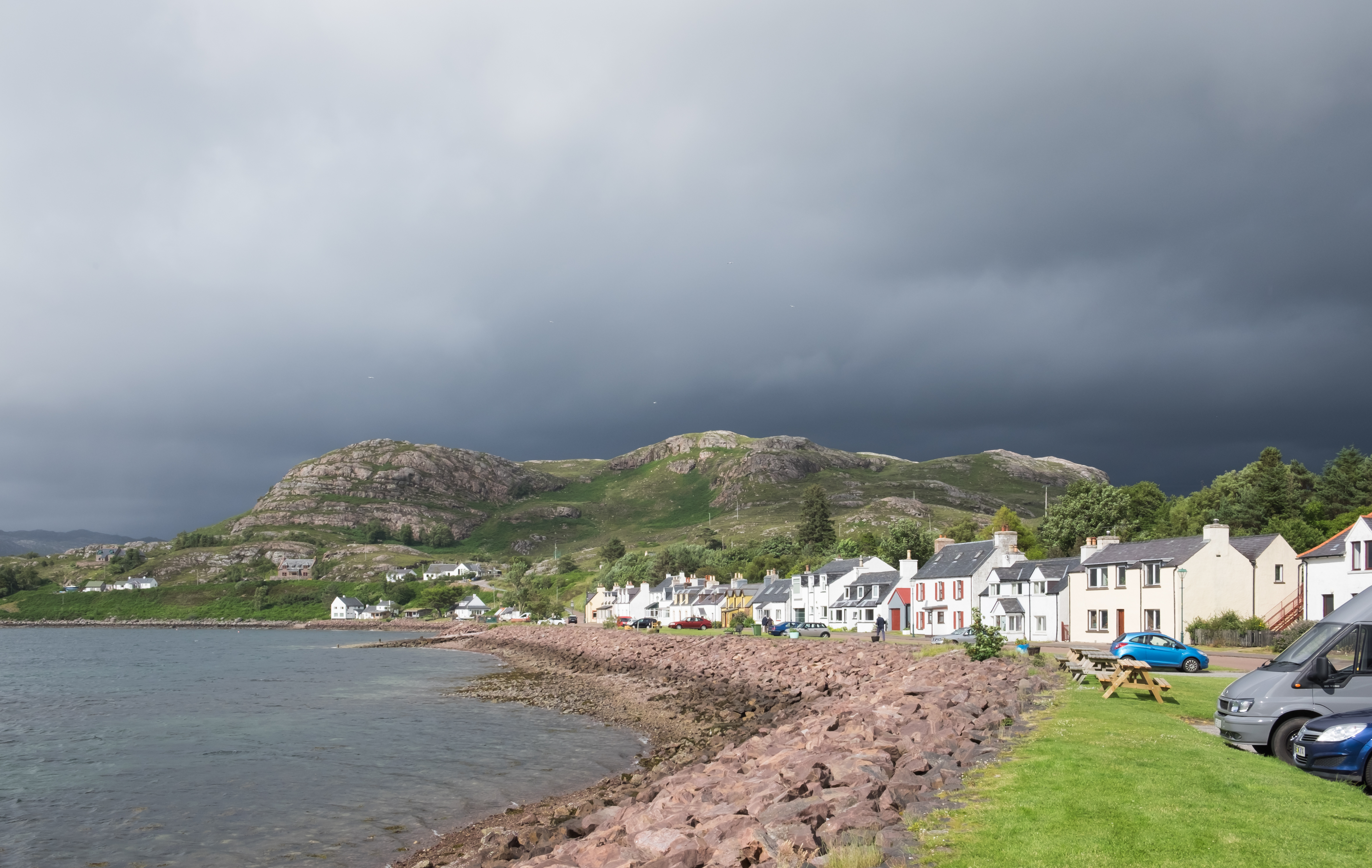
Shieldaig
Shieldaig (Scottish Gaelic: Sìldeag; Old Norse: síld-vík, lit. 'herring bay') is a village in Wester Ross in the Northwest Highlands, in the Scottish council...
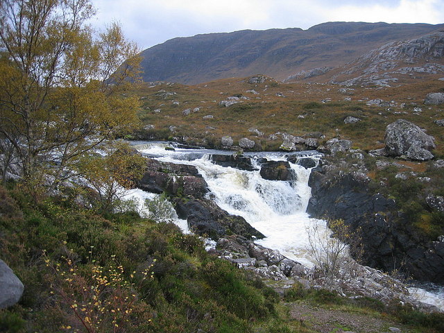
Falls of Balgy
Falls of Balgy is a waterfall near Torridon in Scotland. == See also == Waterfalls of Scotland == References ==

Inveralligin
Inveralligin (Scottish Gaelic: Inbhir Àiliginn) is a remote crofting township which lies on the north shore of Loch Torridon in Wester Ross and is in the...
Ardheslaig
Ardheslaig (Scottish Gaelic: Àird Heisleag) is a crofting settlement at the northern end of the Applecross peninsula in the Scottish Highlands. It is 3...
Nearby Amenities
Located within 500m of 57.525928,-5.6268837Have you been to Òb Mheallaidh?
Leave your review of Òb Mheallaidh below (or comments, questions and feedback).