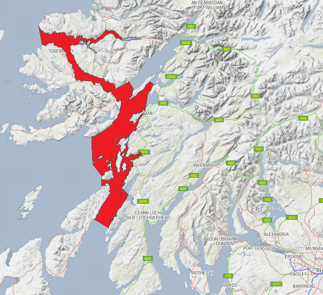
Slatrach Bay

Bay in Argyllshire

Scotland

Slatrach Bay

North of Barr-nam-boc Bay North of Barr-nam-Boc Bay, the west coast of Kerrera continues to get shelter from Rubha a' Fhreastaig. The dip of the rocks ensures that the coast remains low, though rocky, as it heads towards Rubha na Lice, which lies hidden in this view by the curve of the coast. The Mute Swan (Cygnus olor) was a bit of a surprise - I don't suppose it was yet nesting anywhere, so perhaps my caution in paddling well away from it was unnecessary, but, better safe than sorry !
North of Barr-nam-boc Bay Credit: Andy Waddington

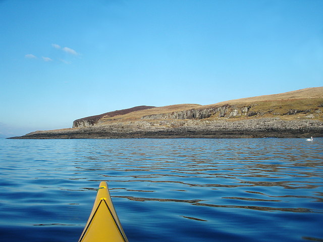
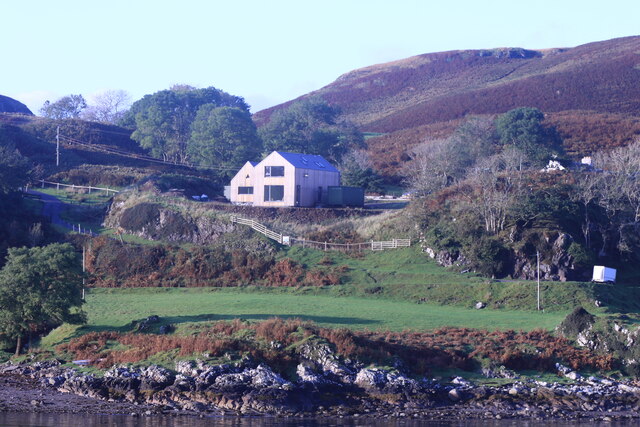
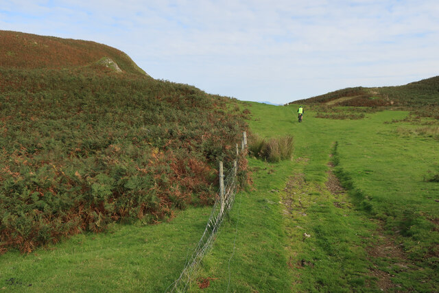
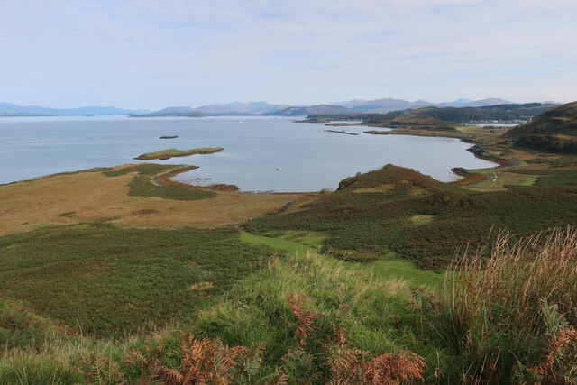
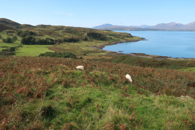
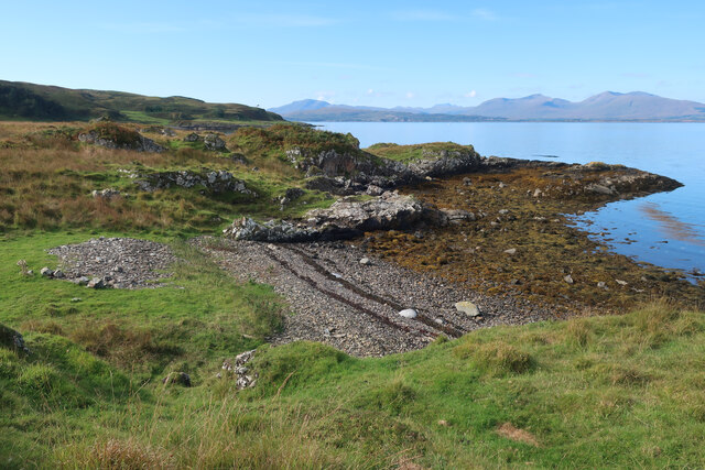
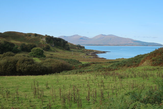
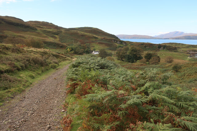
Slatrach Bay is a picturesque bay located in Argyllshire, Scotland. The bay is known for its stunning natural beauty, with crystal clear waters and sandy beaches that stretch along the coastline. The surrounding area is rich in wildlife, making it a popular spot for birdwatching and nature enthusiasts.

Slatrach Bay is also a popular destination for water sports enthusiasts, with opportunities for sailing, kayaking, and paddleboarding. The bay's calm waters and gentle breezes make it an ideal location for beginners and experienced water sports enthusiasts alike.

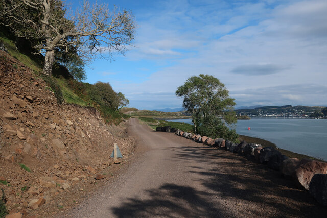
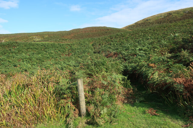
Visitors to Slatrach Bay can enjoy leisurely walks along the shoreline, taking in the breathtaking views of the surrounding hills and coastline. The bay is also a great spot for picnicking and relaxing on the beach, making it a perfect destination for a day trip or weekend getaway.

Overall, Slatrach Bay is a hidden gem in Argyllshire, offering a peaceful and scenic retreat for those looking to escape the hustle and bustle of everyday life.

If you have any feedback on the listing, please let us know in the comments section below.
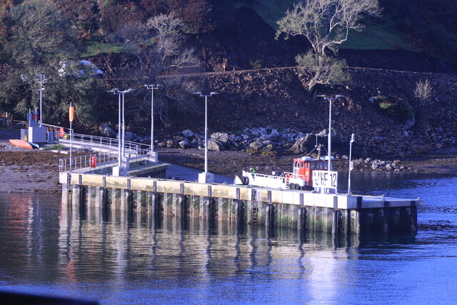
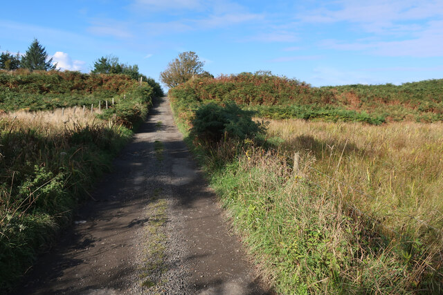
Slatrach Bay Images

Images are sourced within 2km of 56.410997/-5.5404664 or Grid Reference NM8129. Thanks to Geograph Open Source API. All images are credited.

North of Barr-nam-boc Bay North of Barr-nam-Boc Bay, the west coast of Kerrera continues to get shelter from Rubha a' Fhreastaig. The dip of the rocks ensures that the coast remains low, though rocky, as it heads towards Rubha na Lice, which lies hidden in this view by the curve of the coast. The Mute Swan (Cygnus olor) was a bit of a surprise - I don't suppose it was yet nesting anywhere, so perhaps my caution in paddling well away from it was unnecessary, but, better safe than sorry !
North of Barr-nam-boc Bay
North of Barr-nam-Boc Bay, the west coast of Kerrera continues to get shelter from Rubha a' Fhreastaig. The dip of the rocks ensures that the coast remains low, though rocky, as it heads towards Rubha na Lice, which lies hidden in this view by the curve of the coast. The Mute Swan (Cygnus olor) was a bit of a surprise - I don't suppose it was yet nesting anywhere, so perhaps my caution in paddling well away from it was unnecessary, but, better safe than sorry !
House above Kerrera Ferry Landing From the MV Hebridean Isles on a journey from Oban to Colonsay.
House above Kerrera Ferry Landing
From the MV Hebridean Isles on a journey from Oban to Colonsay.
Kererra Ferry Landing From the MV Hebridean Isles on a journey from Oban to Colonsay.
Kererra Ferry Landing
From the MV Hebridean Isles on a journey from Oban to Colonsay.
Construction work on Kererra From the MV Hebridean Isles on a journey from Oban to Colonsay.
Construction work on Kererra
From the MV Hebridean Isles on a journey from Oban to Colonsay.
New road on Kerrera Finally connecting the two communities on the island. Taken before it was fully surfaced.
New road on Kerrera
Finally connecting the two communities on the island. Taken before it was fully surfaced.
Track past Sìdhean Riabhach
Oitir Mhòr from Sìdhean Riabhach
Sheep on Sìdhean Riabhach Looking towards Slatrach Bay.
Sheep on Sìdhean Riabhach
Looking towards Slatrach Bay.
Bracken covered slopes, Kerrera
Track to Slaterich
Track to Slaterich
Small beach on Kerrera
Looking towards Slatrach Bay
Slatrach Bay, Kerrera
Pebble on the beach, Slatrach Bay Pulled in by the drag of the seaweed growing on it.
Pebble on the beach, Slatrach Bay
Pulled in by the drag of the seaweed growing on it.
Ruin by Slatrach Bay
Fields near Slatrach Bay
Track to Barnabuck, Kerrera
Rough grassland on Kerrera
Show me another place!

Slatrach Bay is located at Grid Ref: NM8129 (Lat: 56.410997, Lng: -5.5404664)

Unitary Authority: Argyll and Bute

Police Authority: Argyll and West Dunbartonshire

What 3 Words

///book.detonated.stirs. Near Oban, Argyll & Bute

Related Wikis

Kerrera

Kerrera (; Scottish Gaelic: Cearara or Cearrara) is an island in the Scottish Inner Hebrides, close to the town of Oban. In 2016 it had a population of...

RAF Oban

RAF Oban is a former Royal Air Force (RAF) flying boat base located at the northern end of the island of Kerrera, in Ardantrive Bay west of Oban, Argyll...

Loch Sunart to the Sound of Jura Marine Protected Area

Loch Sunart to the Sound of Jura Marine Protected Area is a Marine Protected Area (MPA) off the west coast of Scotland. The MPA, which covers 741 km2...
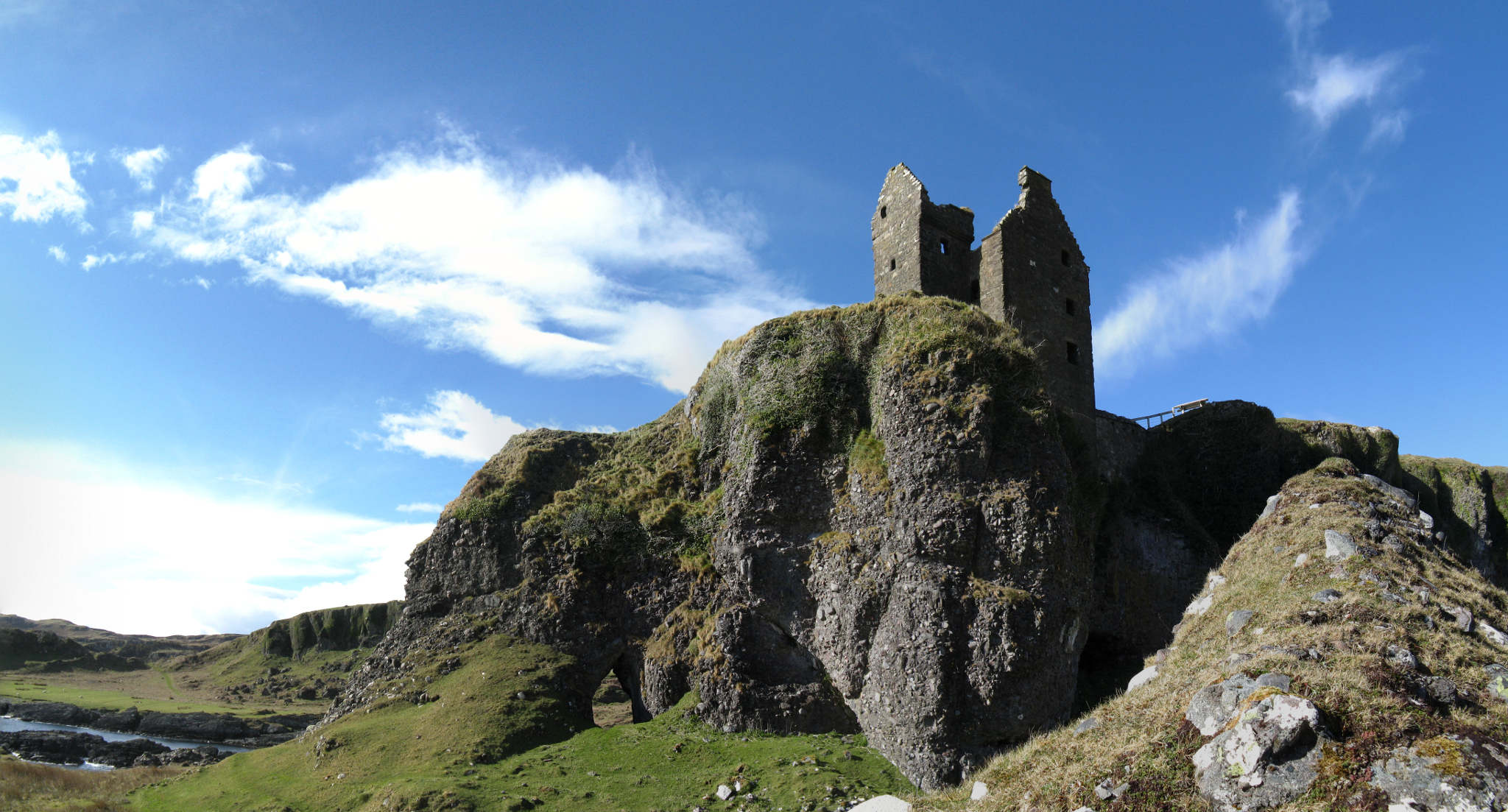
Gylen Castle

Gylen Castle is a ruined castle, or tower house, at the south end of the island of Kerrera in Argyll and Bute, Scotland, on a promontory overlooking the...

Nearby Amenities

Located within 500m of 56.410997,-5.5404664
Marker: cable
Lat/Long: 56.4075407/-5.5442709
Location Transition: yes
Power: pole
Lat/Long: 56.4074116/-5.5445686
The data included in this document is from www.openstreetmap.org. The data is made available under ODbL.

Have you been to Slatrach Bay?

Leave your review of Slatrach Bay below (or comments, questions and feedback).