Macharioch Bay

Bay in Argyllshire

Scotland

Macharioch Bay

Triangulation pillar, Creagach Leac, Argyll The pillar sits within an ancient cairn.  An excavation in 2008 confirmed it to be a ring cairn.  See <span class="nowrap"><a title="https://canmore.org.uk/site/38695" rel="nofollow ugc noopener" href="https://canmore.org.uk/site/38695">Link</a><img style="margin-left:2px;" alt="External link" title="External link - shift click to open in new window" src="https://s1.geograph.org.uk/img/external.png" width="10" height="10"/></span>.
Triangulation pillar, Creagach Leac, Argyll Credit: Claire Pegrum

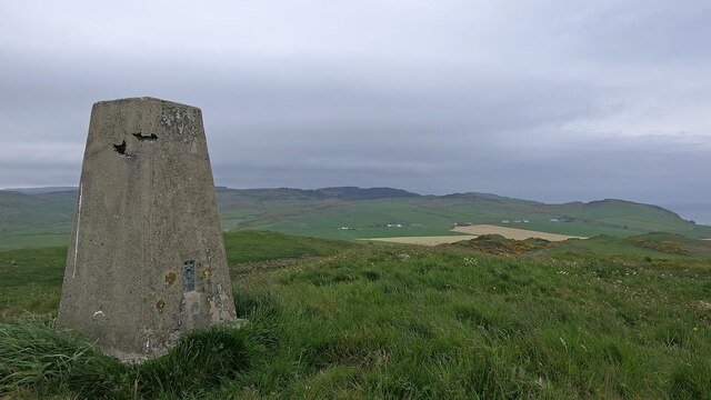
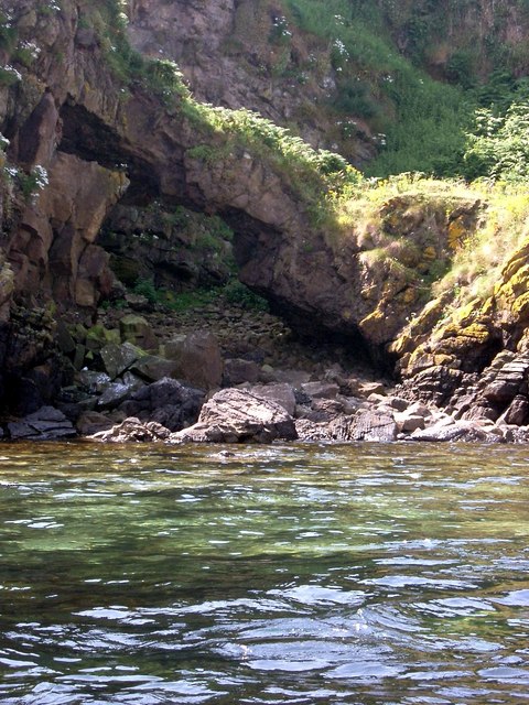
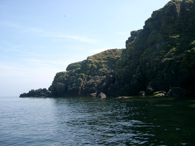
Macharioch Bay is a picturesque coastal area located in Argyllshire, Scotland. Situated on the western coast of the Scottish mainland, it offers stunning views of the surrounding landscape and is known for its natural beauty. The bay is nestled between rolling hills and is characterized by its sandy beaches, clear turquoise waters, and rocky outcrops.

The bay is a popular destination for outdoor enthusiasts and nature lovers. Its calm waters provide an ideal spot for various water activities such as swimming, kayaking, and sailing. The sandy beaches are perfect for sunbathing or leisurely walks along the shore, while the rocky areas offer opportunities for rock pooling and exploring marine life.

The bay is also home to a diverse range of wildlife, making it a haven for bird watchers and nature enthusiasts. Seals can often be spotted basking on the rocks, and there are frequent sightings of seabirds such as gannets, guillemots, and puffins.

Aside from its natural attractions, Macharioch Bay also boasts a rich history. The area is dotted with ancient ruins and archaeological sites, including standing stones and burial mounds, providing a glimpse into the region's past.

For those seeking tranquility and natural splendor, Macharioch Bay in Argyllshire is a must-visit destination. With its breathtaking scenery, abundant wildlife, and historical significance, it offers a truly immersive experience in the heart of Scotland's coastal beauty.

If you have any feedback on the listing, please let us know in the comments section below.

Macharioch Bay Images

Images are sourced within 2km of 55.322375/-5.566075 or Grid Reference NR7308. Thanks to Geograph Open Source API. All images are credited.

Triangulation pillar, Creagach Leac, Argyll The pillar sits within an ancient cairn.  An excavation in 2008 confirmed it to be a ring cairn.  See <span class="nowrap"><a title="https://canmore.org.uk/site/38695" rel="nofollow ugc noopener" href="https://canmore.org.uk/site/38695">Link</a><img style="margin-left:2px;" alt="External link" title="External link - shift click to open in new window" src="https://s1.geograph.org.uk/img/external.png" width="10" height="10"/></span>.
Triangulation pillar, Creagach Leac, Argyll
The pillar sits within an ancient cairn. An excavation in 2008 confirmed it to be a ring cairn. See LinkExternal link.
Macharioch cross Coastline monument to one of the dukes of Argyll.
Macharioch cross
Coastline monument to one of the dukes of Argyll.
Minor Road, south-east Kintyre Peninsula Near Coledrain Farm.
Minor Road, south-east Kintyre Peninsula
Near Coledrain Farm.
Minor road at Macharioch Farm Looking north-westward.
Minor road at Macharioch Farm
Looking north-westward.
Track to Coledrain Farm Looking south-eastward to the farm and the sea.
Track to Coledrain Farm
Looking south-eastward to the farm and the sea.
Field track near to Coledrain Looking north-eastward.
Field track near to Coledrain
Looking north-eastward.
Caravans at Macharioch Bay
Ribbed sands in Macharioch Bay Memorial to George Douglas, 8th Duke of Argyll on the small headland.
Ribbed sands in Macharioch Bay
Memorial to George Douglas, 8th Duke of Argyll on the small headland.
Old milestone One of 7 milestones 10 miles from Campbeltown.  This one is about ¼ mile north of Polliwilline on the minor road that is part of the Kintyre Way.  It may have been recently reset and painted.
Old milestone
One of 7 milestones 10 miles from Campbeltown. This one is about ¼ mile north of Polliwilline on the minor road that is part of the Kintyre Way. It may have been recently reset and painted.
Hillside above Coledrain A small hill near Southend. The black and white post marks a single track road passing place.
Hillside above Coledrain
A small hill near Southend. The black and white post marks a single track road passing place.
Sanda Island from Macharioch Bay A view across Macharioch Bay towards Sanda Island from the beach.
Sanda Island from Macharioch Bay
A view across Macharioch Bay towards Sanda Island from the beach.
Macharioch Dairy country on the southern tip of Kintyre. There was a view past Arran towards Ayrshire.
Macharioch
Dairy country on the southern tip of Kintyre. There was a view past Arran towards Ayrshire.
Cows, Coledrain The south coast of Kintyre - dairy country.
Cows, Coledrain
The south coast of Kintyre - dairy country.
Creagach Leac After The Bastard & Sanda. Trig is summit. Good views of Sanda as the grey clouds come in. Parked to SW on roadside.


Name: Creagach Leac
Hill number: 6957
Height: 126m / 413ft
Area: 19B: Knapdale and Kintyre
Class: sHu
Grid ref: NR721091 (est)
Drop: 92m
Col: 34m  NR724102
Creagach Leac
After The Bastard & Sanda. Trig is summit. Good views of Sanda as the grey clouds come in. Parked to SW on roadside. Name: Creagach Leac Hill number: 6957 Height: 126m / 413ft Area: 19B: Knapdale and Kintyre Class: sHu Grid ref: NR721091 (est) Drop: 92m Col: 34m NR724102
Coledrain Farm
Coledrain Farm
Minor road near Coledrain Farm
Coledrain Farm Glunimore Sheep and Sanda Islands beyond.
Coledrain Farm
Glunimore Sheep and Sanda Islands beyond.
Sheep at Coledrain "Paddy's milestone", Ailsa Craig, in the distance.
Sheep at Coledrain
"Paddy's milestone", Ailsa Craig, in the distance.
Show me another place!

Macharioch Bay is located at Grid Ref: NR7308 (Lat: 55.322375, Lng: -5.566075)

Unitary Authority: Argyll and Bute

Police Authority: Argyll and West Dunbartonshire

What 3 Words

///mile.thirsty.petulant. Near Campbeltown, Argyll & Bute

Related Wikis

Macharioch Motte

Macharioch Motte is the remains of a motte-and-bailey castle situated in a field near the farm of Macharioch in Kintyre, Argyll and Bute, Scotland. �...

Sheep Island, Argyll

Sheep Island is a small uninhabited island situated off the southern tip of the Kintyre peninsula in Scotland. Sheep Island, along with Sanda Island and...

Glunimore Island

Glunimore Island is an uninhabited island around 3 miles (5 kilometres) southeast of the Kintyre peninsula, Scotland. It lies alongside Sanda Island and...

Sanda Island

Sanda Island (Scottish Gaelic: Sandaigh) is a small island in Argyll and Bute, Scotland, off the southern tip of the Kintyre peninsula, near Southend and...

Nearby Amenities

Located within 500m of 55.322375,-5.566075
Historic: archaeological_site
Wikidata: Q56666171
Lat/Long: 55.3252458/-5.5696178
The data included in this document is from www.openstreetmap.org. The data is made available under ODbL.

Have you been to Macharioch Bay?

Leave your review of Macharioch Bay below (or comments, questions and feedback).