The Wick

Bay in Pembrokeshire

Wales

The Wick

Path around Skomer
Path around Skomer Credit: Hugh Venables

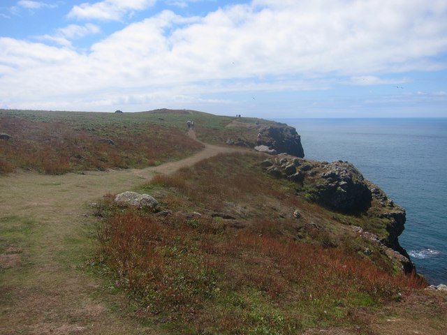
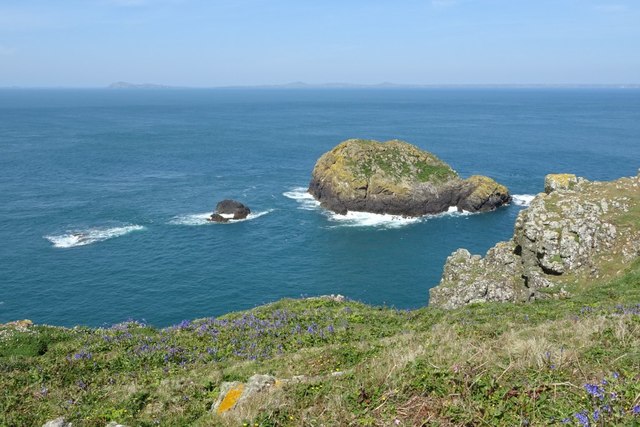
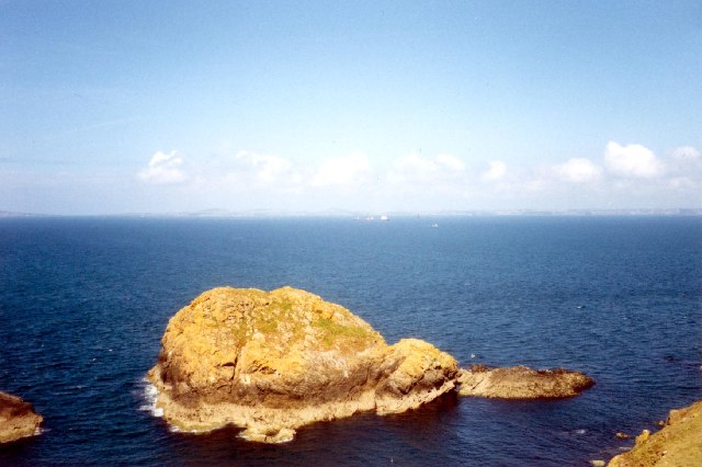
The Wick is a picturesque bay located in Pembrokeshire, Wales. It is known for its stunning natural beauty, with rugged cliffs, clear blue waters, and golden sandy beaches. The bay is surrounded by dramatic coastal scenery, making it a popular destination for nature lovers and outdoor enthusiasts.

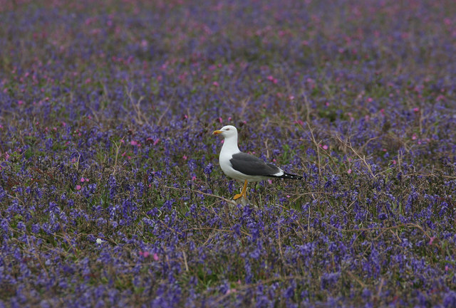
The Wick is a haven for wildlife, with a variety of seabirds nesting on the cliffs and seals often seen basking on the rocks. The clear waters are also home to a diverse range of marine life, making it a great spot for snorkeling and diving.

Visitors to The Wick can enjoy a range of activities, including hiking along the coastal paths, sunbathing on the beach, or exploring the rock pools at low tide. The bay is also a popular spot for water sports such as kayaking and paddleboarding.

The Wick is easily accessible by car, with parking available nearby. There are also facilities such as toilets and a café for visitors to enjoy. Overall, The Wick is a stunning coastal destination that offers something for everyone to enjoy.

If you have any feedback on the listing, please let us know in the comments section below.

The Wick Images

Images are sourced within 2km of 51.730159/-5.299535 or Grid Reference SM7208. Thanks to Geograph Open Source API. All images are credited.

Path around Skomer
Path around Skomer
Cliffs by Garland Stone The northern edge of Skomer, an excellent place to watch for Harbour Porpoise.
Cliffs by Garland Stone
The northern edge of Skomer, an excellent place to watch for Harbour Porpoise.
Garland Stone A haven for Atlantic Grey seals and a nesting pair of geese.
Garland Stone
A haven for Atlantic Grey seals and a nesting pair of geese.
Paine's Rock Just visible from the coastal path on the North of Skomer Island.
Paine's Rock
Just visible from the coastal path on the North of Skomer Island.
Footpath around the Northern edge of Skomer Island
Lesser Black-backed Gull in the bluebells A typical site on Skomer, where large numbers of Lesser Black-backs breed and there are wide swathes of bluebells.
Lesser Black-backed Gull in the bluebells
A typical site on Skomer, where large numbers of Lesser Black-backs breed and there are wide swathes of bluebells.
Garland Stone Garland Stone, off Skomer Island.
Garland Stone
Garland Stone, off Skomer Island.
Pains Rock Pains Rock, a small islet off Skomer.
Pains Rock
Pains Rock, a small islet off Skomer.
A Sea of Bluebells A sea of bluebells on the northern slopes of Skomer Island.
A Sea of Bluebells
A sea of bluebells on the northern slopes of Skomer Island.
Path through bluebells Path through blooming bluebells on Skomer Island.
Path through bluebells
Path through blooming bluebells on Skomer Island.
Garland Stone View to the Garland Stone off the north coast of Skomer Island.  Ramsay Island and the Pembrokeshire coast around St David's can be seen in the background.
Garland Stone
View to the Garland Stone off the north coast of Skomer Island. Ramsay Island and the Pembrokeshire coast around St David's can be seen in the background.
The north coast of Skomer Island The north coast of Skomer Island with Pains Rocks below just off the coast
The north coast of Skomer Island
The north coast of Skomer Island with Pains Rocks below just off the coast
Garland Stone, Skomer, Pembrokeshire The Garland Stone is just off the north coast of Skomer Island. In the distance is St David's Head.
Garland Stone, Skomer, Pembrokeshire
The Garland Stone is just off the north coast of Skomer Island. In the distance is St David's Head.
North Side of Skomer Island
The Garlandstone Rock Photo taken from St Brides Haven, from left to right are, Wooltack point, Skomer, the Garlandstone and in the far distance the island of Grassholm, topped by white guano from Europe's largest Gannet colony.
The Garlandstone Rock
Photo taken from St Brides Haven, from left to right are, Wooltack point, Skomer, the Garlandstone and in the far distance the island of Grassholm, topped by white guano from Europe's largest Gannet colony.
Skomer North West Coast This cliff faces north, further to the right and just out of view is Pains Rock.  A good place to see gannets and porpoises.   Grassholm lies just out of view behind the cliffs to the west, and The Garland Stone behind you to the east.  There is also a fine view of Ramsay to the north.
Skomer North West Coast
This cliff faces north, further to the right and just out of view is Pains Rock. A good place to see gannets and porpoises. Grassholm lies just out of view behind the cliffs to the west, and The Garland Stone behind you to the east. There is also a fine view of Ramsay to the north.
View of Skomer from Newgale beach The island is not usually quite so visible.
View of Skomer from Newgale beach
The island is not usually quite so visible.
Show me another place!

The Wick is located at Grid Ref: SM7208 (Lat: 51.730159, Lng: -5.299535)

Unitary Authority: Pembrokeshire

Police Authority: Dyfed Powys

What 3 Words

///training.district.whizzing. Near Dale, Pembrokeshire

Related Wikis

Skomer

Skomer (Welsh: Ynys Sgomer) or Skomer Island is an island off the coast of Pembrokeshire, in the community of Marloes and St Brides in west Wales. It is...

Skomer Marine Conservation Zone

Skomer Marine Conservation Zone is an underwater marine nature reserve located off the coast of Pembrokeshire in Wales. The nature reserve completely surrounds...

Middleholm

Middleholm, also known as Midland Isle, is a small island lying off southwest Pembrokeshire in Wales, between the island of Skomer and the mainland in...

Jack Sound

Jack Sound is a treacherous body of water about 800 metres (2,600 ft) wide between the island of Skomer and the Pembrokeshire mainland that contains numerous...

Nearby Amenities

Located within 500m of 51.730159,-5.299535
The Wick
Natural: bay
Lat/Long: 51.7310291/-5.2970606
The data included in this document is from www.openstreetmap.org. The data is made available under ODbL.

Have you been to The Wick?

Leave your review of The Wick below (or comments, questions and feedback).