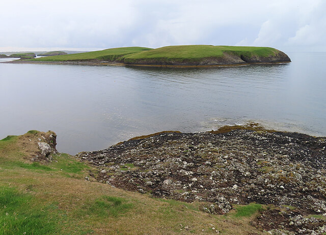
Bàgh Thuilm

Bay in Ross-shire

Scotland

Bàgh Thuilm

HMC Valiant approaching Stornoway Harbour HMC Valiant is passing Holm as she approaches Stornoway.

Valiant is a UK Border Force (customs, formerly UK Border Agency) cutter She was launched in 2003 and is one of four 42-metre cutters operated by the UK Border Force.
HMC Valiant approaching Stornoway Harbour Credit: David Dixon

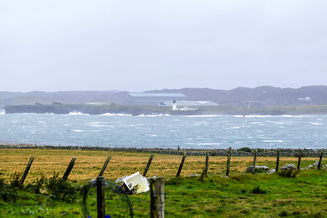
Bàgh Thuilm, located in Ross-shire, is a picturesque bay nestled on the western coast of Scotland. With its stunning natural beauty and tranquil ambiance, it is a popular destination for nature lovers and outdoor enthusiasts.

The bay is surrounded by lush green hills and rugged cliffs, offering breathtaking panoramic views of the surrounding landscape. Its pristine sandy beach stretches for miles, providing an ideal spot for sunbathing, beachcombing, and leisurely walks. The crystal-clear waters of Bàgh Thuilm are perfect for swimming and various water activities such as kayaking and paddleboarding.

Bàgh Thuilm is also known for its rich biodiversity. The bay is teeming with diverse marine life, making it a favorite spot for snorkeling and scuba diving. Visitors might spot seals, dolphins, and even the occasional whale swimming in the bay's waters. The surrounding hills and woodlands are home to a wide variety of bird species, making it a haven for birdwatchers.

For those seeking adventure, Bàgh Thuilm offers numerous hiking trails that wind their way through the stunning countryside. The challenging climb up the nearby hills rewards hikers with breathtaking views of the bay and its surroundings.

In addition to its natural beauty, Bàgh Thuilm is also steeped in history. The bay was once a bustling fishing village, and remnants of its fishing heritage can still be seen today. Visitors can explore the quaint village and learn about its history at the local heritage center.

Bàgh Thuilm truly offers a haven of natural beauty and tranquility, making it a must-visit destination for anyone seeking to immerse themselves in Scotland's rugged coastal charm.

If you have any feedback on the listing, please let us know in the comments section below.
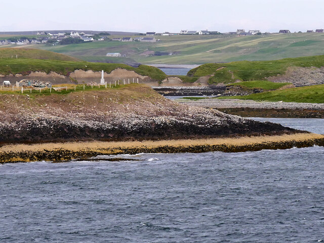
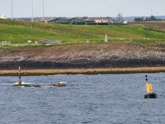
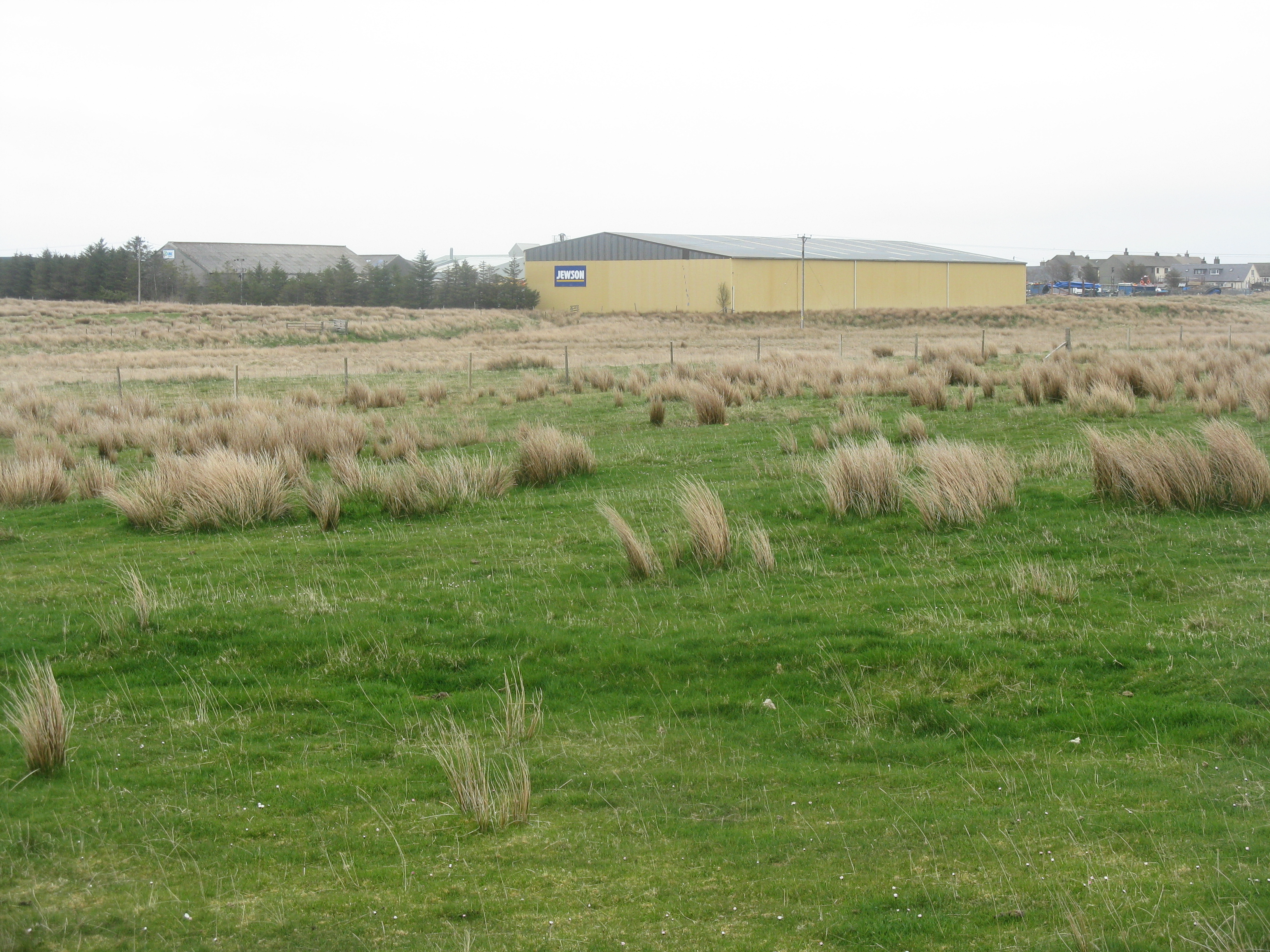
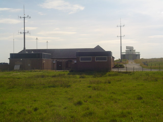
Bàgh Thuilm Images

Images are sourced within 2km of 58.190452/-6.3356893 or Grid Reference NB4530. Thanks to Geograph Open Source API. All images are credited.

HMC Valiant approaching Stornoway Harbour HMC Valiant is passing Holm as she approaches Stornoway.

Valiant is a UK Border Force (customs, formerly UK Border Agency) cutter She was launched in 2003 and is one of four 42-metre cutters operated by the UK Border Force.
HMC Valiant approaching Stornoway Harbour
HMC Valiant is passing Holm as she approaches Stornoway. Valiant is a UK Border Force (customs, formerly UK Border Agency) cutter She was launched in 2003 and is one of four 42-metre cutters operated by the UK Border Force.
Stormy Waves hit Arnish Point Lighthouse Stormy waves batter Arnish Point Lighthouse, Isle of Lewis
Stormy Waves hit Arnish Point Lighthouse
Stormy waves batter Arnish Point Lighthouse, Isle of Lewis
Iolaire memorial In the early hours of New Year's Day 1919 the biggest tragedy ever to affect the Western Isles occurred when H.M.Y. Iolaire carrying soldiers and sailors returning home from the First World War struck rocks within sight of Stornoway harbour. 205 men lost their lives and almost every community in Lewis and Harris was affected with the loss of a father, husband, brother or son. What should have been a joyful celebration at the end of the war turned into years of mourning for these islands and the beginning of the population decline which is still felt in the islands today.
Iolaire memorial
In the early hours of New Year's Day 1919 the biggest tragedy ever to affect the Western Isles occurred when H.M.Y. Iolaire carrying soldiers and sailors returning home from the First World War struck rocks within sight of Stornoway harbour. 205 men lost their lives and almost every community in Lewis and Harris was affected with the loss of a father, husband, brother or son. What should have been a joyful celebration at the end of the war turned into years of mourning for these islands and the beginning of the population decline which is still felt in the islands today.
Path to the shore
Path to the shore
A Lewis Rainbow
A Lewis Rainbow
Sewage Windmills "blowing the smell away" Geocaching is a type of global treasure hunt of people looking for caches, or hidden stashes of objects. Geocaching may also be described as a series of hide-and-seek games, where hiders provide online clues for seekers. Seekers use global positioning system (GPS) devices to find hidden caches
Sewage Windmills "blowing the smell away"
Geocaching is a type of global treasure hunt of people looking for caches, or hidden stashes of objects. Geocaching may also be described as a series of hide-and-seek games, where hiders provide online clues for seekers. Seekers use global positioning system (GPS) devices to find hidden caches
Iolaire Monument The curving strips on the right are the names of the islanders who died in the 'Iolaire' disaster, arranged by the locality where they lived. The longest strips are those communities who lost the largest number of their men. The original monument is in the background.
Iolaire Monument
The curving strips on the right are the names of the islanders who died in the 'Iolaire' disaster, arranged by the locality where they lived. The longest strips are those communities who lost the largest number of their men. The original monument is in the background.
Iolaire Monument This is the plaque on the monument to the men lost in the 'Iolaire' disaster.
Iolaire Monument
This is the plaque on the monument to the men lost in the 'Iolaire' disaster.
Eilean Thuilm Eilean Thuilm lies just offshore, close to the 'Beasts of Holm', the rocks on which HMY 'Iolaire' was wrecked.
Eilean Thuilm
Eilean Thuilm lies just offshore, close to the 'Beasts of Holm', the rocks on which HMY 'Iolaire' was wrecked.
Iolaire Monument This is the original monument commemorating the 'Iolaire' disaster of 1 January 1919.
Iolaire Monument
This is the original monument commemorating the 'Iolaire' disaster of 1 January 1919.
Iolaire Monument The curving strips on the left are the names of the islanders who died in the 'Iolaire' disaster, arranged by the locality where they lived. The longest strips are those communities who lost the largest number of their men. The original monument is in the background.
Iolaire Monument
The curving strips on the left are the names of the islanders who died in the 'Iolaire' disaster, arranged by the locality where they lived. The longest strips are those communities who lost the largest number of their men. The original monument is in the background.
Old Red Sandstone Conglomerate Most of Na h-Eileanan an Iar (The Western Isles) is composed of Lewisian Gneiss, apart from a relatively small area of Old Red Sandstone at Stornoway and the Eye Peninsula. This is some of that sandstone, laid down by intermittent floods in a desert environment over 400 million years ago.
Old Red Sandstone Conglomerate
Most of Na h-Eileanan an Iar (The Western Isles) is composed of Lewisian Gneiss, apart from a relatively small area of Old Red Sandstone at Stornoway and the Eye Peninsula. This is some of that sandstone, laid down by intermittent floods in a desert environment over 400 million years ago.
Arnish Point Lateral Marker Buoy Lateral Marks are used generally to mark the sides of well-defined, navigable channels. They are coloured red (port hand marks) and green (starboard hand marks) and indicate the port and starboard hand sides of the route to be followed.
Arnish Point Lateral Marker Buoy
Lateral Marks are used generally to mark the sides of well-defined, navigable channels. They are coloured red (port hand marks) and green (starboard hand marks) and indicate the port and starboard hand sides of the route to be followed.
Isle of Lewis, Holm Point, Iolaire Monument The obelisk on top of the cliff is the Iolaire Monument, a memorial to those who died on the Admiralty yacht HMY Iolaire which was carrying 280 Island servicemen returning home from the Great War when it sank at the entrance to Stornoway harbour on New Year’s Day 1919. 205 of the passengers, of whom 181 were islanders, were lost in the tragedy.

<a href="https://www.geograph.org.uk/photo/8718">NB4430 : The Iolaire Plaque</a>
Isle of Lewis, Holm Point, Iolaire Monument
The obelisk on top of the cliff is the Iolaire Monument, a memorial to those who died on the Admiralty yacht HMY Iolaire which was carrying 280 Island servicemen returning home from the Great War when it sank at the entrance to Stornoway harbour on New Year’s Day 1919. 205 of the passengers, of whom 181 were islanders, were lost in the tragedy. NB4430 : The Iolaire Plaque
Beasts of Holm (Biastan Thuilm) The Beasts of Holm are dangerous rocks lying just offshore at the entrance to Stornoway Harbour. On New Year’s Day in 1919, the Admiralty yacht HMY Iolaire which was carrying 280 servicemen returning home from the Great War sank here with the loss of 205 passengers, of whom 181 were islanders. A yellow buoy marks the site of the wreckage and a memorial on Holm Point (behind) commemorates the disaster.

<a href="https://www.geograph.org.uk/photo/8718">NB4430 : The Iolaire Plaque</a>
Beasts of Holm (Biastan Thuilm)
The Beasts of Holm are dangerous rocks lying just offshore at the entrance to Stornoway Harbour. On New Year’s Day in 1919, the Admiralty yacht HMY Iolaire which was carrying 280 servicemen returning home from the Great War sank here with the loss of 205 passengers, of whom 181 were islanders. A yellow buoy marks the site of the wreckage and a memorial on Holm Point (behind) commemorates the disaster. NB4430 : The Iolaire Plaque
The Iolaire Memorial and the Beast of Holm Beacon
The Iolaire Monument stands above Rubha Thuilm It is hard to imagine a more tragic story than that of the Iolaire which struck the 'Beasts of Holm', on 1st January 1919 when returning servicemen home after the Great War and which was so near to a safe berth at Stornoway, just a couple of miles away. The official death toll was 205 but may have been more as the records of those aboard were incomplete. 181 of the official casualties were Lewis islanders.
The Iolaire Monument stands above Rubha Thuilm
It is hard to imagine a more tragic story than that of the Iolaire which struck the 'Beasts of Holm', on 1st January 1919 when returning servicemen home after the Great War and which was so near to a safe berth at Stornoway, just a couple of miles away. The official death toll was 205 but may have been more as the records of those aboard were incomplete. 181 of the official casualties were Lewis islanders.
A view towards Eilean Thuilm from the Iolaire Monument
Show me another place!

Bàgh Thuilm is located at Grid Ref: NB4530 (Lat: 58.190452, Lng: -6.3356893)

Unitary Authority: Na h-Eileanan an Iar

Police Authority: Highlands and Islands

What 3 Words

///parent.reshape.entrusted. Near Stornoway, Na h-Eileanan Siar

Related Wikis

Holm, Lewis

Holm Village (Scottish Gaelic: Tolm) is a village in the Scottish Outer Hebrides, on the Isle of Lewis near Stornoway. The modern area of Holm can be split...
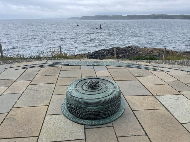
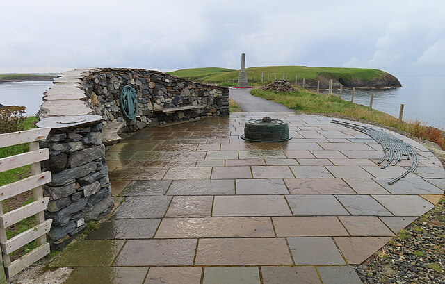
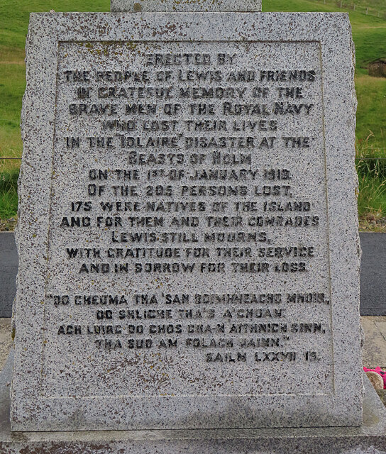
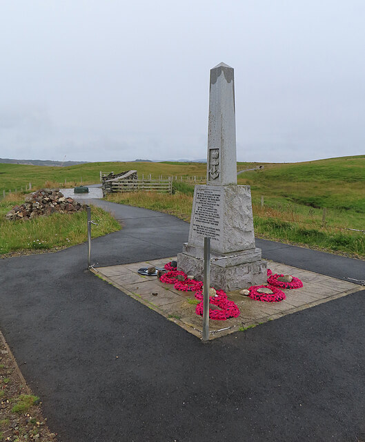
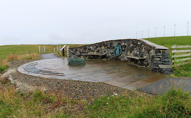
HMY Iolaire

HMY Iolaire was an Admiralty Yacht that sank at the entrance to Stornoway harbour on 1 January 1919, with the loss of at least 201 men out of the 283 on...

Parkend, Lewis

Parkend (Scottish Gaelic: Ceann nam Buailtean) is a hamlet in the Sandwick region of the Isle of Lewis, although like Melbost, it is not a part of the...

Sandwick, Lewis

Sandwick (Scottish Gaelic: Sanndabhaig, IPA:[ˈs̪aun̴̪t̪əvɪkʲ]) is a village in the Scottish Outer Hebrides, on the Isle of Lewis and a quasi-suburb of...

Branahuie

Branahuie (Scottish Gaelic: Bràigh na h-Aoidhe) is a village on the Isle of Lewis in the Outer Hebrides, Scotland. Branahuie is within the parish of Stornoway...

Melbost

Melbost (Scottish Gaelic: Mealabost) is a traditionally Gaelic-speaking village in Point on the east coast of the Isle of Lewis, in Scotland's north-west...

Stornoway power station

Stornoway power station, also known as Battery Point Power Station, is an electrical generation facility in Stornoway, Scotland. It was commissioned in...

Plasterfield

Plasterfield (Scottish Gaelic: Raon na Crèadha) is a hamlet in the Scottish Outer Hebrides, on the Isle of Lewis. Plasterfield is within the parish of...

Nearby Amenities

Located within 500m of 58.190452,-6.3356893
The data included in this document is from www.openstreetmap.org. The data is made available under ODbL.

Have you been to Bàgh Thuilm?

Leave your review of Bàgh Thuilm below (or comments, questions and feedback).