Bassingthorpe

Settlement in Lincolnshire South Kesteven

England

Bassingthorpe

Track to Pasture Farm Flat landscape of the Kesteven Uplands
Track to Pasture Farm Credit: Tim Heaton

Bassingthorpe is a small village located in the county of Lincolnshire, England. Situated in the district of South Kesteven, it is nestled amidst the picturesque countryside of the East Midlands. The village is approximately 5 miles northwest of Grantham and 17 miles east of the city of Nottingham.

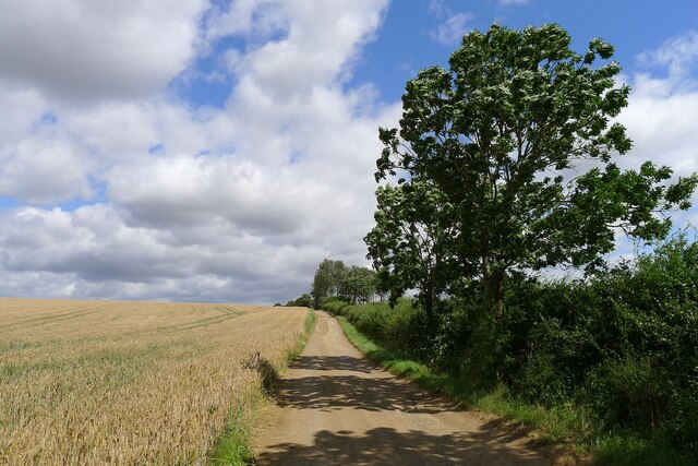
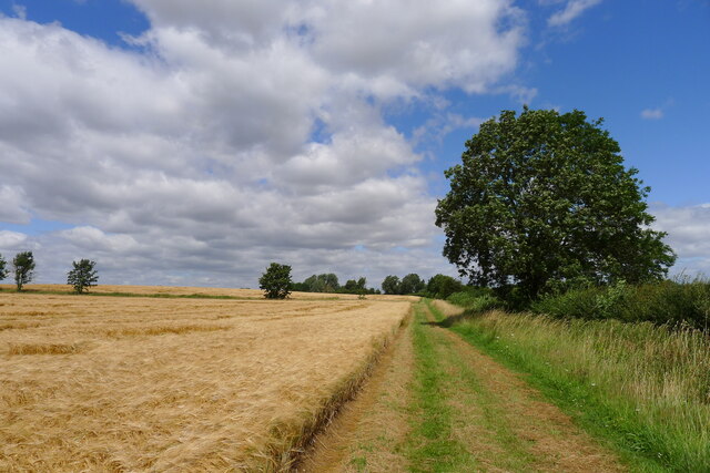
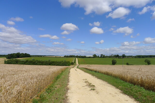
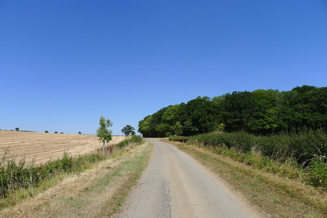
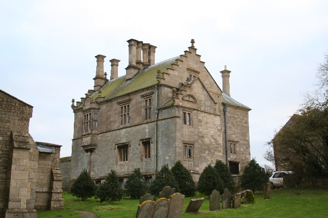
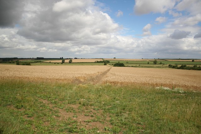
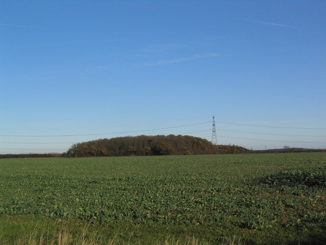
With a population of around 200 residents, Bassingthorpe exudes a peaceful and rural charm. The village is characterized by its quaint cottages, well-maintained gardens, and traditional architecture. The surrounding landscape is predominantly agricultural, with vast fields and rolling hills stretching as far as the eye can see.

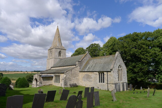
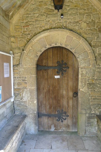
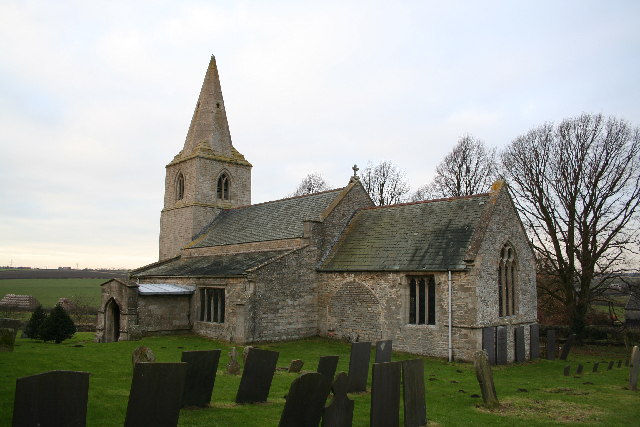
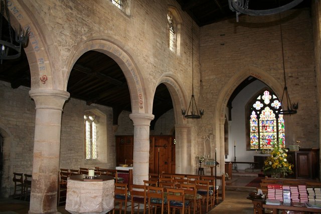
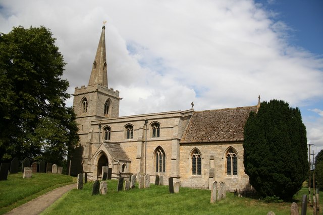
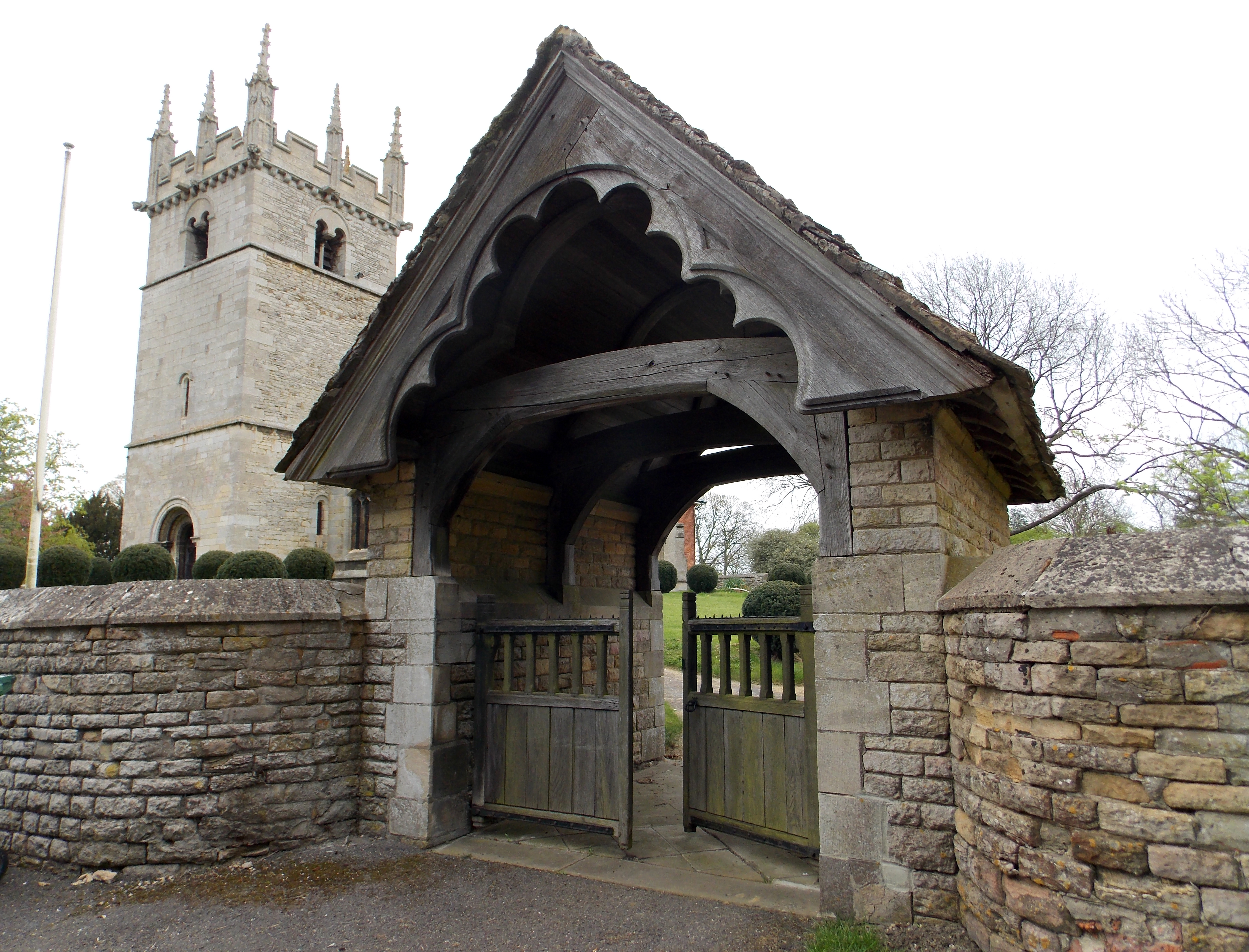
Bassingthorpe is known for its historical significance, boasting a rich heritage that dates back centuries. St. Thomas' Church, a Grade II listed building, is a prominent landmark in the village. This charming church, dating back to the 13th century, showcases stunning medieval architecture and serves as a testament to the village's long-standing religious traditions.

Despite its small size, Bassingthorpe benefits from a close-knit community spirit. The village has a local pub, The Plough Inn, which serves as a hub for social gatherings and community events. Residents enjoy coming together for various activities, including village fairs, charity fundraisers, and sports competitions.

For those seeking tranquility and a slower pace of life, Bassingthorpe offers an idyllic retreat. Surrounded by natural beauty and steeped in history, it remains a hidden gem within the Lincolnshire countryside.

If you have any feedback on the listing, please let us know in the comments section below.

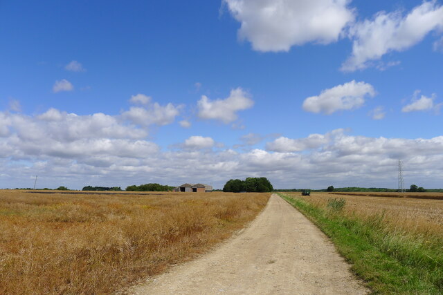
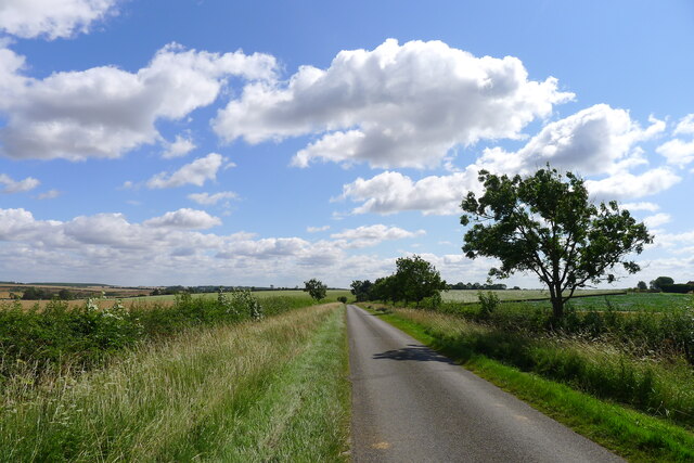
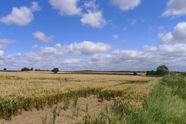
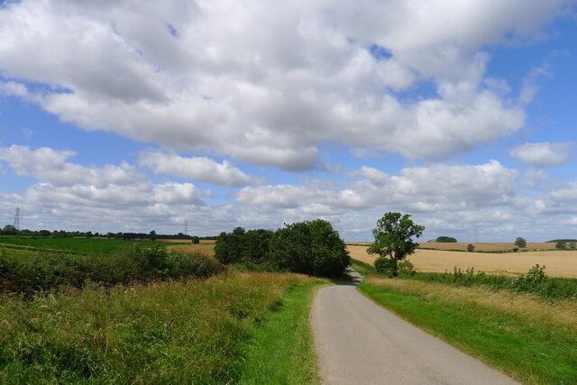
Bassingthorpe Images

Images are sourced within 2km of 52.845968/-0.568069 or Grid Reference SK9628. Thanks to Geograph Open Source API. All images are credited.

Track to Pasture Farm Flat landscape of the Kesteven Uplands
Track to Pasture Farm
Flat landscape of the Kesteven Uplands
The road from Bassingthorpe to Great Ponton
Wheat field north of Stoke Tunnel Farm The long grass at the field boundary conceals a tributary stream to the West Glen River
Wheat field north of Stoke Tunnel Farm
The long grass at the field boundary conceals a tributary stream to the West Glen River
Road west from Bassingthorpe heading towards Ermine Street A quiet road across farmland of the Kesteven Uplands.
Road west from Bassingthorpe heading towards Ermine Street
A quiet road across farmland of the Kesteven Uplands.
Track from Lower Bassingthorpe to Boothby Pagnell An 'other route with public access'
Track from Lower Bassingthorpe to Boothby Pagnell
An 'other route with public access'
Church of St Thomas a Becket, Bassingthorpe Listed Grade I, from 13th century and later. Contains some Romanesque features <span class="nowrap"><a title="https://www.crsbi.ac.uk/view-item?i=8143" rel="nofollow ugc noopener" href="https://www.crsbi.ac.uk/view-item?i=8143">Link</a><img style="margin-left:2px;" alt="External link" title="External link - shift click to open in new window" src="https://s1.geograph.org.uk/img/external.png" width="10" height="10"/></span>
Church of St Thomas a Becket, Bassingthorpe
Listed Grade I, from 13th century and later. Contains some Romanesque features LinkExternal link
Road heading west to Bassingthorpe To the right, a bridleway to Boothby Pagnell. To the left, a road to Westby and Burton-le-Coggles.
Road heading west to Bassingthorpe
To the right, a bridleway to Boothby Pagnell. To the left, a road to Westby and Burton-le-Coggles.
Church of St Mary Magdalene, Bitchfield Situated in Lower Bitchfield. Listed Grade I, from the 11th century and later <span class="nowrap"><a title="https://britishlistedbuildings.co.uk/101062863-church-of-st-mary-magdalene-bitchfield-and-bassingthorpe#.YQWfbI5KhPY" rel="nofollow ugc noopener" href="https://britishlistedbuildings.co.uk/101062863-church-of-st-mary-magdalene-bitchfield-and-bassingthorpe#.YQWfbI5KhPY">Link</a><img style="margin-left:2px;" alt="External link" title="External link - shift click to open in new window" src="https://s1.geograph.org.uk/img/external.png" width="10" height="10"/></span>
Church of St Mary Magdalene, Bitchfield
Situated in Lower Bitchfield. Listed Grade I, from the 11th century and later LinkExternal link
South doorway to Church of St Mary Magdalene, Bitchfield " ...late C12, round headed, with dogtooth ..." <span class="nowrap"><a title="https://historicengland.org.uk/listing/the-list/list-entry/1062863" rel="nofollow ugc noopener" href="https://historicengland.org.uk/listing/the-list/list-entry/1062863">Link</a><img style="margin-left:2px;" alt="External link" title="External link - shift click to open in new window" src="https://s1.geograph.org.uk/img/external.png" width="10" height="10"/></span>
This wall, and that of the enclosing 14th century porch has numerous late 17th century graffiti (including "TH 1677" - am I that old?). I've noticed graffiti of similar date on other churches.
South doorway to Church of St Mary Magdalene, Bitchfield
" ...late C12, round headed, with dogtooth ..." LinkExternal link This wall, and that of the enclosing 14th century porch has numerous late 17th century graffiti (including "TH 1677" - am I that old?). I've noticed graffiti of similar date on other churches.
Footpath from Burton-le-Coggles north to Lower Bitchfield Alongside very large fields of barley.
Footpath from Burton-le-Coggles north to Lower Bitchfield
Alongside very large fields of barley.
Track towards Boothby Lodge Farm Crossing the West Glen River in the dip
Track towards Boothby Lodge Farm
Crossing the West Glen River in the dip
Westby Road approaching Lownd Wood The Dictionaries of the Scots Language lists 'Lownd' as a variant (possibly past participle) of 'Lown', meaning calm (of weather), sheltered, peaceful <span class="nowrap"><a title="https://www.dsl.ac.uk/entry/snd/lown" rel="nofollow ugc noopener" href="https://www.dsl.ac.uk/entry/snd/lown">Link</a><img style="margin-left:2px;" alt="External link" title="External link - shift click to open in new window" src="https://s1.geograph.org.uk/img/external.png" width="10" height="10"/></span> . It may also be a family name.
Westby Road approaching Lownd Wood
The Dictionaries of the Scots Language lists 'Lownd' as a variant (possibly past participle) of 'Lown', meaning calm (of weather), sheltered, peaceful LinkExternal link . It may also be a family name.
St.Thomas' church, Bassingthorpe, Lincs. Norman and Early English, the south arcade is c1200 and a Norman chancel arch.
St.Thomas' church, Bassingthorpe, Lincs.
Norman and Early English, the south arcade is c1200 and a Norman chancel arch.
Bassingthorpe Manor A fragment of a much larger Elizabethan house - looking down on the church and the tiny hamlet of Bassingthorpe. Built by Thomas Coney in 1568, his heraldic pun (a rabbit) can be spotted on the outside of the house.
Bassingthorpe Manor
A fragment of a much larger Elizabethan house - looking down on the church and the tiny hamlet of Bassingthorpe. Built by Thomas Coney in 1568, his heraldic pun (a rabbit) can be spotted on the outside of the house.
St.Mary Magdalene's church, Bitchfield, Lincs. St.Mary's church has 11th century origins, an Early English tower with a recessed Decorated spire. Inside an early 13th century Transitional Norman arcade and an intersecting octagonal 14th century font. In a lovely spot at Lower Bitchfield.
St.Mary Magdalene's church, Bitchfield, Lincs.
St.Mary's church has 11th century origins, an Early English tower with a recessed Decorated spire. Inside an early 13th century Transitional Norman arcade and an intersecting octagonal 14th century font. In a lovely spot at Lower Bitchfield.
St.Mary's church nave Early 13th century north arcade in St.Mary's church, Bitchfield
St.Mary's church nave
Early 13th century north arcade in St.Mary's church, Bitchfield
Footpath to Boothby Pagnell View north from Westby towards Boothby Pagnell
Footpath to Boothby Pagnell
View north from Westby towards Boothby Pagnell
View from Canner's Lane, north-east to Old Park Wood
Show me another place!

Bassingthorpe is located at Grid Ref: SK9628 (Lat: 52.845968, Lng: -0.568069)

Division: Parts of Kesteven

Administrative County: Lincolnshire

District: South Kesteven

Police Authority: Lincolnshire

What 3 Words

///playfully.ecologist.cover. Near Corby Glen, Lincolnshire

Nearby Locations

Bassingthorpe

Related Wikis

Bassingthorpe

Bassingthorpe is a small village in the South Kesteven district of Lincolnshire, England. It is in the civil parish of Bitchfield and Bassingthorpe, 5...

Westby, Lincolnshire

Westby is a hamlet in the civil parish of Bitchfield and Bassingthorpe, in the South Kesteven district of Lincolnshire, England. It is situated approximately...

Stoke Bank

Stoke Bank is an inclined stretch of the East Coast Main Line (ECML) between Peterborough and Grantham. It is named after the village of Stoke Rochford...

Bitchfield and Bassingthorpe

Bitchfield and Bassingthorpe is a civil parish which includes Boothby Pagnell and Burton Coggles in the South Kesteven district of Lincolnshire, England...

Grantham Rural District

Grantham was a rural district in Lincolnshire, Parts of Kesteven from 1894 to 1931. It was created by the Local Government Act 1894 based on the Grantham...

Bitchfield

Bitchfield is a small village in the South Kesteven district of Lincolnshire, England. It consists of two groups of buildings connected by Dark Lane, known...

Boothby Pagnell

Boothby Pagnell is a village and civil parish in the South Kesteven district of Lincolnshire, England. The population is now included in the civil parish...

Burton Coggles

Burton Coggles (full name Burton-le-Coggles from Byrton-en-les-Coggles) is a small village and civil parish in the South Kesteven district of Lincolnshire...

Nearby Amenities

Located within 500m of 52.845968,-0.568069
Bassingthorpe
Place: hamlet
Lat/Long: 52.8456267/-0.5668716
Manor Farm
Place: farm
Source: Bing
Lat/Long: 52.8465739/-0.5675899
Manor Farm
Place: farm
Source: Bing
Lat/Long: 52.8493344/-0.5696296
The data included in this document is from www.openstreetmap.org. The data is made available under ODbL.

Have you been to Bassingthorpe?

Leave your review of Bassingthorpe below (or comments, questions and feedback).