Dearg Phort

Bay in Argyllshire

Scotland

Dearg Phort

Rainbow above Fionnphort From the A849.
Rainbow above Fionnphort Credit: Andrew Abbott

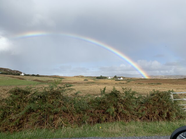
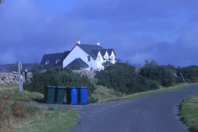
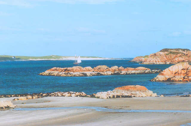
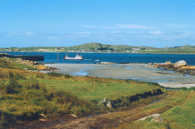
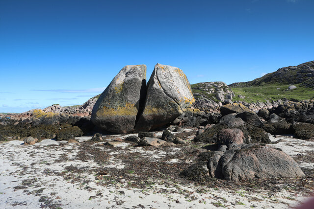
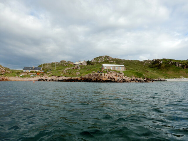
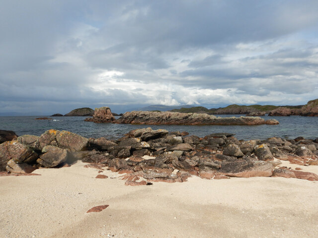
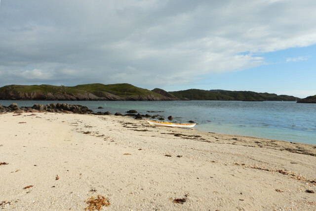
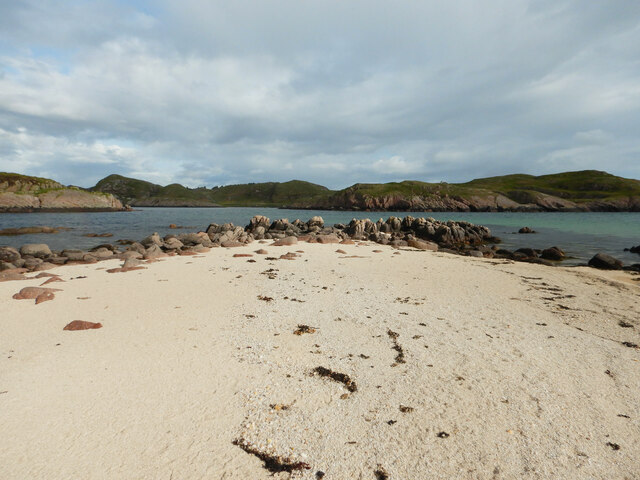
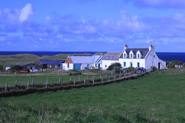
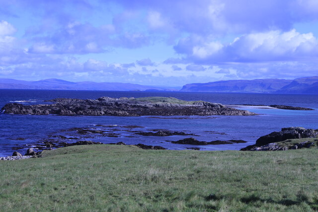
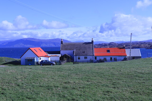
Dearg Phort is a small bay located on the west coast of Scotland in Argyllshire. The bay is known for its stunning natural beauty, with rugged cliffs and crystal-clear waters that attract visitors looking to immerse themselves in the peaceful surroundings.

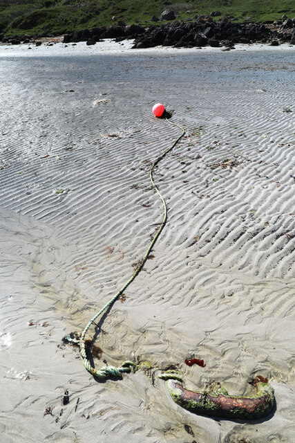
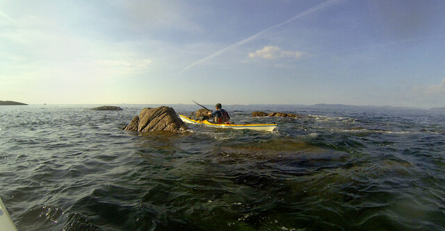
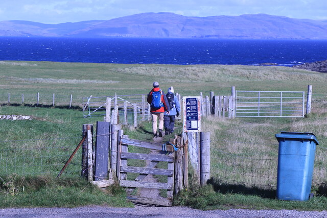
Dearg Phort is a popular spot for outdoor enthusiasts, with opportunities for hiking, birdwatching, and water activities such as kayaking and swimming. The bay is also home to a variety of wildlife, including seals, otters, and a wide range of bird species.

In addition to its natural attractions, Dearg Phort is also steeped in history, with several ancient ruins scattered throughout the area. Visitors can explore the remains of old settlements and castles, providing a glimpse into the area's rich past.

The surrounding area offers plenty of accommodation options, from cozy bed and breakfasts to luxurious hotels, making it a perfect destination for a relaxing getaway. Dearg Phort is a hidden gem on Scotland's west coast, offering a peaceful retreat for those looking to escape the hustle and bustle of everyday life.

If you have any feedback on the listing, please let us know in the comments section below.

Dearg Phort Images

Images are sourced within 2km of 56.341134/-6.3600227 or Grid Reference NM3025. Thanks to Geograph Open Source API. All images are credited.

Rainbow above Fionnphort From the A849.
Rainbow above Fionnphort
From the A849.
Taigh Geal House near Fionnphort.
Taigh Geal
House near Fionnphort.
The Beach at Fionnphort
Fionnphort Beach and Iona A view across the Sound of Iona.
Fionnphort Beach and Iona
A view across the Sound of Iona.
Split boulder at Fionnphort A distinctive feature of the shore at Fionnphort, this huge split boulder of Ross of Mull Granite can only be approached dryshod at the bottom of a spring tide when an easy walk across the soft sand gives close up views from any angle of choice. The split is most obvious with the sky behind, looking north (its clear from the other side, too, of course, but then the rock is in shade and not so attractive to photograph). This rock must have been dropped here by ice - it's definitely a boulder, not bedrock. In some parts of the world, not too far away, the explanation would undoubtedly be that it had been lobbed by an angry Troll and had split on hitting some warrior's helmet.
Split boulder at Fionnphort
A distinctive feature of the shore at Fionnphort, this huge split boulder of Ross of Mull Granite can only be approached dryshod at the bottom of a spring tide when an easy walk across the soft sand gives close up views from any angle of choice. The split is most obvious with the sky behind, looking north (its clear from the other side, too, of course, but then the rock is in shade and not so attractive to photograph). This rock must have been dropped here by ice - it's definitely a boulder, not bedrock. In some parts of the world, not too far away, the explanation would undoubtedly be that it had been lobbed by an angry Troll and had split on hitting some warrior's helmet.
Mooring on Fionnphort beach I usually encounter mooring buoys by paddling past them in a sea kayak, but this one is at the bottom of a spring tide and entirely stranded, so the huge chain link to which it is attached can be inspected.
Mooring on Fionnphort beach
I usually encounter mooring buoys by paddling past them in a sea kayak, but this one is at the bottom of a spring tide and entirely stranded, so the huge chain link to which it is attached can be inspected.
Tòrr Mòr quarry pier from Bull Hole Bull Hole is a sheltered channel between Eilean nam Ban and the Ross of Mull, which forms a convenient anchorage for any vessel with a shallow enough draft. This includes the Iona ferry, which beds down tied to the island each night. The pier and buildings here are associated with the granite quarry at Tòrr Mòr and the jetty would have provided a secure place to tie up boats exporting the product elsewhere, out of the swiftly flowing tide in the Hole itself. It's looking a bit decrepit now, however, and what boats are here are pulled up safely on the grass above the beach.
Tòrr Mòr quarry pier from Bull Hole
Bull Hole is a sheltered channel between Eilean nam Ban and the Ross of Mull, which forms a convenient anchorage for any vessel with a shallow enough draft. This includes the Iona ferry, which beds down tied to the island each night. The pier and buildings here are associated with the granite quarry at Tòrr Mòr and the jetty would have provided a secure place to tie up boats exporting the product elsewhere, out of the swiftly flowing tide in the Hole itself. It's looking a bit decrepit now, however, and what boats are here are pulled up safely on the grass above the beach.
Eilean Dubh na Ciste Eilean Dubh na Ciste is a rocky skerry at the NNE end of Bull Hole, a narrow channel and anchorage between Iona and the Ross of Mull. Its advantage from my perspective is that the two main rocks are linked by a small sandy tombolo beach which provides a convenient place to land a sea kayak and wander around getting the best views. This view looks northwards to more skerries outside Kinta harbour, where the water is a lot calmer than on my last visit <a href="https://www.geograph.org.uk/photo/5796448">NM3125 : Paddling into the sun - Eilean Corrach</a>.
Eilean Dubh na Ciste
Eilean Dubh na Ciste is a rocky skerry at the NNE end of Bull Hole, a narrow channel and anchorage between Iona and the Ross of Mull. Its advantage from my perspective is that the two main rocks are linked by a small sandy tombolo beach which provides a convenient place to land a sea kayak and wander around getting the best views. This view looks northwards to more skerries outside Kinta harbour, where the water is a lot calmer than on my last visit NM3125 : Paddling into the sun - Eilean Corrach.
Landing on Eilean Dubh na Ciste Eilean Dubh na Ciste is a rocky skerry at the NNE end of Bull Hole, a narrow channel and anchorage between Iona and the Ross of Mull. Its advantage from my perspective is that the two main rocks are linked by a small sandy tombolo beach which provides a convenient place to land a sea kayak and wander around getting the best views. This is the full extent of the beach - my back is almost against the rocks looking over my landing spot towards the bay south of Kintra.
Landing on Eilean Dubh na Ciste
Eilean Dubh na Ciste is a rocky skerry at the NNE end of Bull Hole, a narrow channel and anchorage between Iona and the Ross of Mull. Its advantage from my perspective is that the two main rocks are linked by a small sandy tombolo beach which provides a convenient place to land a sea kayak and wander around getting the best views. This is the full extent of the beach - my back is almost against the rocks looking over my landing spot towards the bay south of Kintra.
Sand on Eilean Dubh na Ciste Eilean Dubh na Ciste is a rocky skerry at the NNE end of Bull Hole, a narrow channel and anchorage between Iona and the Ross of Mull. Its advantage from my perspective is that the two main rocks are linked by a small sandy tombolo beach which provides a convenient place to land a sea kayak and wander around getting the best views. These are the rocks on the eastern edge of the beach, beyond which lie the shallow bays and rocky coast hiding the settlement of Kintra.
Sand on Eilean Dubh na Ciste
Eilean Dubh na Ciste is a rocky skerry at the NNE end of Bull Hole, a narrow channel and anchorage between Iona and the Ross of Mull. Its advantage from my perspective is that the two main rocks are linked by a small sandy tombolo beach which provides a convenient place to land a sea kayak and wander around getting the best views. These are the rocks on the eastern edge of the beach, beyond which lie the shallow bays and rocky coast hiding the settlement of Kintra.
Rock-hopping towards Rubh na Cearc, Ross of Mull Like most sea kayaking trips, we'd chosen our time of day to get the tides working for us - soon after this shot was taken, the ebb tide was whisking us south down the Sound of Iona with very little effort on our part. That meant that we were passing Rubha na Cearc close to the top of the tide (and getting towards evening). These skerries look a lot bigger on the map and on aerial photos which are mostly shot near low tide. Even with this much water covering them, the small swell was causing the occasional breaking wave, one of which had just knocked Pete somewhat off-course, needing a swift reactive steering stroke to avoid the biggest barnacle-encrusted bit of granite.
Rock-hopping towards Rubh na Cearc, Ross of Mull
Like most sea kayaking trips, we'd chosen our time of day to get the tides working for us - soon after this shot was taken, the ebb tide was whisking us south down the Sound of Iona with very little effort on our part. That meant that we were passing Rubha na Cearc close to the top of the tide (and getting towards evening). These skerries look a lot bigger on the map and on aerial photos which are mostly shot near low tide. Even with this much water covering them, the small swell was causing the occasional breaking wave, one of which had just knocked Pete somewhat off-course, needing a swift reactive steering stroke to avoid the biggest barnacle-encrusted bit of granite.
A849 at Fionnphort
A849 at Fionnphort
Lagandorain House The most northerly property on Iona.
Lagandorain House
The most northerly property on Iona.
Eilean Annraidh An island off the north coast of Iona.
Eilean Annraidh
An island off the north coast of Iona.
Track down to Traigh Bhan On the north coast of Iona.
Track down to Traigh Bhan
On the north coast of Iona.
Trekking north Near Summer House, Iona.
Trekking north
Near Summer House, Iona.
The Summer House Near Traigh Bhan, Iona.
The Summer House
Near Traigh Bhan, Iona.
House on Iona Opposite the memorial cross.
House on Iona
Opposite the memorial cross.
Show me another place!

Dearg Phort is located at Grid Ref: NM3025 (Lat: 56.341134, Lng: -6.3600227)

Unitary Authority: Argyll and Bute

Police Authority: Argyll and West Dunbartonshire

What 3 Words

///sofas.recorder.burn. Near Fionnphort, Argyll & Bute

Related Wikis

Kintra

Kintra (Scottish Gaelic: Ceann na Tràgha), literally "country" in Scots is a settlement on the North-Western coast of the Ross of Mull, Scotland. The settlement...

Fionnphort

Fionnphort (English: , Scottish Gaelic: [ˈfjun̪ˠafɔrˠt̪]) is the principal port of the Ross of Mull, and the second largest settlement in the area (its...

Bishop's House, Iona

Bishop's House is a retreat house for the Scottish Episcopal Church, located on the island of Iona, off the west coast of Scotland. == History == It was...

St Oran's Chapel

St Oran's Chapel (Odhráin/Orain/Odran) is a medieval chapel located on the island of Iona in the Inner Hebrides off the west coast of Scotland. Built in...

Nearby Amenities

Located within 500m of 56.341134,-6.3600227
Source: PGS
Lat/Long: 56.337957/-6.3648772
Created By: dmgroom_coastlines
Source: PGS
Lat/Long: 56.33809/-6.36428
Source: PGS
Lat/Long: 56.3384982/-6.3631359
Location Transition: yes
Power: pole
Lat/Long: 56.3404441/-6.3578278
Power: pole
Lat/Long: 56.3404351/-6.3577741
Power: pole
Lat/Long: 56.3390399/-6.3533378
Power: pole
Lat/Long: 56.3395707/-6.3536087
Power: pole
Lat/Long: 56.3396718/-6.3540566
Power: pole
Lat/Long: 56.339984/-6.3555372
Power: pole
Lat/Long: 56.3402887/-6.3570339
Power: pole
Lat/Long: 56.3407035/-6.3568354
Power: pole
Lat/Long: 56.3409904/-6.3571036
Power: pole
Lat/Long: 56.3416148/-6.3571546
The data included in this document is from www.openstreetmap.org. The data is made available under ODbL.

Have you been to Dearg Phort?

Leave your review of Dearg Phort below (or comments, questions and feedback).