Slochd Bran

Bay in Argyllshire

Scotland

Slochd Bran

Cairn na Burgh Beg & More from Coll ferry terminal Taken from beside the ferry terminal south of Arinagour on Coll looking over to the northernmost two of the Treshnish Isles. On the left is Cairn na Burgh Beg with the larger Cairn na Burgh More on the right. The remains of a chapel (the triangular gables can be seen) and part of the ancient castle are atop the larger island. Distance from Coll is c.15km (10½ miles)
Cairn na Burgh Beg & More from Coll ferry terminal Credit: Rob Farrow

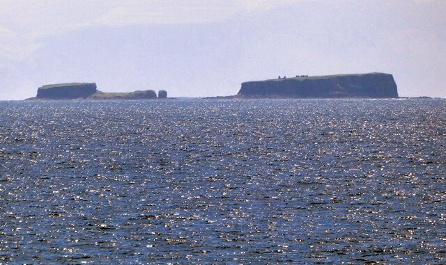
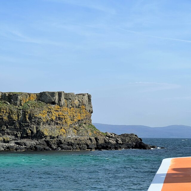
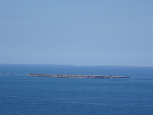
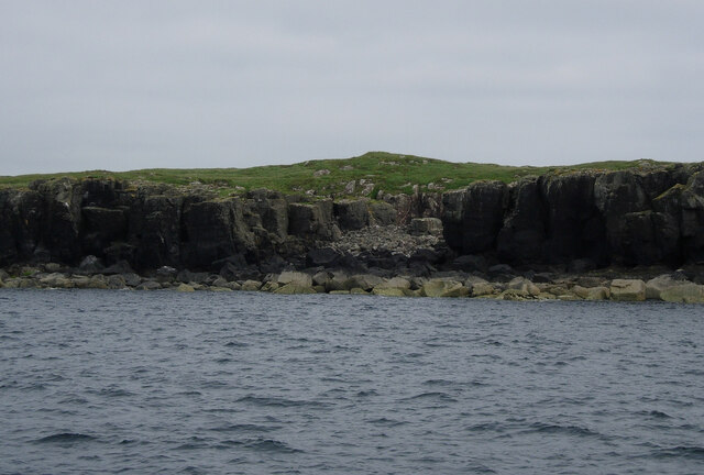
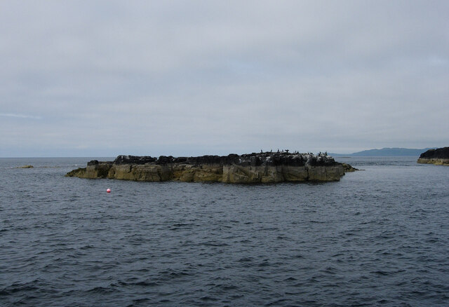
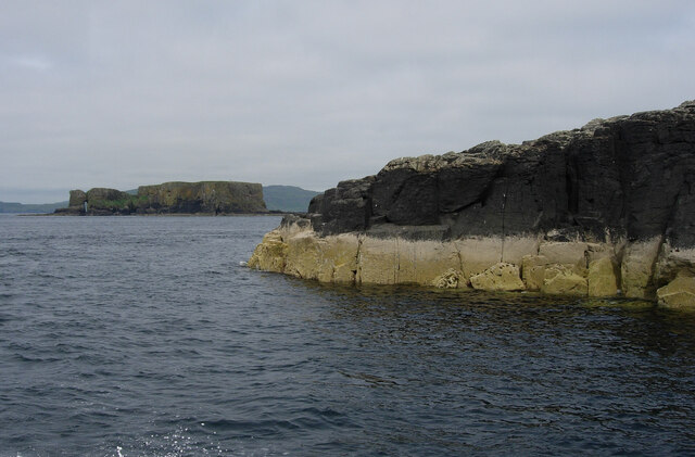
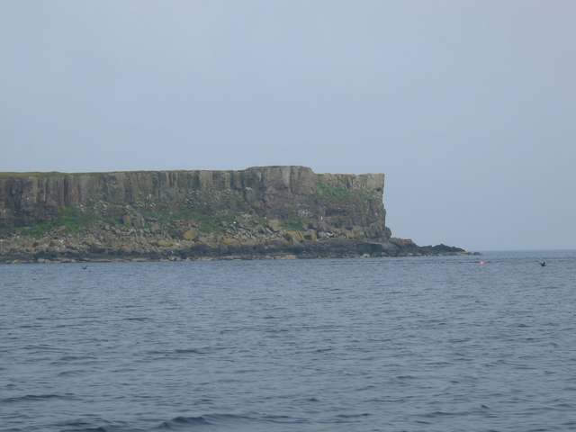
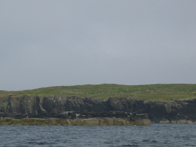
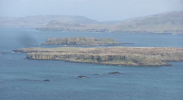
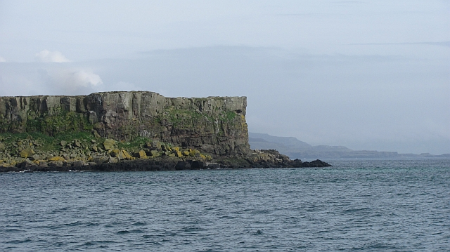
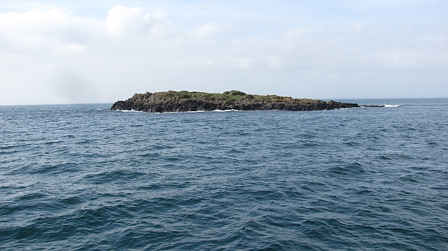
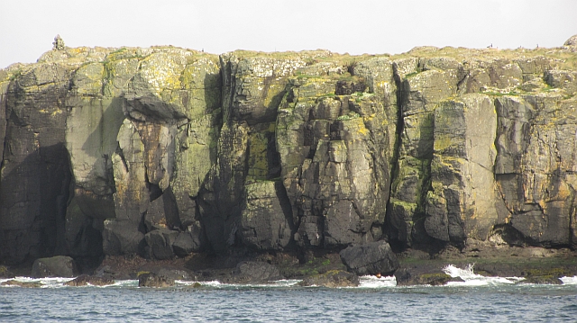
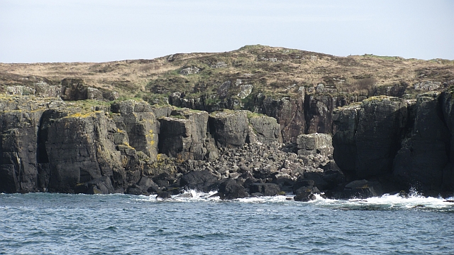
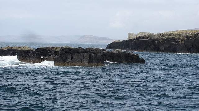
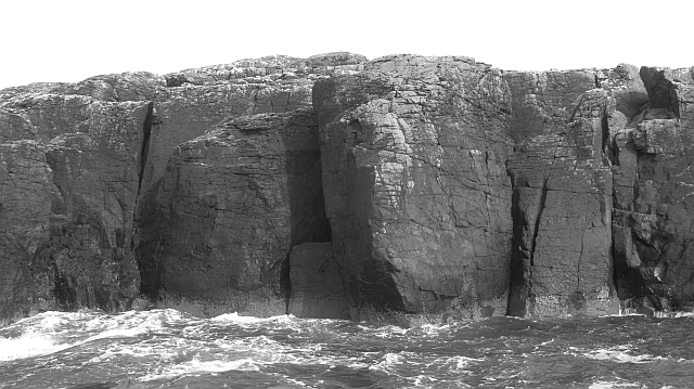
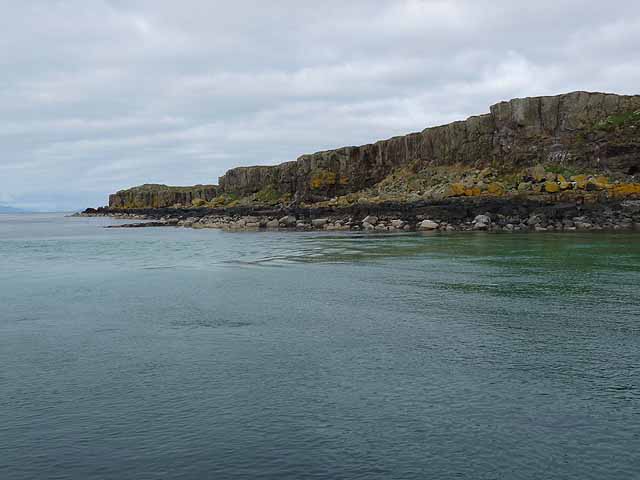
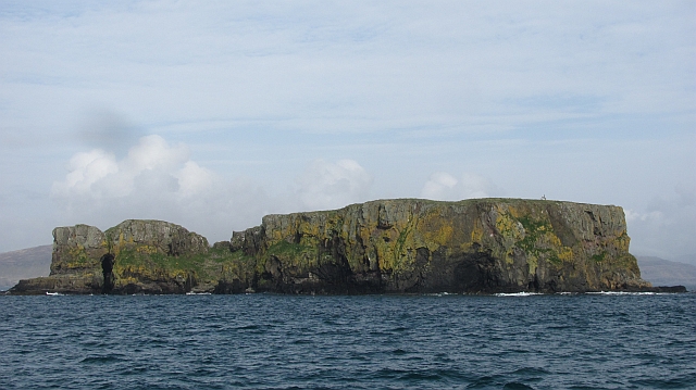
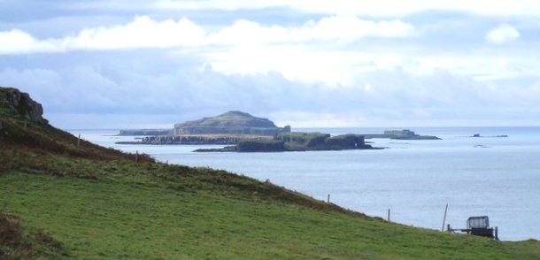
Slochd Bran is a small bay located in Argyllshire, Scotland. The bay is situated on the west coast of Scotland, overlooking the Atlantic Ocean. Slochd Bran is surrounded by rugged cliffs and rolling hills, creating a picturesque and serene setting.

The bay is known for its stunning natural beauty and is a popular destination for tourists looking to explore the Scottish Highlands. Visitors can enjoy scenic walks along the coastline, taking in the breathtaking views of the sea and surrounding countryside.

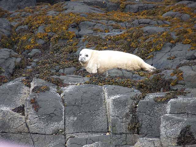
Slochd Bran is also a haven for wildlife, with a variety of bird species making their home in the area. Birdwatchers can spot seabirds such as gannets, puffins, and guillemots, as well as birds of prey like eagles and falcons.

In addition to its natural attractions, Slochd Bran also offers opportunities for outdoor activities such as fishing, kayaking, and sailing. The bay is a peaceful and tranquil retreat, perfect for those looking to escape the hustle and bustle of city life and immerse themselves in the beauty of the Scottish countryside.

If you have any feedback on the listing, please let us know in the comments section below.

Slochd Bran Images

Images are sourced within 2km of 56.518377/-6.384151 or Grid Reference NM3044. Thanks to Geograph Open Source API. All images are credited.

Cairn na Burgh Beg & More from Coll ferry terminal Taken from beside the ferry terminal south of Arinagour on Coll looking over to the northernmost two of the Treshnish Isles. On the left is Cairn na Burgh Beg with the larger Cairn na Burgh More on the right. The remains of a chapel (the triangular gables can be seen) and part of the ancient castle are atop the larger island. Distance from Coll is c.15km (10½ miles)
Cairn na Burgh Beg & More from Coll ferry terminal
Taken from beside the ferry terminal south of Arinagour on Coll looking over to the northernmost two of the Treshnish Isles. On the left is Cairn na Burgh Beg with the larger Cairn na Burgh More on the right. The remains of a chapel (the triangular gables can be seen) and part of the ancient castle are atop the larger island. Distance from Coll is c.15km (10½ miles)
Southern tip of Fladda The Staffa tour boat threaded its way through the Treshnish Isles on its return journey to Kilchoan and Tobermory.
Southern tip of Fladda
The Staffa tour boat threaded its way through the Treshnish Isles on its return journey to Kilchoan and Tobermory.
Fladda A typical basalt flat island, unlike its Icelandic near namesake, uninhabited.  Coll and Tiree make up the background.
Fladda
A typical basalt flat island, unlike its Icelandic near namesake, uninhabited. Coll and Tiree make up the background.
Small beach on Fladda On the way back from a trip to Lunga.
Small beach on Fladda
On the way back from a trip to Lunga.
Island off Fladda On the way back from a trip to Lunga.
Island off Fladda
On the way back from a trip to Lunga.
North end of Fladda Looking towards Cairn na Burgh More.
North end of Fladda
Looking towards Cairn na Burgh More.
Sron Urraidh The southern tip of Fladda, in the Treshnish Isles.
Sron Urraidh
The southern tip of Fladda, in the Treshnish Isles.
Fladda Low cliffs on the west coast of Fladda in the Treshnish Isles.
Fladda
Low cliffs on the west coast of Fladda in the Treshnish Isles.
Fladda View towards Mull over Fladda and the fortified Burgh islands from Cruachan on Lunga.
Fladda
View towards Mull over Fladda and the fortified Burgh islands from Cruachan on Lunga.
Sròn Urraidh The southern tip of Fladda. Fladda is a typical Tresnish structure, a flat deck about 20m above sea level.
Sròn Urraidh
The southern tip of Fladda. Fladda is a typical Tresnish structure, a flat deck about 20m above sea level.
Sgeir na h-Iolaire A small Treshnish isle.
Sgeir na h-Iolaire
A small Treshnish isle.
Crag, Fladda 20m sea cliffs on the west side of Fladda.
Crag, Fladda
20m sea cliffs on the west side of Fladda.
Boulder beach, Fladda
Skerry off Fladda
Skerry off Fladda
Crags, north end of Fladda Fladda is a flat topped island surrounded by low steep crags.
Crags, north end of Fladda
Fladda is a flat topped island surrounded by low steep crags.
South-west coast of Fladda One of the larger Treshnish Islands.
South-west coast of Fladda
One of the larger Treshnish Islands.
Atlantic Grey Seal pup Making pitiful sounds on the shoreline at the southern end of Fladda.
Atlantic Grey Seal pup
Making pitiful sounds on the shoreline at the southern end of Fladda.
Cairn na Burgh More One of two fortified islands at the north end of the Treshnish chain.
Cairn na Burgh More
One of two fortified islands at the north end of the Treshnish chain.
Show me another place!

Slochd Bran is located at Grid Ref: NM3044 (Lat: 56.518377, Lng: -6.384151)

Unitary Authority: Argyll and Bute

Police Authority: Argyll and West Dunbartonshire

What 3 Words

///backyards.ratty.translated. Near Calgary, Argyll & Bute

Related Wikis

Cairnburgh Castle

Cairnburgh Castle is a ruined castle that is located on the islands of Cairn na Burgh Mòr and Cairn na Burgh Beag, Argyll and Bute, Scotland. These islands...

Cairn na Burgh Mòr

Cairn na Burgh Mòr (also Cairnburgh More) is one of the Treshnish Isles in the Inner Hebrides of Scotland. Cairn na Burgh Mòr is the larger of the two...

Cairn na Burgh Beag

Cairn na Burgh Beag is one of the Treshnish Isles in the Inner Hebrides, Scotland. Cairn na Burgh Beag is the smaller of the two "Carnburgs" (as they...

Fladda, Treshnish Isles

Fladda is the northernmost of the Treshnish Isles. Its name comes from the Old Norse Flat-ey meaning "flat island". Fladda is owned by the Hebridean Trust...

Nearby Amenities

Located within 500m of 56.518377,-6.384151
Source: PGS
Lat/Long: 56.5187492/-6.3764086
Source: PGS
Lat/Long: 56.518774/-6.3781281
Source: PGS
Lat/Long: 56.518927/-6.3786338
Source: PGS
Lat/Long: 56.5195849/-6.3785959
Source: PGS
Lat/Long: 56.5199792/-6.3791459
Source: PGS
Lat/Long: 56.5200478/-6.378861
Source: PGS
Lat/Long: 56.5198531/-6.3782608
Source: PGS
Lat/Long: 56.5199596/-6.3777931
Source: PGS
Lat/Long: 56.5202473/-6.376777
Source: PGS
Lat/Long: 56.5194849/-6.3764611
Source: PGS
Lat/Long: 56.5174846/-6.3783346
Source: PGS
Lat/Long: 56.5176779/-6.3788828
Source: PGS
Lat/Long: 56.5180578/-6.3789585
Source: PGS
Lat/Long: 56.5179969/-6.3783593
Source: PGS
Lat/Long: 56.5170567/-6.3821842
Source: PGS
Lat/Long: 56.5171986/-6.3823714
Source: PGS
Lat/Long: 56.5171487/-6.3823819
Source: PGS
Lat/Long: 56.5172208/-6.3825041
Source: PGS
Lat/Long: 56.5173651/-6.3830008
Source: PGS
Lat/Long: 56.5174071/-6.383087
Source: PGS
Lat/Long: 56.5175051/-6.3831146
Source: PGS
Lat/Long: 56.5185427/-6.3828929
Source: PGS
Lat/Long: 56.5184247/-6.3831803
Source: PGS
Lat/Long: 56.5185548/-6.3835695
Source: PGS
Lat/Long: 56.5185979/-6.383241
Source: PGS
Lat/Long: 56.5192446/-6.3825023
Source: PGS
Lat/Long: 56.5194163/-6.3813343
Source: PGS
Lat/Long: 56.518944/-6.380572
Source: PGS
Lat/Long: 56.5180747/-6.3802275
Source: PGS
Lat/Long: 56.5179601/-6.3804176
Source: PGS
Lat/Long: 56.5177195/-6.3806094
Source: PGS
Lat/Long: 56.5174944/-6.3809983
Source: PGS
Lat/Long: 56.5172978/-6.3814718
Slochd Bran
Natural: bay
Lat/Long: 56.5183268/-6.3836209
Natural: arch
Lat/Long: 56.5188081/-6.3830781
The data included in this document is from www.openstreetmap.org. The data is made available under ODbL.

Have you been to Slochd Bran?

Leave your review of Slochd Bran below (or comments, questions and feedback).