Brandarsaig Bay

Bay in Inverness-shire

Scotland

Brandarsaig Bay

Ford on the Forse Burn Ford where the Orbost forest road crosses the Forse Burn. The road stops immediately after the ford and becomes a footpath.
Ford on the Forse Burn Credit: John Allan

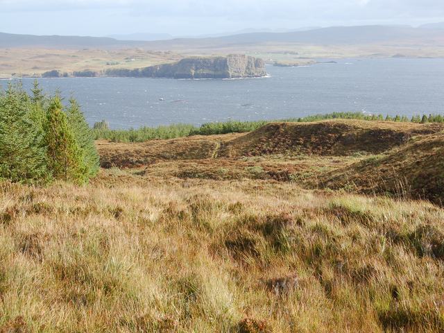
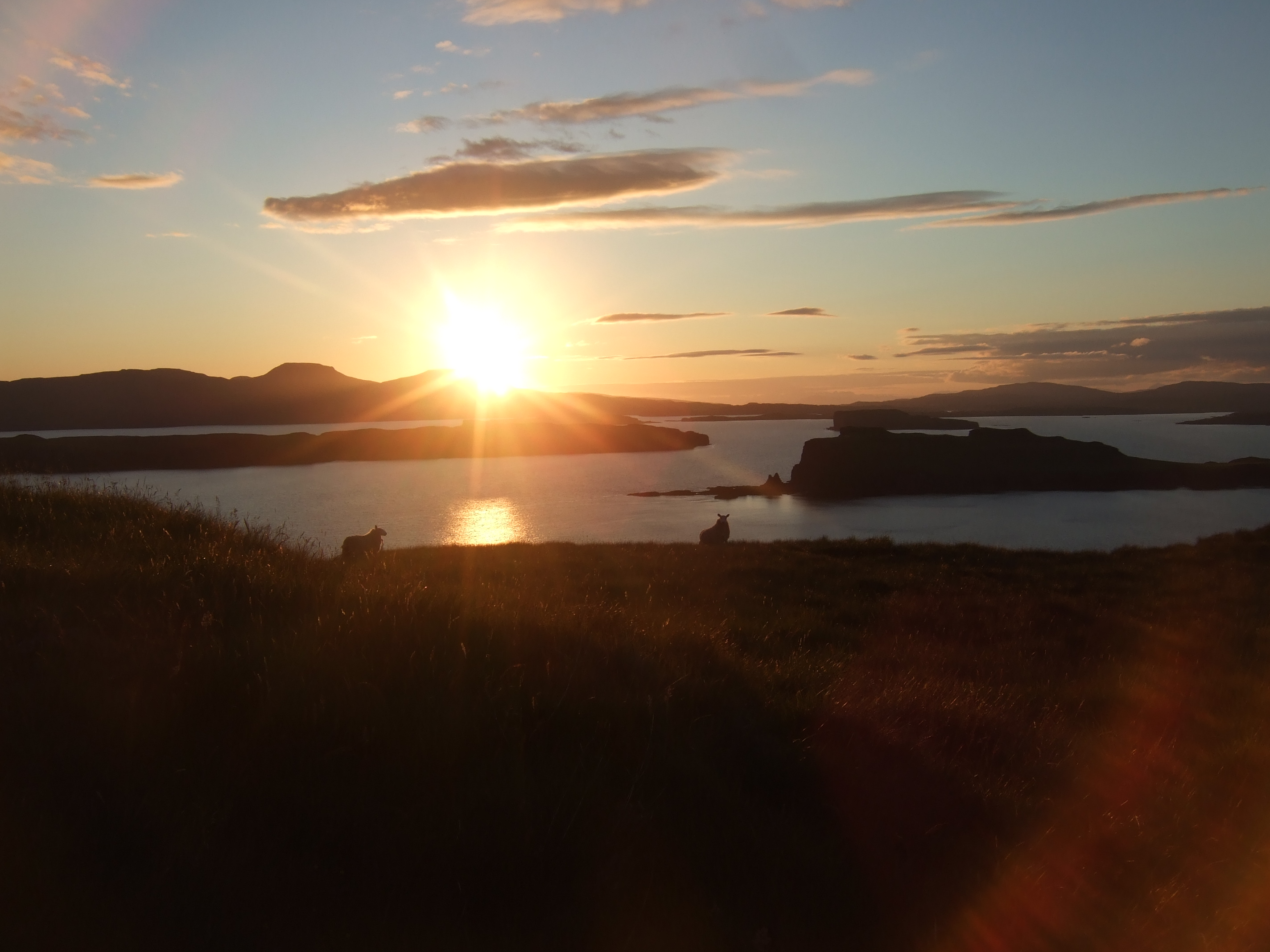
Brandarsaig Bay is a picturesque bay located in Inverness-shire, Scotland. Nestled on the west coast of the Scottish Highlands, it offers breathtaking views of the surrounding rugged landscapes and pristine waters of the Atlantic Ocean. The bay is situated approximately 15 miles south of the town of Mallaig.

The bay is famous for its stunning sandy beach, which stretches for over a mile and is often described as one of the most beautiful beaches in Scotland. The golden sands are complemented by crystal-clear turquoise waters, creating a tranquil and idyllic setting for visitors to enjoy.

The bay is also known for its diverse wildlife. It is a popular spot for birdwatchers, as it attracts a variety of seabirds, including gannets, puffins, and terns. Dolphins and seals can often be spotted playing in the bay, adding to the enchanting atmosphere.

The surrounding area of Brandarsaig Bay offers numerous opportunities for outdoor activities. Hiking enthusiasts can explore the nearby hills and enjoy panoramic views of the bay and the surrounding mountains. The bay is also a popular spot for water sports such as kayaking, sailing, and windsurfing.

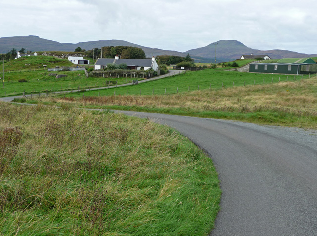
Visitors to Brandarsaig Bay can find accommodation options in the nearby town of Mallaig, which offers a range of hotels, guesthouses, and self-catering cottages. The bay is easily accessible by road, with parking facilities available for those traveling by car.

Overall, Brandarsaig Bay is a hidden gem in Inverness-shire, offering a peaceful and picturesque retreat for nature lovers and outdoor enthusiasts alike.

If you have any feedback on the listing, please let us know in the comments section below.

Brandarsaig Bay Images

Images are sourced within 2km of 57.358566/-6.5645504 or Grid Reference NG2539. Thanks to Geograph Open Source API. All images are credited.

Ford on the Forse Burn Ford where the Orbost forest road crosses the Forse Burn. The road stops immediately after the ford and becomes a footpath.
Ford on the Forse Burn
Ford where the Orbost forest road crosses the Forse Burn. The road stops immediately after the ford and becomes a footpath.
North slopes of Beinn na Moine With a view in the background across Loch Bracadale to the cliffs at Meall Greepa.
North slopes of Beinn na Moine
With a view in the background across Loch Bracadale to the cliffs at Meall Greepa.
Forse Burn gorge The burn has cut a sheer-sided gorge at this point.
Forse Burn gorge
The burn has cut a sheer-sided gorge at this point.
You lookin' at me? There is something about the quizzical body language of this sheep that appeals to me. 
Maybe it has never before watched a Geograph photographer scramble thirty feet up snow covered rocks to get a picture over the top of a deer fence...

The sheep is standing at the side of the Forse Burn at the lower end of a gorge.
You lookin' at me?
There is something about the quizzical body language of this sheep that appeals to me. Maybe it has never before watched a Geograph photographer scramble thirty feet up snow covered rocks to get a picture over the top of a deer fence... The sheep is standing at the side of the Forse Burn at the lower end of a gorge.
Forest clear fell This part of Orbost Forest was cleared several years ago.
The view looks north north-east up the forestry road. Beyond, the headland of Meall Greepa stands between Loch Bharcasaig (left) and Loch Vatten.
Forest clear fell
This part of Orbost Forest was cleared several years ago. The view looks north north-east up the forestry road. Beyond, the headland of Meall Greepa stands between Loch Bharcasaig (left) and Loch Vatten.
Spectacular sky over Beinn Bhac-ghlais From above the path through Orbost Forest.
Spectacular sky over Beinn Bhac-ghlais
From above the path through Orbost Forest.
Orbost Forest On the slopes of Beinn na Boineid.
Orbost Forest
On the slopes of Beinn na Boineid.
Orbost Forest In spite of the OS map showing this area to be entirely forest, here on the northern slopes of Beinn na Moine, only patches of trees have been planted.
The lighter coloured area on the left has been cleared.
The water beyond is Loch Bharcasaig, and the headland on the right is Meall Greepa.
Orbost Forest
In spite of the OS map showing this area to be entirely forest, here on the northern slopes of Beinn na Moine, only patches of trees have been planted. The lighter coloured area on the left has been cleared. The water beyond is Loch Bharcasaig, and the headland on the right is Meall Greepa.
No forest here In spite of being marked on the OS map as forest, this part of the slopes of Beinn na Moine has flourishing heather, but no trees.
The headland centrally in the picture is Meall Greepa, with Loch Bharcasaig to the left and Loch Vatten to the right.
No forest here
In spite of being marked on the OS map as forest, this part of the slopes of Beinn na Moine has flourishing heather, but no trees. The headland centrally in the picture is Meall Greepa, with Loch Bharcasaig to the left and Loch Vatten to the right.
Flourishing heather A dense growth of heather on the northern slopes of Beinn na Moire, which the OS map shows to be forest...
The vertical line on the distant hillside is a drystone wall, photographed by John Allan - <a href="https://www.geograph.org.uk/photo/245313">NG2441 : Wall on Cnoc na Pairce</a> .
Flourishing heather
A dense growth of heather on the northern slopes of Beinn na Moire, which the OS map shows to be forest... The vertical line on the distant hillside is a drystone wall, photographed by John Allan - NG2441 : Wall on Cnoc na Pairce .
Orbost Forest Looking east south-east over the young forest plantation from the northern slope of Beinn na Boineid.
The water is Loch Bracadale, with Harlosh Island (nearer) and Tarner Island showing clearly, and the Cuillin on the horizon.
Orbost Forest
Looking east south-east over the young forest plantation from the northern slope of Beinn na Boineid. The water is Loch Bracadale, with Harlosh Island (nearer) and Tarner Island showing clearly, and the Cuillin on the horizon.
Edge of the forest The fence marks the boundary of Orbost Forest. 
The slope on the right is Beinn na Boineid, the Black Cuillin are in the distance.
Edge of the forest
The fence marks the boundary of Orbost Forest. The slope on the right is Beinn na Boineid, the Black Cuillin are in the distance.
Forse Burn ford The track from Orbost to MacLeod's Maidens and the coast walk to Neist Point crosses the burn at this point.
The ford is usually passable - for those with good balancing skills - without getting wet feet.
Forse Burn ford
The track from Orbost to MacLeod's Maidens and the coast walk to Neist Point crosses the burn at this point. The ford is usually passable - for those with good balancing skills - without getting wet feet.
Young trees in Orbost plantation There are fewer trees here than the OS map would suggest.
Some of the plantation has been felled, and here, young trees are growing, but not as densely planted as would normally be the case in a forestry plantation.
The water in the background is Loch Bracadale.
Young trees in Orbost plantation
There are fewer trees here than the OS map would suggest. Some of the plantation has been felled, and here, young trees are growing, but not as densely planted as would normally be the case in a forestry plantation. The water in the background is Loch Bracadale.
Ford on the Forse Burn
Footpath to Orbost
Footpath to Orbost
Small ford on footpath to the maidens
Beinn na Boineid in the distance
Show me another place!

Brandarsaig Bay is located at Grid Ref: NG2539 (Lat: 57.358566, Lng: -6.5645504)

Unitary Authority: Highland

Police Authority: Highlands and Islands

What 3 Words

///scope.drum.yacht. Near Dunvegan, Highland

Related Wikis

Harlosh Island

Harlosh Island is one of four islands to be found in Skye's Loch Bracadale. Harlosh Island is one mile (1.5 kilometres) from the coast of the Duirinish...

Harlosh

Harlosh (Scottish Gaelic: Heàrrlois) is a settlement on the island of Skye off the west coast of Scotland. The settlement is on a peninsula of the same...

Loch Bracadale

Loch Bracadale (Scottish Gaelic: Loch Bhràcadail) is a sea loch on the west coast of Skye in Scotland. It separates the Minginish Peninsula in the south...

Tarner Island

Tarner Island is a triangular shaped island in Loch Bracadale just off the coast off the Harlosh peninsula of Skye in Scotland. It is about 28 hectares...

Nearby Amenities

Located within 500m of 57.358566,-6.5645504
Source: PGS
Lat/Long: 57.3559036/-6.5648646
Source: PGS
Lat/Long: 57.3559302/-6.5646674
Source: PGS
Lat/Long: 57.3568675/-6.5655424
Created By: dmgroom_coastlines
Source: PGS
Lat/Long: 57.35699/-6.56553
Source: PGS
Lat/Long: 57.3573565/-6.5665534
Source: PGS
Lat/Long: 57.3578653/-6.5667567
Source: PGS
Lat/Long: 57.3579925/-6.5671226
Source: PGS
Lat/Long: 57.3580495/-6.5673503
Source: PGS
Lat/Long: 57.3581153/-6.5675047
Source: PGS
Lat/Long: 57.3583697/-6.5676267
Created By: dmgroom_coastlines
Source: PGS
Lat/Long: 57.35922/-6.56799
Created By: dmgroom_coastlines
Source: PGS
Lat/Long: 57.35948/-6.56798
Source: PGS
Lat/Long: 57.3599806/-6.5673252
Source: PGS
Lat/Long: 57.3601834/-6.5669788
Created By: dmgroom_coastlines
Source: PGS
Lat/Long: 57.36059/-6.56624
Created By: dmgroom_coastlines
Source: PGS
Lat/Long: 57.36072/-6.56599
Source: PGS
Lat/Long: 57.3605387/-6.5656152
Source: PGS
Lat/Long: 57.3604452/-6.5649333
Created By: dmgroom_coastlines
Source: PGS
Lat/Long: 57.36068/-6.56434
Source: PGS
Lat/Long: 57.3608627/-6.5646487
Source: PGS
Lat/Long: 57.3613678/-6.5629783
Source: PGS
Lat/Long: 57.362019/-6.562167
Source: PGS
Lat/Long: 57.3626795/-6.5625558
Created By: dmgroom_coastlines
Source: PGS
Lat/Long: 57.36269/-6.56208
The Hoe
Ele: 94
Natural: peak
Lat/Long: 57.3556698/-6.5678357
The data included in this document is from www.openstreetmap.org. The data is made available under ODbL.

Have you been to Brandarsaig Bay?

Leave your review of Brandarsaig Bay below (or comments, questions and feedback).