Tòb a' Cheòsan

Bay in Ross-shire

Scotland

Tòb a' Cheòsan

Craft workshop in Kirkibost One of the old shellfish processing factories at Kirkibost (Circeabost) is now reborn as a craftshop.
Craft workshop in Kirkibost Credit: Gus Macdonald

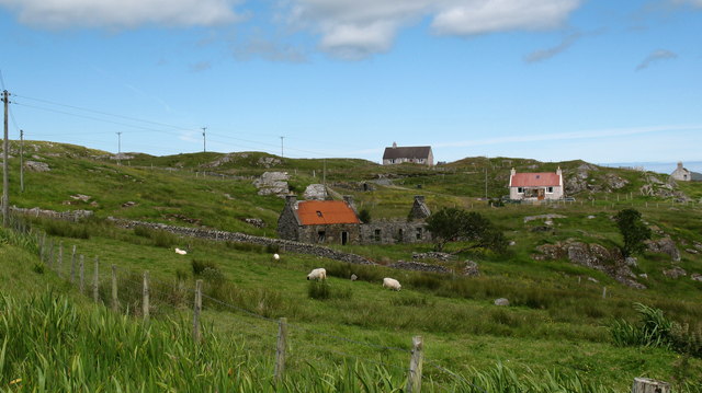
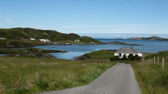
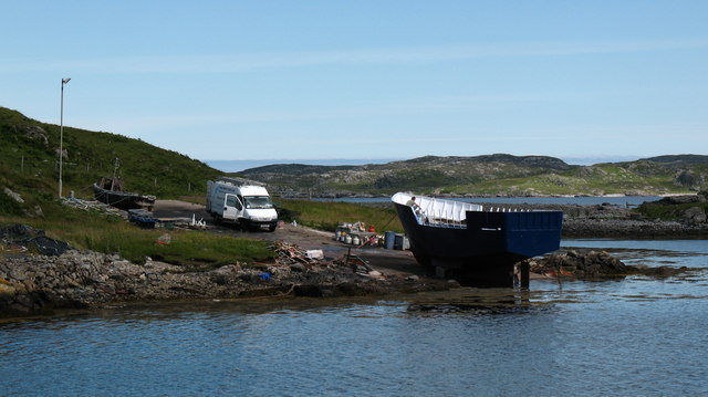
Tòb a' Cheòsan is a picturesque bay located in Ross-shire, Scotland. Situated on the west coast of Scotland, it is part of the larger Lochbroom area. The bay is known for its natural beauty, with stunning views of the surrounding landscape.

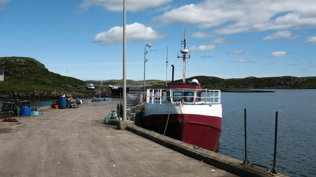
Tòb a' Cheòsan is characterized by its sandy beach, which stretches along the bay and provides a peaceful and tranquil environment for visitors. The clear turquoise waters of the bay are perfect for swimming, kayaking, and other water activities. The beach is also a popular spot for picnics and sunbathing during the warmer months.

Surrounding Tòb a' Cheòsan, visitors can find a diverse range of flora and fauna, making it a haven for nature enthusiasts. The bay is home to various bird species, including herons and oystercatchers, which can often be spotted along the shoreline. The area is also known for its wildflowers and grasses, creating a colorful and vibrant landscape.

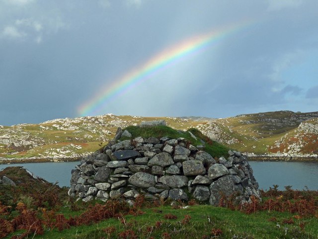
Tòb a' Cheòsan is a place of historical significance as well. There are several ancient ruins nearby, such as the remains of the Balnakeil Church, which dates back to the 12th century. These historical sites provide a glimpse into the rich heritage and culture of the area.

Overall, Tòb a' Cheòsan is a hidden gem in Ross-shire, offering visitors a perfect blend of natural beauty, outdoor activities, and historical exploration. Whether one is seeking a peaceful beach getaway or an opportunity to connect with nature, this bay provides a truly unforgettable experience.

If you have any feedback on the listing, please let us know in the comments section below.

Tòb a' Cheòsan Images

Images are sourced within 2km of 58.220761/-6.792996 or Grid Reference NB1835. Thanks to Geograph Open Source API. All images are credited.

Craft workshop in Kirkibost One of the old shellfish processing factories at Kirkibost (Circeabost) is now reborn as a craftshop.
Craft workshop in Kirkibost
One of the old shellfish processing factories at Kirkibost (Circeabost) is now reborn as a craftshop.
Cleibh ghiomaich aig cidhe Chirceabost Lobster creels at Kirkibost harbour
Cleibh ghiomaich aig cidhe Chirceabost
Lobster creels at Kirkibost harbour
View towards Circebost Pier
Tolstachaolais: hillside cows and Bernera view Looking across the sound separating the eastern side of Bernera from the Lewis mainland, beyond three cows grazing on the slopes to the south of Tolstachaolais village.
Tolstachaolais: hillside cows and Bernera view
Looking across the sound separating the eastern side of Bernera from the Lewis mainland, beyond three cows grazing on the slopes to the south of Tolstachaolais village.
Croftland, Circebost, Great Bernera Looking across Loch Ròg an Ear (East Loch Roag) towards Eilean Chearstaigh.
Croftland, Circebost, Great Bernera
Looking across Loch Ròg an Ear (East Loch Roag) towards Eilean Chearstaigh.
Lazy beds below Cnoc Righseodh, Great Bernera/Beàrnaraigh
Shieling above Tob Chèurabhagh, Great Bernera/Beàrnaraigh Tob Chèurabhagh is a bay at the southern end of Loch Riosaigh.
Shieling above Tob Chèurabhagh, Great Bernera/Beàrnaraigh
Tob Chèurabhagh is a bay at the southern end of Loch Riosaigh.
Calanais/Callanish XV, Circebost, Great Bernera/Beàrnaraigh From Discovery and Excavation in Scotland, 1976: "On grassy ridge 100m N of road, 25m E of track through Croft 24, Kirkibost. A large prone slab approx. 3.55m x 1.35m, thickness varying from 0.25-0.45m, lying in peat on a grassy ridge. The lower end appears to be surrounded by packing stones and there is a void under the centre of the stone. This stone was brought to our notice by Mr Norman MacDonald of Kirkibost."
Calanais/Callanish XV, Circebost, Great Bernera/Beàrnaraigh
From Discovery and Excavation in Scotland, 1976: "On grassy ridge 100m N of road, 25m E of track through Croft 24, Kirkibost. A large prone slab approx. 3.55m x 1.35m, thickness varying from 0.25-0.45m, lying in peat on a grassy ridge. The lower end appears to be surrounded by packing stones and there is a void under the centre of the stone. This stone was brought to our notice by Mr Norman MacDonald of Kirkibost."
Possible fallen standing stone, Circebost, Great Bernera/Beàrnaraigh This stone lies approximately 80m ESE of <a href="https://www.geograph.org.uk/photo/5293759">NB1734 : Calanais/Callanish XV, Circebost, Great Bernera/Beàrnaraigh</a>.  The croft owner, who is the grandson of Norman MacDonald who originally brought Callanish XV to archaeologists' attention, believes it to be fallen standing stone.
Possible fallen standing stone, Circebost, Great Bernera/Beàrnaraigh
This stone lies approximately 80m ESE of NB1734 : Calanais/Callanish XV, Circebost, Great Bernera/Beàrnaraigh. The croft owner, who is the grandson of Norman MacDonald who originally brought Callanish XV to archaeologists' attention, believes it to be fallen standing stone.
Looking down at Circebost Circebost or Kirkibost is a tiny settlement on Great Bernera. This island is now connected to Lewis by a short pre-stressed concrete bridge. In 1953 when it was built it was and remains the first bridge of such material in Europe.  

The settlemenr is also important as it is the first planned crofting township in the Outer Hebrides, though I think town is a lofty description for such a small group of houses.
Looking down at Circebost
Circebost or Kirkibost is a tiny settlement on Great Bernera. This island is now connected to Lewis by a short pre-stressed concrete bridge. In 1953 when it was built it was and remains the first bridge of such material in Europe. The settlemenr is also important as it is the first planned crofting township in the Outer Hebrides, though I think town is a lofty description for such a small group of houses.
Ruined cottage on Great Bernera The ruin stands at the side of the minor road close to the north shore of Loch Barraglom.
Ruined cottage on Great Bernera
The ruin stands at the side of the minor road close to the north shore of Loch Barraglom.
End of the road at Tobhtaral Two houses at the end of the road in the SE corner of Great Bernera island.
End of the road at Tobhtaral
Two houses at the end of the road in the SE corner of Great Bernera island.
Am Port Mor A shallow bay on the south east coast of Great Bernera.
Am Port Mor
A shallow bay on the south east coast of Great Bernera.
Church ruin near Circebost. The ruin is presumed to be medieval, and is situated on a point of land on the north side of Am Port Mor.
Church ruin near Circebost.
The ruin is presumed to be medieval, and is situated on a point of land on the north side of Am Port Mor.
Circebost A crofting community in the south east of Great Bernera island.
Circebost
A crofting community in the south east of Great Bernera island.
The road to Circebost pier. looking north along the road towards the inlet of Dubh Thob.
The road to Circebost pier.
looking north along the road towards the inlet of Dubh Thob.
Circebost Pier The pier at Circebost, where shellfish are regularly landed.
Circebost Pier
The pier at Circebost, where shellfish are regularly landed.
Working on the boat Repairing and refurbishing a boat at Circebost.
Working on the boat
Repairing and refurbishing a boat at Circebost.
Show me another place!

Tòb a' Cheòsan is located at Grid Ref: NB1835 (Lat: 58.220761, Lng: -6.792996)

Unitary Authority: Na h-Eileanan an Iar

Police Authority: Highlands and Islands

What 3 Words

///barstool.readings.mostly. Near Carloway, Na h-Eileanan Siar

Related Wikis

Ceabhaigh

Ceabhaigh is a small island in an arm of Loch Ròg on the west coast of Lewis in the Outer Hebrides of Scotland. It is about 25 hectares (62 acres) in extent...

Tolsta Chaolais

Tolsta Chaolais (also Tolastadh Chaolais, Tolstadh a' Chaolais) is a village on the Isle of Lewis, Scotland. It consists of about forty houses, clustered...

Callanish VIII

The Callanish VIII stone setting is one of many megalithic structures around the better-known (and larger) Calanais I on the west coast of the Isle of...

Eilean Chearstaidh

Eilean Kearstay (Scottish Gaelic: Eilean Chearstaigh) is an uninhabited island in Loch Roag in the Outer Hebrides of Scotland. It lies south east of Great...

Nearby Amenities

Located within 500m of 58.220761,-6.792996
Passing Place
Lat/Long: 58.2202945/-6.7992196
Barrier: cattle_grid
Lat/Long: 58.2197238/-6.7988753
Leisure: slipway
Source: Bing
Lat/Long: 58.2233329/-6.7974459
Passing Place
Lat/Long: 58.2182459/-6.7933761
Power: pole
Lat/Long: 58.2207088/-6.7985394
Power: pole
Lat/Long: 58.2195673/-6.7973606
Power: pole
Lat/Long: 58.2192293/-6.7964477
Power: pole
Lat/Long: 58.2189298/-6.795775
Power: pole
Lat/Long: 58.2185078/-6.7946713
Power: pole
Lat/Long: 58.2181499/-6.7937933
Power: pole
Lat/Long: 58.2181428/-6.7927971
Power: pole
Lat/Long: 58.218697/-6.7931304
Power: pole
Lat/Long: 58.219235/-6.7934482
Power: pole
Lat/Long: 58.2165226/-6.7917745
Power: pole
Lat/Long: 58.2171523/-6.7924652
Power: pole
Lat/Long: 58.2176281/-6.79293
Power: pole
Lat/Long: 58.216491/-6.7926569
Power: pole
Lat/Long: 58.2170689/-6.792156
Power: pole
Lat/Long: 58.2173021/-6.791343
Power: pole
Lat/Long: 58.2177232/-6.7920057
Barrier: cattle_grid
Lat/Long: 58.2174355/-6.7928181
Barrier: cattle_grid
Lat/Long: 58.2173521/-6.7927055
Passing Place
Lat/Long: 58.2165495/-6.7924956
Turning Circle
Lat/Long: 58.220998/-6.7980806
Power: pole
Lat/Long: 58.2192617/-6.7937361
Power: pole
Lat/Long: 58.2177996/-6.7913182
Tob a´Cheosan
Natural: bay
Lat/Long: 58.2204043/-6.7925253
The data included in this document is from www.openstreetmap.org. The data is made available under ODbL.

Have you been to Tòb a' Cheòsan?

Leave your review of Tòb a' Cheòsan below (or comments, questions and feedback).