Bàgh Buidhe

Bay in Inverness-shire

Scotland

Bàgh Buidhe

Drinishader A bay on the west side of islet-studded Loch Tairbeart, the largest of the sea-lochs on the east side of Harris.
Drinishader Credit: Anne Burgess

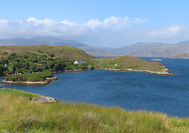
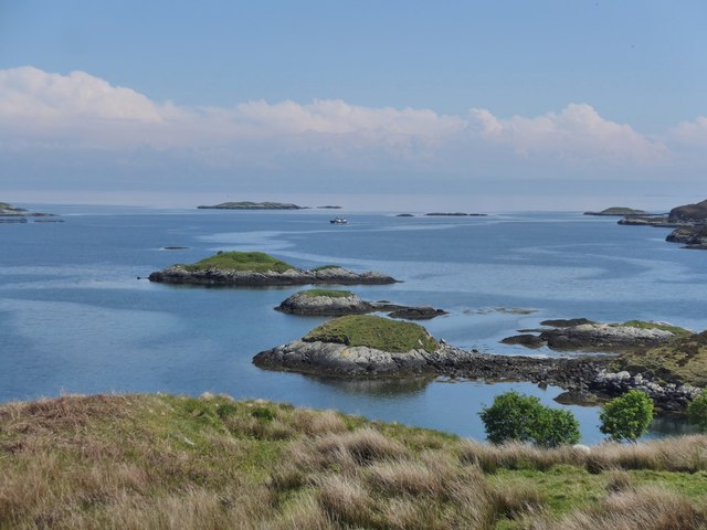
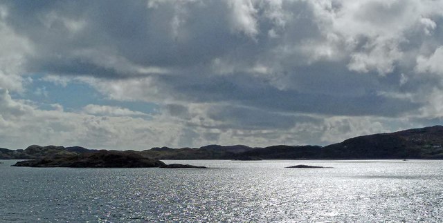
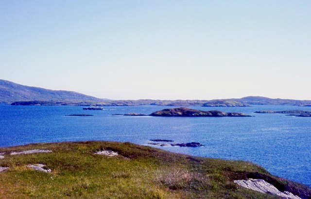
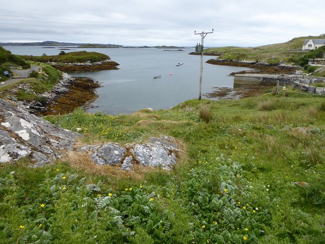
Bàgh Buidhe, located in Inverness-shire, Scotland, is a picturesque bay renowned for its natural beauty and scenic surroundings. Nestled along the western coast of the Highlands, this bay possesses a unique charm that attracts visitors from far and wide.

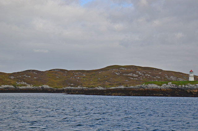
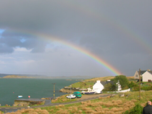
The bay is characterized by its tranquil, turquoise waters and soft sandy beaches, making it a popular destination for beachgoers and water sports enthusiasts alike. The idyllic coastal landscape is adorned with rocky cliffs and lush greenery, offering breathtaking views of the surrounding hills and mountains.

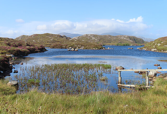
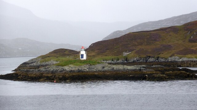
Bàgh Buidhe is also a haven for wildlife enthusiasts, as it is home to a diverse range of marine and bird species. Visitors may spot seals basking in the sun on the rocky outcrops or catch glimpses of various seabirds soaring through the skies. The bay's rich marine ecosystem provides an excellent opportunity for snorkeling and diving, allowing visitors to explore the underwater world and discover its hidden treasures.

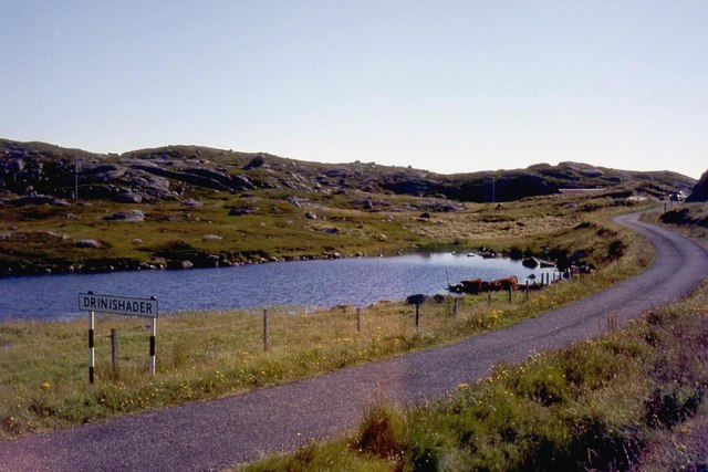
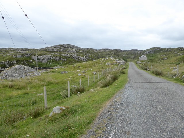
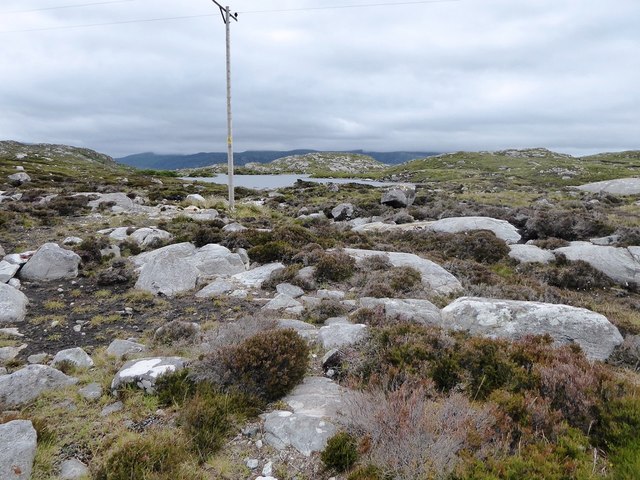
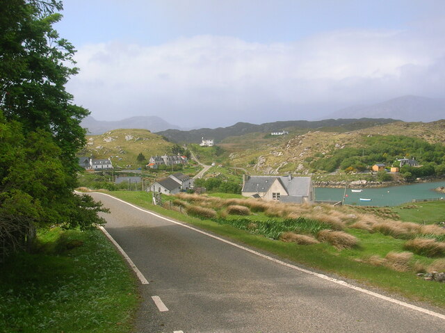
For those seeking outdoor adventures, Bàgh Buidhe offers numerous hiking trails that wind through the nearby hills, providing panoramic vistas of the bay and its surroundings. The area is also a great spot for fishing, with salmon and trout being common catches in the bay's waters.

In summary, Bàgh Buidhe in Inverness-shire is a captivating bay that captivates visitors with its awe-inspiring natural beauty, serene beaches, and abundant wildlife. It is a must-visit destination for nature lovers and outdoor enthusiasts looking for a tranquil escape amidst Scotland's stunning Highlands.

If you have any feedback on the listing, please let us know in the comments section below.

Bàgh Buidhe Images

Images are sourced within 2km of 57.862214/-6.767971 or Grid Reference NG1795. Thanks to Geograph Open Source API. All images are credited.

Drinishader A bay on the west side of islet-studded Loch Tairbeart, the largest of the sea-lochs on the east side of Harris.
Drinishader
A bay on the west side of islet-studded Loch Tairbeart, the largest of the sea-lochs on the east side of Harris.
Loch Drinisiadair This is just the southern tip of one of the larger lochs in eastern Harris.
Loch Drinisiadair
This is just the southern tip of one of the larger lochs in eastern Harris.
In the driving seat of the Hattersley Mk1 at Drinisiadar Built in Keighley, West Yorkshire and one time Luddite bait the loom was designed by George Hattersley and from 1919 to the present has proved a godsend to the people of Harris.
In the driving seat of the Hattersley Mk1 at Drinisiadar
Built in Keighley, West Yorkshire and one time Luddite bait the loom was designed by George Hattersley and from 1919 to the present has proved a godsend to the people of Harris.
All trades their gear, tackle, and trim.. The loom and some of the products at the exhibition at Drinisiadar.
All trades their gear, tackle, and trim..
The loom and some of the products at the exhibition at Drinisiadar.
Original Harris Tweed Introduced to Harris in 1919 the Hattersley cottage loom which was manufactured by George Hattersley of Keighley, West Yorkshire and proved a godsend for the people of Harris.
Original Harris Tweed
Introduced to Harris in 1919 the Hattersley cottage loom which was manufactured by George Hattersley of Keighley, West Yorkshire and proved a godsend for the people of Harris.
Nostalgia's not what it used to be! If ever a poem ran in parallel with Yeats' Lake Isle of Innisfree then this is the one.
Nostalgia's not what it used to be!
If ever a poem ran in parallel with Yeats' Lake Isle of Innisfree then this is the one.
The Spinning Wheels of Harris Before you weave, first spin the wool.
The Spinning Wheels of Harris
Before you weave, first spin the wool.
Islands and skerries off Drinishader Not quite a painted ship on a painted ocean, but close;  there is a fishing boat dead-centre in this image.
Islands and skerries off Drinishader
Not quite a painted ship on a painted ocean, but close; there is a fishing boat dead-centre in this image.
Gloraig Dhubh, Loch an Tairbeairt, Harris The northern (right hand) tip of Gloraig Dhubh, the larger skerry, and the whole of the smaller skerry lie within the grid square.
Gloraig Dhubh, Loch an Tairbeairt, Harris
The northern (right hand) tip of Gloraig Dhubh, the larger skerry, and the whole of the smaller skerry lie within the grid square.
South end of Loch Drinisiadair
Rubha na Mòine The ferry heading in to Tarbert past the Gloraigs.
Rubha na Mòine
The ferry heading in to Tarbert past the Gloraigs.
Sgeotasaigh Sgeotasaigh, or Scotsay, is an island west of Scalpay in East Loch Tarbert. The light on the right of the image is on Sgeir Ghlas in NG1896.
Sgeotasaigh
Sgeotasaigh, or Scotsay, is an island west of Scalpay in East Loch Tarbert. The light on the right of the image is on Sgeir Ghlas in NG1896.
Minor road among rock outcrops east of Meavag
Rocks and heather next to the 'Golden Road' looking towards Loch Drinisiadair
The harbour at Drinisiadair
Drinishader on The Golden Road Wonderful cycling southwards from Tarbert.
Drinishader on The Golden Road
Wonderful cycling southwards from Tarbert.
Rainbow over East Loch Tarbert A lovely end to the day at Drinishader.
Rainbow over East Loch Tarbert
A lovely end to the day at Drinishader.
Sgeir Ghlas lighthouse A small lighthouse built around 1900. <span class="nowrap"><a title="https://uklighthousetour.com/tag/sgeir-ghlas/" rel="nofollow ugc noopener" href="https://uklighthousetour.com/tag/sgeir-ghlas/">Link</a><img style="margin-left:2px;" alt="External link" title="External link - shift click to open in new window" src="https://s1.geograph.org.uk/img/external.png" width="10" height="10"/></span>
Sgeir Ghlas lighthouse
A small lighthouse built around 1900. LinkExternal link
Show me another place!

Bàgh Buidhe is located at Grid Ref: NG1795 (Lat: 57.862214, Lng: -6.767971)

Unitary Authority: Na h-Eileanan an Iar

Police Authority: Highlands and Islands

What 3 Words

///ducks.verve.retire. Near Tarbert, Na h-Eileanan Siar

Related Wikis

East Loch Tarbert

East Loch Tarbert (Scottish Gaelic: Loch an Tairbeairt) is a sea loch that lies to the east of Harris in the Outer Hebrides of Scotland. The loch contains...

Sgeotasaigh

Scotasay (Scottish Gaelic: Sgeotasaigh) is small island in the Outer Hebrides of Scotland. It lies 1 kilometre (0.6 miles) off the east coast of Harris...

Harris distillery

Harris distillery is a Scotch whisky and Gin distillery in Tarbert on the Isle of Harris, Scotland. The distillery was the first legal distillery ever...

Tarbert, Harris

Tarbert (Scottish Gaelic: An Tairbeart [ən̪ˠ ˈt̪ɛrʲɛbərˠʃt̪]) is the main community on Harris in the Western Isles of Scotland. The name means "isthmus...

Nearby Amenities

Located within 500m of 57.862214,-6.767971
Poll Gorm
Natural: bay
Lat/Long: 57.8656903/-6.7724721
Bagh Buidhe
Natural: bay
Lat/Long: 57.8616839/-6.7676441
Turning Circle
Lat/Long: 57.8582457/-6.7719313
Turning Circle
Lat/Long: 57.8591837/-6.7704556
Power: pole
Lat/Long: 57.8588976/-6.7705483
Power: pole
Lat/Long: 57.8594704/-6.7705455
Power: pole
Lat/Long: 57.8601791/-6.7705468
Power: pole
Lat/Long: 57.8610815/-6.7705521
Power: pole
Lat/Long: 57.8606358/-6.7705495
Rubha na Buaile
Natural: cape
Lat/Long: 57.8614033/-6.7644926
The data included in this document is from www.openstreetmap.org. The data is made available under ODbL.

Have you been to Bàgh Buidhe?

Leave your review of Bàgh Buidhe below (or comments, questions and feedback).