Bàgh Salach
Bay in Inverness-shire
Scotland
Bàgh Salach

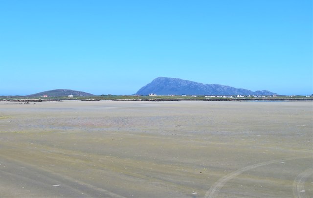
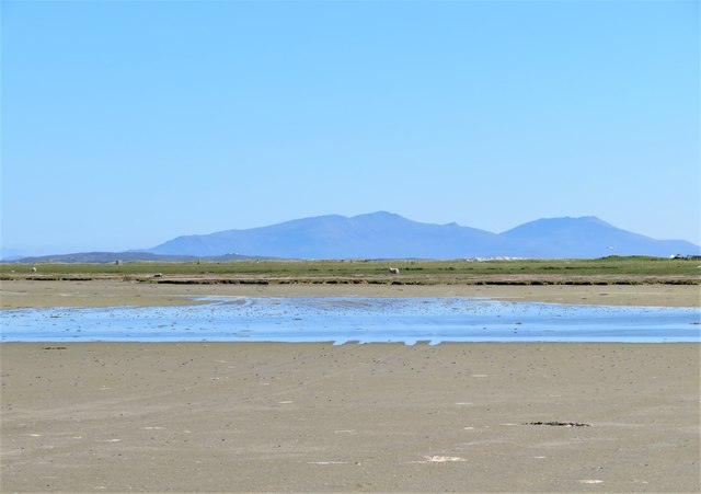
Bàgh Salach, located in Inverness-shire, Scotland, is a picturesque bay nestled along the western coast of the Scottish Highlands. Surrounded by rolling hills and lush greenery, it offers breathtaking views of the rugged coastline and the open waters of the Atlantic Ocean.
The bay is characterized by its pristine sandy beaches and crystal-clear turquoise waters, making it an idyllic destination for beach lovers and water sports enthusiasts. It is a popular spot for swimming, snorkeling, and kayaking, with its calm and sheltered waters providing a safe environment for recreational activities.
Bàgh Salach is also renowned for its diverse wildlife and natural beauty. The bay is home to a variety of marine life, including seals, dolphins, and porpoises, making it a perfect spot for wildlife enthusiasts and photographers. The surrounding hills and cliffs are teeming with birdlife, with species such as puffins, gannets, and razorbills being commonly spotted.
In addition to its natural attractions, Bàgh Salach offers several amenities for visitors. There are well-maintained footpaths that run along the coastline, allowing visitors to take leisurely walks and enjoy the stunning views. The bay is also equipped with picnic areas and parking facilities, making it a convenient location for a day trip or a family outing.
Overall, Bàgh Salach is a hidden gem on the Scottish coast, offering a tranquil and unspoiled natural environment for visitors to enjoy. Its pristine beaches, diverse wildlife, and breathtaking scenery make it a must-visit destination for nature lovers and outdoor enthusiasts alike.
If you have any feedback on the listing, please let us know in the comments section below.
Bàgh Salach Images
Images are sourced within 2km of 57.530955/-7.3448385 or Grid Reference NF8061. Thanks to Geograph Open Source API. All images are credited.


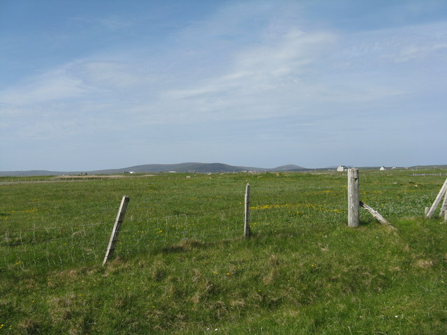
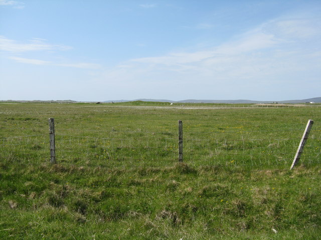
![Machair fields at Sloch Sabhaidh On the flat sandy island of Baleshare/Baile Sear. The distant hill is Eaval on North Uist [11.5km].](https://s3.geograph.org.uk/geophotos/05/02/57/5025707_6baed3b6.jpg)
Bàgh Salach is located at Grid Ref: NF8061 (Lat: 57.530955, Lng: -7.3448385)
Unitary Authority: Na h-Eileanan an Iar
Police Authority: Highlands and Islands
What 3 Words
///washroom.code.liked. Near Balivanich, Na h-Eileanan Siar
Nearby Locations
Related Wikis

Baleshare
Baleshare (Scottish Gaelic: Baile Sear) is a flat tidal island in the Outer Hebrides of Scotland. Baleshare lies to the south-west of North Uist. Its economics...

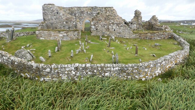
Teampull na Trionaid
Teampull na Trionaid ("trinity church") is a ruined 13th-century Augustinian nunnery at Carinish, on North Uist, in the Outer Hebrides of Scotland. �...

Battle of Carinish
The Battle of Carinish was a Scottish clan battle fought in North Uist in 1601. It was part of a year of feuding between Clan MacLeod of Dunvegan and the...

Carinish
Carinish (Scottish Gaelic: Càirinis), is a hamlet on North Uist, in the Outer Hebrides, Scotland. It is in the south of the island, about two miles (three...

Bail' Iochdrach
Bail' Iochdrach or Baliochrach (Scottish Gaelic: Am Baile Ìochdrach) is a village on Benbecula in the Outer Hebrides, Scotland. Baliochrach is within the...

Kirkibost
Kirkibost (Scottish Gaelic: Eilean Chirceaboist) is a low-lying island west of North Uist in the Outer Hebrides of Scotland. == Geography == Kirkibost...

Benbecula Airport
Benbecula Airport (Scottish Gaelic: Port-adhair Bheinn na Faoghla) (IATA: BEB, ICAO: EGPL) is located on the island of Benbecula in the Outer Hebrides...

Uachdar
Uachdar (Scottish Gaelic: An t-Uachdar [ən̪ˠ ˈt̪ʰuəxkəɾ]) is a settlement on the Outer Hebridean Island of Benbecula. Uachdar is within the parish of South...
Related Videos
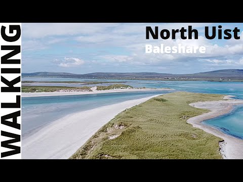
A walk round, Baleshare - North Uist - Scotland
This was our first walk, whilst on staycation in North Uist. This is a figure of 8 walk round the island of Baleshare. You can look at ...
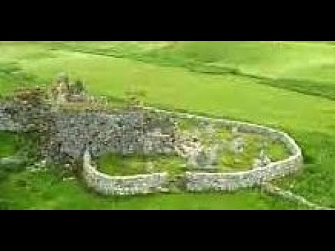
Trinity Temple On Visit To Carinish Island Of North Uist Outer Hebrides Scotland
Tour Scotland travel video clip, with Scottish music, of Trinity Temple on visit to Carinish on the Island of North Uist in the Outer ...

Teampull na Trionaid With Music On Visit To Carinish Island Of North Uist Outer Hebrides Scotland
Tour Scotland 4K travel video, with Scottish music, of Trinity Temple on ancestry, genealogy, family history visit to Carinish on the ...

Teampull na Trionaid On Visit To Carinish Island Of North Uist Outer Hebrides Scotland
Tour Scotland travel video, with Scottish music, of Teampull na Trionaid on visit to Carinish on the Island of North Uist in the Outer ...
Nearby Amenities
Located within 500m of 57.530955,-7.3448385Have you been to Bàgh Salach?
Leave your review of Bàgh Salach below (or comments, questions and feedback).