Black Force

Waterfall in Durham

England

Black Force

Moorland with boundary stone south of Harnisha Hill Heather moorland south of Harnisha Hill is managed for grouse - a grouse butt is in view. Also in view, a boundary stone; it's inscribed on the shadowed face, 'AA', with the second 'A' smaller and as a superscript.
Moorland with boundary stone south of Harnisha Hill Credit: Trevor Littlewood

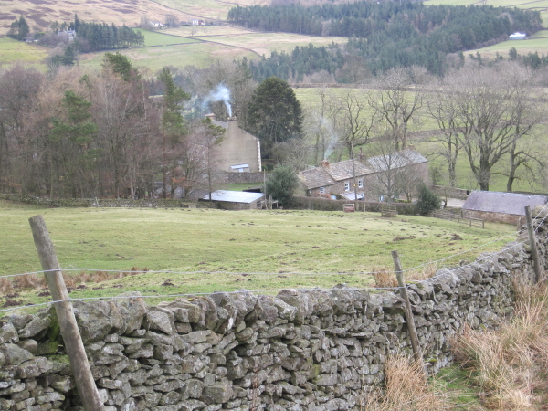
Black Force, located in Durham, is a captivating waterfall that offers visitors a mesmerizing natural spectacle. Nestled within a picturesque woodland area, this waterfall is a popular destination for nature enthusiasts and hikers alike. The waterfall is formed by the convergence of two streams, creating a powerful cascade that plunges into a deep pool below.

The name "Black Force" is derived from the dark color of the rocks that surround the waterfall, giving it a mysterious and enchanting appearance. The water flows down a series of natural steps and ledges, creating a mesmerizing display of cascading water and mist. During periods of heavy rain, the force of the water intensifies, adding to the dramatic effect.

Surrounded by lush greenery and towering trees, Black Force offers a serene and tranquil atmosphere, making it an ideal spot for relaxation and contemplation. The area is rich in biodiversity, with an abundance of plant and animal species, providing nature lovers with ample opportunities for exploration and wildlife spotting.

Access to Black Force is via a well-maintained hiking trail, which offers stunning views of the surrounding landscape. The trail is suitable for all levels of hikers, though caution is advised due to the occasionally slippery terrain. Along the path, visitors can enjoy the sights and sounds of nature, including the chirping of birds and the rustling of leaves.

In conclusion, Black Force in Durham is a captivating waterfall that offers a breathtaking natural spectacle. With its stunning surroundings and tranquil ambiance, it is a must-visit destination for those seeking to immerse themselves in nature's beauty.

If you have any feedback on the listing, please let us know in the comments section below.

Black Force Images

Images are sourced within 2km of 54.676639/-2.0623091 or Grid Reference NY9631. Thanks to Geograph Open Source API. All images are credited.

Moorland with boundary stone south of Harnisha Hill Heather moorland south of Harnisha Hill is managed for grouse - a grouse butt is in view. Also in view, a boundary stone; it's inscribed on the shadowed face, 'AA', with the second 'A' smaller and as a superscript.
Moorland with boundary stone south of Harnisha Hill
Heather moorland south of Harnisha Hill is managed for grouse - a grouse butt is in view. Also in view, a boundary stone; it's inscribed on the shadowed face, 'AA', with the second 'A' smaller and as a superscript.
Estate road on south side of Carr's Hill Sunshine illuminates the grass of the moorland beside the road whilst Monk's Moor, beyond, is shadowed; the wall appearing to act as a dividing line.
Estate road on south side of Carr's Hill
Sunshine illuminates the grass of the moorland beside the road whilst Monk's Moor, beyond, is shadowed; the wall appearing to act as a dividing line.
Snowed heather moor south of Harnisha Hill Fresh snow covers thinly the heather on the south side of Harnisha Hill. The view beyond is across Great Eggleshope to the moorland block of Monk's Moor.
Snowed heather moor south of Harnisha Hill
Fresh snow covers thinly the heather on the south side of Harnisha Hill. The view beyond is across Great Eggleshope to the moorland block of Monk's Moor.
Ruin in the heather, Manor Gill There is much evidence of former lead mining in the area so this building may have been connected to this activity. The footpath descends into Great Eggles Hope ahead.
Ruin in the heather, Manor Gill
There is much evidence of former lead mining in the area so this building may have been connected to this activity. The footpath descends into Great Eggles Hope ahead.
Great Eggles Hope The footpath from Hudes Hope reaches the valley at Manorgill Sike. Once a centre of lead mining activity, all is now quiet even on a sunny Bank Holiday weekend.
Great Eggles Hope
The footpath from Hudes Hope reaches the valley at Manorgill Sike. Once a centre of lead mining activity, all is now quiet even on a sunny Bank Holiday weekend.
Fording Great Eggleshope Beck The footpath heading downstream fords the beck here.
Fording Great Eggleshope Beck
The footpath heading downstream fords the beck here.
Vermin trap, Wire Gill These nasty devices are usually laid across obstacles in the hope of trapping animals such as weasels, stoats or rats which may predate game birds. Sadly, it was a grouse which had somehow set off the trap and been caught within. Even more cruel it was still alive but with a broken leg and battered wings. I had to put the poor bird out of its misery.
Vermin trap, Wire Gill
These nasty devices are usually laid across obstacles in the hope of trapping animals such as weasels, stoats or rats which may predate game birds. Sadly, it was a grouse which had somehow set off the trap and been caught within. Even more cruel it was still alive but with a broken leg and battered wings. I had to put the poor bird out of its misery.
Estate track climbs above mine spoil, Great Eggleshope Beck The track leads upwards to a large shooting hut on the slopes of Harnisha Hill. The valley below finds Great Eggleshope Beck weaving between lead mining spoil tips representing a truly impressive volume of waste rock taken from underground. The photographer was standing on one long spoil tip (through which the estate track has been cut) which extends another two hundred and fifty metres downstream, separating the beck from a large level area with a number of old buildings and lots more spoil tips.
Estate track climbs above mine spoil, Great Eggleshope Beck
The track leads upwards to a large shooting hut on the slopes of Harnisha Hill. The valley below finds Great Eggleshope Beck weaving between lead mining spoil tips representing a truly impressive volume of waste rock taken from underground. The photographer was standing on one long spoil tip (through which the estate track has been cut) which extends another two hundred and fifty metres downstream, separating the beck from a large level area with a number of old buildings and lots more spoil tips.
Sinuous pool north of Monk's Moor It's not apparent from the image but the pool is elongated and winding.
Monk's Moor is behind the camera position, Carr's Hill is in the distance.
I've speculated in an earlier submission - <a title="https://www.geograph.org.uk/photo/2085032" href="https://www.geograph.org.uk/photo/2085032">Link</a> - that the pool might be a residue of an old hushing reservoir.
(That image whilst rather dark does show the sinuous form of the pool.)
Sinuous pool north of Monk's Moor
It's not apparent from the image but the pool is elongated and winding. Monk's Moor is behind the camera position, Carr's Hill is in the distance. I've speculated in an earlier submission - Link - that the pool might be a residue of an old hushing reservoir. (That image whilst rather dark does show the sinuous form of the pool.)
Earth parapet of small dam The grassed-over parapet of the dam is close to the col between Carrs Hill and Monk's Moor. The valleys to both sides of the col have been mined extensively. It's probable then that the dam was used to retain a small reservoir for hushing purposes.
There's further mining evidence in the middle distance beyond the earthwork and the valley of Hudes Hope where the Coldberry Mine complex can be seen.
Earth parapet of small dam
The grassed-over parapet of the dam is close to the col between Carrs Hill and Monk's Moor. The valleys to both sides of the col have been mined extensively. It's probable then that the dam was used to retain a small reservoir for hushing purposes. There's further mining evidence in the middle distance beyond the earthwork and the valley of Hudes Hope where the Coldberry Mine complex can be seen.
Climbing out of Hudes Hope A good track, maintained for grouse shooters, climbs above spoil tips from lead mining activity near Marl Beck. It leads over the moor into Great Eggles Hope.
Climbing out of Hudes Hope
A good track, maintained for grouse shooters, climbs above spoil tips from lead mining activity near Marl Beck. It leads over the moor into Great Eggles Hope.
Overgrown dam above Great Eggles Hope The footpath which climbs up Monk's Moor passes a small overgrown dam which probably once fed water down to the mines below.
Overgrown dam above Great Eggles Hope
The footpath which climbs up Monk's Moor passes a small overgrown dam which probably once fed water down to the mines below.
Lead Mining Debris, Hudes Hope
Bridge over Marl Beck to Lodge Sike Lead Mine (Disused)
The Great Eggleshope Beck This beck ran through the heart of a great lead mining district in Upper Teesdale, with mines and workings on either side of it. However, nothing but abandoned mine shafts and disused buildings can now be found.
The Great Eggleshope Beck
This beck ran through the heart of a great lead mining district in Upper Teesdale, with mines and workings on either side of it. However, nothing but abandoned mine shafts and disused buildings can now be found.
Boundary Wall on Monk's Moor, Upper Teesdale One could wonder why somebody had gone to all the trouble of having a boundary wall follow the contours of the land exactly. Almost certainly it was because the land was potentially highly valuable in respect of mineral rights.
Boundary Wall on Monk's Moor, Upper Teesdale
One could wonder why somebody had gone to all the trouble of having a boundary wall follow the contours of the land exactly. Almost certainly it was because the land was potentially highly valuable in respect of mineral rights.
Harnisha Hill On the 584 metre hill.
Harnisha Hill
On the 584 metre hill.
Rocks on Harnisha Hill I assume these are what is known as Raven Seat. It is indicative of the featurelessness of the surroundings that such an unimpressive place as this is thought worthy of a name.
Rocks on Harnisha Hill
I assume these are what is known as Raven Seat. It is indicative of the featurelessness of the surroundings that such an unimpressive place as this is thought worthy of a name.
Show me another place!

Black Force is located at Grid Ref: NY9631 (Lat: 54.676639, Lng: -2.0623091)

Unitary Authority: County Durham

Police Authority: Durham

What 3 Words

///cups.polishing.underway. Near Newbiggin, Co. Durham

Nearby Locations

Black Force

Related Wikis

Teesdale Allotments

Teesdale Allotments is a Site of Special Scientific Interest in the Teesdale district of County Durham, England. It consists of two large upland areas...

Snaisgill

Snaisgill is a hamlet in County Durham, in England. It is situated to the north of Middleton-in-Teesdale. The surrounding area was extensively mined for...

Bollihope, Pikestone, Eggleston and Woodland Fells

Bollihope, Pikestone, Eggleston and Woodland Fells is a Site of Special Scientific Interest in the Teesdale district of west County Durham, England. It...

Aukside

Aukside is a small village in County Durham, in England. It is situated on the north side of Teesdale, a short distance from Middleton-in-Teesdale. It...

Cornish Hush Mine

The Cornish Hush Mine was a British lead ore and fluorspar mine in Weardale. == Location == The mine was located in the Howden Burn valley in the Bollihope...

Fairy Holes Cave

Fairy Holes Cave is a Site of Special Scientific Interest in the Wear Valley district of west County Durham, England. It is located on the western flanks...

High Dyke, County Durham

High Dyke is a village in County Durham, in England. It is situated a short distance to the north of Middleton-in-Teesdale. == References ==

Middle Side

Middle Side is a village in County Durham, in England. It is situated on the north side of Teesdale between Middleton-in-Teesdale and Newbiggin. ��2�...

Have you been to Black Force?

Leave your review of Black Force below (or comments, questions and feedback).