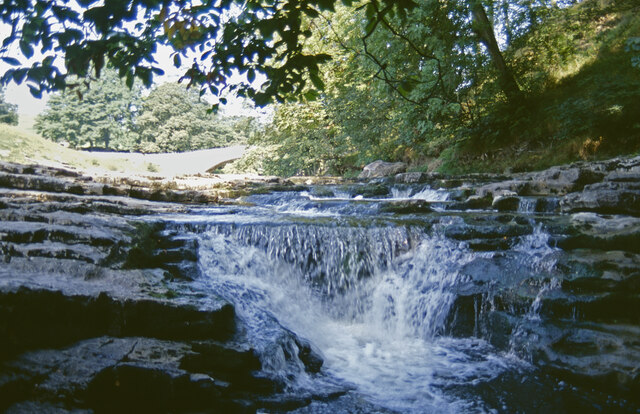
Stainforth Force

Waterfall in Yorkshire Craven

England

Stainforth Force

View from Feizor Thwaite In the middle ground there is a green track that crosses over the hill and goes down to join the bridleway to Feizor village. The hill must surely be Pendle Hill, a long way away!
View from Feizor Thwaite Credit: Humphrey Bolton

Stainforth Force, located in the picturesque Yorkshire Dales National Park in England, is a stunning waterfall that captivates visitors with its natural beauty and tranquil surroundings. Situated near the charming village of Stainforth, the waterfall is a popular destination for nature lovers, hikers, and photographers.

The waterfall is formed by the River Ribble as it cascades over a series of rocky ledges and drops approximately 10 meters into a crystal-clear pool below. The force of the water creates a mesmerizing display of cascading white froth, which contrasts beautifully with the lush greenery that surrounds it.

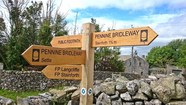
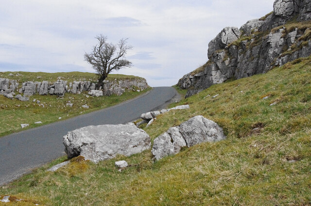
Access to Stainforth Force is relatively easy, with a well-marked footpath leading visitors from the village to the waterfall. The path winds through scenic meadows, offering stunning views of the surrounding countryside. Along the way, visitors can enjoy the sounds of birds chirping and the calming rush of the river.

Upon reaching the waterfall, visitors are treated to a serene and peaceful environment. The area is surrounded by ancient woodland and offers ample opportunities for picnicking and relaxation. Many visitors choose to sit on the rocks surrounding the waterfall, taking in the breathtaking views and enjoying the soothing sounds of rushing water.

Stainforth Force is not only a beautiful natural attraction but also holds historical significance. It was a popular spot for Victorian artists and writers who sought inspiration from its sublime beauty. Today, it continues to be a beloved destination for those seeking a tranquil escape into nature.

If you have any feedback on the listing, please let us know in the comments section below.

Stainforth Force Images

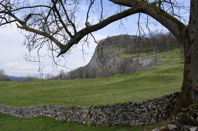
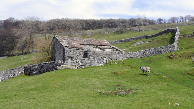
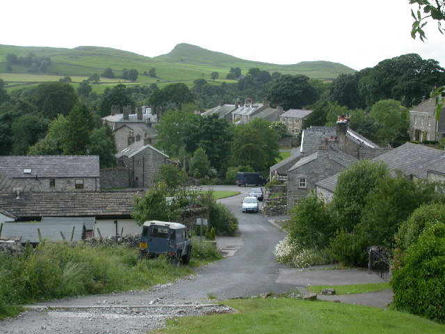
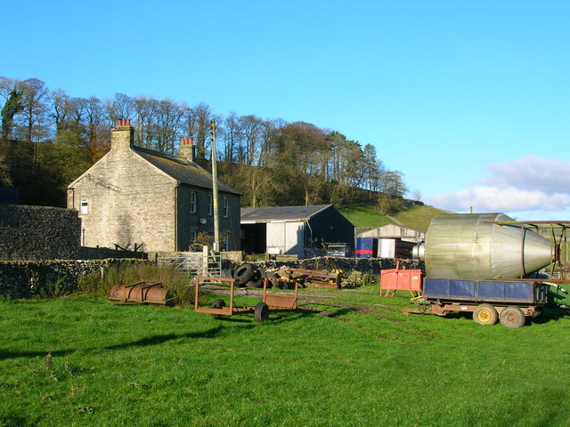
Images are sourced within 2km of 54.100008/-2.2791332 or Grid Reference SD8167. Thanks to Geograph Open Source API. All images are credited.

View from Feizor Thwaite In the middle ground there is a green track that crosses over the hill and goes down to join the bridleway to Feizor village. The hill must surely be Pendle Hill, a long way away!
View from Feizor Thwaite
In the middle ground there is a green track that crosses over the hill and goes down to join the bridleway to Feizor village. The hill must surely be Pendle Hill, a long way away!
Erratic boulder on Feizor Thwaite Carried by a glacier, perhaps from Cumbria, and dropped onto the surface of the limestone bedrock.
Erratic boulder on Feizor Thwaite
Carried by a glacier, perhaps from Cumbria, and dropped onto the surface of the limestone bedrock.
An area of springs The spring marked on the OS map is to the left, on the Feizor side of the parish boundary wall, but there seem to be more springs here in this curiously-shaped enclosure in Giggleswick parish. The grid line passes through the enclosure, so some of it is in SD8067.
An area of springs
The spring marked on the OS map is to the left, on the Feizor side of the parish boundary wall, but there seem to be more springs here in this curiously-shaped enclosure in Giggleswick parish. The grid line passes through the enclosure, so some of it is in SD8067.
Distant View Towards Smearsett Scar A frozen moorland view across to Smearsett Scar.
Distant View Towards Smearsett Scar
A frozen moorland view across to Smearsett Scar.
Gate and Ladder Stile in wall Looking south-east from footpath.
Gate and Ladder Stile in wall
Looking south-east from footpath.
Wall enclosed minor road passing a stone built barn Looking south-eastward.
Wall enclosed minor road passing a stone built barn
Looking south-eastward.
Pennine Bridleway sign at Upper Winskill Farm No excuses for getting lost here!  This state-of-the-art fingerpost leaves Pennine Bridleway users in no doubt over its route through this tricky five-way junction.
Pennine Bridleway sign at Upper Winskill Farm
No excuses for getting lost here! This state-of-the-art fingerpost leaves Pennine Bridleway users in no doubt over its route through this tricky five-way junction.
Settle to Carlisle Railway at Stainforth
New industrial unit, Langcliffe Craven District Council is developing the former Craven Lime Works site, providing new offices, workshops and industrial units.
New industrial unit, Langcliffe
Craven District Council is developing the former Craven Lime Works site, providing new offices, workshops and industrial units.
Knight Stainforth Bridge This single span bridge carries the minor road linking Stainforth with Little Stainforth over the River Ribble. It was built around 1675 by Samuel Watson whose house, Knight Stainforth Hall, gave its name to the bridge. It is sometimes referred to as a packhorse bridge but this seems unlikely; packhorse bridges do not generally have parapets which would impede the horses' packs. In fact, the roadway is just the right width for a horse-drawn cart. The structure is grade II listed and is now owned by the National Trust.
Knight Stainforth Bridge
This single span bridge carries the minor road linking Stainforth with Little Stainforth over the River Ribble. It was built around 1675 by Samuel Watson whose house, Knight Stainforth Hall, gave its name to the bridge. It is sometimes referred to as a packhorse bridge but this seems unlikely; packhorse bridges do not generally have parapets which would impede the horses' packs. In fact, the roadway is just the right width for a horse-drawn cart. The structure is grade II listed and is now owned by the National Trust.
Stainforth Force The River Ribble tumbles over exposed limestone rocks just south of Knight Stainforth Bridge (which can be seen in the background). These falls have long been a tourist attraction and are now a highlight of the Yorkshire Dales National Park.
Stainforth Force
The River Ribble tumbles over exposed limestone rocks just south of Knight Stainforth Bridge (which can be seen in the background). These falls have long been a tourist attraction and are now a highlight of the Yorkshire Dales National Park.
Winskill Stones Limestone outcrops by the minor road between Langcliffe and Malham.
Winskill Stones
Limestone outcrops by the minor road between Langcliffe and Malham.
Goat Scar Lane See <a href="https://www.geograph.org.uk/photo/1357559">SD8367 : Goat Scar Lane</a> (June 2009) for a similar view later in the year.
Goat Scar Lane
See SD8367 : Goat Scar Lane (June 2009) for a similar view later in the year.
Catrigg Force Stainforth Beck falls into a wooded ravine.
[Image formed from 2 photos merged together.]
Catrigg Force
Stainforth Beck falls into a wooded ravine. [Image formed from 2 photos merged together.]
Lower Winskill
Lower Winskill
Grazing land, Langcliffe Sloping ground, currently grazed by cattle. Stainforth Scar, a disused limestone quarry, is in the background.
Grazing land, Langcliffe
Sloping ground, currently grazed by cattle. Stainforth Scar, a disused limestone quarry, is in the background.
Field barn, Langcliffe Compare with <a href="https://www.geograph.org.uk/photo/1043610">SD8265 : Barn near Langcliffe</a> (2008) & <a href="https://www.geograph.org.uk/photo/2174195">SD8265 : Barn above Langcliffe</a> (2010).
Field barn, Langcliffe
Cattle at River Ribble Knight Stainforth Bridge beyond the cattle
Cattle at River Ribble
Knight Stainforth Bridge beyond the cattle
Show me another place!

Stainforth Force is located at Grid Ref: SD8167 (Lat: 54.100008, Lng: -2.2791332)

Division: West Riding

Administrative County: North Yorkshire

District: Craven

Police Authority: North Yorkshire

What 3 Words

///lamppost.void.rebounds. Near Settle, North Yorkshire

Related Wikis

Stainforth Force

Stainforth Force (also known as Stainforth Foss and Ribble Falls), is a 2.5-metre (8 ft 2 in) high cascade waterfall on the River Ribble at Stainforth...
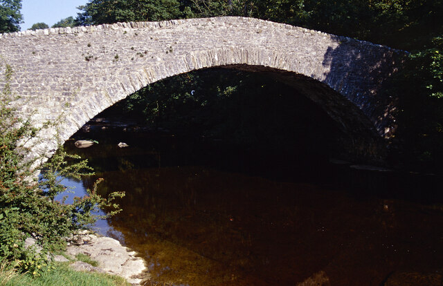
Stainforth Bridge

Stainforth Bridge, (also known as Stainforth packhorse bridge and Knight Stainforth bridge) is a 17th century, arched packhorse bridge over the River Ribble...

St Peter's Church, Stainforth

St Peter's Church is in the village of Stainforth, North Yorkshire, England. It is an active Anglican parish church in the deanery of Bowland, the archdeaconry...

Stainforth, North Yorkshire

Stainforth is a village and civil parish in the Craven district of North Yorkshire, England. It is situated north of Settle. Nearby there is a waterfall...

Stackhouse, North Yorkshire

Stackhouse (sometimes written as Stack House), is a hamlet near to Giggleswick on the western bank of the River Ribble in North Yorkshire, England. �...

Langcliffe

Langcliffe is a village and civil parish in the Craven district of North Yorkshire, in England. It lies to the north of Settle and east of Giggleswick...

Pennine Cycleway

The Pennine Cycleway is a Sustrans-sponsored route in the Pennines range in northern England, an area often called the "backbone of England". The route...
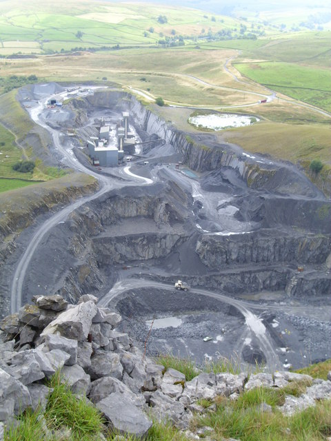
Dry Rigg Quarry

Dry Rigg Quarry is a quarry at Helwith Bridge in North Yorkshire, England, located within the Yorkshire Dales National Park. The quarry produces a hard...

Nearby Amenities

Located within 500m of 54.100008,-2.2791332
Give Way
Direction: backward
Lat/Long: 54.1011548/-2.2737058
Post Box
Image: https://www.geograph.org.uk/photo/3837950
Post Box Type: wall
Postal Code: BD24
Ref: BD24 76
Lat/Long: 54.1003022/-2.2852951
Ford: stepping_stones
Lat/Long: 54.1024036/-2.2736298
Stainforth
Place: village
Source: NPE
Wikidata: Q1941870
Wikipedia: en:Stainforth, North Yorkshire
Lat/Long: 54.101956/-2.2749464
Hazard Backward: cattle
Lat/Long: 54.0967614/-2.2743544
Telephone
Booth: KX100
Covered: booth
Payment Coins: no
Lat/Long: 54.1012448/-2.2757715
Board Type: notice
Information: board
Source: GPS
Tourism: information
Lat/Long: 54.1003106/-2.2855005
Piggery to Pinfold
Information: board
Tourism: information
Lat/Long: 54.1019805/-2.2746212
Grit Bin
Lat/Long: 54.1024638/-2.2741132
Barrier: stile
Material: stone
Source: survey;gps
Stile: stepover
Lat/Long: 54.0980769/-2.2737786
Barrier: stile
Material: stone
Source: survey;gps
Stile: stepover
Lat/Long: 54.1009443/-2.2732392
Barrier: entrance
Source: survey;gps
Lat/Long: 54.1023048/-2.2759227
Barrier: stile
Foot: yes
Source: Survey
Lat/Long: 54.1006294/-2.2812651
Power: pole
Lat/Long: 54.095723/-2.2776975
Power: pole
Lat/Long: 54.0962169/-2.2777243
Power: pole
Lat/Long: 54.0965409/-2.2777404
Power: pole
Lat/Long: 54.0974343/-2.2777887
Power: pole
Lat/Long: 54.0983025/-2.2778102
Power: pole
Lat/Long: 54.0996551/-2.2778584
Power: pole
Lat/Long: 54.1001238/-2.2778316
Power: pole
Lat/Long: 54.1008378/-2.2784593
Power: pole
Lat/Long: 54.1013097/-2.2788723
Power: pole
Lat/Long: 54.1028289/-2.2801383
Power: pole
Lat/Long: 54.1036467/-2.2808357
Power: pole
Lat/Long: 54.1042914/-2.2813614
Give Way
Direction: forward
Lat/Long: 54.1010162/-2.2764508
Give Way
Direction: backward
Lat/Long: 54.1014289/-2.2769604
Give Way
Direction: forward
Lat/Long: 54.101762/-2.2747242
Give Way
Direction: forward
Lat/Long: 54.1020386/-2.2747168
Defibrillator
Emergency: defibrillator
Indoor: no
Lat/Long: 54.1012199/-2.2744706
Little Stainforth
Is In County: North Yorkshire
Is In Municipality: Craven
Place: hamlet
Wikidata: Q1941870
Wikipedia: en:Stainforth, North Yorkshire
Lat/Long: 54.1007783/-2.2854832
Direction: SSE
Generator Method: photovoltaic
Generator Output Electricity: yes
Generator Source: solar
Generator Type: solar_photovoltaic_panel
Location: roof
Power: generator
Lat/Long: 54.1022945/-2.2738484
Stainforth Force
Alt Name: Stainforth Foss;Ribble Falls
Image: https://www.geograph.org.uk/photo/7147100
Waterway: waterfall
Wikidata: Q111943333
Wikipedia: en:Stainforth Force
Lat/Long: 54.1000744/-2.2791656
Power: pole
Lat/Long: 54.1006125/-2.2844715
Power: pole
Lat/Long: 54.1010714/-2.2835945
Power: pole
Lat/Long: 54.1015886/-2.2826385
Power: pole
Lat/Long: 54.1021267/-2.2817386
Power: pole
Lat/Long: 54.10291/-2.2812823
Power: portal
Lat/Long: 54.0988209/-2.2826831
Barrier: stile
Lat/Long: 54.1005735/-2.2826843
Hiking: yes
Information: guidepost
Tourism: information
Lat/Long: 54.1007794/-2.2856508
Hiking: yes
Information: guidepost
Tourism: information
Lat/Long: 54.1005708/-2.2826622
Defibrillator
Emergency: defibrillator
Fixme: Confirm location is correct - seems unlikely
Lat/Long: 54.100289/-2.28526
Drinking Water
Lat/Long: 54.0998784/-2.2824124
Leisure: picnic_table
Lat/Long: 54.0998721/-2.2849001
Leisure: picnic_table
Lat/Long: 54.099839/-2.2848988
Leisure: picnic_table
Lat/Long: 54.0998021/-2.2848974
Recycling
Lat/Long: 54.1000466/-2.2838473
Barrier: lift_gate
Lat/Long: 54.1001236/-2.2836545
Shop: laundry
Lat/Long: 54.0988812/-2.2823614
Sanitary Dump Station
Lat/Long: 54.0997211/-2.282871
Shower
Lat/Long: 54.0988828/-2.2824499
Toilets
Lat/Long: 54.0988828/-2.2825143
Bench
Lat/Long: 54.0997368/-2.280288
Bench
Lat/Long: 54.0997808/-2.280288
Drinking Water
Lat/Long: 54.0999727/-2.2836757
Drinking Water
Lat/Long: 54.0992524/-2.281664
The Foss Wood
Leisure: garden
Lat/Long: 54.099416/-2.2804302
Stainforth Woodland
Board Type: plants
Information: board
Tourism: information
Lat/Long: 54.0976819/-2.2808778
Image: https://www.geograph.org.uk/photo/7147100
Tourism: viewpoint
Lat/Long: 54.0999491/-2.2793104
Barrier: entrance
Lat/Long: 54.1012819/-2.2742543
Give Way
Direction: backward
Lat/Long: 54.0995567/-2.2745122
Give Way
Direction: backward
Lat/Long: 54.100914/-2.2743145
Give Way
Direction: forward
Lat/Long: 54.1011556/-2.2742192
Give Way
Direction: backward
Lat/Long: 54.1011864/-2.2759357
Give Way
Direction: backward
Lat/Long: 54.1014077/-2.2754279
Vending Machine
Vending: parking_tickets
Lat/Long: 54.1010608/-2.2757069
Give Way
Direction: backward
Lat/Long: 54.1019035/-2.2747884
Give Way
Direction: forward
Lat/Long: 54.1004584/-2.2745012
Give Way
Direction: forward
Lat/Long: 54.1001358/-2.2744383
Charging Station
Access: yes
Capacity: 2
Fee: yes
Operator: Pod Point
Operator Wikidata: Q42888154
Ref: Alec-Axel
Socket Type2: 2
Socket Type2 Output: 7 kW
Lat/Long: 54.1010954/-2.2760257
Power: pole
Lat/Long: 54.1019803/-2.2794324
Man Made: utility_pole
Lat/Long: 54.1021329/-2.2745387
Man Made: utility_pole
Source: bing
Lat/Long: 54.1013516/-2.275454
Man Made: utility_pole
Lat/Long: 54.1023444/-2.274013
The data included in this document is from www.openstreetmap.org. The data is made available under ODbL.

Have you been to Stainforth Force?

Leave your review of Stainforth Force below (or comments, questions and feedback).