Aberdulais Falls

Waterfall in Glamorgan

Wales

Aberdulais Falls

Red tin tabernacle, Cilfrew Red painted corrugated iron clad chapel/school room with ‘ecclesiastic’ Gothic style fenestration and small entrance porch.
Red tin tabernacle, Cilfrew Credit: Alan Hughes

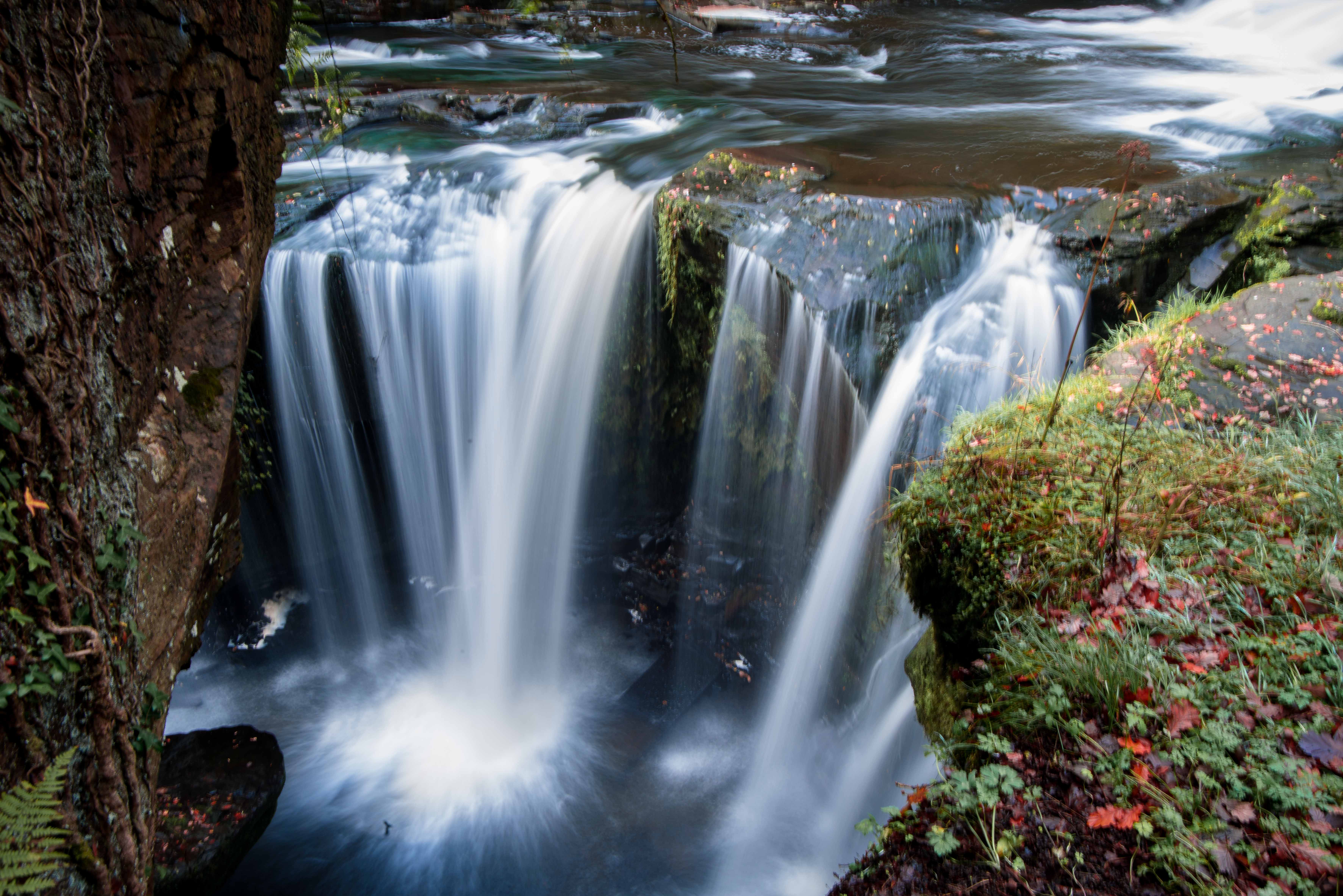
Aberdulais Falls, located in Glamorgan, Wales, is a captivating waterfall that holds historical and natural significance. Set amidst a picturesque landscape, this waterfall attracts visitors with its beauty and unique features.

The falls are formed by the River Dulais as it tumbles over a series of rocky ledges, creating a dramatic cascade. The water rushes down with great force, producing a mesmerizing display of power and energy. Standing at approximately 8 meters tall, Aberdulais Falls is not the highest waterfall in the region, but its charm lies in its rugged and untamed nature.

What makes Aberdulais Falls truly special is its historical importance. The site is home to an ancient industrial complex that dates back to the 16th century. It was once a thriving industrial hub, harnessing the power of the waterfall to drive waterwheels and generate energy for various industries, such as copper smelting and tinplate production. Today, visitors can explore the remains of the waterwheel and machinery, gaining insight into the area's industrial past.

Aberdulais Falls offers a range of activities for visitors to enjoy. The surrounding area boasts well-maintained walking paths that allow for scenic hikes, offering breathtaking views of the falls and the surrounding woodlands. The on-site visitor center provides informative exhibits about the history of the falls and the industrial complex, ensuring an enriching experience for all.

Whether you are a nature lover, history enthusiast, or simply seeking a peaceful escape, Aberdulais Falls is a must-visit destination that offers a perfect blend of natural beauty and historical intrigue.

If you have any feedback on the listing, please let us know in the comments section below.

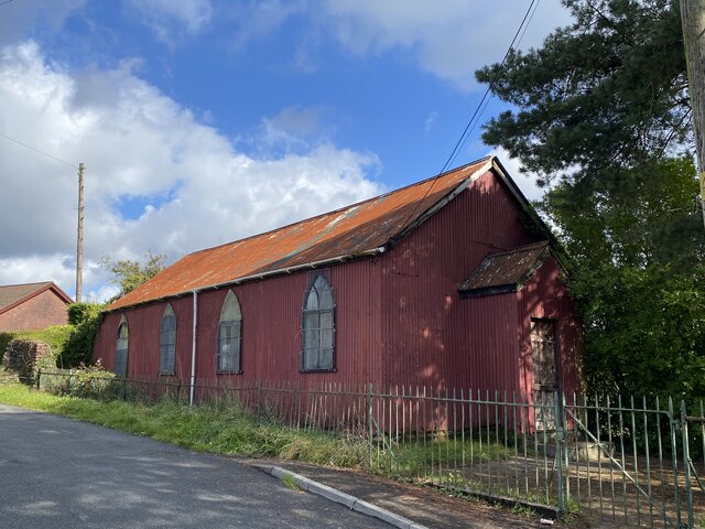
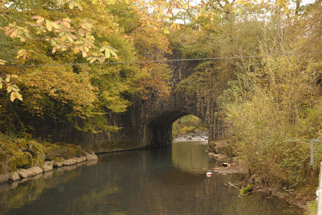
Aberdulais Falls Images

Images are sourced within 2km of 51.681243/-3.7783606 or Grid Reference SS7799. Thanks to Geograph Open Source API. All images are credited.

Red tin tabernacle, Cilfrew Red painted corrugated iron clad chapel/school room with ‘ecclesiastic’ Gothic style fenestration and small entrance porch.
Red tin tabernacle, Cilfrew
Red painted corrugated iron clad chapel/school room with ‘ecclesiastic’ Gothic style fenestration and small entrance porch.
Ordnance Survey Rivet This OS rivet can be found on a stone north side of the path. It marks a point 116.940m above mean sea level.
Ordnance Survey Rivet
This OS rivet can be found on a stone north side of the path. It marks a point 116.940m above mean sea level.
Ordnance Survey Rivet This OS rivet can be found on a rock outcrop west side of the path. It marks a point 149.739m above mean sea level.
Ordnance Survey Rivet
This OS rivet can be found on a rock outcrop west side of the path. It marks a point 149.739m above mean sea level.
Ordnance Survey Cut Mark This OS cutmark can be found on a stone south side of the path. It marks a point 161.398m above mean sea level.
Ordnance Survey Cut Mark
This OS cutmark can be found on a stone south side of the path. It marks a point 161.398m above mean sea level.
Ordnance Survey Rivet This OS rivet can be found on a rock south side of the path. It marks a point 180.213m above mean sea level.
Ordnance Survey Rivet
This OS rivet can be found on a rock south side of the path. It marks a point 180.213m above mean sea level.
Ordnance Survey Rivet This OS rivet can be found at the base of the wall NE side of the road. It marks a point 201.491m above mean sea level.
Ordnance Survey Rivet
This OS rivet can be found at the base of the wall NE side of the road. It marks a point 201.491m above mean sea level.
Ordnance Survey Cut Mark This OS cut mark can be found on the NE angle of the Tabor Chapel. It marks a point 153.055m above mean sea level.
Ordnance Survey Cut Mark
This OS cut mark can be found on the NE angle of the Tabor Chapel. It marks a point 153.055m above mean sea level.
Ordnance Survey Cut Mark This OS cut mark can be found on the east parapet of the bridge. It marks a point 136.127m above mean sea level.
Ordnance Survey Cut Mark
This OS cut mark can be found on the east parapet of the bridge. It marks a point 136.127m above mean sea level.
Gelli-march Farm Near Neath Golf Club
Gelli-march Farm
Near Neath Golf Club
The entrance to Sarn Helen Roman Road from the B4242 Hidden in the shadows is the signposted entrance to the Roman Road that is categorised as a 'byway open to all traffic' despite its historic significance.
The entrance to Sarn Helen Roman Road from the B4242
Hidden in the shadows is the signposted entrance to the Roman Road that is categorised as a 'byway open to all traffic' despite its historic significance.
Railway viaduct over the River Dulais Viaduct carrying the former 'Neath & Brecon Railway' and now used to transport coal from the washeries at the top of the Dulais Valley.
Railway viaduct over the River Dulais
Viaduct carrying the former 'Neath & Brecon Railway' and now used to transport coal from the washeries at the top of the Dulais Valley.
Tabor Chapel (built 1866) near Cilfrew
Old mine chimney near Ty Draw Farm I assume this was an air vent. As with <a href="https://www.geograph.org.uk/photo/1048317">SS6094 : Air shaft at former mine south of Waunarlwydd</a> holes have been knocked in at the base, presumably to allow the shaft beneath to be filled in.
Old mine chimney near Ty Draw Farm
I assume this was an air vent. As with SS6094 : Air shaft at former mine south of Waunarlwydd holes have been knocked in at the base, presumably to allow the shaft beneath to be filled in.
Ruins of mine above Ty Draw farm The view is along the south wall of a building and it is the only wall still standing.
Ruins of mine above Ty Draw farm
The view is along the south wall of a building and it is the only wall still standing.
Detached houses at the northern end of Rosser Terrace, Cilfrew Two detached houses located between Rosser Terrace and New Road, Cilfrew.
Detached houses at the northern end of Rosser Terrace, Cilfrew
Two detached houses located between Rosser Terrace and New Road, Cilfrew.
New Road, Cilfrew Viewed across Main Road.
New Road, Cilfrew
Viewed across Main Road.
New Road houses, Cilfrew Viewed from the Main Road end.
New Road houses, Cilfrew
Viewed from the Main Road end.
Cilfrew Post Office Located at 10 Main Street, Cilfrew, a village NE of Neath.
Cilfrew Post Office
Located at 10 Main Street, Cilfrew, a village NE of Neath.
Show me another place!

Aberdulais Falls is located at Grid Ref: SS7799 (Lat: 51.681243, Lng: -3.7783606)

Unitary Authority: Neath Port Talbot

Police Authority: South Wales

What 3 Words

///placed.senses.slim. Near Neath, Neath Port Talbot

Related Wikis

River Dulais

River Dulais (Welsh: Afon Dulais) is a river of Wales which has its source at Mynydd y Drum. It joins the River Neath after flowing over Aberdulais Falls...

Aberdulais Falls

The Aberdulais Falls are found on the River Dulais at Aberdulais, near Neath in the county borough of Neath Port Talbot, Wales. The falls are formed as...

Penscynor Wildlife Park

Penscynor Wildlife Park was a wildlife and safari park located near Neath in South Wales. == History == In 1966, Neath builder Idris Hale bought the semi...

Aberdulais

Aberdulais is a village and electoral ward in Neath Port Talbot, Wales, lying on the River Neath, in the community of Blaenhonddan. The village grew...

Aberdylais Halt railway station

Aberdylais halt railway station served the village of Aberdulais in Wales. It was located on the line from Neath to Merthyr Tydfil. == History == Opened...

Penscynor Halt railway station

Penscynor Halt railway station served the village of Cilfrew, in the historical county of Glamorganshire, Wales, from 1929 to 1962 on the Neath and Brecon...

Tonna, Neath

Tonna (Welsh: Tonnau) is the name of a village and community in Neath Port Talbot, Wales, located to the north-east of Neath. Immediately between Tonna...

Cilfrew railway station

Cilfrew railway station served the village of Cilfrew, in the historical county of Glamorgan, Wales, from 1888 to 1962 on the Neath and Brecon Railway...

Nearby Amenities

Located within 500m of 51.681243,-3.7783606
Aberdulais
Place: village
Wikidata: Q4667051
Lat/Long: 51.6791431/-3.7794145
Traffic Calming: table
Lat/Long: 51.6810751/-3.7818254
Cilfrew
Place: village
Source: npe
Wikidata: Q13127104
Lat/Long: 51.6843585/-3.7816461
Cafe
Lat/Long: 51.6800792/-3.7775811
Bus Stop
Is In: Main Road
Lat/Long: 51.6846777/-3.7810024
Bus Stop
Aberdulais Falls
Bus: yes
Public Transport: platform
Lat/Long: 51.679682/-3.7779715
Place Of Worship
Religion: christian
Lat/Long: 51.6822627/-3.7750789
Traffic Signals
Traffic Signals Direction: both
Lat/Long: 51.6797397/-3.7776361
Motorway Junction
Aberdulais
Lat/Long: 51.6780108/-3.7799664
Post Box
Post Box Type: lamp
Ref: SA10 86D
Royal Cypher: EIIR
Royal Cypher Wikidata: Q33102113
Lat/Long: 51.6800123/-3.7774448
Direction: 170
Generator Method: photovoltaic
Generator Output Electricity: yes
Generator Solar Modules: 16
Generator Source: solar
Generator Type: solar_photovoltaic_panel
Location: roof
Power: generator
Lat/Long: 51.6787957/-3.7802705
Give Way
Direction: forward
Lat/Long: 51.6782113/-3.7763996
Give Way
Direction: backward
Lat/Long: 51.6781391/-3.7763554
Direction: E
Generator Method: photovoltaic
Generator Output Electricity: yes
Generator Solar Modules: 12
Generator Source: solar
Generator Type: solar_photovoltaic_panel
Location: roof
Power: generator
Lat/Long: 51.6809511/-3.7820394
Direction: W
Generator Method: photovoltaic
Generator Output Electricity: yes
Generator Solar Modules: 6
Generator Source: solar
Generator Type: solar_photovoltaic_panel
Location: roof
Power: generator
Lat/Long: 51.681349/-3.7822885
Direction: S
Generator Method: photovoltaic
Generator Output Electricity: yes
Generator Solar Modules: 5
Generator Source: solar
Generator Type: solar_photovoltaic_panel
Location: roof
Power: generator
Lat/Long: 51.6813852/-3.782317
Direction: ESE
Generator Method: photovoltaic
Generator Output Electricity: yes
Generator Solar Modules: 18
Generator Source: solar
Generator Type: solar_photovoltaic_panel
Location: roof
Power: generator
Lat/Long: 51.6787303/-3.7824528
Direction: SSW
Generator Method: photovoltaic
Generator Output Electricity: yes
Generator Solar Modules: 16
Generator Source: solar
Generator Type: solar_photovoltaic_panel
Location: roof
Power: generator
Lat/Long: 51.6793999/-3.7821122
Direction: SSW
Generator Method: photovoltaic
Generator Output Electricity: yes
Generator Solar Modules: 16
Generator Source: solar
Generator Type: solar_photovoltaic_panel
Location: roof
Power: generator
Lat/Long: 51.6798554/-3.7817716
Direction: ESE
Generator Method: photovoltaic
Generator Output Electricity: yes
Generator Solar Modules: 10
Generator Source: solar
Generator Type: solar_photovoltaic_panel
Location: roof
Power: generator
Lat/Long: 51.6808302/-3.7820596
Direction: 185
Generator Method: photovoltaic
Generator Output Electricity: yes
Generator Solar Modules: 16
Generator Source: solar
Generator Type: solar_photovoltaic_panel
Location: roof
Power: generator
Lat/Long: 51.6807942/-3.7824314
Direction: SE
Generator Method: photovoltaic
Generator Output Electricity: yes
Generator Solar Modules: 16
Generator Source: solar
Generator Type: solar_photovoltaic_panel
Location: roof
Power: generator
Lat/Long: 51.6795591/-3.7798521
Direction: 125
Generator Method: photovoltaic
Generator Output Electricity: yes
Generator Solar Modules: 11
Generator Source: solar
Generator Type: solar_photovoltaic_panel
Location: roof
Power: generator
Lat/Long: 51.6800547/-3.7798145
Direction: SSE
Generator Method: photovoltaic
Generator Output Electricity: yes
Generator Solar Modules: 6
Generator Source: solar
Generator Type: solar_photovoltaic_panel
Location: roof
Power: generator
Lat/Long: 51.678907/-3.7738312
Direction: WSW
Generator Method: photovoltaic
Generator Output Electricity: yes
Generator Solar Modules: 7
Generator Source: solar
Generator Type: solar_photovoltaic_panel
Location: roof
Power: generator
Lat/Long: 51.6789687/-3.7738922
Direction: 265
Generator Method: photovoltaic
Generator Output Electricity: yes
Generator Solar Modules: 10
Generator Source: solar
Generator Type: solar_photovoltaic_panel
Location: roof
Power: generator
Lat/Long: 51.682761/-3.7755996
Direction: ESE
Generator Method: photovoltaic
Generator Output Electricity: yes
Generator Solar Modules: 2
Generator Source: solar
Generator Type: solar_photovoltaic_panel
Location: roof
Power: generator
Lat/Long: 51.6843821/-3.7818209
Direction: 265
Generator Method: photovoltaic
Generator Output Electricity: yes
Generator Solar Modules: 7
Generator Source: solar
Generator Type: solar_photovoltaic_panel
Location: roof
Power: generator
Lat/Long: 51.6821819/-3.7755129
Direction: 175
Generator Method: photovoltaic
Generator Output Electricity: yes
Generator Solar Modules: 10
Generator Source: solar
Generator Type: solar_photovoltaic_panel
Location: roof
Power: generator
Lat/Long: 51.6839434/-3.7752459
Traffic Calming: table
Lat/Long: 51.6840944/-3.7811354
Direction: 215
Generator Method: photovoltaic
Generator Output Electricity: yes
Generator Solar Modules: 16
Generator Source: solar
Generator Type: solar_photovoltaic_panel
Location: roof
Power: generator
Lat/Long: 51.6802389/-3.78004
Direction: SE
Generator Method: photovoltaic
Generator Output Electricity: yes
Generator Solar Modules: 16
Generator Source: solar
Generator Type: solar_photovoltaic_panel
Location: roof
Power: generator
Lat/Long: 51.6816793/-3.7748226
Direction: 175
Generator Method: photovoltaic
Generator Output Electricity: yes
Generator Solar Modules: 6
Generator Source: solar
Generator Type: solar_photovoltaic_panel
Location: roof
Power: generator
Lat/Long: 51.682158/-3.7754757
Direction: 85
Generator Method: photovoltaic
Generator Output Electricity: yes
Generator Solar Modules: 3
Generator Source: solar
Generator Type: solar_photovoltaic_panel
Location: roof
Power: generator
Lat/Long: 51.6839345/-3.775337
Direction: 175
Generator Method: photovoltaic
Generator Output Electricity: yes
Generator Solar Modules: 12
Generator Source: solar
Generator Type: solar_photovoltaic_panel
Location: roof
Power: generator
Lat/Long: 51.6818512/-3.7756836
Direction: 215
Generator Method: photovoltaic
Generator Output Electricity: yes
Generator Solar Modules: 9
Generator Source: solar
Generator Type: solar_photovoltaic_panel
Location: roof
Power: generator
Lat/Long: 51.6815613/-3.7828973
Direction: ESE
Generator Method: photovoltaic
Generator Output Electricity: yes
Generator Solar Modules: 2
Generator Source: solar
Generator Type: solar_photovoltaic_panel
Location: roof
Power: generator
Lat/Long: 51.6844274/-3.7818044
Direction: ESE
Generator Method: photovoltaic
Generator Output Electricity: yes
Generator Solar Modules: 2
Generator Source: solar
Generator Type: solar_photovoltaic_panel
Location: roof
Power: generator
Lat/Long: 51.6842976/-3.7818675
Direction: 175
Generator Method: photovoltaic
Generator Output Electricity: yes
Generator Solar Modules: 5
Generator Source: solar
Generator Type: solar_photovoltaic_panel
Location: roof
Power: generator
Lat/Long: 51.6815506/-3.7828267
Direction: 175
Generator Method: photovoltaic
Generator Output Electricity: yes
Generator Solar Modules: 16
Generator Source: solar
Generator Type: solar_photovoltaic_panel
Location: roof
Power: generator
Lat/Long: 51.6816631/-3.7759304
Direction: ESE
Generator Method: photovoltaic
Generator Output Electricity: yes
Generator Solar Modules: 2
Generator Source: solar
Generator Type: solar_photovoltaic_panel
Location: roof
Power: generator
Lat/Long: 51.6843484/-3.7818379
Direction: 85
Generator Method: photovoltaic
Generator Output Electricity: yes
Generator Solar Modules: 5
Generator Source: solar
Generator Type: solar_photovoltaic_panel
Location: roof
Power: generator
Lat/Long: 51.6818823/-3.7756376
Direction: 85
Generator Method: photovoltaic
Generator Output Electricity: yes
Generator Solar Modules: 3
Generator Source: solar
Generator Type: solar_photovoltaic_panel
Location: roof
Power: generator
Lat/Long: 51.6839724/-3.7753435
Direction: 85
Generator Method: photovoltaic
Generator Output Electricity: yes
Generator Solar Modules: 10
Generator Source: solar
Generator Type: solar_photovoltaic_panel
Location: roof
Power: generator
Lat/Long: 51.6827644/-3.7755365
Direction: S
Generator Method: photovoltaic
Generator Output Electricity: yes
Generator Solar Modules: 24
Generator Source: solar
Generator Type: solar_photovoltaic_panel
Location: roof
Power: generator
Lat/Long: 51.6817419/-3.7760856
Bus Stop
Dulais Drive
Bus: yes
Public Transport: platform
Lat/Long: 51.6814359/-3.7751354
Bus Stop
Dulais Drive
Bus: yes
Public Transport: platform
Lat/Long: 51.6811848/-3.7753259
Bus Stop
Aberdulais Falls
Bus: yes
Public Transport: platform
Lat/Long: 51.6790043/-3.77846
Man Made: watermill
Lat/Long: 51.6810277/-3.7781144
Man Made: chimney
Lat/Long: 51.6807769/-3.7782476
The data included in this document is from www.openstreetmap.org. The data is made available under ODbL.

Have you been to Aberdulais Falls?

Leave your review of Aberdulais Falls below (or comments, questions and feedback).