Downie's Loup

Waterfall in Stirlingshire

Scotland

Downie's Loup

Unnamed reservoir A small reservoir formed by damming the two Blackspouts.
Unnamed reservoir Credit: Stephen Coyne

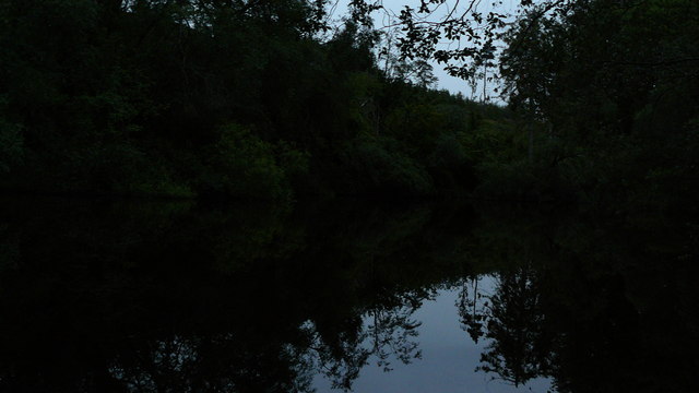
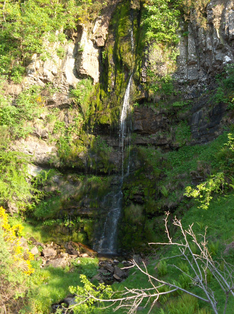
Downie's Loup is a picturesque waterfall located in Stirlingshire, Scotland. Nestled in the heart of the stunning Trossachs National Park, this natural wonder attracts visitors from near and far. The waterfall is situated on the Keltie Water, a small but fast-flowing river that adds to the allure of the area.

The cascading waters of Downie's Loup create a mesmerizing sight, plunging over a series of rocky ledges and creating a veil of mist that adds to its ethereal charm. The height of the falls varies depending on the season and rainfall, but it typically ranges between 10 to 15 meters.

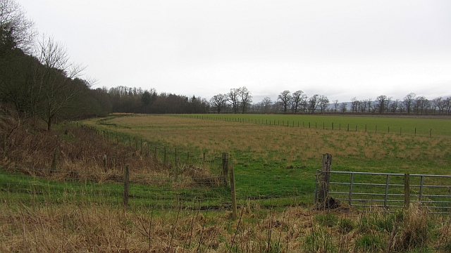
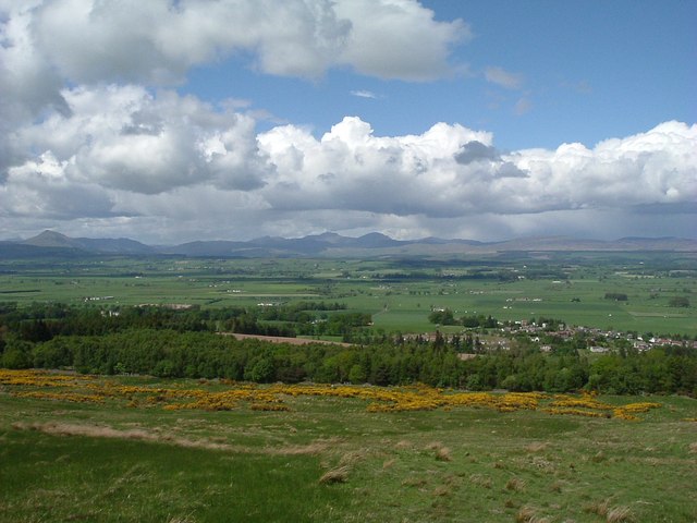
The surrounding landscape offers a captivating backdrop to the waterfall. Lush greenery, dense woodlands, and towering cliffs frame the area, creating a tranquil and idyllic setting. Visitors can enjoy scenic walks along the riverbank, taking in the beauty of the natural surroundings.

For those seeking adventure, Downie's Loup also provides opportunities for outdoor activities. The area is popular for hiking, with several trails leading to and around the waterfall. Additionally, the Keltie Water offers a chance for fishing enthusiasts to try their luck in its crystal-clear waters.

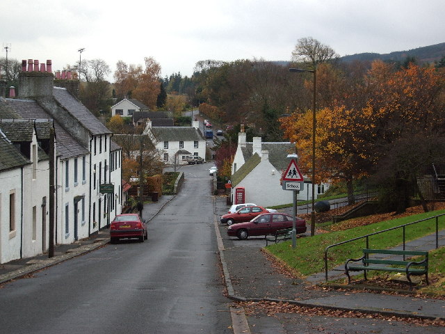
Access to Downie's Loup is relatively easy, with a nearby car park and well-maintained paths leading to the waterfall. The site is free to visit and is open to the public throughout the year.

Overall, Downie's Loup is a captivating attraction in Stirlingshire, offering visitors a chance to immerse themselves in the beauty of Scotland's natural landscape and witness the awe-inspiring power of nature.

If you have any feedback on the listing, please let us know in the comments section below.

Downie's Loup Images

Images are sourced within 2km of 56.112959/-4.0803377 or Grid Reference NS7093. Thanks to Geograph Open Source API. All images are credited.

Unnamed reservoir A small reservoir formed by damming the two Blackspouts.
Unnamed reservoir
A small reservoir formed by damming the two Blackspouts.
Foot of the steps Where the carse meets the first steep section of the Gargunnock Hills. The scarp is stepped with successive lava flows.
Foot of the steps
Where the carse meets the first steep section of the Gargunnock Hills. The scarp is stepped with successive lava flows.
Moorland on the Gargunnock Hills On the edge of the steep scarp above Gargunnock.
Moorland on the Gargunnock Hills
On the edge of the steep scarp above Gargunnock.
Gargunnock Hills traps, Tulmore An expanse of flat terrain above the steep Gargunnock Hills scarp. The flatness is the top of a lava flow, now a resistant layer of basalt. The next flow can be seen as a step (hence the term trap) on the right.  (We are told the term "trap" comes from Swedish, but it is of course an English word too.)
Gargunnock Hills traps, Tulmore
An expanse of flat terrain above the steep Gargunnock Hills scarp. The flatness is the top of a lava flow, now a resistant layer of basalt. The next flow can be seen as a step (hence the term trap) on the right. (We are told the term "trap" comes from Swedish, but it is of course an English word too.)
Footbridge in the Leckie Estate A bridge carrying a woodland path over a branch of the Leckie Burn.
Footbridge in the Leckie Estate
A bridge carrying a woodland path over a branch of the Leckie Burn.
Below the Gargunnock Hills escarpment Looking towards the distant Ochil Hills.
Below the Gargunnock Hills escarpment
Looking towards the distant Ochil Hills.
Below the Gargunnock Hills
Bield Farm Bield Farm at bend in road towards Gargunock from the road that runs from the A811
Bield Farm
Bield Farm at bend in road towards Gargunock from the road that runs from the A811
East Lodge East Lodge, Leckie, was originally the gate lodge for Watson House. It has no been extended and is a private family home.
East Lodge
East Lodge, Leckie, was originally the gate lodge for Watson House. It has no been extended and is a private family home.
North Edge of Gargunnock Hills from Tulmore Cliffs (old lava flows) on the northern edge of the Gargunnock Hills below Carleatheran with Ben Lomond in the distance.
North Edge of Gargunnock Hills from Tulmore
Cliffs (old lava flows) on the northern edge of the Gargunnock Hills below Carleatheran with Ben Lomond in the distance.
Tulmore Cliffs, Gargunnock Hills Tulmore cliffs (old lava flows) on the north edge of the Gargunnock Hills. Gargunnock village on the left with the Carse of Stirling beyond.
Tulmore Cliffs, Gargunnock Hills
Tulmore cliffs (old lava flows) on the north edge of the Gargunnock Hills. Gargunnock village on the left with the Carse of Stirling beyond.
Inside Leckie Broch
Inside Leckie Broch
Open hillside below Gargunnock Crags Looking over Flanders Moss toward the twin peaks of Ben Vorlich and Stuc a'Chroin in centre and Ben Ledi to the left. The village of Gargunnock is to the right of the photo. Flanders Moss is a vast area of around 50 square miles forming the flood plain for the River Forth. Once entirely bog it was drained and is now rich arable farmland.
Open hillside below Gargunnock Crags
Looking over Flanders Moss toward the twin peaks of Ben Vorlich and Stuc a'Chroin in centre and Ben Ledi to the left. The village of Gargunnock is to the right of the photo. Flanders Moss is a vast area of around 50 square miles forming the flood plain for the River Forth. Once entirely bog it was drained and is now rich arable farmland.
Gorge of the Easter Blackspout This burn which drains from the moorland plateau of the Gargunnock Hills has cut a very deep gorge through the cliffs northward to Flanders Moss and eventually into the River Forth. Following the course of the burn with care provides a possible, but none too straightforward, line of descent from the summit of Carleatheran. In spate the burn gushes over the cliffs with considerable force, hence the name.
Gorge of the Easter Blackspout
This burn which drains from the moorland plateau of the Gargunnock Hills has cut a very deep gorge through the cliffs northward to Flanders Moss and eventually into the River Forth. Following the course of the burn with care provides a possible, but none too straightforward, line of descent from the summit of Carleatheran. In spate the burn gushes over the cliffs with considerable force, hence the name.
Crags above Gargunnock Looking across the tussocks and broom to the crags above Gargunnock.
Crags above Gargunnock
Looking across the tussocks and broom to the crags above Gargunnock.
Approaching Gargunnock Approaching Gargunnock through the Leckie estate.
Approaching Gargunnock
Approaching Gargunnock through the Leckie estate.
Entrance to Leckie House
Row of grouse butts on Gargunnock Hills
Show me another place!

Downie's Loup is located at Grid Ref: NS7093 (Lat: 56.112959, Lng: -4.0803377)

Unitary Authority: Stirling

Police Authority: Forth Valley

What 3 Words

///nicely.committed.resolves. Near Kippen, Stirling

Related Wikis

Downie's Loup

Downie's Loup is a waterfall of Scotland located near the village of Gargunnock. == See also == Waterfalls of Scotland == References ==

Stirling (UK Parliament constituency)

Stirling is a county constituency of the House of Commons of the Parliament of the United Kingdom. It elects one Member of Parliament (MP) by the first...

Gargunnock

Gargunnock is a small village in the Stirling council area with an active community trust, seven miles (eleven kilometres) west of Stirling, in Scotland...

Leckie Broch

Leckie Broch is an iron-age broch located in Stirlingshire, Scotland. == Location == Just above the confluence of two streams with deep gulleys on the...

Gargunnock railway station

Gargunnock railway station served the village of Gargunnock, Stirling, Scotland, from 1856 to 1959 on the Forth and Clyde Junction Railway. == History... ==

Gargunnock Hills

The Gargunnock Hills are a range of hills west of the city of Stirling, Scotland. They culminate in the peak of Carleatheran, whose 485-metre (1,591 ft...

Touch House

Touch House is a country house located 4 kilometres (2.5 mi) west of Stirling in central Scotland. It stands at the foot of the Touch Hills, on the south...

Central 103.1 FM

Central 103.1 FM is an Independent Local Radio station serving Falkirk, Stirling, Clackmannanshire and the Forth Valley. It is owned and operated by businessman...

Nearby Amenities

Located within 500m of 56.112959,-4.0803377
Waterway: waterfall
Lat/Long: 56.1172529/-4.0807829
Ford: yes
Source: survey
Lat/Long: 56.1148529/-4.0814971
Waterway: waterfall
Lat/Long: 56.11181/-4.0806451
Man Made: flagpole
Lat/Long: 56.1115473/-4.075406
The data included in this document is from www.openstreetmap.org. The data is made available under ODbL.

Have you been to Downie's Loup?

Leave your review of Downie's Loup below (or comments, questions and feedback).