Eas a' Chobhain Duibh

Waterfall in Ross-shire

Scotland

Eas a' Chobhain Duibh

Forestry Road Forestry road on Church Hill.
Forestry Road Credit: Donald H Bain

Eas a' Chobhain Duibh, also known as the Black Waterfall, is a stunning natural feature located in Ross-shire, Scotland. Situated near the village of Ullapool, this waterfall is one of the hidden gems of the Scottish Highlands, attracting nature enthusiasts and hikers alike.

The waterfall is nestled amidst a picturesque landscape, surrounded by lush greenery and towering cliffs. It is fed by the Black Water River, which flows through a narrow gorge before cascading down into a pool below. The water plunges over a series of rocky ledges, creating a mesmerizing spectacle of white frothy water against the dark rocks, thus giving the waterfall its name.

Reaching Eas a' Chobhain Duibh requires a moderate hike through a well-marked trail. The trail offers breathtaking views of the surrounding countryside, with opportunities to spot local wildlife such as red deer, eagles, and otters. The hike takes you through a mix of dense forests, open moorland, and rugged terrain, adding to the adventure of the journey.

Once you arrive at the waterfall, you can witness its raw power and beauty up close. The roar of the rushing water and the misty spray that fills the air create a truly immersive experience. Visitors can also take a dip in the pool at the base of the waterfall, although caution is advised due to the strong currents.

Eas a' Chobhain Duibh is a must-visit destination for nature lovers seeking tranquility and stunning natural beauty. Its remote location and relatively undiscovered status make it a hidden treasure waiting to be explored by those who appreciate the wonders of the natural world.

If you have any feedback on the listing, please let us know in the comments section below.

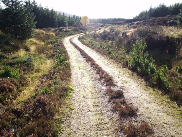
Eas a' Chobhain Duibh Images

Images are sourced within 2km of 57.846631/-4.3471692 or Grid Reference NH6086. Thanks to Geograph Open Source API. All images are credited.

Forestry Road Forestry road on Church Hill.
Forestry Road
Forestry road on Church Hill.
Forestry Road Well there is not a lot to see; it's trees or the road.
Forestry Road
Well there is not a lot to see; it's trees or the road.
Wester Fearn Burn
Wester Fearn Burn
Road in the forest at Badvoon
Junction of tracks in the forest at Badvoon
Cables for a new power line On the hill above Wester Fearn Burn.
Cables for a new power line
On the hill above Wester Fearn Burn.
Rigging new power cables Where the line crosses the Cobhar Dubh ravine.
Rigging new power cables
Where the line crosses the Cobhar Dubh ravine.
Eas a' Chobhain Duibh An impressive fall where the Wester Fearn Burn plunges into the ravine.
Eas a' Chobhain Duibh
An impressive fall where the Wester Fearn Burn plunges into the ravine.
The head of Eas a' Chobhain Duibh waterfall
Looking down towards Wester Fearn And the Kyle of Sutherland beyond.
Looking down towards Wester Fearn
And the Kyle of Sutherland beyond.
Forestry road in the Badvoon Forest The snow revealed only footprints of people, dogs and predominately deer. Dense coniferous forest constitutes Badvoon.
Forestry road in the Badvoon Forest
The snow revealed only footprints of people, dogs and predominately deer. Dense coniferous forest constitutes Badvoon.
Forestry road in Badvoon Forest Snow predominated on and beside the forest road, and was not as firm as would make walking easy.
Forestry road in Badvoon Forest
Snow predominated on and beside the forest road, and was not as firm as would make walking easy.
Plantation boundary and sign "Garvary" The spaces between the boundaries in the forest were very wide - presumably to act as a fire break should the need arise.
Plantation boundary and sign "Garvary"
The spaces between the boundaries in the forest were very wide - presumably to act as a fire break should the need arise.
Walking a track in Garvary Forest Retracing our morning footsteps as the snow softened further.
Walking a track in Garvary Forest
Retracing our morning footsteps as the snow softened further.
Gate and deer fence in the Badvoon Forest The only barrier to a walk through Badvoon Forest.  Simple for humans; still a problem to get a dog over it, as no low down slot in the stile or gate was deep enough for even a slinky dog to squirm through.
Gate and deer fence in the Badvoon Forest
The only barrier to a walk through Badvoon Forest. Simple for humans; still a problem to get a dog over it, as no low down slot in the stile or gate was deep enough for even a slinky dog to squirm through.
The east-west axis of Carr Dubh Carr Dubh is a glacial feature rising out of the wet land surrounding it.  Conical from a distance, it has nevertheless a pronounced east/west ridge. This is the view along it from the east.
The east-west axis of Carr Dubh
Carr Dubh is a glacial feature rising out of the wet land surrounding it. Conical from a distance, it has nevertheless a pronounced east/west ridge. This is the view along it from the east.
Edge of wetland of Coirriefearn croft The terrain gets drier as you turn uphill from the level of Coirriefearn croft.  Carr Dubh is the heather covered cone in the near distance.
Edge of wetland of Coirriefearn croft
The terrain gets drier as you turn uphill from the level of Coirriefearn croft. Carr Dubh is the heather covered cone in the near distance.
Tributary of the Easter Fearn Burn A rare tree in a bare landscape benefitting from its location in the defile of a stream.
Tributary of the Easter Fearn Burn
A rare tree in a bare landscape benefitting from its location in the defile of a stream.
Show me another place!

Eas a' Chobhain Duibh is located at Grid Ref: NH6086 (Lat: 57.846631, Lng: -4.3471692)

Unitary Authority: Highland

Police Authority: Highlands and Islands

What 3 Words

///flames.flush.asleep. Near Tain, Highland

Nearby Locations

Eas a' Chobhain Duibh

Related Wikis

Ardchronie

Ardchronie (Scottish Gaelic: Àird Chrònaidh) is a hamlet in the Highland Council area of Scotland. It lies on the south side of the Dornoch Firth, about...

Kincardine, Sutherland

Kincardine (Scottish Gaelic: Cinn Chàrdainn) is a small hamlet in Sutherland, situated on the west end of the south shore of the Dornoch Firth. The village...

Easter Fearn

Easter Fearn is a small settlement in the Ross-shire area of the Highland council area in Scotland, on the A836 and B9176 roads it is 3 miles from Ardgay...

Ardgay

Ardgay ard-GY (Scottish Gaelic: Àird Gaoith or Àird Ghaoithe) ["high wind"] is a small Scottish village on the south west shore of the Dornoch Firth,...

Have you been to Eas a' Chobhain Duibh?

Leave your review of Eas a' Chobhain Duibh below (or comments, questions and feedback).