Lots Ait

Island in Middlesex

England

Lots Ait

Colourful bedding at Kew One of the less botanical, and more overtly ornamental, displays in the Royal Botanic Gardens - a circle of imapatiens plants, with the Palm House in the background.
Colourful bedding at Kew Credit: Paul Harrop

Lots Ait is a small island located in the River Thames in the borough of Hounslow, Middlesex, England. It is situated between Brentford and Isleworth, and covers an area of approximately 1.5 acres. The island is accessible by a footbridge from the mainland.

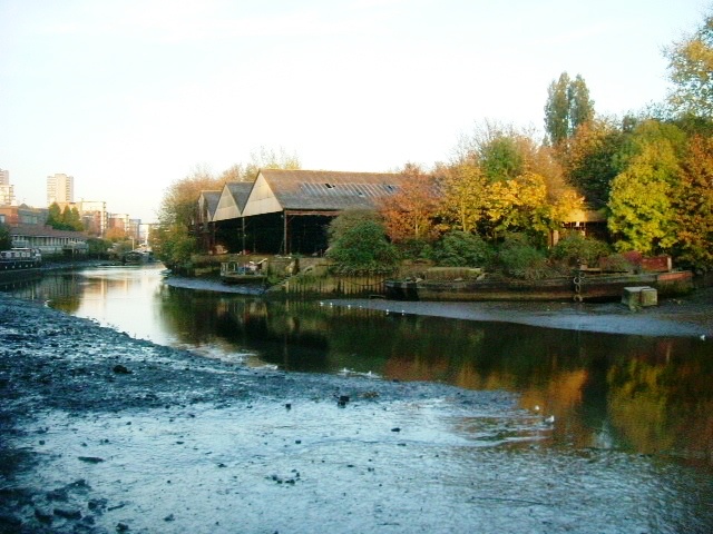
Lots Ait has a rich history dating back to the 18th century when it was used as a shipyard. The island was known for its boatbuilding industry, and many famous vessels were constructed here, including lifeboats and steam launches. The shipbuilding activity continued until the mid-20th century when it eventually ceased operations.

Today, Lots Ait has been transformed into a vibrant hub for creative industries. The island is home to a number of businesses, including artists' studios, workshops, and offices. The unique setting and picturesque surroundings make it an attractive location for creative professionals looking for a tranquil and inspiring workspace.

In addition to its creative community, Lots Ait also offers a variety of recreational activities. The island features a café, providing visitors with a place to relax and enjoy the scenic views of the river. There are also boatyards and moorings available for those interested in boating and water-based activities.

Lots Ait is a hidden gem in Middlesex, offering a blend of history, creativity, and natural beauty. With its rich heritage and thriving creative scene, it has become a prominent destination for both locals and tourists seeking a unique experience in the heart of the River Thames.

If you have any feedback on the listing, please let us know in the comments section below.

Lots Ait Images

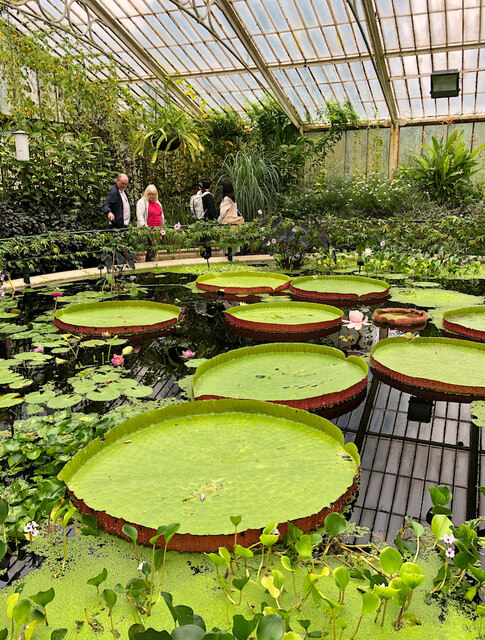
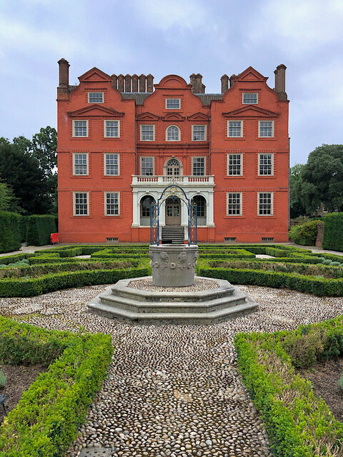
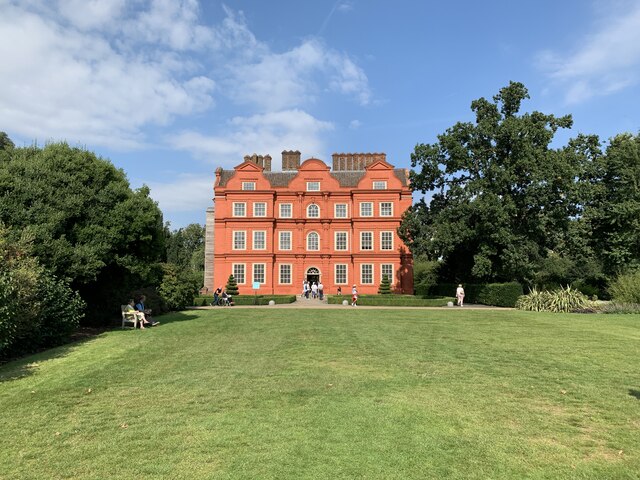
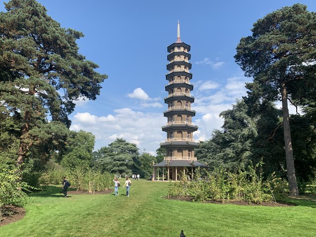
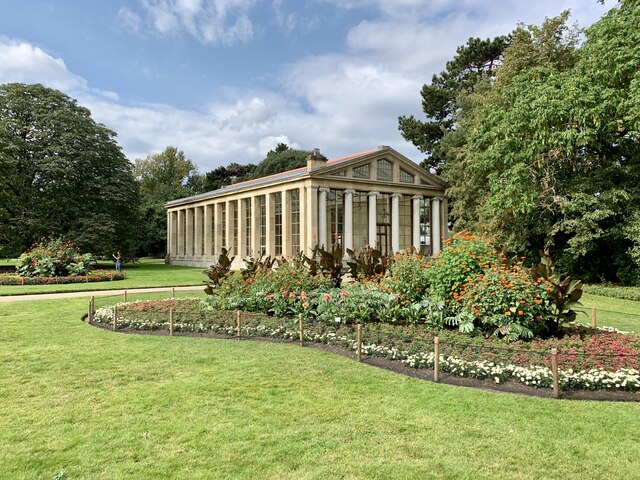
Images are sourced within 2km of 51.484666/-0.29835049 or Grid Reference TQ1877. Thanks to Geograph Open Source API. All images are credited.

Colourful bedding at Kew One of the less botanical, and more overtly ornamental, displays in the Royal Botanic Gardens - a circle of imapatiens plants, with the Palm House in the background.
Colourful bedding at Kew
One of the less botanical, and more overtly ornamental, displays in the Royal Botanic Gardens - a circle of imapatiens plants, with the Palm House in the background.
Waterlily House, Kew The small, square glasshouse at the Royal Botanic Gardens <span class="nowrap"><a title="https://www.kew.org/kew-gardens/whats-in-the-gardens/waterlily-house" rel="nofollow ugc noopener" href="https://www.kew.org/kew-gardens/whats-in-the-gardens/waterlily-house">Link</a><img style="margin-left:2px;" alt="External link" title="External link - shift click to open in new window" src="https://s1.geograph.org.uk/img/external.png" width="10" height="10"/></span>  designed specifically to showcase the giant Amazon waterlily (Victoria amazonica).

It was completed in 1852 and is now a listed building, filled with aquatic plants and tropical fruit.
Waterlily House, Kew
The small, square glasshouse at the Royal Botanic Gardens LinkExternal link designed specifically to showcase the giant Amazon waterlily (Victoria amazonica). It was completed in 1852 and is now a listed building, filled with aquatic plants and tropical fruit.
Kew Palace Seen from the parterre garden at the rear, this remnant of a much larger complex is also known as the Dutch House, now within the grounds of the Royal Botanic Gardens. Dating from 1631 but built over the undercroft of an earlier building, it was a royal residence from 1728 to 1818, with a final short-lived occupation in 1844. It is Grade I listed, and open to visitors.
Kew Palace
Seen from the parterre garden at the rear, this remnant of a much larger complex is also known as the Dutch House, now within the grounds of the Royal Botanic Gardens. Dating from 1631 but built over the undercroft of an earlier building, it was a royal residence from 1728 to 1818, with a final short-lived occupation in 1844. It is Grade I listed, and open to visitors.
Old Milestone, A307, Kew Road, opposite Holmesdale Road The milestone is located on the West side of the road on the front edge of the pavement. Parish of Richmond Upon Thames (Richmond Upon Thames District). Carved stone post, Richmond stone design, erected by the Kensington to Cranford Bridge turnpike trust in the 19th century.

Inscription reads:-   VII / MILES / FROM / HYDE PARK / CORNER

Grade II listed by Historic England, List Entry Number:  1357698 <span class="nowrap"><a title="https://historicengland.org.uk/listing/the-list/list-entry/1357698" rel="nofollow ugc noopener" href="https://historicengland.org.uk/listing/the-list/list-entry/1357698">Link</a><img style="margin-left:2px;" alt="External link" title="External link - shift click to open in new window" src="https://s1.geograph.org.uk/img/external.png" width="10" height="10"/></span>

The image was taken before 2010

Milestone Society National ID: SY_LNRM07
Old Milestone, A307, Kew Road, opposite Holmesdale Road
The milestone is located on the West side of the road on the front edge of the pavement. Parish of Richmond Upon Thames (Richmond Upon Thames District). Carved stone post, Richmond stone design, erected by the Kensington to Cranford Bridge turnpike trust in the 19th century. Inscription reads:- VII / MILES / FROM / HYDE PARK / CORNER Grade II listed by Historic England, List Entry Number: 1357698 LinkExternal link The image was taken before 2010 Milestone Society National ID: SY_LNRM07
Kew Palace Grade I listed. Listing number 1263073. Dating from 1631. Built by Samuel Fortrey a Flemish merchant whose initials with those of his wife are above the door.
Kew Palace
Grade I listed. Listing number 1263073. Dating from 1631. Built by Samuel Fortrey a Flemish merchant whose initials with those of his wife are above the door.
The Pagoda, Kew Gardens Grade I listed. Listing number 1262593. Built 1761-2 by Sir William Chambers. Grey stock brick. Ten storeys high (163 ft). Octagonal. Each of the upper storeys arcaded and balconied with "Chippendale" Chinese style railing all round, painted in Chinese red on the balcony projections. Each storey sheltered by roofed coving, also painted red. Ring of timber posts support slated roof to ground storey. The Pagoda roof originally of glazed tiles but is now leaded
The Pagoda, Kew Gardens
Grade I listed. Listing number 1262593. Built 1761-2 by Sir William Chambers. Grey stock brick. Ten storeys high (163 ft). Octagonal. Each of the upper storeys arcaded and balconied with "Chippendale" Chinese style railing all round, painted in Chinese red on the balcony projections. Each storey sheltered by roofed coving, also painted red. Ring of timber posts support slated roof to ground storey. The Pagoda roof originally of glazed tiles but is now leaded
Aroid House, Kew Gardens Grade II* listed. Listing number 1250800. By John Nash, originally one of the two pavilions flanking the Garden Facade of Buckingham Palace. It has glass walls with square Tuscan piers along the sides and six Ionic columns in antis along the fronts. Pediments and roof mostly glazed. North wall blind. Re-erected in this position in 1836.
Aroid House, Kew Gardens
Grade II* listed. Listing number 1250800. By John Nash, originally one of the two pavilions flanking the Garden Facade of Buckingham Palace. It has glass walls with square Tuscan piers along the sides and six Ionic columns in antis along the fronts. Pediments and roof mostly glazed. North wall blind. Re-erected in this position in 1836.
Kew Gardens railway station Grade II listed. Listing number 1031878. Built 1868-9 for the London and South Western Railway.
Kew Gardens railway station
Grade II listed. Listing number 1031878. Built 1868-9 for the London and South Western Railway.
Syon Lane station On the so-called Hounslow Loop.

The photo was taken in a brief sunny spell on an afternoon in late October.
Syon Lane station
On the so-called Hounslow Loop. The photo was taken in a brief sunny spell on an afternoon in late October.
Hercules Fountain, Kew Gardens Providing a focal feature in the pond, the bronze statue of Hercules wrestles with the Greek river god Achelous in the form of a serpent.  It is part of the Royal Collection and has had a peripatectic existence since being acquired by King George IV in 1829. It has been at Kew since 1961.
Hercules Fountain, Kew Gardens
Providing a focal feature in the pond, the bronze statue of Hercules wrestles with the Greek river god Achelous in the form of a serpent. It is part of the Royal Collection and has had a peripatectic existence since being acquired by King George IV in 1829. It has been at Kew since 1961.
The Botanical Brasserie The 3,300 sq ft café is located in the historic 19th-century building formerly known as Museum No.1, and features a terrace overlooking the Palm House Conservatory and pond, as well as a bar and private dining room. 

The cafe is the fifth outlet run by caterer Peyton and Byrne and the first all-day table service café in Kew Gardens.


The predominantly plant-based British menu, created by executive chef Lawrence Keogh (formerly of The Wolseley), reflects the location and puts emphasis on natural, seasonal ingredients.
The Botanical Brasserie
The 3,300 sq ft café is located in the historic 19th-century building formerly known as Museum No.1, and features a terrace overlooking the Palm House Conservatory and pond, as well as a bar and private dining room. The cafe is the fifth outlet run by caterer Peyton and Byrne and the first all-day table service café in Kew Gardens. The predominantly plant-based British menu, created by executive chef Lawrence Keogh (formerly of The Wolseley), reflects the location and puts emphasis on natural, seasonal ingredients.
Princess Amelia's bath house with magnolia blossom, Gunnersbury Park Magnolia trees are bearing more blossom than usual this year. The building is Princess Amelia's bath house built originally about 1780 but modified by subsequent owners and restored recently. See <a href="https://www.geograph.org.uk/photo/420128">TQ1979 : Princess Amelia's Bathhouse, Gunnersbury Park</a> for another photo and description, see <span class="nowrap"><a title="https://brentfordandchiswicklhs.org.uk/publications/the-journal/journal-10-2000/princess-amelias-bath-house/" rel="nofollow ugc noopener" href="https://brentfordandchiswicklhs.org.uk/publications/the-journal/journal-10-2000/princess-amelias-bath-house/">Link</a><img style="margin-left:2px;" alt="External link" title="External link - shift click to open in new window" src="https://s1.geograph.org.uk/img/external.png" width="10" height="10"/></span> Brentford and Chiswick Local History Society for detailed account of archaeological investigation.
Princess Amelia's bath house with magnolia blossom, Gunnersbury Park
Magnolia trees are bearing more blossom than usual this year. The building is Princess Amelia's bath house built originally about 1780 but modified by subsequent owners and restored recently. See TQ1979 : Princess Amelia's Bathhouse, Gunnersbury Park for another photo and description, see LinkExternal link Brentford and Chiswick Local History Society for detailed account of archaeological investigation.
Magnolia in blossom by bath house, Gunnersbury Park Magnolia blossom is very good this year. See <a href="https://www.geograph.org.uk/photo/7121746">TQ1979 : Princess Amelia's bath house with magnolia blossom, Gunnersbury Park</a> for details of Princess Amelia's bath house.
Magnolia in blossom by bath house, Gunnersbury Park
Magnolia blossom is very good this year. See TQ1979 : Princess Amelia's bath house with magnolia blossom, Gunnersbury Park for details of Princess Amelia's bath house.
Community garden in Gunnersbury Park The garden is prepared for spring planting.
Community garden in Gunnersbury Park
The garden is prepared for spring planting.
Jay (Garrulus glandarius) on magnolia, Kew Gardens The barred  electric blue and darker blue stripes on the wing are evident. The bird sat in the tree while people walked by admiring magnolia blossom.
Jay (Garrulus glandarius) on magnolia, Kew Gardens
The barred electric blue and darker blue stripes on the wing are evident. The bird sat in the tree while people walked by admiring magnolia blossom.
Magnolias in full bloom, Kew Gardens Magnolias in West London in general have profuse blossom this year, it even makes driving along the North Circular a pleasure. Kew Gardens has an excellent display.
Magnolias in full bloom, Kew Gardens
Magnolias in West London in general have profuse blossom this year, it even makes driving along the North Circular a pleasure. Kew Gardens has an excellent display.
Grove of magnolias in bloom, Kew Gardens See also <a href="https://www.geograph.org.uk/photo/7122226">TQ1877 : Magnolias in full bloom, Kew Gardens</a> taken just before. Geograph has other photos over the years of these spectacular trees, e.g. <a href="https://www.geograph.org.uk/photo/1220669">TQ1877 : Magnolia bud in Kew Gardens</a> and <a href="https://www.geograph.org.uk/photo/3433175">TQ1877 : Magnolias</a>.
Grove of magnolias in bloom, Kew Gardens
See also TQ1877 : Magnolias in full bloom, Kew Gardens taken just before. Geograph has other photos over the years of these spectacular trees, e.g. TQ1877 : Magnolia bud in Kew Gardens and TQ1877 : Magnolias.
Yoshino cherry blossom by Kew Gardens palm house A gift of 35 cherry blossom trees from Gifu Sakura no Kai (Gifu Cherry Blossoms Association) to promote peace and friendship between Japan and UK, planted May 2017.
Yoshino cherry blossom by Kew Gardens palm house
A gift of 35 cherry blossom trees from Gifu Sakura no Kai (Gifu Cherry Blossoms Association) to promote peace and friendship between Japan and UK, planted May 2017.
Show me another place!

Lots Ait is located at Grid Ref: TQ1877 (Lat: 51.484666, Lng: -0.29835049)

Unitary Authority: Hounslow

Police Authority: Metropolitan

What 3 Words

///dame.torn.oven. Near Brentford, London

Related Wikis

Lot's Ait

Lot's Ait is a 1.724-acre (0.7 ha) ait (river island) in the Thames. It is on the Tideway near Brentford, in the London Borough of Hounslow, England....

Watermans Arts Centre

Watermans Art Centre is a combined arts centre. It is located in Brentford, England alongside the banks of the River Thames overlooking Kew Gardens in...
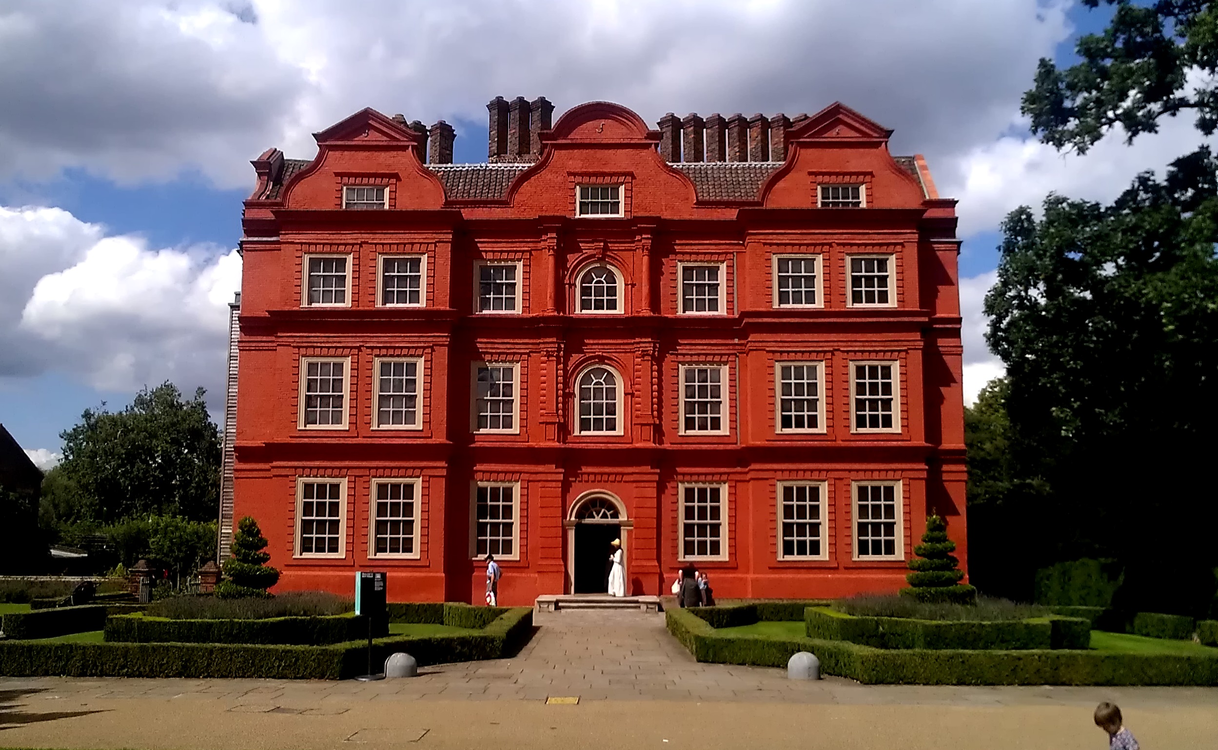
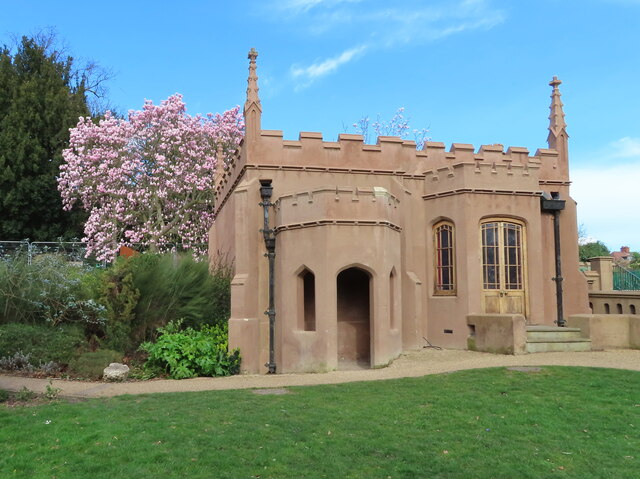
Kew Palace

Kew Palace is a British royal palace within the grounds of Kew Gardens on the banks of the River Thames. Originally a large complex, few elements of it...

Brentford Urban District

Brentford was a local government district in the county of Middlesex, England from 1874 to 1927. Brentford Local Government District was created in 1874...

Nearby Amenities

Located within 500m of 51.484666,-0.29835049
Source: PGS
Lat/Long: 51.485464/-0.2984395
Source: PGS
Lat/Long: 51.4857244/-0.2977547
Source: PGS
Lat/Long: 51.4858778/-0.2973481
Source: PGS
Lat/Long: 51.486096/-0.2968096
Source: PGS
Lat/Long: 51.4862656/-0.2963452
Source: PGS
Lat/Long: 51.4864874/-0.2957211
Source: PGS
Lat/Long: 51.4867052/-0.2950587
Source: PGS
Lat/Long: 51.4870047/-0.2940539
Source: PGS
Lat/Long: 51.4872254/-0.2934343
Source: PGS
Lat/Long: 51.4859146/-0.2917997
Source: PGS
Lat/Long: 51.4856634/-0.292761
Source: PGS
Lat/Long: 51.4854762/-0.2935793
Source: PGS
Lat/Long: 51.4851289/-0.2946063
Source: PGS
Lat/Long: 51.484751/-0.2953952
Source: PGS
Lat/Long: 51.4844872/-0.2958344
Source: PGS
Lat/Long: 51.484113/-0.2964123
Source: PGS
Lat/Long: 51.4837513/-0.2969925
Source: PGS
Lat/Long: 51.4835333/-0.2973206
Source: PGS
Lat/Long: 51.4832818/-0.2976465
Source: PGS
Lat/Long: 51.4825417/-0.2984816
Source: PGS
Lat/Long: 51.4821239/-0.2989551
Source: PGS
Lat/Long: 51.4818752/-0.2992635
Source: PGS
Lat/Long: 51.4815492/-0.2996774
Source: PGS
Lat/Long: 51.4811864/-0.3001322
Source: PGS
Lat/Long: 51.4809787/-0.3003989
Source: PGS
Lat/Long: 51.4807467/-0.3006889
Seamark Type: gate
Waterway: lock_gate
Lat/Long: 51.483421/-0.3001175
Bus Stop
Brentford Gate
Bus: yes
Public Transport: platform
Ref: 5
Wheelchair: yes
Lat/Long: 51.4813113/-0.297556
Toilets
Created By: Potlatch 0.6a
Wheelchair: yes
Lat/Long: 51.4815655/-0.2978537
Seamark Type: gate
Waterway: lock_gate
Lat/Long: 51.4819239/-0.3008947
The Queen's Garden
Leisure: garden
Lat/Long: 51.484112/-0.295268
White Peaks
Addr City: Richmond
Addr Housename: Kew Gardens
Addr Postcode: TW9 3AB
Addr Street: Kew Road
Disused Amenity: cafe
Fhrs Id: 353412
Source Addr: FHRS Open Data
Wheelchair: yes
Lat/Long: 51.4824805/-0.295803
Tourism: information
Lat/Long: 51.4842739/-0.291243
Created By: Potlatch 0.6a
Tourism: information
Lat/Long: 51.4822386/-0.2981695
Ref GB Tflcid: RWG231186
Traffic Calming: table
Lat/Long: 51.4870547/-0.3032973
Mini Roundabout
Direction: clockwise
Lat/Long: 51.4838752/-0.3030375
Give Way
Direction: forward
Lat/Long: 51.4888697/-0.2983835
Crossing
Crossing: unmarked
Traffic Calming: table
Lat/Long: 51.4885853/-0.2984402
Place Of Worship
North Road Baptist Church
Denomination: baptist
Religion: christian
Lat/Long: 51.4870672/-0.2965164
Pub
The Griffin
Brand: Fuller's
Brand Wikidata: Q5253950
Website: https://www.griffinbrentford.co.uk/
Lat/Long: 51.4870591/-0.3029644
Ref GB Tflcid: RWG231186
Traffic Calming: table
Lat/Long: 51.4870752/-0.3033759
Crossing
Crossing: unmarked
Lat/Long: 51.4848845/-0.3034795
Crossing
Crossing: unmarked
Lat/Long: 51.4859177/-0.30462
Pub
Royal Horse Guardsman
Check Date: 2024-02-21
Disused: yes
Wheelchair: no
Lat/Long: 51.4863995/-0.3000448
Post Box
Collection Times: Mo-Fr 09:00; Sa 07:00
Operator: Royal Mail
Operator Wikidata: Q638098
Post Box Type: pillar
Ref: TW8 205D
Royal Cypher: EIIR
Royal Cypher Wikidata: Q33102113
Lat/Long: 51.4885989/-0.2983054
Car Sharing
Capacity: 1
Operator: Streetcar
Source: WebSite
Lat/Long: 51.485712/-0.300579
Bus Stop
Albany Road
Local Ref: BD
Naptan AtcoCode: 490003137V
Naptan Bearing: S
Naptan CommonName: Albany Road Ealing Road
Naptan Indicator: Stop BD
Naptan Street: EALING ROAD
Naptan Verified: no
Public Transport: platform
Ref: 47671
Lat/Long: 51.4865694/-0.2998726
Bus Stop
Albany Road
Bus: yes
Local Ref: BR
Naptan AtcoCode: 490003137X
Naptan Bearing: N
Naptan CommonName: Albany Road Ealing Road
Naptan Indicator: Stop BR
Naptan Verified: no
Public Transport: platform
Ref: 57578
Lat/Long: 51.4861857/-0.2998343
Bus Stop
Brentford County Court
Local Ref: Z2
Naptan AtcoCode: 490004289B
Naptan Bearing: W
Naptan CommonName: Brentford County Court
Naptan Indicator: Stand Z2
Naptan Street: BACK LANE
Naptan Verified: no
Note: Bus stand.
Public Transport: platform
Lat/Long: 51.4844077/-0.3050551
Bus Stop
Brentford County Court
Local Ref: BQ
Naptan AtcoCode: 490004289C
Naptan Bearing: N
Naptan CommonName: Brentford County Court
Naptan Indicator: BQ
Naptan Street: BACK LANE
Naptan Verified: no
Public Transport: platform
Ref: 71704
Lat/Long: 51.484336/-0.3051746
Bus Stop
Brentford County Court
Bench: yes
Bin: yes
Bus: yes
Lit: yes
Local Ref: BP
Naptan AtcoCode: 490004289D
Naptan Bearing: N
Naptan CommonName: Brentford County Court
Naptan Indicator: BP
Naptan Street: BRENTFORD HIGH STREET
Naptan Verified: no
Public Transport: platform
Ref: 73967
Shelter: yes
Tactile Paving: no
Lat/Long: 51.4839869/-0.3042541
Brentford County Court
Local Ref: Z1
Naptan AtcoCode: 490004289N
Naptan Bearing: N
Naptan CommonName: Brentford County Court
Naptan Indicator: Stop Z1
Naptan Verified: no
Lat/Long: 51.4843177/-0.3041292
Bus Stop
The Musical Museum
Bench: yes
Bus: yes
Local Ref: BF
Naptan AtcoCode: 490004293E
Naptan Bearing: E
Naptan CommonName: Brentford Musical Museum
Naptan Indicator: Stop BF
Naptan Street: BRENTFORD HIGH STREET
Naptan Verified: no
Public Transport: platform
Ref: 76132
Shelter: yes
Lat/Long: 51.4874371/-0.2939248
Bus Stop
Watermans Centre
Bench: yes
Bin: yes
Bus: yes
Lit: yes
Local Ref: BH
Naptan AtcoCode: 490006297B
Naptan Bearing: N
Naptan CommonName: Ealing RdWatermans Art Centre
Naptan Indicator: Stop BH
Naptan Street: BRENTFORD HIGH STREET
Naptan Verified: no
Public Transport: platform
Ref: 76280
Shelter: yes
Tactile Paving: no
Lat/Long: 51.4862573/-0.2975217
Bus Stop
Watermans Centre
Bench: yes
Bus: yes
Local Ref: BE
Naptan AtcoCode: 490006297W
Naptan Bearing: N
Naptan CommonName: Ealing RdWatermans Art Centre
Naptan Indicator: Stop BE
Naptan Street: BRENTFORD HIGH STREET
Naptan Verified: no
Public Transport: platform
Ref: 53884
Shelter: yes
Lat/Long: 51.4860482/-0.2988262
Bus Stop
Goat Wharf
Bench: yes
Bin: yes
Bus: yes
Lit: yes
Local Ref: BJ
Naptan AtcoCode: 490007259W
Naptan Bearing: W
Naptan CommonName: Goat Wharf
Naptan Indicator: BJ
Naptan Street: BRENTFORD HIGH STREET
Naptan Verified: no
Public Transport: platform
Ref: 48622
Shelter: yes
Tactile Paving: no
Lat/Long: 51.4851703/-0.3005948
Bus Stop
New Road
Bench: yes
Bin: yes
Lit: yes
Local Ref: BS
Naptan AtcoCode: 490010259Y
Naptan Bearing: N
Naptan CommonName: New Road Brentford F.C.
Naptan Indicator: Stop BS
Naptan Verified: no
Public Transport: platform
Ref: 48860
Shelter: yes
Tactile Paving: no
Lat/Long: 51.4886901/-0.3013631
Bus Stop
Orangery
Bench: yes
Bus: yes
Public Transport: platform
Ref: 6
Shelter: no
Tactile Paving: no
Wheelchair: yes
Wheelchair Description: Smooth path to Elizabeth Gate and coach drop off point. (Blue Badge spaces near entrance). Land train has drop-down ramp on last coach.
Lat/Long: 51.4832148/-0.2935247
Toilets
Orangery Restaurant
Wheelchair: yes
Wheelchair Description: Only 120cm turning circle
Lat/Long: 51.4834214/-0.292875
Disused Amenity: toilets
Wheelchair: yes
Lat/Long: 51.4826251/-0.29556
Toilets
Wheelchair: yes
Lat/Long: 51.4839062/-0.2940831
Cinema
Watermans Arts Centre
Lat/Long: 51.4858042/-0.2979129
Brentford Monument
Historic: monument
Lat/Long: 51.4840988/-0.3039798
Tourism: viewpoint
Wheelchair: yes
Lat/Long: 51.4843915/-0.2952021
Kew Gardens Meteorological Station
Man Made: monitoring_station
Monitoring Weather: yes
Recording Automated: yes
Recording Manually: yes
Lat/Long: 51.4819069/-0.2943256
Clock
Display: sundial
Wikidata: Q27082384
Lat/Long: 51.4830381/-0.2943401
Crossing
Crossing: traffic_signals
Crossing Island: no
Crossing Ref: pelican
Kerb: flush
Tactile Paving: yes
Lat/Long: 51.4866216/-0.2964856
Crossing
Crossing: unmarked
Tactile Paving: yes
Lat/Long: 51.4871028/-0.2944924
Crossing
Crossing: unmarked
Tactile Paving: yes
Lat/Long: 51.4872808/-0.2938888
Drinking Water
Brentford Gate, Kew Gardens
Image: http://findafountain.org/system/872/original/uk-greater-london-london-richmond-brentford-gate-kew-gardens-outdoor-fountain.jpg
Maintenance: ok
Source: osmsync:findafountain
Source Pkey: 1140
Lat/Long: 51.4838/-0.29691
Drinking Water
The Orangery Drinking Fountain
Description: Found outside the restaurant, this ornate fountain has a pair that can be found in the Mediterranean Garden, also at Kew Gardens
Historic: yes
Maintenance: ok
Source: osmsync:findafountain
Source Pkey: 1143
Website: https://artuk.org/discover/artworks/drinking-fountain-296425
Wheelchair: limited
Wheelchair Description: On a slight plinth beside smooth path, tap may be difficult to reach.
Lat/Long: 51.4834751/-0.2935546
Drinking Water
Treehouse Towers, Kew Gardens
Image: http://findafountain.org/system/865/original/uk-greater-london-london-richmond-treehouse-towers-kew-gardens-outdoor-fountain.jpg
Maintenance: ok
Source: osmsync:findafountain
Source Pkey: 1132
Wheelchair: yes
Lat/Long: 51.4824534/-0.2957113
Crossing
Crossing: traffic_signals
Lat/Long: 51.4858596/-0.2991133
Turning Circle
Lat/Long: 51.4846167/-0.302023
Ref GB Tflcid: RWG229912
Traffic Calming: hump
Lat/Long: 51.4873277/-0.3026524
Waterway: lock_gate
Lat/Long: 51.48228/-0.3044506
Post Box
Albany Parade
Brand: Royal Mail
Brand Wikidata: Q638098
Collection Times: Mo-Fr 17:15; Sa 11:45
Operator: Royal Mail
Operator Wikidata: Q638098
Post Box Type: pillar
Ref: TW8 219
Royal Cypher: GR
Royal Cypher Wikidata: Q33102273
Source: survey
Lat/Long: 51.48562/-0.3006161
Maxspeed: 20 mph
Lat/Long: 51.4843026/-0.3053103
Bench
Lat/Long: 51.4838242/-0.3041864
Street Lamp
Lat/Long: 51.4844128/-0.3047906
Street Lamp
Lat/Long: 51.4845319/-0.3045119
Street Lamp
Lat/Long: 51.484267/-0.3051832
Street Lamp
Lat/Long: 51.4843382/-0.3049824
Access: customers
Entrance: yes
Wheelchair: yes
Lat/Long: 51.483745/-0.3052196
Street Lamp
Lat/Long: 51.4837212/-0.3051783
Barrier: bollard
Material: metal
Lat/Long: 51.4837544/-0.3048708
Barrier: bollard
Material: metal
Lat/Long: 51.4837676/-0.3048175
Barrier: bollard
Material: metal
Lat/Long: 51.4837813/-0.304763
Barrier: bollard
Material: metal
Lat/Long: 51.4837963/-0.3047113
Barrier: bollard
Material: metal
Lat/Long: 51.483812/-0.304659
Barrier: bollard
Material: metal
Lat/Long: 51.4838438/-0.304555
Barrier: bollard
Material: metal
Lat/Long: 51.4838597/-0.304507
Barrier: bollard
Material: metal
Lat/Long: 51.4838762/-0.304455
Entrance: yes
Lat/Long: 51.4843038/-0.3041739
Street Lamp
Lat/Long: 51.4841577/-0.303934
Barrier: bollard
Material: metal
Lat/Long: 51.4840755/-0.3039145
Crossing
Crossing: unmarked
Crossing Island: no
Lat/Long: 51.4841174/-0.303833
Barrier: lift_gate
Lat/Long: 51.4844846/-0.3043459
Street Lamp
Lat/Long: 51.4838343/-0.3042452
Street Lamp
Lat/Long: 51.4839223/-0.3039941
Street Lamp
Lat/Long: 51.4840201/-0.3037306
Give Way
Direction: backward
Lat/Long: 51.4841044/-0.30382
Barrier: bollard
Lat/Long: 51.4846597/-0.3042688
Waste Basket
Source: gps+mapnoter
Waste: dog_excrement
Lat/Long: 51.4862184/-0.2974167
Waste Basket
Source: gps+mapnoter
Lat/Long: 51.4862067/-0.2974918
Bicycle Parking
Bicycle Parking: stands
Capacity: 10
Covered: no
Source: gps+mapnoter
Lat/Long: 51.4860781/-0.2977118
Bicycle Parking
Source: gps+mapnoter
Lat/Long: 51.485876/-0.2978566
Leisure: picnic_table
Lat/Long: 51.4873357/-0.2932621
Leisure: picnic_table
Lat/Long: 51.4873807/-0.2933948
Traffic Signals
Traffic Signals Direction: forward
Lat/Long: 51.4856217/-0.299698
Information: guidepost
Tourism: information
Lat/Long: 51.4838339/-0.3005759
Crossing
Crossing: marked
Crossing Island: no
Crossing Markings: yes
Crossing Ref: zebra
Kerb: lowered
Tactile Paving: yes
Lat/Long: 51.4868285/-0.3000874
Premier
Brand: Premier
Brand Wikidata: Q7240340
Check Date: 2024-02-21
Level: 0
Opening Hours: Mo-Sa 07:00-23:00; Su 07:30-22:00
Shop: convenience
Wheelchair: yes
Lat/Long: 51.4866611/-0.3001305
Restaurant
Real Dragon
Check Date: 2024-02-21
Cuisine: chinese
Level: 0
Takeaway: only
Wheelchair: yes
Lat/Long: 51.4866103/-0.3000985
Coral
Addr Housenumber: 25
Addr Postcode: TW8 0LQ
Addr Street: Ealing Road
Check Date: 2024-02-21
Level: 0
Shop: bookmaker
Wheelchair: yes
Lat/Long: 51.4865538/-0.3000644
Toilets
Changing Table: yes
Fee: no
Wheelchair: yes
Lat/Long: 51.4821817/-0.296267
Charging Station
Source London
Brand: Source London
Brand Wikidata: Q7565133
Capacity: 2
Operator: Source London
Operator Wikidata: Q7565133
Lat/Long: 51.4853928/-0.3006593
Bicycle Parking
Bicycle Parking: stands
Capacity: 20
Covered: no
Lat/Long: 51.4847078/-0.2911928
Royal Kitchens
Toilets Wheelchair: no
Tourism: attraction
Wheelchair: no
Wheelchair Description: Access across lawn from Palace. Stairs down to kitchen and up to offices. Garden has level sandy paths.
Lat/Long: 51.4833727/-0.2951986
Kew Palace
Toilets Wheelchair: no
Tourism: attraction
Wheelchair: yes
Wheelchair Description: Ramp to right of steps at entrance is behind a low wall. Lift to upper floors, ask staff. No toilets in building.
Lat/Long: 51.4837854/-0.295031
Bus Stop
Brentford County Court
Bench: yes
Bus: yes
Local Ref: BK
Naptan AtcoCode: 490004289E
Naptan Bearing: N
Naptan CommonName: Brentford County Court
Naptan Indicator: BK
Naptan Street: BRENTFORD HIGH STREET
Naptan Verified: no
Public Transport: platform
Ref: 75333
Shelter: yes
Lat/Long: 51.4838505/-0.3040981
Bicycle Parking
Bicycle Parking: stands
Capacity: 6
Check Date: 2024-04-10
Covered: no
Lat/Long: 51.4857082/-0.300891
Pub
The Black Dog
Lat/Long: 51.4855411/-0.3018164
Parking
Access: private
Capacity: 500
Operator: Ballymore
Parking: multi-storey
Lat/Long: 51.4833689/-0.3047908
Bicycle Parking
Bicycle Parking: stands
Capacity: 6
Covered: no
Lat/Long: 51.4823469/-0.2982552
Bicycle Parking
Bicycle Parking: stands
Capacity: 8
Covered: no
Lat/Long: 51.4824267/-0.2983762
Bicycle Parking
Bicycle Parking: stands
Capacity: 24
Covered: yes
Lat/Long: 51.4825009/-0.2983144
Cycleway: asl
Direction: forward
Lat/Long: 51.485647/-0.2996296
Cycleway: asl
Direction: forward
Lat/Long: 51.4857836/-0.2990818
Traffic Calming: island
Lat/Long: 51.4857204/-0.2993345
Crossing
Crossing: traffic_signals
Crossing Ref: pelican
Lat/Long: 51.4857673/-0.2991287
Crossing
Crossing: traffic_signals
Crossing Ref: pelican
Mapillary: 298063986044559
Survey Date: 2023-07-13
Tactile Paving: yes
Lat/Long: 51.4856803/-0.2995518
Barrier: bollard
Lat/Long: 51.4856009/-0.2993924
Traffic Signals
Traffic Signals Direction: forward
Lat/Long: 51.4858081/-0.2990218
Traffic Signals
Traffic Signals Direction: forward
Lat/Long: 51.4858409/-0.299166
Traffic Signals
Traffic Signals Direction: forward
Lat/Long: 51.4859527/-0.2995493
Crossing
Crossing: traffic_signals
Crossing Ref: pelican
Tactile Paving: yes
Lat/Long: 51.4856129/-0.2994912
Barrier: bollard
Lat/Long: 51.4846946/-0.3041488
Bench
Lat/Long: 51.4820833/-0.292794
Bench
Lat/Long: 51.4821265/-0.2928189
Bench
Lat/Long: 51.4820478/-0.2929595
Bench
Lat/Long: 51.4820822/-0.2929844
Bench
Lat/Long: 51.4824291/-0.2932054
Bench
Lat/Long: 51.4824801/-0.2932286
Bench
Lat/Long: 51.4824679/-0.2930346
Bench
Lat/Long: 51.4825134/-0.2930613
Information: guidepost
Tourism: information
Lat/Long: 51.4831417/-0.2936129
Waste Basket
Lat/Long: 51.4831816/-0.2935951
Information: guidepost
Tourism: information
Lat/Long: 51.4837094/-0.2932477
Bench
Backrest: yes
Lat/Long: 51.4838764/-0.2931699
Waste Basket
Lat/Long: 51.484016/-0.2925799
Waste Basket
Lat/Long: 51.4843395/-0.2916151
Bench
Backrest: yes
Lat/Long: 51.4843694/-0.2915065
Information: map
Tourism: information
Lat/Long: 51.4843573/-0.291567
Bench
Lat/Long: 51.4842888/-0.291708
Bench
Lat/Long: 51.484281/-0.2917293
Bench
Lat/Long: 51.4842766/-0.2917507
Bench
Lat/Long: 51.4842592/-0.2914837
Information: guidepost
Tourism: information
Lat/Long: 51.4814455/-0.2953631
Information: guidepost
Tourism: information
Lat/Long: 51.4813758/-0.2954134
Information: map
Tourism: information
Lat/Long: 51.4812525/-0.2965487
Information: guidepost
Tourism: information
Lat/Long: 51.4813588/-0.2972994
Information: guidepost
Tourism: information
Lat/Long: 51.4817879/-0.2981047
Waste Basket
Lat/Long: 51.4818415/-0.2981348
Information: guidepost
Tourism: information
Lat/Long: 51.4818192/-0.2981693
Bench
Lat/Long: 51.4820176/-0.2981176
Drinking Water
Lat/Long: 51.482208/-0.2981865
Information: map
Tourism: information
Lat/Long: 51.4821973/-0.2982583
Bench
Lat/Long: 51.482124/-0.2981822
Information: guidepost
Tourism: information
Lat/Long: 51.4804097/-0.3000078
Waste Basket
Lat/Long: 51.4803882/-0.3000379
Waste Basket
Lat/Long: 51.4824298/-0.2956237
Waste Basket
Lat/Long: 51.4823982/-0.2955675
Bench
Lat/Long: 51.4842437/-0.2953741
Bench
Lat/Long: 51.4840642/-0.2947049
Bench
Lat/Long: 51.4840843/-0.2947602
Bench
Lat/Long: 51.4840287/-0.294718
Bench
Lat/Long: 51.4842262/-0.2953866
Bench
Lat/Long: 51.4842368/-0.2953463
Bench
Lat/Long: 51.4842937/-0.2939129
Bench
Lat/Long: 51.4842813/-0.29389
Bench
Lat/Long: 51.4842697/-0.2938471
Bicycle Parking
Lat/Long: 51.4859241/-0.2993244
Crossing
Crossing: traffic_signals
Crossing Island: yes
Crossing Ref: pelican
Tactile Paving: yes
Lat/Long: 51.4871819/-0.2946684
Brentford Reach
Place: locality
Lat/Long: 51.4857994/-0.293625
Operator: Port of London Authority
Seamark Buoy Lateral Category: port
Seamark Buoy Lateral Colour: red
Seamark Buoy Lateral Shape: can
Seamark Buoy Lateral System: iala-a
Seamark Light Character: Fl
Seamark Light Colour: red
Seamark Type: buoy_lateral
Lat/Long: 51.4857205/-0.2939895
Operator: Port of London Authority
Seamark Buoy Lateral Category: port
Seamark Buoy Lateral Colour: red
Seamark Buoy Lateral Shape: can
Seamark Buoy Lateral System: iala-a
Seamark Light Character: Fl
Seamark Light Colour: red
Seamark Mooring Category: buoy
Seamark Type: buoy_lateral
Lat/Long: 51.4835257/-0.298072
Waste Basket
Waste: trash
Lat/Long: 51.4815843/-0.2951357
Covered: no
Leisure: picnic_table
Lat/Long: 51.4830646/-0.2930299
Bench
Backrest: yes
Material: wood
Seats: 5
Lat/Long: 51.4840034/-0.2926124
Covered: no
Leisure: picnic_table
Lat/Long: 51.4830701/-0.2925937
Covered: no
Leisure: picnic_table
Lat/Long: 51.4830119/-0.2930344
Covered: no
Leisure: picnic_table
Lat/Long: 51.4831106/-0.2930575
Covered: no
Leisure: picnic_table
Lat/Long: 51.48317/-0.292796
Covered: no
Leisure: picnic_table
Lat/Long: 51.4830934/-0.2926543
Covered: no
Leisure: picnic_table
Lat/Long: 51.4831301/-0.2927256
Covered: no
Leisure: picnic_table
Lat/Long: 51.4831206/-0.293103
The Children's Garden
Tourism: attraction
Lat/Long: 51.4819292/-0.2960438
Barrier: chain
Lat/Long: 51.4847209/-0.30173
Recycling
Opening Hours: 24/7
Recycling PET: yes
Recycling Cardboard: yes
Recycling Glass: yes
Recycling Glass Bottles: yes
Recycling Plastic: yes
Recycling Plastic Bottles: yes
Recycling Plastic Packaging: yes
Recycling Type: centre
Lat/Long: 51.4879835/-0.299332
Telephone
Covered: booth
Operator: New World Payphones
Payment Coins: yes
Payment Telephone Cards: yes
Lat/Long: 51.4884082/-0.2983742
Post Box
Collection Times: Mo-Fr 09:00; Sa 07:00
Operator: Royal Mail
Operator Wikidata: Q638098
Post Box Type: pillar
Ref: TW8 206D
Royal Cypher: GR
Royal Cypher Wikidata: Q33102273
Lat/Long: 51.4867882/-0.3026726
Bicycle Parking
Access: private
Bicycle Parking: shed
Capacity: 6
Covered: yes
Operator: cyclehoop
Ref: Bikehangar 2709
Lat/Long: 51.4875957/-0.301966
Defibrillator
Access: yes
Defibrillator Location: Attached to building wall, North side of road
Emergency: defibrillator
Level: 0
Wheelchair: yes
Lat/Long: 51.4817317/-0.3038073
Post Box
Collection Times: Mo-Fr 09:00; Sa 07:00
Operator: Royal Mail
Operator Wikidata: Q638098
Post Box Type: pillar
Ref: TW8 222D
Royal Cypher: EIIR
Royal Cypher Wikidata: Q33102113
Lat/Long: 51.4817246/-0.3037131
Post Box
Brand: Royal Mail
Brand Wikidata: Q638098
Collection Times: Mo-Fr 16:30; Sa 12:15
Operator: Royal Mail
Operator Wikidata: Q638098
Post Box Type: wall
Ref: TW8 203
Royal Cypher: GR
Royal Cypher Wikidata: Q33102273
Lat/Long: 51.4845356/-0.3025737
Crossing
Crossing: unmarked
Lat/Long: 51.4860986/-0.2981017
Crossing
Crossing: unmarked
Lat/Long: 51.4860678/-0.2981973
Give Way
Direction: backward
Lat/Long: 51.4873175/-0.2943803
Traffic Signals
Traffic Signals Direction: forward
Lat/Long: 51.487167/-0.2947238
Traffic Signals
Traffic Signals Direction: backward
Lat/Long: 51.4871974/-0.2946071
Was Highway: crossing
Lat/Long: 51.4868396/-0.2962032
Give Way
Direction: forward
Lat/Long: 51.4867733/-0.2961565
Cafe
Family Kitchen
Indoor Seating: yes
Level: 0
Outdoor Seating: yes
Toilets Wheelchair: yes
Wheelchair: yes
Lat/Long: 51.4820296/-0.2965198
Level: 0
Shop: gift
Wheelchair: yes
Lat/Long: 51.4823044/-0.2961573
Traffic Signals
Traffic Signals Direction: backward
Lat/Long: 51.4866408/-0.2964263
Traffic Signals
Traffic Signals Direction: forward
Lat/Long: 51.4866045/-0.2965387
Speed Camera
Direction: 145
Maxspeed: 20 mph
Lat/Long: 51.4886658/-0.3012386
Leisure: fitness_station
Sport: fitness
Lat/Long: 51.4867016/-0.295328
Barrier: kerb
Lat/Long: 51.4864917/-0.2998088
Barrier: bollard
Lat/Long: 51.4866262/-0.299387
Barrier: bollard
Lat/Long: 51.4849978/-0.3051119
Barrier: bollard
Lat/Long: 51.4862309/-0.303664
Barrier: bollard
Lat/Long: 51.4856725/-0.3031938
Barrier: bollard
Lat/Long: 51.4882742/-0.298618
Give Way
Direction: backward
Lat/Long: 51.4882962/-0.2986463
Barrier: bollard
Lat/Long: 51.4876951/-0.2982399
Kerb: lowered
Lat/Long: 51.4876916/-0.2982372
Give Way
Direction: forward
Lat/Long: 51.4876929/-0.2982383
Barrier: bollard
Lat/Long: 51.4885324/-0.29737
Kerb: sloped
Lat/Long: 51.4884937/-0.2980921
Barrier: bollard
Lat/Long: 51.488495/-0.2980735
Barrier: bollard
Lat/Long: 51.4869721/-0.2973479
Bicycle Parking
Bicycle Parking: stands
Capacity: 10
Covered: no
Lat/Long: 51.4830481/-0.3012835
Restaurant
Pappadums
Cuisine: indian
Lat/Long: 51.4838099/-0.3012976
Bicycle Parking
Bicycle Parking: stands
Capacity: 12
Covered: no
Lat/Long: 51.4830874/-0.3010726
Bicycle Parking
Bicycle Parking: stands
Capacity: 12
Covered: no
Lat/Long: 51.483169/-0.3006607
Restaurant
Gyoza San
Cuisine: japanese
Lat/Long: 51.4841358/-0.3006684
Restaurant
Galata Pera
Cuisine: turkish
Lat/Long: 51.4836908/-0.3014981
Bicycle Parking
Bicycle Parking: stands
Capacity: 6
Ref GB Tflcid: RWG232472
Lat/Long: 51.4870364/-0.3033233
Bicycle Parking
Bicycle Parking: stands
Capacity: 4
Ref GB Tflcid: RWG232449
Lat/Long: 51.4885801/-0.2979574
Bicycle Parking
Bicycle Parking: stands
Capacity: 4
Ref GB Tflcid: RWG232448
Lat/Long: 51.4886079/-0.2978465
Bicycle Parking
Bicycle Parking: stands
Capacity: 4
Ref GB Tflcid: RWG232459
Lat/Long: 51.4880463/-0.3006454
Bicycle Parking
Bicycle Parking: stands
Capacity: 4
Covered: no
Ref GB Tflcid: RWG232313
Lat/Long: 51.485534/-0.2999652
Bicycle Parking
Bicycle Parking: post_hoop
Capacity: 2
Covered: no
Ref GB Tflcid: RWG232308
Lat/Long: 51.4847908/-0.3019689
Bicycle Parking
Bicycle Parking: stands
Capacity: 6
Covered: no
Ref GB Tflcid: RWG232312
Lat/Long: 51.4854451/-0.3002298
Bicycle Parking
Bicycle Parking: stands
Capacity: 6
Covered: no
Ref GB Tflcid: RWG232311
Lat/Long: 51.4854058/-0.3003357
Bicycle Parking
Bicycle Parking: stands
Capacity: 4
Covered: no
Ref GB Tflcid: RWG232309
Lat/Long: 51.4847349/-0.3021655
Bicycle Parking
Bicycle Parking: stands
Capacity: 20
Covered: no
Ref GB Tflcid: RWG232306
Lat/Long: 51.4850923/-0.3003366
Ref GB Tflcid: RWG229942
Traffic Calming: hump
Lat/Long: 51.4867304/-0.3020112
Ref GB Tflcid: RWG229941
Traffic Calming: hump
Lat/Long: 51.4858673/-0.3015097
Ref GB Tflcid: RWG229940
Traffic Calming: hump
Lat/Long: 51.4855099/-0.3022384
Cycleway: asl
Direction: forward
Lat/Long: 51.4859077/-0.299523
Crossing
Button Operated: yes
Crossing: traffic_signals
Crossing Ref: pelican
Kerb: lowered
Tactile Paving: yes
Lat/Long: 51.4858701/-0.2994949
Barrier: bollard
Lat/Long: 51.4874752/-0.2932702
Dentist
Albany Dental Practice
Healthcare: dentist
Lat/Long: 51.4856496/-0.3000623
African Supermarket
Shop: convenience
Lat/Long: 51.4857056/-0.2999106
Reneighbouring Hounslow
Office: yes
Lat/Long: 51.4856843/-0.2999763
Brentford Off Licence
Shop: alcohol
Lat/Long: 51.485629/-0.3001339
Boy with a Dolphin
Artist Name: Andrea del Verrocchio
Artwork Type: statue
Description: replica
Tourism: artwork
Lat/Long: 51.4842034/-0.2953619
Piping Satyr
Artist Name: Unknown
Artwork Type: statue
Description: Smn claim that this is a Pan himself, but it could also be one of his followers.
Tourism: artwork
Wikimedia Commons: File:Kew_Gardens,_Statue_of_Pan_in_Kew_Palace_garden.jpg
Lat/Long: 51.4842804/-0.2951236
Terminal Figure
Artist Name: Peter Scheemakers II
Artwork Type: statue
Description: Oldest statues in the garden, dated to 1730. Five 18th terms, commissioned by Frederick, Prince of Wales in 1734–5.
Tourism: artwork
Lat/Long: 51.4843219/-0.2954616
Terminal Figure
Artist Name: Peter Scheemakers II
Artwork Type: statue
Description: Oldest statues in the garden, dated to 1730. Five 18th terms, commissioned by Frederick, Prince of Wales in 1734–5.
Tourism: artwork
Lat/Long: 51.4841923/-0.2955354
Terminal Figure
Artist Name: Peter Scheemakers II
Artwork Type: statue
Description: Oldest statues in the garden, dated to 1730. Five 18th terms, commissioned by Frederick, Prince of Wales in 1734–5.
Tourism: artwork
Lat/Long: 51.4842748/-0.295547
Terminal Figure
Artist Name: Peter Scheemakers II
Artwork Type: statue
Description: Oldest statues in the garden, dated to 1730. Five 18th terms, commissioned by Frederick, Prince of Wales in 1734–5.
Tourism: artwork
Lat/Long: 51.4843312/-0.2953413
Terminal Figure
Artist Name: Peter Scheemakers II
Artwork Type: statue
Description: Oldest statues in the garden, dated to 1730. Five 18th terms, commissioned by Frederick, Prince of Wales in 1734–5.
Tourism: artwork
Lat/Long: 51.4842837/-0.2952473
Iron pillar from Hampton Court Palace
Tourism: artwork
Lat/Long: 51.483992/-0.2955249
Meridian
Artist Name: Edwin Russell
Artwork Type: sculpture
Tourism: artwork
Lat/Long: 51.4840609/-0.2947715
Medici Vase
Artwork Type: sculpture
Tourism: artwork
Lat/Long: 51.4840113/-0.2949485
Bowl and Kerb
Artist Name: John Marriott Blashfield
Tourism: artwork
Website: https://artuk.org/discover/artworks/bowl-and-kerb-296424
Lat/Long: 51.4836152/-0.2937678
Bentley Sterling & Co
Office: lawyer
Lat/Long: 51.4841751/-0.3012919
Ross Poole
Shop: beauty
Lat/Long: 51.4858504/-0.3011521
Harper Kitchens
Shop: kitchen
Lat/Long: 51.4843143/-0.300939
Bicycle Parking
Bicycle Parking: stands
Capacity: 38
Covered: no
Lat/Long: 51.4839887/-0.3011519
Hunters
Shop: estate_agent
Lat/Long: 51.4844276/-0.3010808
Dentist
Bright Smile Studio
Lat/Long: 51.4842593/-0.3014235
Best Quality Foods
Shop: convenience
Lat/Long: 51.4857112/-0.3013692
Hawks
Shop: estate_agent
Lat/Long: 51.485712/-0.300745
Veterinary
Young Vetinary Partnership
Lat/Long: 51.4856588/-0.3006522
Fast Food
Domino's
Brand: Domino's
Brand Wikidata: Q839466
Cuisine: pizza
Opening Hours: Mo-Su 11:00-23:00
Takeaway: yes
Website: https://www.dominos.co.uk/pizza-near-me/brentford/10-albany-parade
Lat/Long: 51.4857465/-0.3008116
Restaurant
Albany Spice
Cuisine: indian
Lat/Long: 51.4856056/-0.3014908
Lyonsden
Shop: hairdresser
Lat/Long: 51.4845341/-0.3012191
B. A. Williams
Shop: chemist
Lat/Long: 51.4855702/-0.3004217
Buy Wise
Shop: hardware
Lat/Long: 51.4858307/-0.3009075
Cafe
River Cafe
Lat/Long: 51.4856487/-0.3014334
Brentford RC
Shop: model
Lat/Long: 51.4858109/-0.3012172
Crossing
Crossing Island: no
Lat/Long: 51.4874889/-0.2937202
Crossing
Crossing: unmarked
Crossing Island: no
Lat/Long: 51.4875678/-0.2934572
Crossing
Crossing Island: no
Lat/Long: 51.4873673/-0.2942392
Crossing
Crossing: unmarked
Crossing Island: no
Crossing Markings: no
Tactile Paving: yes
Traffic Calming: table
Lat/Long: 51.487869/-0.3005338
Crossing
Crossing: unmarked
Crossing Island: no
Crossing Markings: no
Tactile Paving: yes
Traffic Calming: table
Lat/Long: 51.4879701/-0.3008325
Crossing
Crossing: unmarked
Crossing Island: no
Crossing Markings: no
Kerb: lowered
Tactile Paving: yes
Lat/Long: 51.4874057/-0.3003189
Crossing
Crossing: unmarked
Crossing Island: no
Crossing Markings: no
Tactile Paving: yes
Traffic Calming: table
Lat/Long: 51.486477/-0.3000232
Proposed Highway: crossing
Lat/Long: 51.4861743/-0.2980139
Proposed Highway: crossing
Lat/Long: 51.4862567/-0.2979986
Tactile Paving: yes
Lat/Long: 51.4862018/-0.2980369
Tactile Paving: yes
Lat/Long: 51.4862475/-0.297991
Crossing
Crossing: unmarked
Crossing Island: no
Kerb: flush
Tactile Paving: yes
Traffic Calming: table
Lat/Long: 51.486795/-0.2961718
Was Highway: crossing
Lat/Long: 51.4837899/-0.3045808
Crossing Island: no
Disused Highway: crossing
Lat/Long: 51.485064/-0.3014094
Crossing
Crossing: unmarked
Crossing Island: no
Lat/Long: 51.4864787/-0.2974097
Crossing Island: no
Proposed Highway: crossing
Lat/Long: 51.4838855/-0.3042817
Bicycle Rental
Bicycle Rental: dropoff_point
Lat/Long: 51.4853958/-0.3005656
Proposed Highway: crossing
Lat/Long: 51.4862274/-0.2983183
Proposed Highway: traffic_signals
Traffic Signals Direction: forward
Lat/Long: 51.4850466/-0.3014746
Proposed Highway: traffic_signals
Traffic Signals Direction: backward
Lat/Long: 51.4850807/-0.3013467
The data included in this document is from www.openstreetmap.org. The data is made available under ODbL.

Have you been to Lots Ait?

Leave your review of Lots Ait below (or comments, questions and feedback).