Queen Rocks
Island in Yorkshire Scarborough
England
Queen Rocks
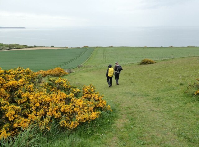
Queen Rocks is a small island located off the coast of Yorkshire, England. It is situated in the North Sea, approximately 5 miles northeast of Whitby. The island covers an area of around 10 acres and is known for its stunning natural beauty and unique rock formations.
The name Queen Rocks is derived from the large rock formation that dominates the island's landscape, resembling a crown or tiara when viewed from a distance. This distinctive feature has made it a popular tourist destination, attracting visitors from all over the world.
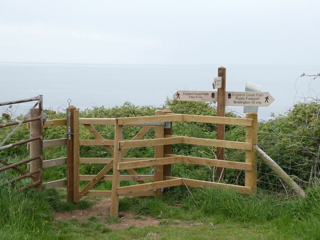
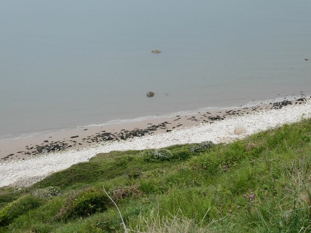
The island is accessible by boat, with regular ferry services operating from Whitby. Upon arrival, visitors are greeted by a rugged coastline, characterized by steep cliffs and jagged rocks. The surrounding waters are teeming with marine life, making it a haven for divers and snorkelers.
In addition to its natural beauty, Queen Rocks also boasts a diverse range of flora and fauna. The island is home to a wide variety of bird species, including puffins, gulls, and cormorants, making it a popular spot for birdwatching enthusiasts.
Despite its small size, Queen Rocks offers a range of recreational activities for visitors. Hiking trails crisscross the island, providing opportunities for exploration and breathtaking views of the surrounding sea. The island also has a small cafe and gift shop, where visitors can relax and purchase souvenirs.
Overall, Queen Rocks is a hidden gem in Yorkshire, offering a tranquil escape from the hustle and bustle of everyday life. Its natural beauty, unique rock formations, and diverse wildlife make it a must-visit destination for nature lovers and adventure seekers alike.
If you have any feedback on the listing, please let us know in the comments section below.
Queen Rocks Images
Images are sourced within 2km of 54.160761/-0.22665471 or Grid Reference TA1575. Thanks to Geograph Open Source API. All images are credited.
Queen Rocks is located at Grid Ref: TA1575 (Lat: 54.160761, Lng: -0.22665471)
Division: North Riding
Administrative County: North Yorkshire
District: Scarborough
Police Authority: North Yorkshire
What 3 Words
///parrot.euphoric.smoker. Near Bempton, East Yorkshire
Nearby Locations
Related Wikis

Speeton
Speeton is a village in the civil parish of Reighton, in North Yorkshire, England. It lies near the edge of the coastal cliffs midway between Filey and...

Speeton railway station
Speeton railway station served the villages of Speeton and Reighton in North Yorkshire, England. It was situated on the Yorkshire Coast Line from Scarborough...

Reighton
Reighton is a village and civil parish, in North Yorkshire, England. From the mediaeval era until the 19th century Reighton was part of Dickering Wapentake...

RAF Bempton
Royal Air Force Bempton or more simply RAF Bempton is a former Royal Air Force station situated at Bempton in the East Riding of Yorkshire, England, 6...
Nearby Amenities
Located within 500m of 54.160761,-0.22665471Have you been to Queen Rocks?
Leave your review of Queen Rocks below (or comments, questions and feedback).