The Island

Island in Buckinghamshire

England

The Island

The Beehive Pub sign: Fuller's pub on Middle Hill
The Beehive Credit: John Myers

The Island, also known as the Buckinghamshire Island, is a small village located in the county of Buckinghamshire, England. Situated in the Chiltern Hills, this picturesque village is surrounded by stunning natural beauty, making it a popular destination for both locals and tourists.

The village gets its name from its unique geographical location, as it is situated on a small piece of land surrounded by the River Thame. This gives the village a distinct charm and tranquility, making it a haven for those seeking a peaceful escape from the hustle and bustle of city life.

Despite its small size, the Island offers a range of amenities and attractions to cater to its residents and visitors. The village is home to a number of quaint cottages and traditional houses, adding to its idyllic appeal. There is also a village hall and a local pub, providing social hubs for the community.

The Island boasts an abundance of natural beauty, with the River Thame offering opportunities for fishing and boating. The surrounding countryside is perfect for hiking and cycling, with numerous trails and paths to explore. Wildlife enthusiasts can also enjoy spotting a variety of bird species and other wildlife in the area.

The Island is conveniently located near the town of Aylesbury, where residents can access a wider range of amenities, including supermarkets, shops, and schools. The village is also well-connected by road, making it easily accessible to those traveling from nearby towns and cities.

Overall, the Island, Buckinghamshire offers a serene and picturesque setting, making it an ideal place for nature lovers and those seeking a peaceful retreat.

If you have any feedback on the listing, please let us know in the comments section below.
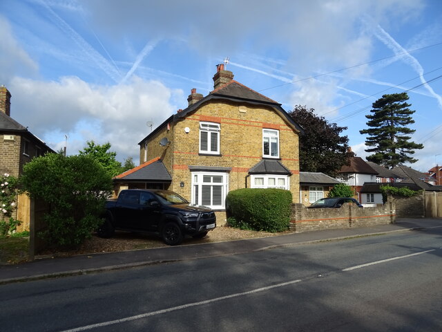
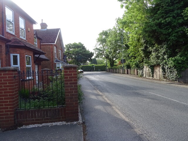
The Island Images

Images are sourced within 2km of 51.441812/-0.54657207 or Grid Reference TQ0172. Thanks to Geograph Open Source API. All images are credited.

The Beehive Pub sign: Fuller's pub on Middle Hill
The Beehive
Pub sign: Fuller's pub on Middle Hill
Egham station This shows the up-side frontage as rebuilt in 1985.
Egham station
This shows the up-side frontage as rebuilt in 1985.
St John the Baptist, Egham - south elevation
St John the Baptist, Egham - north elevation
High Street, Egham This is the north side looking east.
High Street, Egham
This is the north side looking east.
Ongoing construction work, Egham This was taken where Church Road (running left-right) is met by Station Road (foreground).
Ongoing construction work, Egham
This was taken where Church Road (running left-right) is met by Station Road (foreground).
Approaching the A30/M25 junction
Motorway gantry - M25 northbound
The George Inn, Wraysbury On Windsor Road.
See <a href="https://www.geograph.org.uk/photo/7297906">TQ0074 : Sign for the George Inn, Wraysbury</a> for sign.
The George Inn, Wraysbury
On Windsor Road. See TQ0074 : Sign for the George Inn, Wraysbury for sign.
Sign for the George Inn, Wraysbury See <a href="https://www.geograph.org.uk/photo/7297905">TQ0074 : The George Inn, Wraysbury</a> for public house.
Sign for the George Inn, Wraysbury
See TQ0074 : The George Inn, Wraysbury for public house.
House on Windsor Road, Wraysbury
House on Staines Road, Wraysbury
Bus stop on Staines Road (B376), Wraysbury
Staines Road (B376)
Staines Road (B376)
Road to sailing club Off Staines Road (B376).
Road to sailing club
Off Staines Road (B376).
Houses on Staines Road (B376)
B376 towards Staines
Spice Village Indian Restaurant & Bar, Hythe End
Show me another place!

The Island is located at Grid Ref: TQ0172 (Lat: 51.441812, Lng: -0.54657207)

Unitary Authority: Windsor and Maidenhead

Police Authority: Thames Valley

What 3 Words

///sake.voice.pans. Near Egham, Surrey

Related Wikis

The Island, Hythe End

The Island is an inhabited island in the River Thames in England on the reach above Bell Weir Lock, a part of the Hythe End part of Wraysbury village...

Wraysbury Skiff and Punting Club

Wraysbury Skiff and Punting Club (WSPC) is an English skiff and punting club founded in 1931 based on the River Thames at the start of the Surrey section...

Bell Weir Lock

Bell Weir Lock is a lock on the River Thames in England by the right bank, Runnymede which is a water meadow associated with Egham of importance for the...

Ankerwycke Priory

Ankerwycke Priory was a priory of Benedictine nuns in Buckinghamshire, England. It was established around 1160 and dissolved in 1536. Excavations were...

Ankerwycke Yew

The Ankerwycke Yew is an ancient yew tree close to the ruins of St Mary's Priory, the site of a Benedictine nunnery built in the 12th century, near Wraysbury...

Colne Brook

The Colne Brook is a river in England that is a distributary of the River Colne which runs from Uxbridge Moor, there forming the western border of Greater...

Runnymede Bridge

Runnymede Bridge is a motorway, A-road, pedestrian, and cycle bridge, built in the 1960s and 1980s and expanded in the 2000s, carrying the M25 and A30...
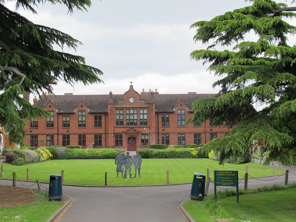
Strode's College

Strode's College is a sixth form college located in Egham, Surrey. It was founded in 1704, when Henry Strode bequeathed £6,000 to set up a free school...

Related Videos

Colne Valley Park Amazing Walk | Hiking in London | 4K | 🇬🇧 Hiking UK | England

The Colne Valley, thatched cottages, brooks, farms, woods and undulating hills Length: 17.7 km (11.0 miles), 5 hours 30 minutes.

Bringing dream holidays home - travel inspired interior design

We have collaborated with interior designers to recreate the most iconic holiday destinations in your home, ranked by popularity.

Bringing dream holidays home - travel inspired interior design ideas

We have collaborated with interior designers to recreate the most iconic holiday destinations in your home, ranked by popularity.

Nearby Amenities

Located within 500m of 51.441812,-0.54657207
Created By: Merkaartor 0.13
Lat/Long: 51.4432084/-0.5509042
Barrier: stile
Lat/Long: 51.4394242/-0.5470068
Restaurant
Runnymede Cafe
Addr Postcode: TW20 0AE
Addr Street: Windsor Road
Fhrs Id: 315364
Indoor Seating: yes
Outdoor Seating: yes
Source Addr: FHRS Open Data
Lat/Long: 51.4408401/-0.5501171
Bench
Backrest: yes
Lat/Long: 51.4390751/-0.5456195
Barrier: cycle_barrier
Note: Offset fence, no equivalent available
Lat/Long: 51.4389217/-0.5455737
Covered: no
Leisure: picnic_table
Lat/Long: 51.4413008/-0.5536026
HM Queen Elizabeth II
Historic: memorial
Material: metal
Memorial: statue
Source: GPS survey
Wheelchair: yes
Lat/Long: 51.4416452/-0.5530635
Bench
Backrest: yes
Source: GPS survey
Lat/Long: 51.4421819/-0.5528274
Bench
Source: GPS survey
Lat/Long: 51.4430822/-0.551784
Bench
Source: GPS survey
Lat/Long: 51.4431407/-0.5516432
Bench
Source: GPS survey
Lat/Long: 51.4431766/-0.5515413
Bench
Source: GPS survey
Lat/Long: 51.4432025/-0.5514032
Bench
Source: GPS survey
Lat/Long: 51.4432151/-0.5512422
Bench
Source: GPS survey
Lat/Long: 51.4432142/-0.5510961
Bench
Source: GPS survey
Lat/Long: 51.4431975/-0.5509458
Bench
Source: GPS survey
Lat/Long: 51.4431816/-0.5508144
Bench
Source: GPS survey
Lat/Long: 51.4428891/-0.5502069
Bench
Backrest: yes
Source: GPS survey
Lat/Long: 51.4424828/-0.5499065
Bench
Source: GPS survey
Lat/Long: 51.4423056/-0.549767
Bench
Source: GPS survey
Lat/Long: 51.4411696/-0.5468836
Bench
Source: GPS survey
Lat/Long: 51.4411512/-0.5467844
Bench
Source: GPS survey
Lat/Long: 51.4411353/-0.5467093
Toilets
Fee: no
Wheelchair: yes
Lat/Long: 51.4408829/-0.549885
Crossing
Crossing: unmarked
Crossing Island: yes
Kerb: lowered
Source: survey
Tactile Paving: yes
Lat/Long: 51.4390905/-0.5458962
Crossing
Crossing: unmarked
Kerb: lowered
Sloped Curb: yes
Source: survey
Tactile Paving: no
Lat/Long: 51.4390152/-0.5455219
Crossing
Crossing: unmarked
Kerb: lowered
Sloped Curb: yes
Source: survey
Lat/Long: 51.4395828/-0.5469542
Crossing
Crossing: unmarked
Kerb: lowered
Sloped Curb: yes
Lat/Long: 51.4382891/-0.5434864
Ferry: yes
Operator: French Brothers Ltd
Public Transport: stop_position
Lat/Long: 51.4416801/-0.5533713
Bench
Backrest: yes
Material: concrete
Seats: 5
Lat/Long: 51.4417044/-0.5533029
Bench
Backrest: yes
Material: concrete
Seats: 5
Lat/Long: 51.4417099/-0.5531042
Waste Basket
Waste: trash
Lat/Long: 51.4413852/-0.553463
Bench
Backrest: yes
Material: concrete
Seats: 5
Lat/Long: 51.4416246/-0.553148
Bench
Backrest: yes
Material: wood
Seats: 5
Lat/Long: 51.4413698/-0.5535619
Bench
Backrest: yes
Material: wood
Seats: 5
Lat/Long: 51.4414436/-0.5534766
Ice Cream
Check Date: 2022-09-25
Diet Vegan: yes
Lat/Long: 51.442948/-0.5505515
Post Box
Lat/Long: 51.4391413/-0.5455232
The data included in this document is from www.openstreetmap.org. The data is made available under ODbL.

Have you been to The Island?

Leave your review of The Island below (or comments, questions and feedback).