Sherriff Island

Island in Berkshire

England

Sherriff Island

On the A404 south-bound at the junction for the A4155
On the A404 south-bound at the junction for the A4155 Credit: Rob Purvis

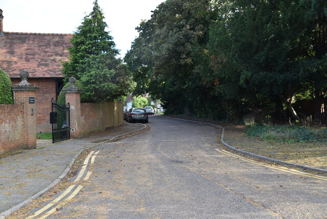
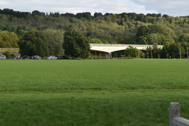
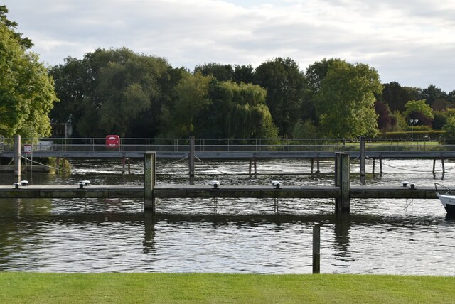
Sherriff Island is a small, uninhabited island located in the county of Berkshire, England. Situated in the River Thames, it lies approximately 2.5 miles north of the town of Maidenhead.

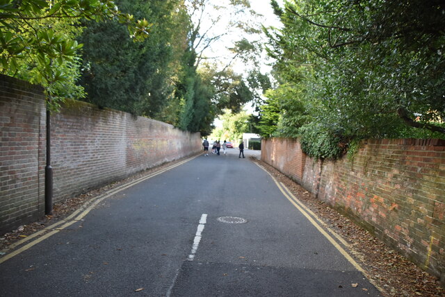
Covering an area of just over 11 acres, Sherriff Island is one of several islands found in this stretch of the river. It is primarily composed of grassland and is known for its picturesque scenery and tranquil environment. The island is accessible by boat or foot during low tide, but caution is advised due to the unpredictable nature of the river's currents.

The island's name is believed to have originated from the Sheriff of Berkshire, who once owned the land. Historical records indicate that Sherriff Island was once used for grazing livestock, particularly sheep. However, it has been uninhabited for many years and is now mainly used for recreational purposes.

Nature enthusiasts are drawn to Sherriff Island due to its diverse wildlife. The island is home to various bird species, such as kingfishers, herons, and swans. Additionally, the surrounding river provides a habitat for fish and other aquatic creatures.

Visitors to Sherriff Island can enjoy peaceful walks along its footpaths, taking in the stunning views of the river and surrounding countryside. The island offers a serene escape from the hustle and bustle of nearby urban areas, providing a tranquil setting for picnics, birdwatching, or simply enjoying the beauty of nature.

Overall, Sherriff Island is a hidden gem in Berkshire, offering a haven of natural beauty and a chance to experience the tranquility of the River Thames.

If you have any feedback on the listing, please let us know in the comments section below.

Sherriff Island Images

Images are sourced within 2km of 51.565524/-0.76041811 or Grid Reference SU8685. Thanks to Geograph Open Source API. All images are credited.

On the A404 south-bound at the junction for the A4155
Entering Berkshire on the A404 south-bound
Approaching roundabout on the A404
Crowne Plaza Hotel Crowne Plaza is a chain of upscale hotels catering to business travelers and to the meetings and conventions market. It forms part of the InterContinental Hotels Group family of brands, which include InterContinental Hotels & Resorts and Holiday Inn Hotels & Resorts, and operates in 52 countries, usually located in city centres, resorts, or near major airports. The chain ws founded in 1983, in the USA, and has nearly 400 hotels worldwide.
Wikipedia: <span class="nowrap"><a title="http://en.wikipedia.org/wiki/Crowne_Plaza" rel="nofollow ugc noopener" href="http://en.wikipedia.org/wiki/Crowne_Plaza">Link</a><img style="margin-left:2px;" alt="External link" title="External link - shift click to open in new window" src="https://s1.geograph.org.uk/img/external.png" width="10" height="10"/></span>
Crowne Plaza Hotel
Crowne Plaza is a chain of upscale hotels catering to business travelers and to the meetings and conventions market. It forms part of the InterContinental Hotels Group family of brands, which include InterContinental Hotels & Resorts and Holiday Inn Hotels & Resorts, and operates in 52 countries, usually located in city centres, resorts, or near major airports. The chain ws founded in 1983, in the USA, and has nearly 400 hotels worldwide. Wikipedia: LinkExternal link
Crowne Plaza access road
A404 bridge
A404 bridge
Travelodge, Marlow Travelodge is the second largest budget hotel chain in the UK, with over 450 budget hotels.
Website: <span class="nowrap"><a title="http://www.travelodge.co.uk/" rel="nofollow ugc noopener" href="http://www.travelodge.co.uk/">Link</a><img style="margin-left:2px;" alt="External link" title="External link - shift click to open in new window" src="https://s1.geograph.org.uk/img/external.png" width="10" height="10"/></span> 
Wikipedia: <span class="nowrap"><a title="http://en.wikipedia.org/wiki/Travelodge_UK" rel="nofollow ugc noopener" href="http://en.wikipedia.org/wiki/Travelodge_UK">Link</a><img style="margin-left:2px;" alt="External link" title="External link - shift click to open in new window" src="https://s1.geograph.org.uk/img/external.png" width="10" height="10"/></span>
Travelodge, Marlow
Travelodge is the second largest budget hotel chain in the UK, with over 450 budget hotels. Website: LinkExternal link Wikipedia: LinkExternal link
Marlow Branch Line The Marlow Branch Line is a 7.25-mile  single track railway line between Maidenhead, Berkshire, Bourne End and Marlow. Passenger services are operated by First Great Western using Class 165 diesel trains. The line connects to the Great Western Main Line at Maidenhead station, and uses a section of the former Wycombe Railway line to High Wycombe together with the former Great Marlow Railway.
Wikipedia: <span class="nowrap"><a title="http://en.wikipedia.org/wiki/Marlow_Branch_Line" rel="nofollow ugc noopener" href="http://en.wikipedia.org/wiki/Marlow_Branch_Line">Link</a><img style="margin-left:2px;" alt="External link" title="External link - shift click to open in new window" src="https://s1.geograph.org.uk/img/external.png" width="10" height="10"/></span>
Marlow Branch Line
The Marlow Branch Line is a 7.25-mile single track railway line between Maidenhead, Berkshire, Bourne End and Marlow. Passenger services are operated by First Great Western using Class 165 diesel trains. The line connects to the Great Western Main Line at Maidenhead station, and uses a section of the former Wycombe Railway line to High Wycombe together with the former Great Marlow Railway. Wikipedia: LinkExternal link
Gossmore Lane
Gossmore Lane
Firview Close
Firview Close
A404 flyover The A404 runs 44 miles from Paddington, London to Maidenhead, via High Wycombe.
<span class="nowrap"><a title="http://www.sabre-roads.org.uk/wiki/index.php?title=A404" rel="nofollow ugc noopener" href="http://www.sabre-roads.org.uk/wiki/index.php?title=A404">Link</a><img style="margin-left:2px;" alt="External link" title="External link - shift click to open in new window" src="https://s1.geograph.org.uk/img/external.png" width="10" height="10"/></span>
A404 flyover
The A404 runs 44 miles from Paddington, London to Maidenhead, via High Wycombe. LinkExternal link
Gossmore Lane
Gossmore Lane
Marlow Mill
Marlow Mill
Marlow Mill
Marlow Mill
Marlow Weir Marlow Lock is a lock and weir situated on the River Thames in the town of Marlow, Buckinghamshire, England. The first pound lock was built by the Thames Navigation Commission in 1773. The present lock dates from 1927.
The weir stretches a long way upstream above the lock.
Marlow Weir
Marlow Lock is a lock and weir situated on the River Thames in the town of Marlow, Buckinghamshire, England. The first pound lock was built by the Thames Navigation Commission in 1773. The present lock dates from 1927. The weir stretches a long way upstream above the lock.
Mill Rd
Mill Rd
Show me another place!

Sherriff Island is located at Grid Ref: SU8685 (Lat: 51.565524, Lng: -0.76041811)

Unitary Authority: Windsor and Maidenhead

Police Authority: Thames Valley

What 3 Words

///mastering.curls.pool. Near Marlow, Buckinghamshire

Related Wikis

Marlow FM

Marlow FM 97.5 is a community radio station serving Marlow, Buckinghamshire in the United Kingdom. Marlow FM currently broadcasts on a Community Radio...

Marlow By-pass Bridge

Marlow By-pass Bridge is a road bridge across the River Thames in England. It carries the A404 road between Maidenhead, Berkshire and High Wycombe, Buckinghamshire...

Sir William Borlase's Grammar School Boat Club

Sir William Borlase's Grammar School Boat Club is a rowing club on the River Thames based at Longridge, Quarry Wood Road, Marlow. The club belongs to the...

Great Marlow School Boat Club

Great Marlow School Boat Club (GMSBC) is a rowing club on the River Thames, based at Longridge Activity Centre boathouse, Quarry Wood Road, Marlow, Buckinghamshire...

Marlow Urban District

Marlow Urban District was a local government authority in the administrative county of Buckinghamshire, England, between 1896 and 1974, covering the town...

Marlow RUFC

Marlow Rugby Union Football Club is an English rugby union club formed in 1947. Marlow Rugby Club play at Riverwoods Drive] which is located in Marlow...

Marlow Lock

Marlow Lock is a lock and weir situated on the River Thames in the town of Marlow, Buckinghamshire, England, about 300m downstream of Marlow Bridge. The...

Marlow railway station

Marlow railway station serves the town of Marlow in Buckinghamshire, England. It is 2 miles 54 chains (4.3 km) west of Bourne End and is the terminus of...

Nearby Amenities

Located within 500m of 51.565524,-0.76041811
Post Box
Ref: SL7 122
Lat/Long: 51.5693791/-0.7616932
Waste Basket
Waste: dog_excrement
Lat/Long: 51.5685889/-0.7639397
Waste Basket
Waste: trash
Lat/Long: 51.5685853/-0.7639515
Waste Basket
Waste: trash
Lat/Long: 51.5678189/-0.766477
Bench
Lat/Long: 51.5671555/-0.7662857
Leisure: picnic_table
Lat/Long: 51.5668487/-0.7657868
Leisure: picnic_table
Lat/Long: 51.566812/-0.7654971
Bench
Lat/Long: 51.566742/-0.764899
Bench
Lat/Long: 51.5667136/-0.7627371
Bench
Lat/Long: 51.5665769/-0.7625306
Bench
Lat/Long: 51.5669721/-0.7537651
Defibrillator
Check Date: 2022-04-02
Emergency: defibrillator
Indoor: no
Lat/Long: 51.5646341/-0.7607969
Direction: WSW
Generator Method: photovoltaic
Generator Output Electricity: yes
Generator Solar Modules: 5
Generator Source: solar
Generator Type: solar_photovoltaic_panel
Location: roof
Power: generator
Lat/Long: 51.5685517/-0.7648099
Direction: WSW
Generator Method: photovoltaic
Generator Output Electricity: yes
Generator Solar Modules: 5
Generator Source: solar
Generator Type: solar_photovoltaic_panel
Location: roof
Power: generator
Lat/Long: 51.5685111/-0.7649337
Location Transition: yes
Material: wood
Power: pole
Lat/Long: 51.5640276/-0.7626808
Power: pole
Lat/Long: 51.5629288/-0.7634479
Waste Basket
Lat/Long: 51.5663462/-0.7611442
Waste Basket
Lat/Long: 51.567779/-0.762255
Direction: 110
Generator Method: photovoltaic
Generator Output Electricity: yes
Generator Solar Modules: 81
Generator Source: solar
Generator Type: solar_photovoltaic_panel
Location: roof
Power: generator
Lat/Long: 51.5645896/-0.7616791
The data included in this document is from www.openstreetmap.org. The data is made available under ODbL.

Have you been to Sherriff Island?

Leave your review of Sherriff Island below (or comments, questions and feedback).