Kineton, Little

Settlement in Warwickshire Stratford-on-Avon

England

Kineton, Little

Footbridge over stream at Butler Marston
Footbridge over stream at Butler Marston Credit: AJD

Kineton, Little is a small village located in Warwickshire, England. Situated approximately 5 miles south-west of the market town of Warwick, Kineton, Little is nestled in the picturesque countryside of the county. The village is part of the larger Kineton civil parish and falls within the Stratford-on-Avon district.

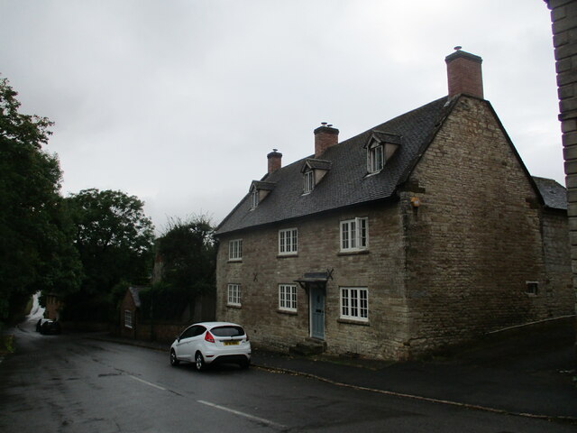
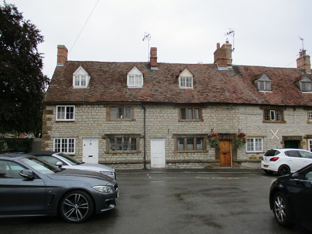
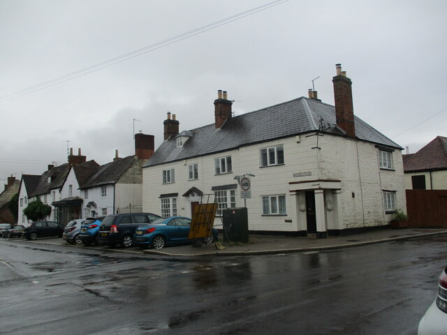
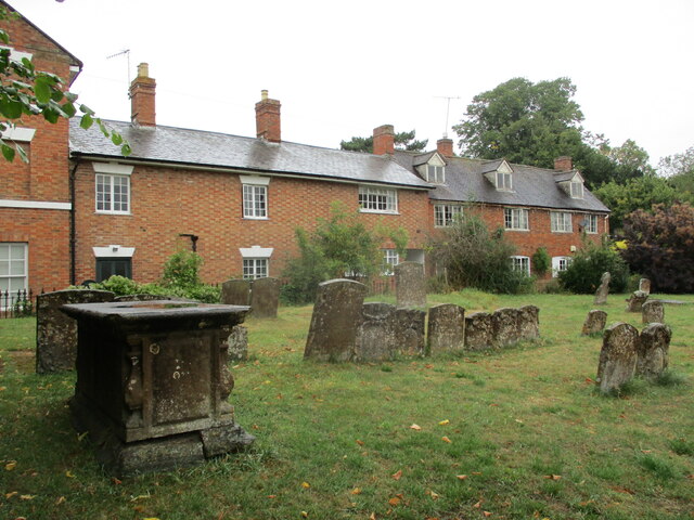
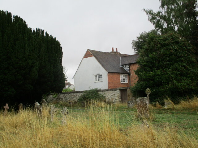
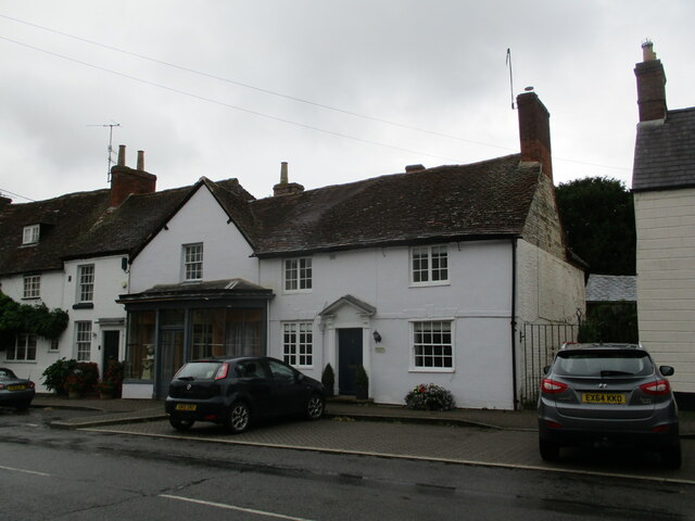
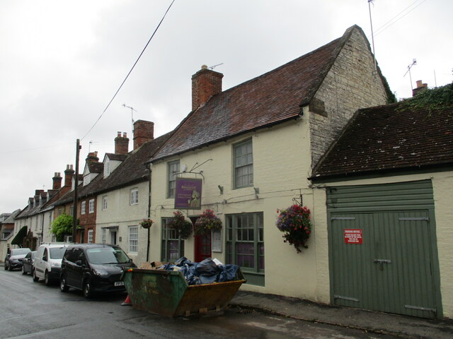
With a population of around 300 residents, Kineton, Little maintains a close-knit community atmosphere. The village is characterized by its charming thatched cottages and traditional English architecture, giving it a timeless and idyllic feel. The surrounding landscape is predominantly rural, comprising rolling hills, farmland, and woodland, making it an ideal location for nature lovers and outdoor enthusiasts.

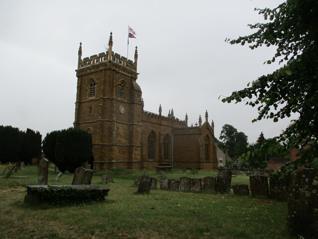
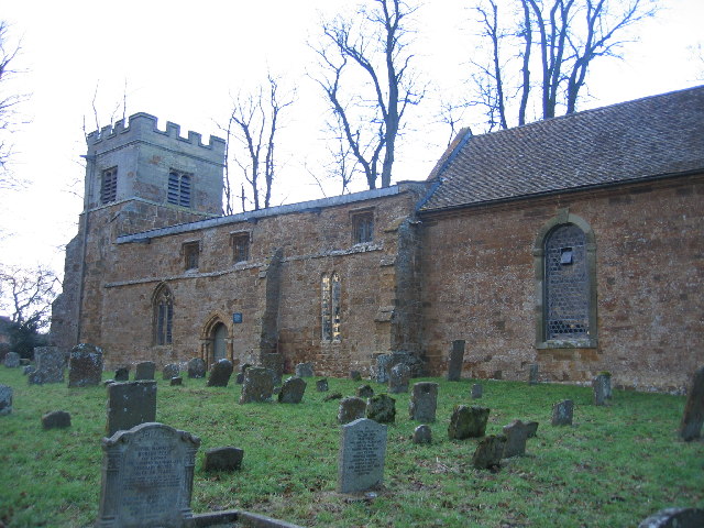
Kineton, Little boasts a rich history dating back to medieval times. The village is home to St. Peter's Church, a Grade II listed building that dates back to the 14th century. This historic church is a focal point for the local community and hosts regular services and events.

Despite its small size, Kineton, Little offers a range of amenities for its residents. These include a village hall, a primary school, and a local pub. The village is also well-connected to nearby towns and cities, with regular bus services and easy access to the A429 road.

Overall, Kineton, Little is a tranquil and picturesque village in Warwickshire, offering a peaceful retreat from the hustle and bustle of city life. Its rich history, beautiful countryside, and strong sense of community make it an attractive place to live or visit.

If you have any feedback on the listing, please let us know in the comments section below.

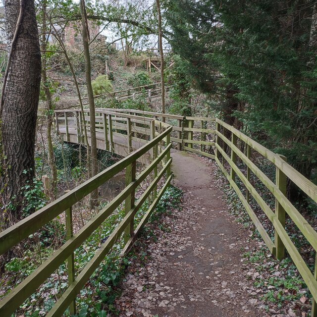
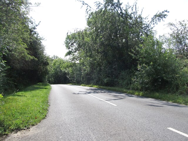
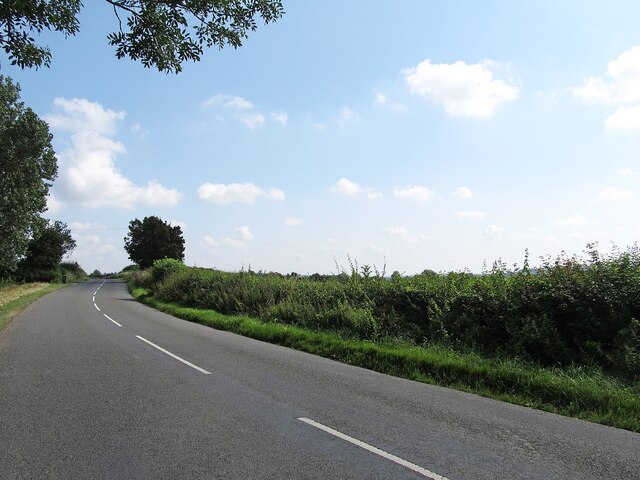
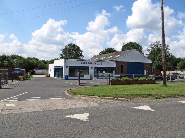
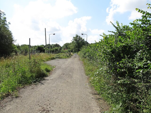
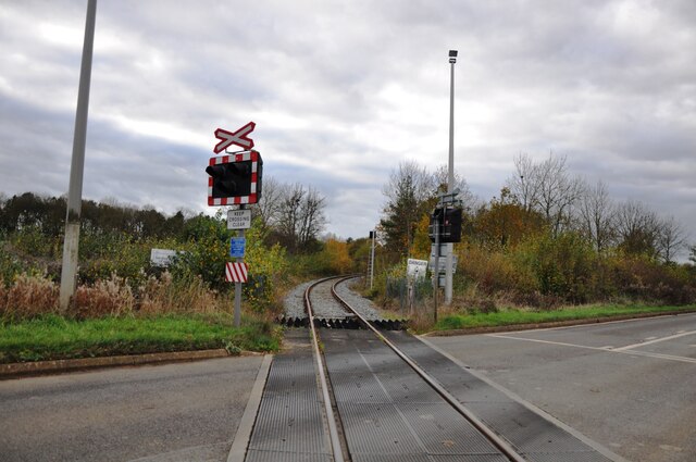
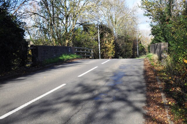
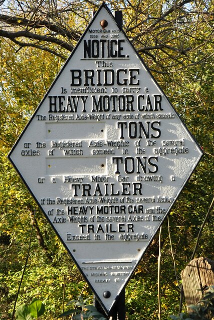
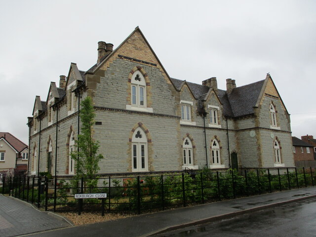
Kineton, Little Images

Images are sourced within 2km of 52.152197/-1.514715 or Grid Reference SP3350. Thanks to Geograph Open Source API. All images are credited.

Footbridge over stream at Butler Marston
Lighthorne Road Looking down the hill towards Kineton from Glebe House.
Lighthorne Road
Looking down the hill towards Kineton from Glebe House.
Kineton-Southam Road Looking towards Chadshunt.
Kineton-Southam Road
Looking towards Chadshunt.
Kineton-Gilk's Garage Cafe On Banbury Road.
Kineton-Gilk's Garage Cafe
On Banbury Road.
Kineton-Ministry of Defence Road Heading down to a Level Crossing.
Kineton-Ministry of Defence Road
Heading down to a Level Crossing.
Walton House, Kineton Eighteenth century house <span class="nowrap"><a title="https://historicengland.org.uk/listing/the-list/list-entry/1381899?section=official-list-entry" rel="nofollow ugc noopener" href="https://historicengland.org.uk/listing/the-list/list-entry/1381899?section=official-list-entry">Link</a><img style="margin-left:2px;" alt="External link" title="External link - shift click to open in new window" src="https://s1.geograph.org.uk/img/external.png" width="10" height="10"/></span>
Walton House, Kineton
Eighteenth century house LinkExternal link
Houses in the Market Place, Kineton Part of a row of houses dated 1671 <span class="nowrap"><a title="https://historicengland.org.uk/listing/the-list/list-entry/1381903?section=official-list-entry" rel="nofollow ugc noopener" href="https://historicengland.org.uk/listing/the-list/list-entry/1381903?section=official-list-entry">Link</a><img style="margin-left:2px;" alt="External link" title="External link - shift click to open in new window" src="https://s1.geograph.org.uk/img/external.png" width="10" height="10"/></span>
Houses in the Market Place, Kineton
Part of a row of houses dated 1671 LinkExternal link
Level Crossing No.6 The MOD railway at Kineton depot crosses the B4086 on its loop around the site of Edge Hill Battle (1642).
Level Crossing No.6
The MOD railway at Kineton depot crosses the B4086 on its loop around the site of Edge Hill Battle (1642).
Old railway bridge This old bridge is on Southam Road, Kineton.  It was built for the Stratford & Midland Junction Railway, which was closed in 1965.
Old railway bridge
This old bridge is on Southam Road, Kineton. It was built for the Stratford & Midland Junction Railway, which was closed in 1965.
Railway bridge sign This restored sign is adjacent to the old railway bridge in Lighthorne Road, Kineton.  It was originally erected sometime after 1909 when the railway line became the Stratford & Midland Junction Railway.
Railway bridge sign
This restored sign is adjacent to the old railway bridge in Lighthorne Road, Kineton. It was originally erected sometime after 1909 when the railway line became the Stratford & Midland Junction Railway.
Roxburgh House, Kineton A former school designed by William Lait 1863.
Roxburgh House, Kineton
A former school designed by William Lait 1863.
St Peter's church, Kineton A medieval tower with the main body of the church rebuilt in 1775 <span class="nowrap"><a title="https://historicengland.org.uk/listing/the-list/list-entry/1381924?section=official-list-entry" rel="nofollow ugc noopener" href="https://historicengland.org.uk/listing/the-list/list-entry/1381924?section=official-list-entry">Link</a><img style="margin-left:2px;" alt="External link" title="External link - shift click to open in new window" src="https://s1.geograph.org.uk/img/external.png" width="10" height="10"/></span>
St Peter's church, Kineton
A medieval tower with the main body of the church rebuilt in 1775 LinkExternal link
Bridge Street, Kineton
The Mew, Kineton Eighteenth century house <span class="nowrap"><a title="https://historicengland.org.uk/listing/the-list/list-entry/1381940?section=official-list-entry" rel="nofollow ugc noopener" href="https://historicengland.org.uk/listing/the-list/list-entry/1381940?section=official-list-entry">Link</a><img style="margin-left:2px;" alt="External link" title="External link - shift click to open in new window" src="https://s1.geograph.org.uk/img/external.png" width="10" height="10"/></span> The chest tomb is also listed <span class="nowrap"><a title="https://historicengland.org.uk/listing/the-list/list-entry/1381925?section=official-list-entry" rel="nofollow ugc noopener" href="https://historicengland.org.uk/listing/the-list/list-entry/1381925?section=official-list-entry">Link</a><img style="margin-left:2px;" alt="External link" title="External link - shift click to open in new window" src="https://s1.geograph.org.uk/img/external.png" width="10" height="10"/></span>
The Mew, Kineton
Eighteenth century house LinkExternal link The chest tomb is also listed LinkExternal link
The Old Vicarage, Kineton
House and  shop, Bridge Street, Kineton Dates from the seventeenth century <span class="nowrap"><a title="https://historicengland.org.uk/listing/the-list/list-entry/1381888?section=official-list-entry" rel="nofollow ugc noopener" href="https://historicengland.org.uk/listing/the-list/list-entry/1381888?section=official-list-entry">Link</a><img style="margin-left:2px;" alt="External link" title="External link - shift click to open in new window" src="https://s1.geograph.org.uk/img/external.png" width="10" height="10"/></span>
House and shop, Bridge Street, Kineton
Dates from the seventeenth century LinkExternal link
3-6 Bridge Street, Kineton Originally of the seventeenth century <span class="nowrap"><a title="https://historicengland.org.uk/listing/the-list/list-entry/1381885?section=official-list-entry" rel="nofollow ugc noopener" href="https://historicengland.org.uk/listing/the-list/list-entry/1381885?section=official-list-entry">Link</a><img style="margin-left:2px;" alt="External link" title="External link - shift click to open in new window" src="https://s1.geograph.org.uk/img/external.png" width="10" height="10"/></span>
3-6 Bridge Street, Kineton
Originally of the seventeenth century LinkExternal link
Bridge Street, Kineton Largely eighteenth century buildings.
Bridge Street, Kineton
Largely eighteenth century buildings.
Show me another place!

Kineton, Little is located at Grid Ref: SP3350 (Lat: 52.152197, Lng: -1.514715)

Administrative County: Warwickshire

District: Stratford-on-Avon

Police Authority: Warwickshire

What 3 Words

///thrusters.fetches.void. Near Gaydon, Warwickshire

Related Wikis

Kineton

Kineton is a village and civil parish on the River Dene in south-east Warwickshire, England. The village is part of Stratford-on-Avon district, and in...

Kineton railway station

Kineton railway station was a railway station that served the village of Kineton, Warwickshire, England. == History == Opened on 1 June 1871, the station...

Kineton High School

Kineton High School is a mixed secondary school located in South Warwickshire, England within the village of Kineton. It is a non-selective academy school...

Butlers Marston

Butlers Marston is a village and civil parish on the River Dene in south-eastern Warwickshire, England. The village is part of Stratford-on-Avon district...

Battle of Edgehill

The Battle of Edgehill (or Edge Hill) was a pitched battle of the First English Civil War. It was fought near Edge Hill and Kineton in southern Warwickshire...

Combrook

Combrook (also spelt Combroke and - more rarely - Combrooke) is a small village of about 65 houses in rural Warwickshire, located near the junction of...

Chadshunt

Chadshunt is a small village and civil parish in the Stratford-on-Avon district, in the county of Warwickshire, England. Chadshunt is located in between...

All Saints Church, Chadshunt

All Saints Church is a redundant Anglican church in the parish of Chadshunt, Warwickshire, England. It is recorded in the National Heritage List for England...

Nearby Amenities

Located within 500m of 52.152197,-1.514715
Bus Stop
Tysoe Road
Bus: yes
Naptan AtcoCode: 4200F039100
Naptan Bearing: SW
Naptan BusStopType: CUS
Naptan CommonName: Tysoe Road
Naptan Indicator: Adj
Naptan NaptanCode: wardamta
Naptan Street: Bridge Street
Naptan Verified: no
Public Transport: platform
Source: naptan_import
Lat/Long: 52.1515476/-1.5138878
Bus Stop
Tysoe Road
Bus: yes
Naptan AtcoCode: 4200F039101
Naptan Bearing: NE
Naptan BusStopType: CUS
Naptan CommonName: Tysoe Road
Naptan Indicator: Opp
Naptan NaptanCode: wardjgmd
Naptan Street: Bridge Street
Naptan Verified: no
Public Transport: platform
Source: naptan_import
Lat/Long: 52.151683/-1.5140179
Turning Circle
Source: bing
Lat/Long: 52.1559804/-1.5132293
Little Kineton
Place: hamlet
Lat/Long: 52.1512459/-1.5151586
Post Box
Collection Times: Mo-Fr 09:00, Sa 07:00
Operator: Royal Mail
Operator Wikidata: Q638098
Post Box Mounting: stone_pillar
Post Box Type: wall
Ref: CV35 21D
Royal Cypher: VR
Royal Cypher Wikidata: Q33102356
Source: survey
Lat/Long: 52.1506638/-1.51447
Restaurant
Shukurs Brasserie
Addr City: Kineton
Addr Housenumber: 3
Addr Postcode: CV35 0HP
Addr Street: Bridge Street
Cuisine: indian
Fhrs Id: 503401
Opening Hours: Mo-Su 17:00-23:00
Outdoor Seating: no
Takeaway: yes
Lat/Long: 52.1559998/-1.5114081
Generator Method: photovoltaic
Generator Output Electricity: yes
Generator Source: solar
Generator Type: solar_photovoltaic_panel
Location: roof
Power: generator
Lat/Long: 52.1499737/-1.5143886
Generator Method: photovoltaic
Generator Output Electricity: yes
Generator Source: solar
Generator Type: solar_photovoltaic_panel
Location: roof
Power: generator
Lat/Long: 52.149745/-1.513415
Generator Method: photovoltaic
Generator Output Electricity: yes
Generator Source: solar
Generator Type: solar_photovoltaic_panel
Location: roof
Power: generator
Lat/Long: 52.1530759/-1.517854
Generator Method: photovoltaic
Generator Output Electricity: yes
Generator Source: solar
Generator Type: solar_photovoltaic_panel
Location: roof
Power: generator
Lat/Long: 52.1527057/-1.517913
Generator Method: photovoltaic
Generator Output Electricity: yes
Generator Source: solar
Generator Type: solar_photovoltaic_panel
Location: roof
Power: generator
Lat/Long: 52.1532076/-1.5170306
Generator Method: photovoltaic
Generator Output Electricity: yes
Generator Source: solar
Generator Type: solar_photovoltaic_panel
Location: roof
Power: generator
Lat/Long: 52.1529542/-1.5170226
Generator Method: photovoltaic
Generator Output Electricity: yes
Generator Source: solar
Generator Type: solar_photovoltaic_panel
Location: roof
Power: generator
Lat/Long: 52.1561384/-1.5151061
Generator Method: photovoltaic
Generator Output Electricity: yes
Generator Source: solar
Generator Type: solar_photovoltaic_panel
Location: roof
Power: generator
Lat/Long: 52.155774/-1.5131696
Bench
Lat/Long: 52.1554011/-1.5190658
Bench
Backrest: yes
Lat/Long: 52.1548092/-1.5192847
Bench
Lat/Long: 52.1548118/-1.5146123
Defibrillator
Booth: K6
Covered: booth
Defibrillator Location: inside red phone box by the village green, Little Kineton
Disused Amenity: telephone
Emergency: defibrillator
Indoor: no
Man Made: telephone_box
Source: survey;aerial imagery
Lat/Long: 52.1508813/-1.5151914
Waste Basket
Waste: dog_excrement
Lat/Long: 52.1515427/-1.5144014
Bench
Lat/Long: 52.1535188/-1.5127901
Waste Basket
Waste: dog_excrement
Lat/Long: 52.1542739/-1.5123336
Waste Basket
Lat/Long: 52.1505508/-1.5147519
Bench
Lat/Long: 52.150538/-1.5147979
Bench
Lat/Long: 52.1506206/-1.5145347
Bench
Lat/Long: 52.150538/-1.5148559
The data included in this document is from www.openstreetmap.org. The data is made available under ODbL.

Have you been to Kineton, Little?

Leave your review of Kineton, Little below (or comments, questions and feedback).