Baa Skerries
Island in Shetland
Scotland
Baa Skerries

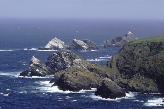
Baa Skerries is a small group of uninhabited islands located in the Shetland archipelago, off the northeast coast of Scotland. It lies approximately 16 kilometers northwest of the mainland and is situated between the larger islands of Papa Stour and Foula. The name "Baa Skerries" is derived from the Old Norse word "baa," meaning dangerous or rocky, reflecting the treacherous nature of the surrounding waters.
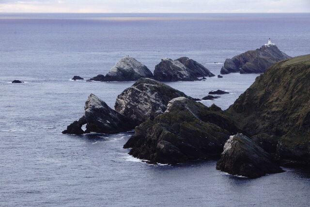
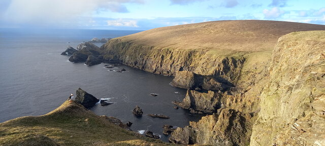
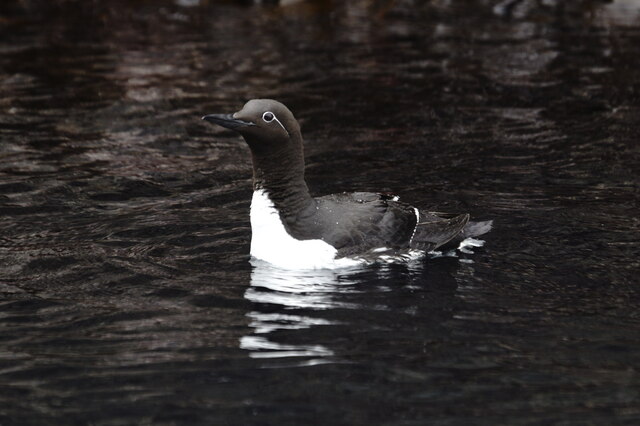
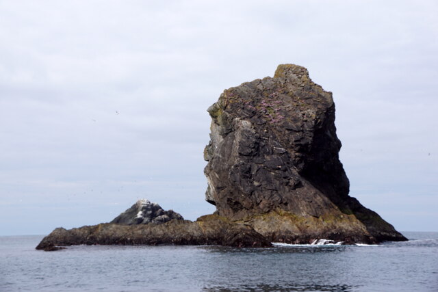
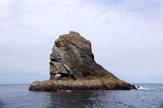
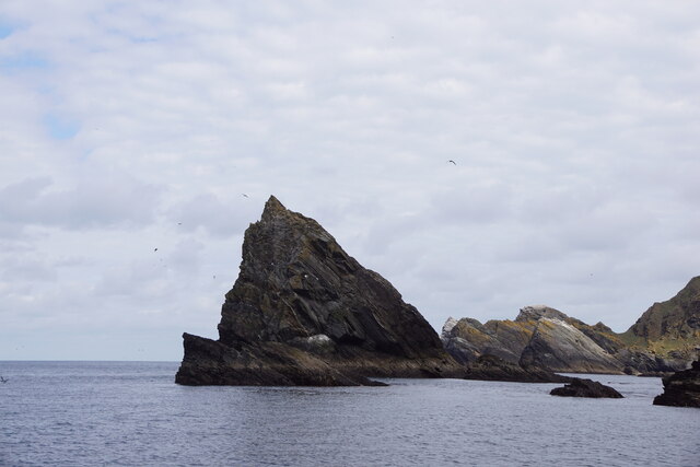
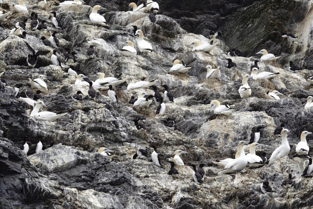
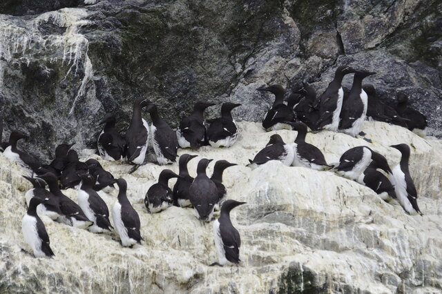
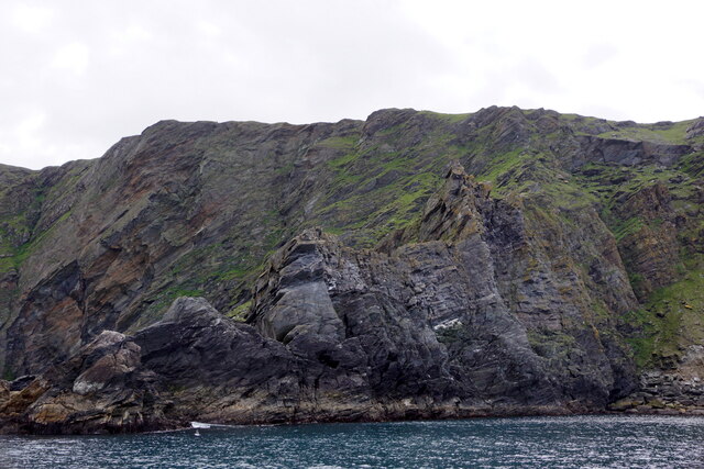
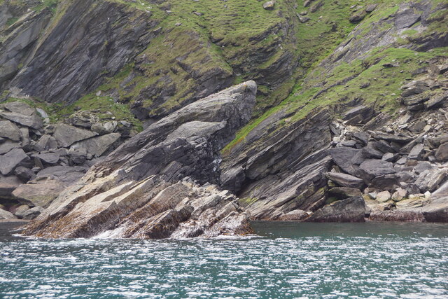
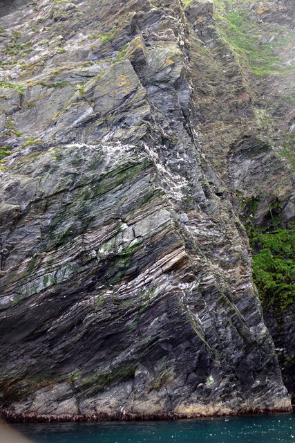
The Skerries consist of several islets and rocks, with the largest being The Herma, which rises to a height of about 30 meters. These rocky islands are known for their stunning cliffs, sea caves, and diverse birdlife. The area is home to numerous seabird colonies, including guillemots, puffins, razorbills, and kittiwakes. Visitors can witness the spectacular sight of these birds nesting and diving into the sea.
Due to its remote location and challenging access, Baa Skerries is not inhabited, and there are no facilities or structures on the islands. However, the area has become a popular destination for wildlife enthusiasts, photographers, and birdwatchers who are drawn by the unique and untouched natural beauty.
To reach Baa Skerries, visitors typically charter boats or join guided tours from nearby Lerwick or other Shetland Islands. It is important to note that the area can be subject to rough seas and unpredictable weather conditions, so visitors should plan their trips accordingly and ensure they have appropriate safety measures in place.
Baa Skerries offers a peaceful and unspoiled environment, allowing visitors to immerse themselves in the beauty of nature and experience the awe-inspiring wildlife that thrives in this remote corner of the Shetland Islands.
If you have any feedback on the listing, please let us know in the comments section below.
Baa Skerries Images
Images are sourced within 2km of 60.844446/-0.89529882 or Grid Reference HP6018. Thanks to Geograph Open Source API. All images are credited.


Baa Skerries is located at Grid Ref: HP6018 (Lat: 60.844446, Lng: -0.89529882)
Unitary Authority: Shetland Islands
Police Authority: Highlands and Islands
What 3 Words
///dancer.acute.reverted. Near Haroldswick, Shetland Islands
Nearby Locations
Related Wikis

Hermaness
Hermaness is the northernmost headland of Unst, the most northerly inhabited island of Shetland, Scotland. It consists of huge sea cliffs and moorland...

Muckle Flugga
Muckle Flugga () is a small rocky island north of Unst in the Shetland Islands, Scotland. It is often described as the northernmost point of the British...

Out Stack
Out Stack or Ootsta is an island in Shetland, Scotland and the northernmost point of both Scotland and the British Isles. It lies 600 m (2,000 ft) northeast...

RAF Saxa Vord
Remote Radar Head Saxa Vord or RRH Saxa Vord (aka RAF Saxa Vord), is a Royal Air Force radar station located on the island of Unst, the most northern of...

Burrafirth
Burrafirth links (Old Norse: Borgarfjorðr, meaning "the fjord with a castle") is a strip of land with a few houses on the island of Unst, Shetland, Scotland...

Skaw, Unst
Skaw is a settlement in the Scottish archipelago of Shetland, located on the island of Unst. It is located north of Haroldswick on a peninsula in the northeast...

Saxa Vord distillery
Saxa Vord distillery is a Scotch whisky and gin distillery on the island of Unst, part of the Shetland islands. The distillery takes its name from its...

Valhalla Brewery
The Valhalla Brewery in Unst, Shetland, Scotland, was the northernmost brewery in the United Kingdom. It was opened by the husband and wife team Sonny...
Nearby Amenities
Located within 500m of 60.844446,-0.89529882Have you been to Baa Skerries?
Leave your review of Baa Skerries below (or comments, questions and feedback).