Boelie
Cliff, Slope in Shetland
Scotland
Boelie

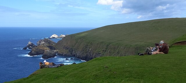
Boelie, Shetland is a picturesque coastal cliff and slope located on the Shetland Islands, a group of islands off the northeast coast of mainland Scotland. It is situated on the eastern side of the main island, known as Mainland, near the village of Cunningsburgh.
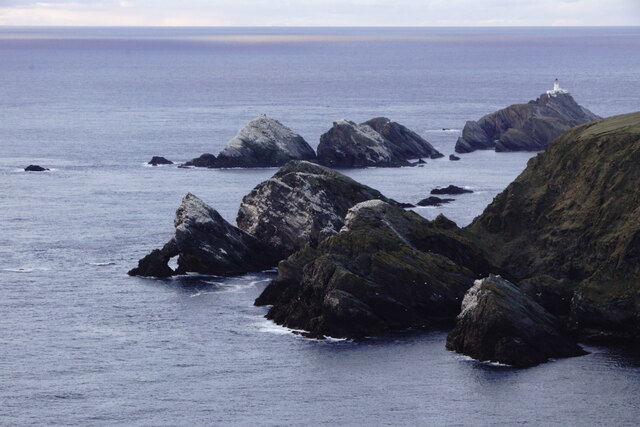
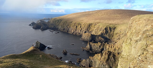
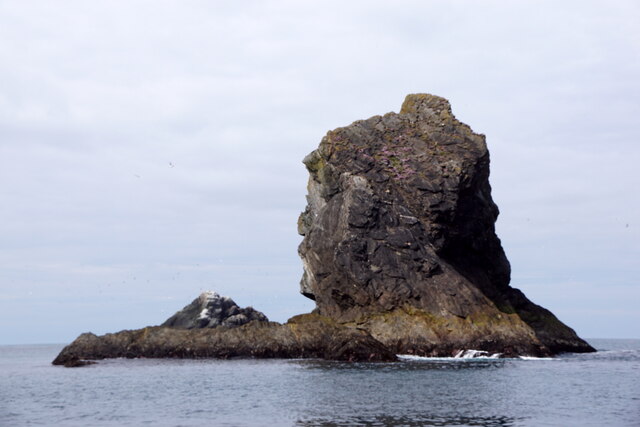
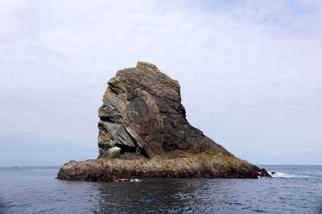
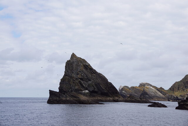
Boelie is renowned for its stunning natural beauty and dramatic landscapes. The cliff stands tall and imposing, offering breathtaking views of the North Sea and the surrounding rugged coastline. Its elevation provides an ideal vantage point to observe the diverse marine life that inhabits the waters below.
The cliff itself is composed of layers of sedimentary rock, showcasing the geological history of the area. These rock formations are an attraction in their own right, displaying various colors and textures. The slope leading up to the cliff is covered in lush vegetation, including grasses, heather, and wildflowers, which adds to the charm of the site.
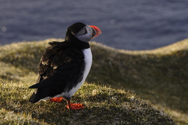
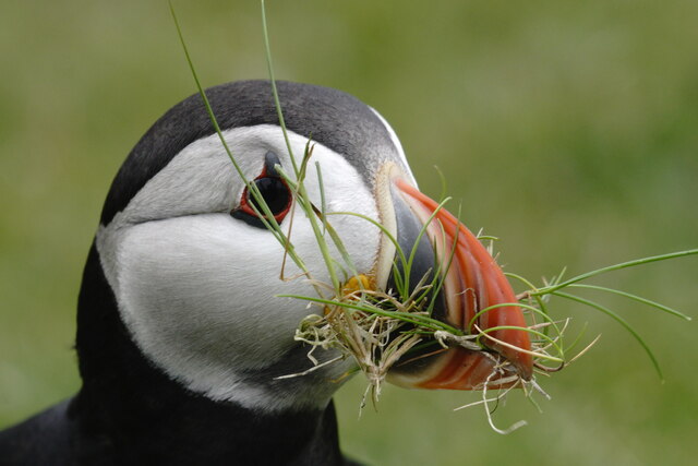
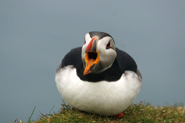
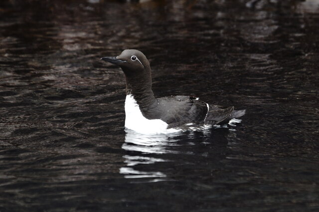
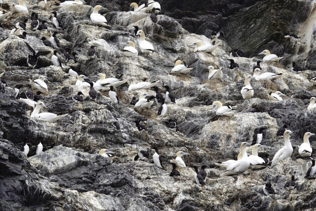
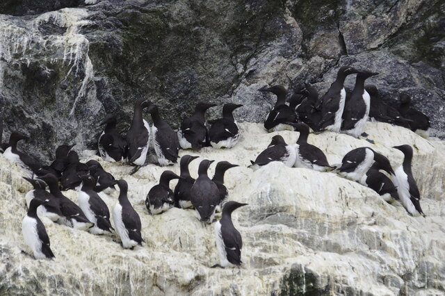
Boelie is a haven for birdwatchers, as numerous seabirds nest on the cliffs, including puffins, guillemots, and razorbills. Their presence adds a vibrant touch to the already stunning scenery. The area is also home to a variety of other wildlife, such as seals, otters, and occasionally, whales and dolphins can be spotted in the waters nearby.
Visitors to Boelie can enjoy the natural beauty of the landscape by taking leisurely walks along the cliff-top paths or simply by sitting and admiring the awe-inspiring views. The area is relatively remote, providing a peaceful and tranquil environment for those seeking solace in nature.
Overall, Boelie, Shetland is a must-visit destination for nature enthusiasts and those seeking an escape from the hustle and bustle of everyday life. Its rugged cliffs, diverse wildlife, and stunning vistas make it a truly remarkable place to explore.
If you have any feedback on the listing, please let us know in the comments section below.
Boelie Images
Images are sourced within 2km of 60.842691/-0.88934274 or Grid Reference HP6018. Thanks to Geograph Open Source API. All images are credited.


Boelie is located at Grid Ref: HP6018 (Lat: 60.842691, Lng: -0.88934274)
Unitary Authority: Shetland Islands
Police Authority: Highlands and Islands
What 3 Words
///treaty.swordfish.words. Near Haroldswick, Shetland Islands
Nearby Locations
Related Wikis

Hermaness
Hermaness is the northernmost headland of Unst, the most northerly inhabited island of Shetland, Scotland. It consists of huge sea cliffs and moorland...

Muckle Flugga
Muckle Flugga () is a small rocky island north of Unst in the Shetland Islands, Scotland. It is often described as the northernmost point of the British...

Out Stack
Out Stack or Ootsta is an island in Shetland, Scotland and the northernmost point of both Scotland and the British Isles. It lies 600 m (2,000 ft) northeast...

RAF Saxa Vord
Remote Radar Head Saxa Vord or RRH Saxa Vord (aka RAF Saxa Vord), is a Royal Air Force radar station located on the island of Unst, the most northern of...

Burrafirth
Burrafirth links (Old Norse: Borgarfjorðr, meaning "the fjord with a castle") is a strip of land with a few houses on the island of Unst, Shetland, Scotland...

Skaw, Unst
Skaw is a settlement in the Scottish archipelago of Shetland, located on the island of Unst. It is located north of Haroldswick on a peninsula in the northeast...

Saxa Vord distillery
Saxa Vord distillery is a Scotch whisky and gin distillery on the island of Unst, part of the Shetland islands. The distillery takes its name from its...

Valhalla Brewery
The Valhalla Brewery in Unst, Shetland, Scotland, was the northernmost brewery in the United Kingdom. It was opened by the husband and wife team Sonny...
Nearby Amenities
Located within 500m of 60.842691,-0.88934274Have you been to Boelie?
Leave your review of Boelie below (or comments, questions and feedback).