Flowing Stack

Island in Shetland

Scotland

Flowing Stack

Valla Field, Unst, Shetland Islands Looking just west of north up the west coast of the island. There are only two higher hills on Unst - Saxa Vord and Southers Field.
Valla Field, Unst, Shetland Islands Credit: Michael Earnshaw

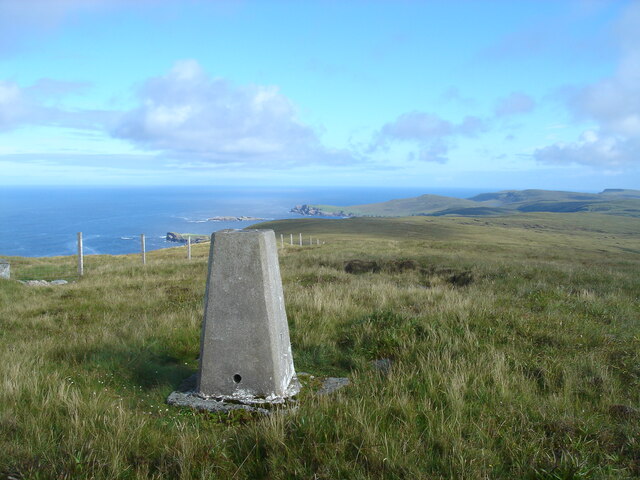
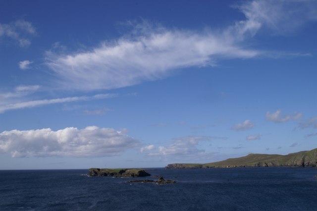
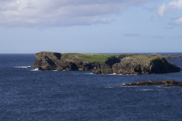
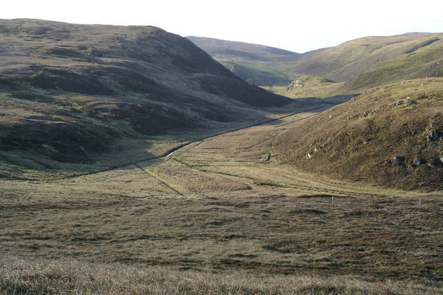
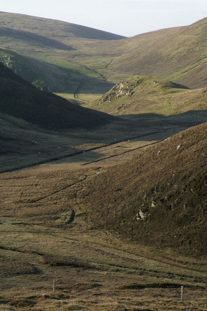
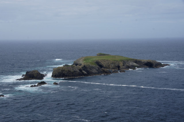
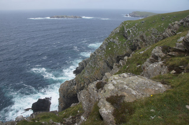
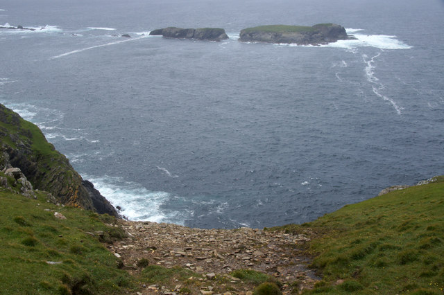
Flowing Stack is a small island located in the Shetland archipelago, which is part of Scotland. It is situated in the North Sea, approximately 370 kilometers north of mainland Scotland. The island is known for its rugged and picturesque landscape, with stunning cliffs and rolling hills.

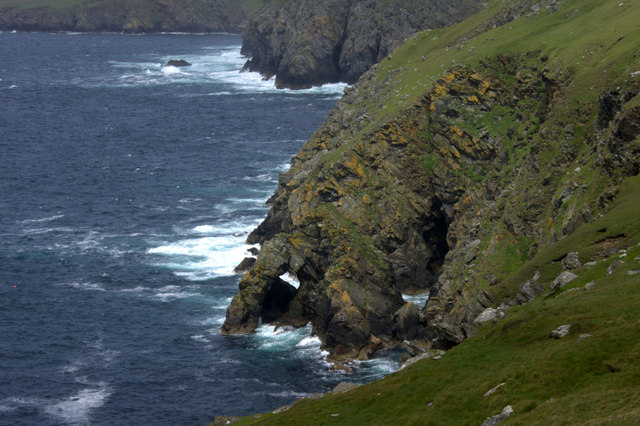
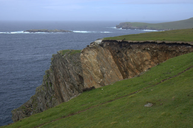
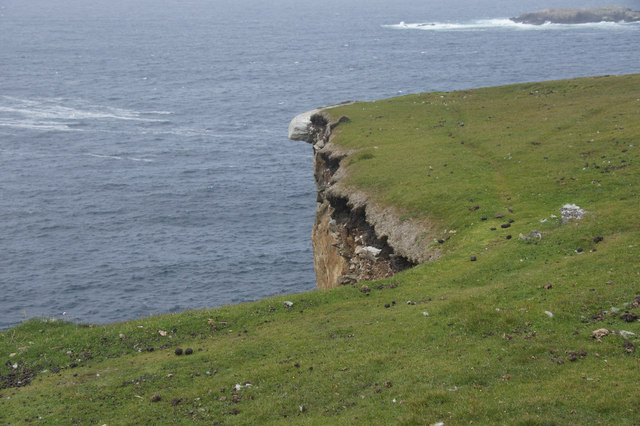
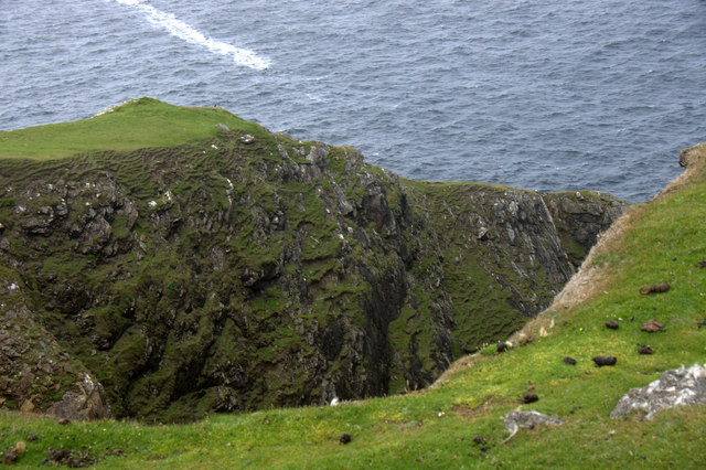
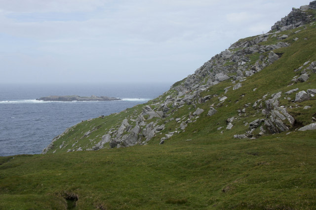
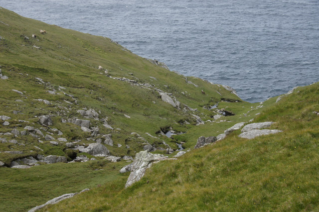
Flowing Stack covers an area of about 2 square kilometers and has a population of around 50 people. The island is predominantly made up of moorland, with heather and grasses covering most of the land. The coastline is characterized by dramatic cliffs, some reaching heights of up to 100 meters, providing breathtaking views of the surrounding sea.

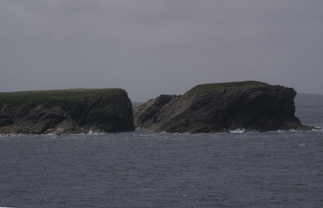
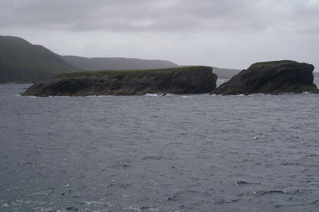
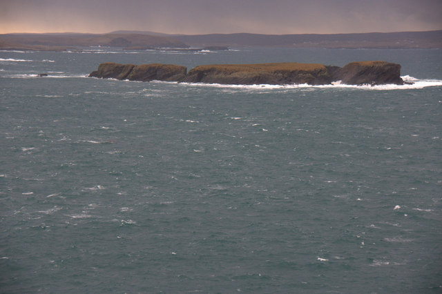
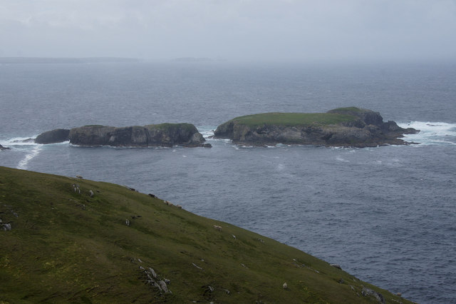
The island's name, Flowing Stack, is derived from the distinctive rock formations found along its coastline. These towering stacks, formed through centuries of erosion, create a mesmerizing sight as the waves crash against them, giving the illusion of water flowing down.

Despite its small size, Flowing Stack is home to a variety of wildlife. The island's cliffs and crags provide nesting sites for numerous seabirds, including puffins, guillemots, and fulmars. It is not uncommon to spot seals and otters along the coastline, and occasionally, whales can be seen in the surrounding waters.

Access to Flowing Stack is primarily by boat, with occasional ferry services connecting it to neighboring islands. The island's remote location and untouched natural beauty make it a popular destination for nature enthusiasts and those seeking tranquility away from the hustle and bustle of city life.

If you have any feedback on the listing, please let us know in the comments section below.

Flowing Stack Images

Images are sourced within 2km of 60.760486/-0.94669198 or Grid Reference HP5709. Thanks to Geograph Open Source API. All images are credited.

Valla Field, Unst, Shetland Islands Looking just west of north up the west coast of the island. There are only two higher hills on Unst - Saxa Vord and Southers Field.
Valla Field, Unst, Shetland Islands
Looking just west of north up the west coast of the island. There are only two higher hills on Unst - Saxa Vord and Southers Field.
The South Holms of Woodwick Sneuga is the hill to the right.
The South Holms of Woodwick
Sneuga is the hill to the right.
The South Holms of Woodwick
Dale of Woodwick Looking south from the Knowe of Tronamires.
Dale of Woodwick
Looking south from the Knowe of Tronamires.
Dale of Woodwick From the Knowe of Tronamires; Heimar Water is just over the lip of the hill in the distance.
Dale of Woodwick
From the Knowe of Tronamires; Heimar Water is just over the lip of the hill in the distance.
South Holms of Woodwick Showing the narrow passage between two of the holms. Taken from one of the Yell Sound ferries on a North Isles cruise.
South Holms of Woodwick
Showing the narrow passage between two of the holms. Taken from one of the Yell Sound ferries on a North Isles cruise.
South Holms of Woodwick Taken from one of the Yell Sound ferries on a North Isles cruise.
South Holms of Woodwick
Taken from one of the Yell Sound ferries on a North Isles cruise.
South Holms of Woodwick Yell is in the background.
South Holms of Woodwick
Yell is in the background.
Sinna Stack, between Westing and Woodwick A natural arch.
Sinna Stack, between Westing and Woodwick
A natural arch.
South Holms of Woodwick from Houllnahevda, between Westing and Woodwick
Longa Geo, south of Woodwick The cliff fall is several years old, but still looks very fresh.
Longa Geo, south of Woodwick
The cliff fall is several years old, but still looks very fresh.
Longa Geo, south of Woodwick May advice would be not to try standing on the rock!
Longa Geo, south of Woodwick
May advice would be not to try standing on the rock!
Longa Geo, south of Woodwick Far too windy to even attempt to see the bottom of the geo.
Longa Geo, south of Woodwick
Far too windy to even attempt to see the bottom of the geo.
South Surida Dale, Woodwick North Holms of Woodwick in the background.
South Surida Dale, Woodwick
North Holms of Woodwick in the background.
South Surida Dale, Woodwick
South Surida Dale, Woodwick South Holms of Woodwick in the background.
South Surida Dale, Woodwick
South Holms of Woodwick in the background.
Cliffs at Muckle Heyler, Woodwick
Above Muckle Heyler, Woodwick South Holms of Woodwick in the background.
Above Muckle Heyler, Woodwick
South Holms of Woodwick in the background.
Show me another place!

Flowing Stack is located at Grid Ref: HP5709 (Lat: 60.760486, Lng: -0.94669198)

Unitary Authority: Shetland Islands

Police Authority: Highlands and Islands

What 3 Words

///loosens.light.guideline. Near Baltasound, Shetland Islands

Related Wikis

Society of Our Lady of the Isles

The Society of Our Lady of the Isles (SOLI) is a small Anglican religious order for women, founded in the late 20th century. It is located in Shetland...

Brough Holm

Brough Holm is a small island off Unst, in the North Isles of Shetland. It is off Westing, which as the name implies is on the west coast of Unst. The...

Unst

Unst (; Norn: Ønst) is one of the North Isles of the Shetland Islands, Scotland. It is the northernmost of the inhabited British Isles and is the third...

1992 New Year's Day Storm

The New Year's Day Storm (Norwegian: Nyttårsorkanen), known in Scotland as the 'Hogmanay Hurricane', was an intense European windstorm that affected much...

Have you been to Flowing Stack?

Leave your review of Flowing Stack below (or comments, questions and feedback).