Achadh a' Chòis
Settlement in Argyllshire
Scotland
Achadh a' Chòis

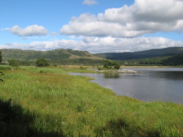
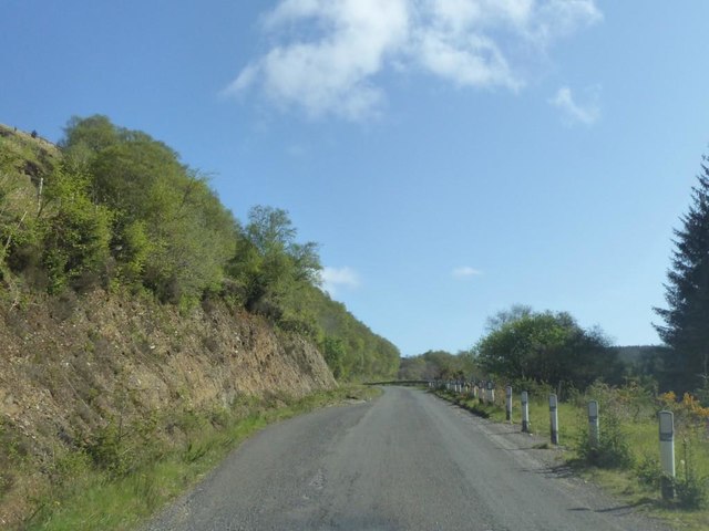
Achadh a' Chòis is a village located in the region of Argyllshire in Scotland. Situated on the western coast of Scotland, it lies on the eastern banks of Loch Fyne, a long sea loch that stretches for 65 kilometers. The village is surrounded by stunning natural beauty, with rolling hills and lush green landscapes.
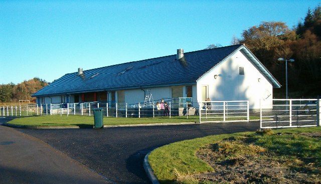
With a population of approximately 500, Achadh a' Chòis is a small and close-knit community. The village is predominantly residential, with a few local businesses and amenities catering to the needs of the residents. The village's economy is primarily based on agriculture, fishing, and tourism.
Achadh a' Chòis offers a peaceful and picturesque setting for visitors and locals alike. The area is known for its outdoor activities, including hiking, cycling, and fishing. Loch Fyne provides opportunities for water sports, such as kayaking and sailing. The village is also a popular destination for birdwatching enthusiasts, with a variety of bird species frequenting the area.
Visitors to Achadh a' Chòis can explore the surrounding countryside and enjoy the tranquility of the region. The nearby Crarae Gardens, managed by the National Trust for Scotland, offer visitors a chance to admire a stunning collection of rhododendrons and other exotic plants. The village also hosts an annual Highland Games event, showcasing traditional Scottish sports and culture.
In summary, Achadh a' Chòis is a charming village in Argyllshire, Scotland, known for its natural beauty, outdoor activities, and close community. It provides a peaceful retreat for those looking to escape the hustle and bustle of city life.
If you have any feedback on the listing, please let us know in the comments section below.
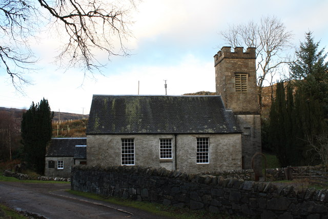
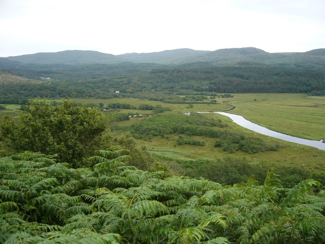
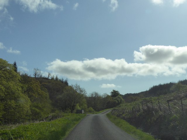
Achadh a' Chòis Images
Images are sourced within 2km of 55.939898/-5.556896 or Grid Reference NR7777. Thanks to Geograph Open Source API. All images are credited.


Achadh a' Chòis is located at Grid Ref: NR7777 (Lat: 55.939898, Lng: -5.556896)
Unitary Authority: Argyll and Bute
Police Authority: Argyll and West Dunbartonshire
Also known as: Achahoish
What 3 Words
///tropic.nuzzling.habits. Near Ardrishaig, Argyll & Bute
Nearby Locations
Related Wikis
Achahoish
Achahoish (Scottish Gaelic: Achadh a’ Chòis) is a village on the west coast of Knapdale in the Scottish council area of Argyll and Bute. In 1882, Wilson...
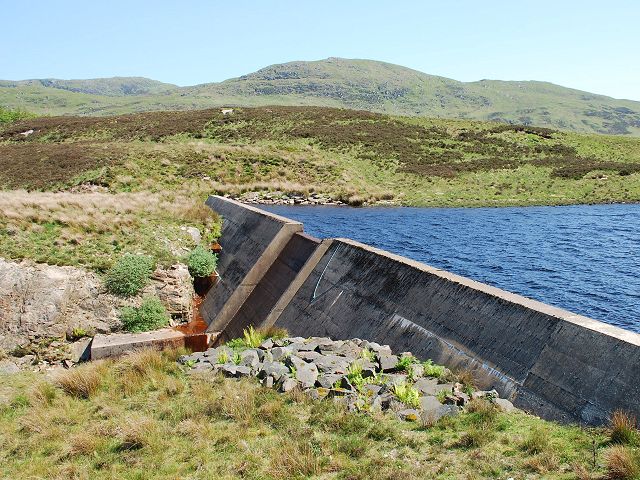
Loch A' Chaorainn
Loch A' Chaorainn (Loch of the Rowan) is an impounding reservoir which lies 9 kilometres (5.6 mi) north west of Tarbert. The concrete dam is 8.2 metres...

Ormsary
Ormsary (Scottish Gaelic: Ormsaraidh) is a hamlet in Knapdale, Argyll and Bute, Scotland. == References ==
Baile Boidheach
Baile Boidheach (Scottish Gaelic: Am Baile Bòidheach) is a hamlet in Argyll and Bute, Scotland.

Loch Sween
Loch Sween (Scottish Gaelic: Loch Suain or Loch Suibhne) is a sea loch located near Lochgilphead, Argyll and Bute, Scotland. Castle Sween is located on...
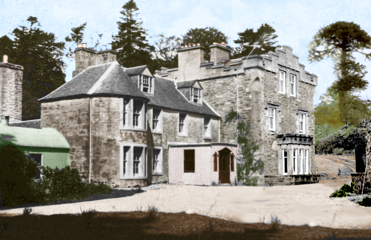
Inverneill House
Inverneill House is a country house in Argyll, western Scotland. It stands on the west shore of Loch Fyne, around 4 miles (6.4 km) south of Lochgilphead...
Ashfield, Argyll and Bute
Ashfield is a village in the civil parish of North Knapdale, in Knapdale, in the council area of Argyll and Bute, Scotland. It has a sheep farm and cottage...

Kilmory, Knapdale
Kilmory (Scottish Gaelic: Cill Mhoire) is a hamlet in the civil parish of South Knapdale, on Knapdale, Argyll and Bute, Scotland. It is situated near the...
Nearby Amenities
Located within 500m of 55.939898,-5.556896Have you been to Achadh a' Chòis?
Leave your review of Achadh a' Chòis below (or comments, questions and feedback).