Green Isle

Island in Shetland

Scotland

Green Isle

Coastal inlet Top of the coastal inlet
Coastal inlet Credit: Mat Tuck

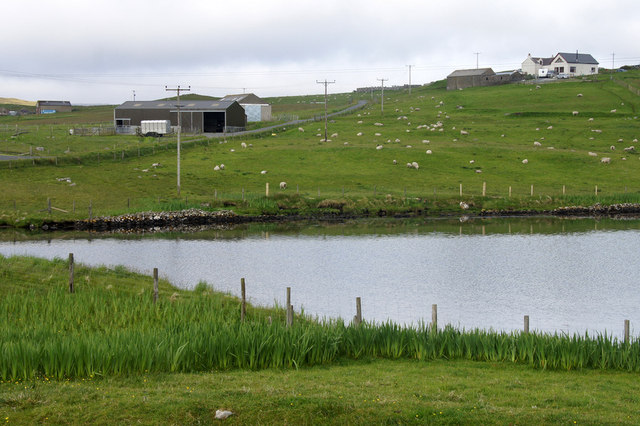
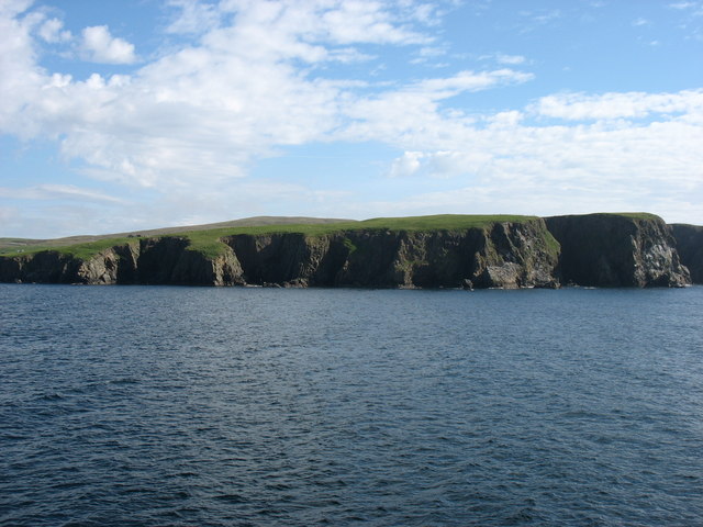
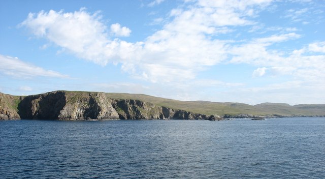
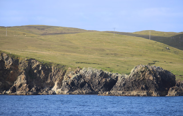
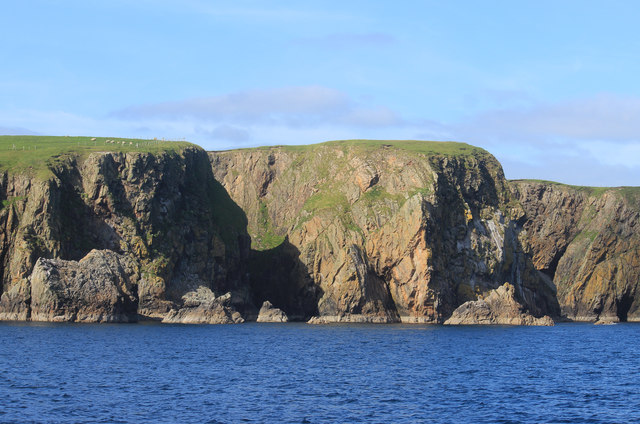
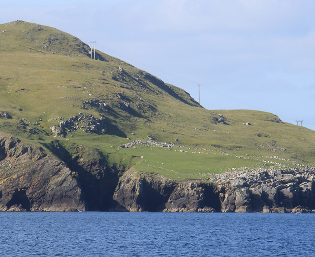
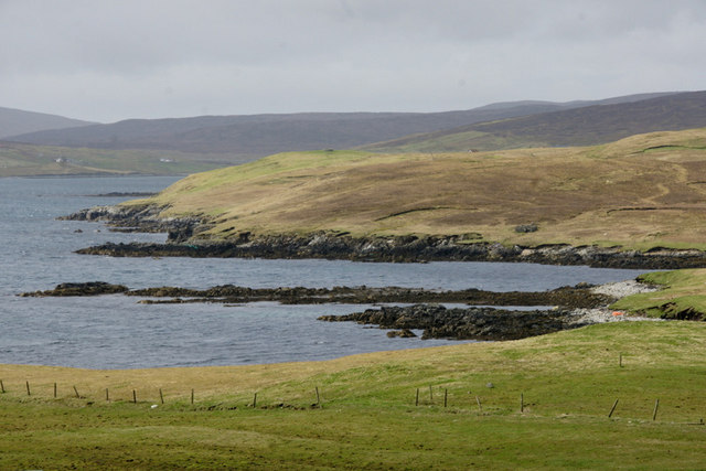
Green Isle is a picturesque island located in the Shetland archipelago, which lies off the northeastern coast of Scotland. With a land area of approximately 7 square kilometers, it is one of the smaller islands in the archipelago. The island is characterized by its rugged landscape, consisting of steep cliffs, rolling hills, and rocky shores, providing breathtaking views of the surrounding sea.

Green Isle is known for its rich biodiversity, with a variety of plant and animal species thriving in its diverse habitats. The island is home to numerous seabird colonies, including puffins, kittiwakes, and guillemots, making it a haven for birdwatchers. Additionally, seals can often be spotted lounging on the island's shores.

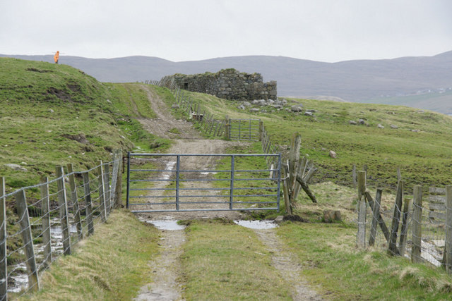
The island's human presence is limited, with only a handful of residents. These residents are primarily engaged in traditional industries such as fishing and agriculture. The island's fertile soil allows for the cultivation of crops such as barley and potatoes, while sheep farming is also prevalent.

Green Isle is a popular destination for outdoor enthusiasts, offering opportunities for hiking, birdwatching, and photography. Its remote location and untouched landscapes make it an ideal spot for those seeking tranquility and a connection with nature. Visitors can explore the island's network of walking trails, which provide access to its stunning viewpoints and secluded beaches.

Ferries connect Green Isle to the neighboring islands and mainland, allowing visitors to easily reach this hidden gem of the Shetland archipelago.

If you have any feedback on the listing, please let us know in the comments section below.

Green Isle Images

Images are sourced within 2km of 60.333063/-1.1260117 or Grid Reference HU4861. Thanks to Geograph Open Source API. All images are credited.

Coastal inlet Top of the coastal inlet
Coastal inlet
Top of the coastal inlet
The Vadill, Billister, at high tide Vadill means a place that can be waded across, but the tide is in.
The Vadill, Billister, at high tide
Vadill means a place that can be waded across, but the tide is in.
House between Billister and Laxfirth Overlooking the head of the Vadill.
House between Billister and Laxfirth
Overlooking the head of the Vadill.
Head of the Vadill, Billister The pink plant on the left is a garden escape, Sweet Rocket.
Head of the Vadill, Billister
The pink plant on the left is a garden escape, Sweet Rocket.
North Nesting Public Hall. Laxfirth
Hamera Head Seen from the Whalsay ferry.
Hamera Head
Seen from the Whalsay ferry.
Cliffs at Levaneap Seen from the Whalsay ferry.
Cliffs at Levaneap
Seen from the Whalsay ferry.
Quoys pier Pier at Quoys
Quoys pier
Pier at Quoys
Quoys pier A small piece of land by Quoys Pier.  There is a picnic bench and space to pull up several cars, making a useful wild camping spot.
Quoys pier
A small piece of land by Quoys Pier. There is a picnic bench and space to pull up several cars, making a useful wild camping spot.
Cliffs near Levaneap Another one from the Whalsay ferry. Good coastal views all along on the crossing from Laxo to Symbister.
Cliffs near Levaneap
Another one from the Whalsay ferry. Good coastal views all along on the crossing from Laxo to Symbister.
Cliffs at Hamera Head
Ruins on Morro Ness Remains of a building and field walls. The building is shown on the map.
This is cropped from a telephoto shot, so it's not as sharp as it might be.
Ruins on Morro Ness
Remains of a building and field walls. The building is shown on the map. This is cropped from a telephoto shot, so it's not as sharp as it might be.
Track to Hamera Head, Levanaeap, near Vidlin
Omans Geo, Levaneap, Vidlin
Brightly-coloured garage, Levaneap, Vidlin
Billister: the pier A tiny harbour on Lax Firth, an inlet from the much larger Dury Voe, which is in the background.
Billister: the pier
A tiny harbour on Lax Firth, an inlet from the much larger Dury Voe, which is in the background.
Billister: old Zetland County Council stone This small slab of stone is almost hidden in the long grass opposite the pier (see <a href="https://www.geograph.org.uk/photo/2758868">HU4760 : Billister: the pier</a>) and is inscribed with the Zetland County Council emblem with the name Billister Pier below.

Zetland County Council is the predecessor (1974) to the present-day Shetland Islands Council.
Billister: old Zetland County Council stone
This small slab of stone is almost hidden in the long grass opposite the pier (see HU4760 : Billister: the pier) and is inscribed with the Zetland County Council emblem with the name Billister Pier below. Zetland County Council is the predecessor (1974) to the present-day Shetland Islands Council.
Billister: the telephone box Looking down the lane towards Billister pier, with a red telephone box on the right. The box also acts as the repository for post for the wheelchair-bound lady, who lives in the cottage, as I discovered when I found a letter (visible on the shelf) inside the box. I knocked on the door and she cheerfully told me that her home help or other visitors checked the box before coming in.
Billister: the telephone box
Looking down the lane towards Billister pier, with a red telephone box on the right. The box also acts as the repository for post for the wheelchair-bound lady, who lives in the cottage, as I discovered when I found a letter (visible on the shelf) inside the box. I knocked on the door and she cheerfully told me that her home help or other visitors checked the box before coming in.
Show me another place!

Green Isle is located at Grid Ref: HU4861 (Lat: 60.333063, Lng: -1.1260117)

Unitary Authority: Shetland Islands

Police Authority: Highlands and Islands

What 3 Words

///crop.packets.songbook. Near Vidlin, Shetland Islands

Nearby Locations

Green Isle Dury Voe

Related Wikis

Billister

Billister is a settlement in the parish of Nesting, on the island of Mainland, in Shetland, Scotland. It is on Lax Firth. Billister was formerly the terminal...

Neap

Neap is a small village in the east coast of the Mainland of the Shetland Islands, Scotland. Neap is situated at the end of the road from Brettabister...

Nesting, Shetland

Nesting is a parish in the Shetland Islands, Scotland. It includes a part of the east Shetland Mainland, measuring about twelve by four miles (19 by 6...

Brettabister

Brettabister is a settlement on the island of Mainland in Shetland, Scotland. It is in the parish of Nesting. St. Ola's parish church lies to the east...

Have you been to Green Isle?

Leave your review of Green Isle below (or comments, questions and feedback).