Markamouth

Island in Shetland

Scotland

Markamouth

Gerherda A headland on the Vigon coast. Taken from one of the Yell Sound ferries on a North Isles cruise.
Gerherda Credit: Mike Pennington

Markamouth is a small village located on the Shetland Islands, an archipelago in Scotland, United Kingdom. Situated on the mainland of Shetland, Markamouth is known for its picturesque coastal setting and rich history.

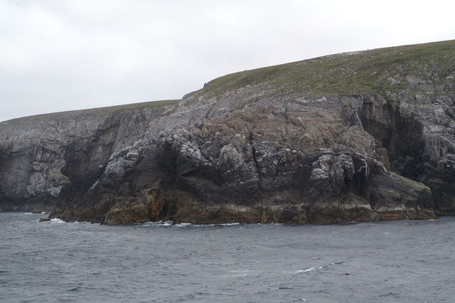
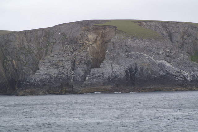
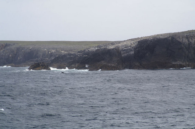
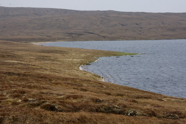
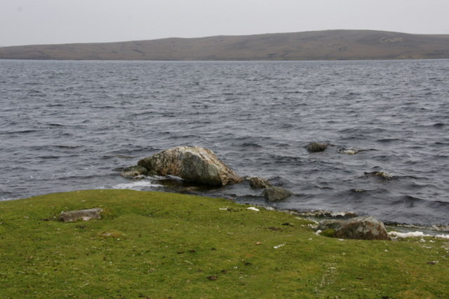
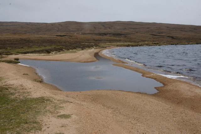
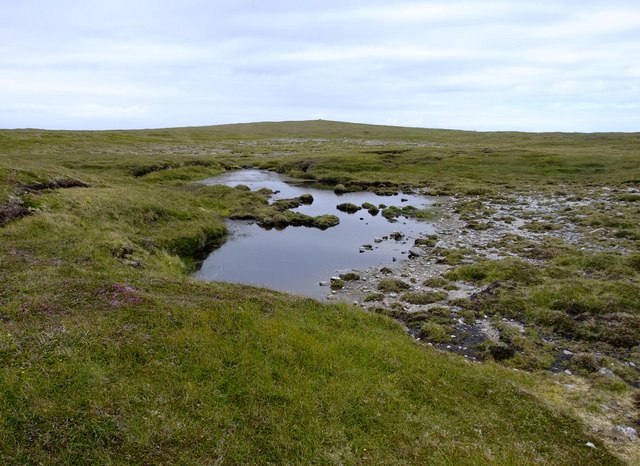
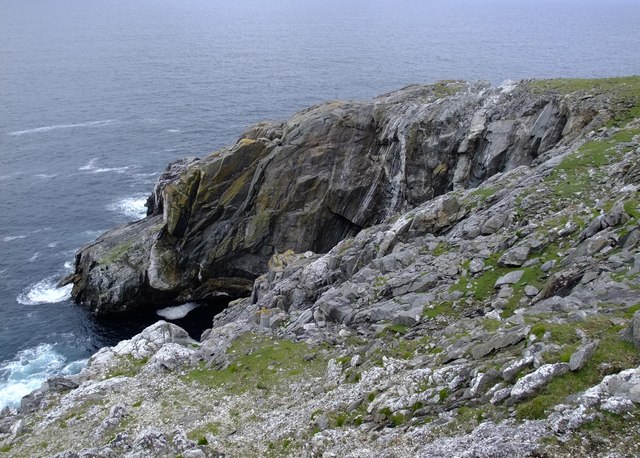
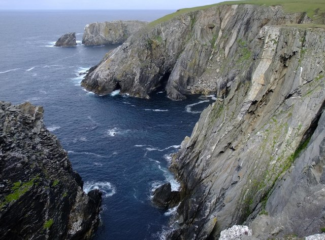
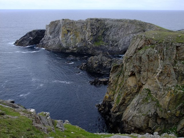
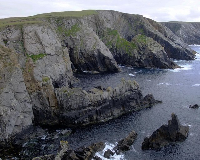
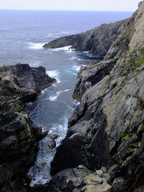
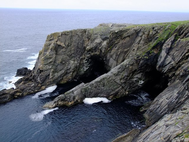
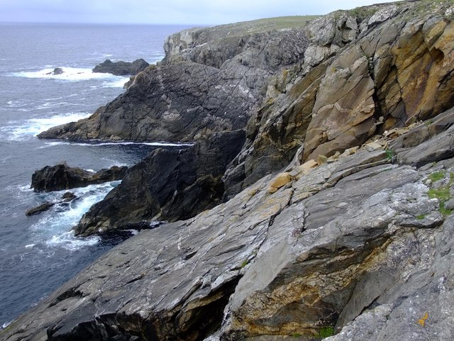
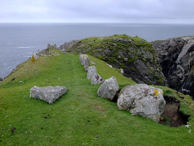
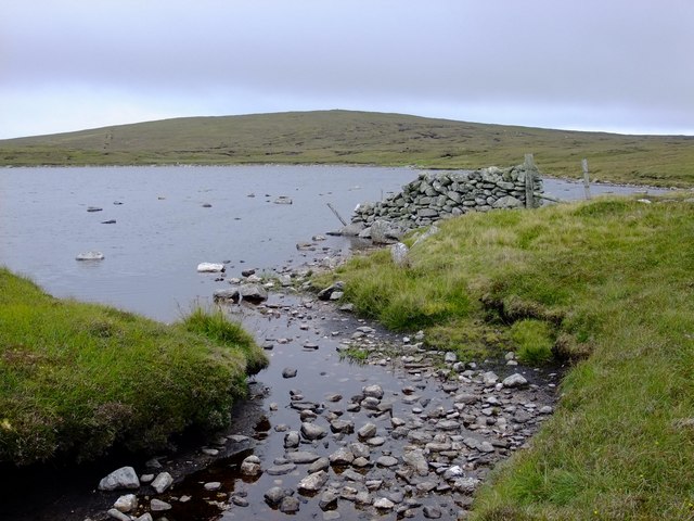
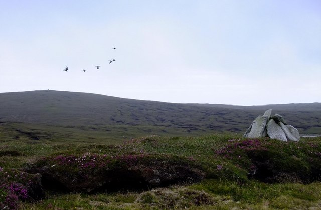
The village is surrounded by stunning natural beauty, with rugged cliffs, sandy beaches, and panoramic views of the North Sea. It is a popular destination for outdoor enthusiasts and nature lovers, offering opportunities for hiking, birdwatching, and exploring the diverse flora and fauna of the area.

Markamouth has a population of around 200 residents, making it a close-knit and friendly community. The village is home to a number of traditional Shetland houses, scattered along winding streets that reflect its historical charm and character.

In terms of amenities, Markamouth boasts a few local shops and services, including a post office and a small grocery store. However, for more extensive facilities, residents and visitors often travel to nearby Lerwick, the main town of Shetland.

The village is steeped in history, with archaeological sites dating back to the Neolithic period. The area has also witnessed Viking settlements, which have left their mark on the local culture and heritage. Visitors can explore ancient ruins and learn about the island's past at the nearby Jarlshof Prehistoric and Norse Settlement.

Overall, Markamouth is a tranquil and idyllic village, offering a peaceful retreat for those seeking a taste of the Shetland Islands' natural beauty and historical significance.

If you have any feedback on the listing, please let us know in the comments section below.

Markamouth Images

Images are sourced within 2km of 60.695376/-1.1327938 or Grid Reference HP4701. Thanks to Geograph Open Source API. All images are credited.

Gerherda A headland on the Vigon coast. Taken from one of the Yell Sound ferries on a North Isles cruise.
Gerherda
A headland on the Vigon coast. Taken from one of the Yell Sound ferries on a North Isles cruise.
Markamouth Promontory on the Vigon coast. Taken from one of the Yell Sound ferries on a North Isles cruise.
Markamouth
Promontory on the Vigon coast. Taken from one of the Yell Sound ferries on a North Isles cruise.
Swinga Taing Promontory on the north-west coast of Yell. Taken from one of the Yell Sound ferries on a North Isles cruise.
Swinga Taing
Promontory on the north-west coast of Yell. Taken from one of the Yell Sound ferries on a North Isles cruise.
North-west shore of Gossa Water Looking towards Fugla Field.
North-west shore of Gossa Water
Looking towards Fugla Field.
Green headland, Gossa Water Green headlands like this are usually formed by extensive eutropication caused by many years of accumulated droppings left behind by roosting gulls and skuas.
Green headland, Gossa Water
Green headlands like this are usually formed by extensive eutropication caused by many years of accumulated droppings left behind by roosting gulls and skuas.
Geomorphology in miniature, Gossa Water A beach-head bar damming a stream and forming a lake behind the beach, but all contained in a few square metres. The dammed burn is the wonderfully-named Burn of Rimminimartha.
Geomorphology in miniature, Gossa Water
A beach-head bar damming a stream and forming a lake behind the beach, but all contained in a few square metres. The dammed burn is the wonderfully-named Burn of Rimminimartha.
Point 83 metres, above Gerherda
Gerherda from across Black Geo Looking across the Black Geo of Gerherda to Gerherda itself.
Gerherda from across Black Geo
Looking across the Black Geo of Gerherda to Gerherda itself.
Looking across the Geo of Markamouth The headland and sea stack of Markamouth are visible in the background, beyond the 60 m high cliffs.
Looking across the Geo of Markamouth
The headland and sea stack of Markamouth are visible in the background, beyond the 60 m high cliffs.
Markamouth The small rocky peninsula carries some wonderful granite pegmatite veins, with huge books of muscovite (light mica) and biotite (dark mica).  It is also a favourite feeding station for Greater black-backed gulls.  The northern side of the peninsula has been scoured clean of vegetation by storms.
Markamouth
The small rocky peninsula carries some wonderful granite pegmatite veins, with huge books of muscovite (light mica) and biotite (dark mica). It is also a favourite feeding station for Greater black-backed gulls. The northern side of the peninsula has been scoured clean of vegetation by storms.
Looking south across Geo of Markamouth
Geo south of Swinga Taing
Sea caves, Swinga Taing
Fishing floats, Burn of Blackies Glen An old sheep fank is being used to store these old fishing floats by Burn of Blackies Glen.  However, it will not be so easy to get them out by sea because there is no safe place to land a boat here.  The nearest place is Geo of Vigon, some 1.5 km north of here.
Fishing floats, Burn of Blackies Glen
An old sheep fank is being used to store these old fishing floats by Burn of Blackies Glen. However, it will not be so easy to get them out by sea because there is no safe place to land a boat here. The nearest place is Geo of Vigon, some 1.5 km north of here.
Looking north across Burgi Geos Burgi Geos derive their name from an Iron-Age fort which sits on the peninsula dividing the two geos.
Looking north across Burgi Geos
Burgi Geos derive their name from an Iron-Age fort which sits on the peninsula dividing the two geos.
Iron-age peninsula fort, Burgi Geo The fort is built on a narrow promontory, surrounded on three sides by 50 m cliffs. It dates from approximately 800 BC, and is typical of many Western European promontory forts of this period.  The well-preserved processional "fence" of stones leads to the fortification itself, some of which can be seen on the promontory.  Remains of hut circles have been found within the fortified area, although much of the fort has now collapsed into the sea.
Iron-age peninsula fort, Burgi Geo
The fort is built on a narrow promontory, surrounded on three sides by 50 m cliffs. It dates from approximately 800 BC, and is typical of many Western European promontory forts of this period. The well-preserved processional "fence" of stones leads to the fortification itself, some of which can be seen on the promontory. Remains of hut circles have been found within the fortified area, although much of the fort has now collapsed into the sea.
Hill of Markamouth from Grud Waters The wall is an extension of a 3.5 km straight fence which runs from Tonga Field to the sea at Markamouth.
Hill of Markamouth from Grud Waters
The wall is an extension of a 3.5 km straight fence which runs from Tonga Field to the sea at Markamouth.
Greylag geese and Hill of Markamouth The numerous lochs in the area host a lot of Greylag geese.  Those in the picture were put up from a lochan some 300 m SW of this spot and flew in a circle around me before heading east in the direction of Fugla Water.  The simple but elegant cairn marks a small high spot.
Greylag geese and Hill of Markamouth
The numerous lochs in the area host a lot of Greylag geese. Those in the picture were put up from a lochan some 300 m SW of this spot and flew in a circle around me before heading east in the direction of Fugla Water. The simple but elegant cairn marks a small high spot.
Show me another place!

Markamouth is located at Grid Ref: HP4701 (Lat: 60.695376, Lng: -1.1327938)

Unitary Authority: Shetland Islands

Police Authority: Highlands and Islands

What 3 Words

///national.innovate.reform. Near Gutcher, Shetland Islands

Related Wikis

Gloup

Note: Gloup is common in Scottish placenames referring to a sea jet. Gloup is a village in the far north of the island of Yell in the Shetland Islands...

Ern Stack

Ern Stack is a sea stack off Yell, in Shetland, Scotland. The word "ern" means an eagle (it is a cognate of, for example, Swedish "örn"), and it is said...

Gloup Holm

Gloup Holm is an islet in the Shetland Islands, lying to the north of Yell. == Geography and geology == Gloup Holm is near to the part of Yell called North...

Cullivoe

Cullivoe (Old Norse: Kollavágr - Bay of Kolli), is a village on Yell in the Shetland Islands. It is in the north east of the island, near Bluemull Sound...

Gutcher

Gutcher is a settlement on the northeast coast of Yell in the Shetland islands. From here, rollon/roll off ferry services to Belmont on Unst and Hamars...

North Isles

The North Isles are the northern islands of the Shetland Islands, Scotland. The main islands in the group are Yell, Unst and Fetlar. Sometimes the islands...

Bluemull Sound

Bluemull Sound is the strait between Unst and Yell in Shetland's North Isles. A ferry service crosses it regularly. Cullivoe is on the Yell side, and the...

Yell, Shetland

Yell (Scots: Yell) is one of the North Isles of Shetland, Scotland. In the 2011 census it had a usually resident population of 966. It is the second largest...

Have you been to Markamouth?

Leave your review of Markamouth below (or comments, questions and feedback).