Trondra

Island in Shetland

Scotland

Trondra

Trondra bridge from the air
Trondra bridge from the air Credit: Mike Pennington

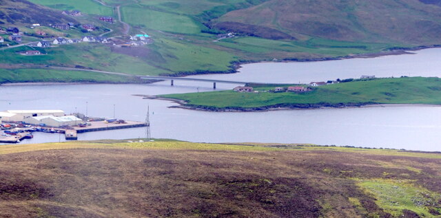
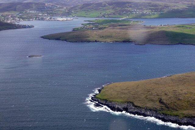
Trondra is a small island located in the Shetland archipelago, off the northern coast of mainland Scotland. With a land area of approximately 4 square kilometers, it is one of the many islands that make up the Shetland Islands. Trondra lies to the west of the larger island of Burra, and is connected to it by a bridge.

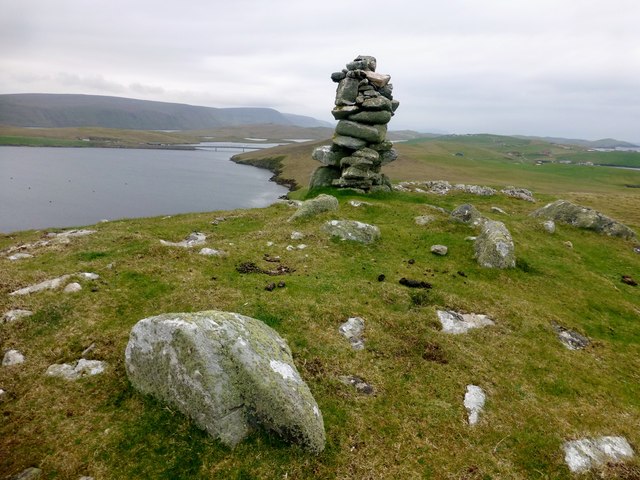
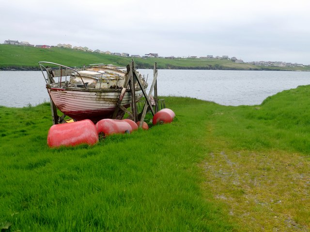
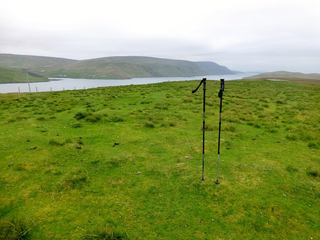
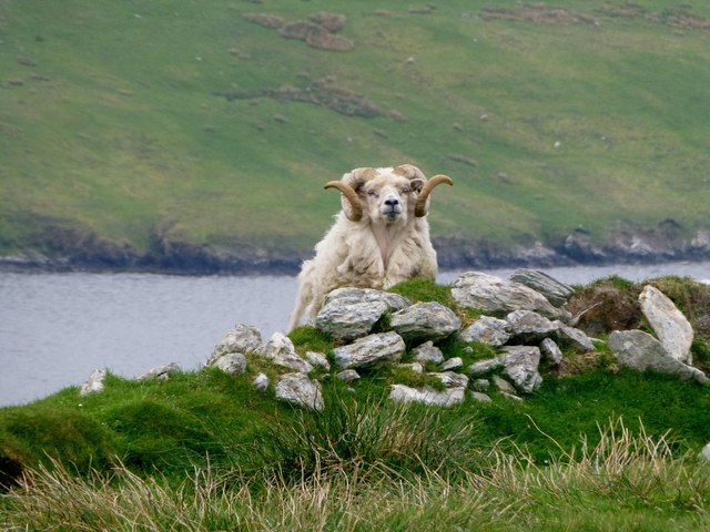
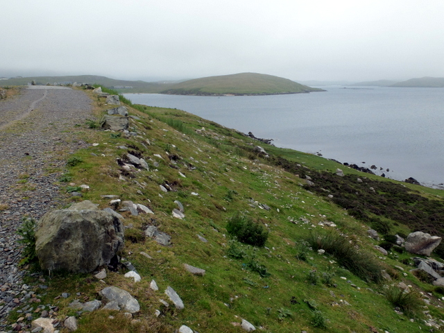
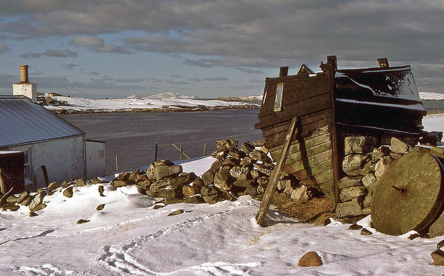
The island is characterized by its rugged and picturesque landscapes, with rolling hills, cliffs, and stunning coastal views. Trondra is primarily composed of peat and heather-covered moorland, providing a habitat for various bird species, such as puffins, gannets, and razorbills. The surrounding waters are teeming with marine life, including seals and otters.

Despite its small size, Trondra has a rich history. The remains of an Iron Age broch, a circular stone tower, can be found on the island, indicating human settlement dating back thousands of years. Trondra was once home to a thriving fishing community, with residents relying on the abundant fish stocks around the island for their livelihoods.

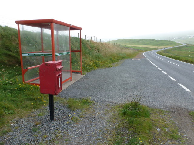
Today, Trondra has a small population, with many residents engaged in traditional industries like fishing and crofting. The island offers a peaceful and idyllic setting, attracting visitors who appreciate its natural beauty and tranquility. Outdoor enthusiasts can enjoy activities such as hiking, birdwatching, and fishing. Trondra is also a popular destination for boat trips, allowing visitors to explore the surrounding waters and spot seals and other wildlife.

Overall, Trondra is a charming island that showcases the rugged beauty and rich history of the Shetland Islands.

If you have any feedback on the listing, please let us know in the comments section below.

Trondra Images

Images are sourced within 2km of 60.115337/-1.2916933 or Grid Reference HU3936. Thanks to Geograph Open Source API. All images are credited.

Trondra bridge from the air
Trondra: postbox № ZE2 55 The postbox serving Trondra stands alongside a bus shelter by a road junction towards the northeast of the island. We are looking along the B9074 back towards Scalloway on the Shetland mainland.
Trondra: postbox № ZE2 55
The postbox serving Trondra stands alongside a bus shelter by a road junction towards the northeast of the island. We are looking along the B9074 back towards Scalloway on the Shetland mainland.
Trondra: pirate scarecrow An unusual scarecrow in a field alongside the B9074.
Trondra: pirate scarecrow
An unusual scarecrow in a field alongside the B9074.
Lang Sound
Lang Sound
Bruna Ness Bagged with Tricky Speirs with view towards the bridge that connect Trondra to West Burra.
Name: Bruna Ness
Hill number: 104041
Height: 59m / 194ft
Area:22: Shetland Islands
Class:0
Grid ref: HU382368 (est)
Drop: 43m
Col: 16m
Bruna Ness
Bagged with Tricky Speirs with view towards the bridge that connect Trondra to West Burra. Name: Bruna Ness Hill number: 104041 Height: 59m / 194ft Area:22: Shetland Islands Class:0 Grid ref: HU382368 (est) Drop: 43m Col: 16m
Old Boat Near Setter Old boat near hamlet of Setter with view across to Hamnavoe.
Old Boat Near Setter
Old boat near hamlet of Setter with view across to Hamnavoe.
Trondra, Island High Point Bagged with Tricky Speirs.
Name:Trondra
Hill number: 104032
Height: 61m / 200ft
Area:22: Shetland Islands
Class: 0
Grid ref: HU395363 (est)
Drop: 61m
Col: Sea
Trondra, Island High Point
Bagged with Tricky Speirs. Name:Trondra Hill number: 104032 Height: 61m / 200ft Area:22: Shetland Islands Class: 0 Grid ref: HU395363 (est) Drop: 61m Col: Sea
Shetland Ram This was as close as I got to this nervous Shetland ram grazing in the field that contain the island high point of Tronda.
Shetland Ram
This was as close as I got to this nervous Shetland ram grazing in the field that contain the island high point of Tronda.
Maa Ness A small promontory on the north side of the entry to Scalloway.
Maa Ness
A small promontory on the north side of the entry to Scalloway.
West Burra The road bridge and Hamnavoe, seen from Scrae Field.
West Burra
The road bridge and Hamnavoe, seen from Scrae Field.
Setter, Burra Isle The old boat serves as a chicken hut and an old millstone lies abandoned in this crofter's yard. The houses of Hamnavoe are visible and in the distance is the snow-clad island of Foula.
Setter, Burra Isle
The old boat serves as a chicken hut and an old millstone lies abandoned in this crofter's yard. The houses of Hamnavoe are visible and in the distance is the snow-clad island of Foula.
The bridge to Hamnavoe Viewed from  aflight en-route from Lerwick to Fair Isle.
The bridge to Hamnavoe
Viewed from aflight en-route from Lerwick to Fair Isle.
Cauldhame Viewed from a plane en-route from Lerwick to Fair Isle.
Cauldhame
Viewed from a plane en-route from Lerwick to Fair Isle.
Green Holm and Merry Holm from the air
Merry Holm from the air
Bruna Ness, Burra, from the air
Bruna Ness, Burra, and Trondra from the air
Burra Bridge from the air
Show me another place!

Trondra is located at Grid Ref: HU3936 (Lat: 60.115337, Lng: -1.2916933)

Unitary Authority: Shetland Islands

Police Authority: Highlands and Islands

What 3 Words

///crossword.fists.lunges. Near Scalloway, Shetland Islands

Nearby Locations

Ayre of Sandwick Trondra

Related Wikis

Trondra

Trondra (Scots: Trondra) is one of the Scalloway Islands, a subgroup of the Shetland Islands in Scotland. It shelters the harbour of Scalloway and has...
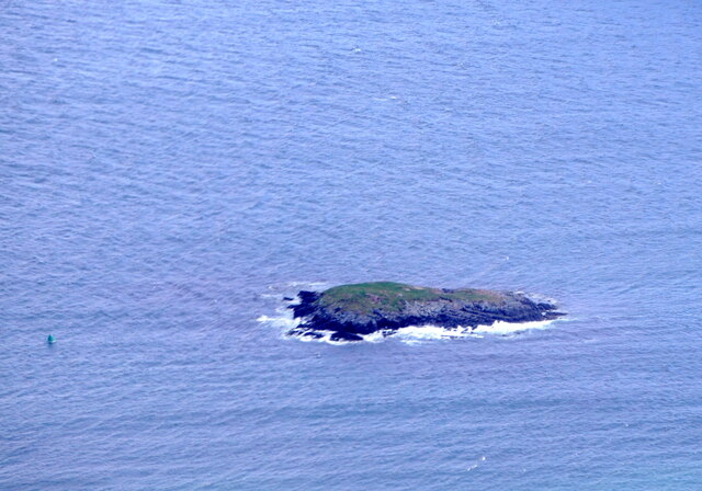
Green Holm

Green Holm, (HU382379), is a small uninhabited island 500 metres north of Burra Ness at the north end of the island of Burra and on the west side of the...

Cutts, Shetland

Cutts is a settlement in the Shetland Islands, United Kingdom. It is on the island of Trondra off the west coast of Shetland Mainland. The B9074 crosses...
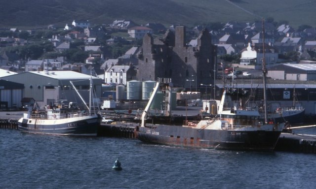
Scalloway

Scalloway (Old Norse: Skálavágr, "bay with the large house(s)") is the largest settlement on the west coast of the Mainland, the largest island of the...

Scalloway Museum

Scalloway Museum is a local museum in Scalloway, Shetland. The museum has collections that cover the history of the Shetland Islands as well as historical...
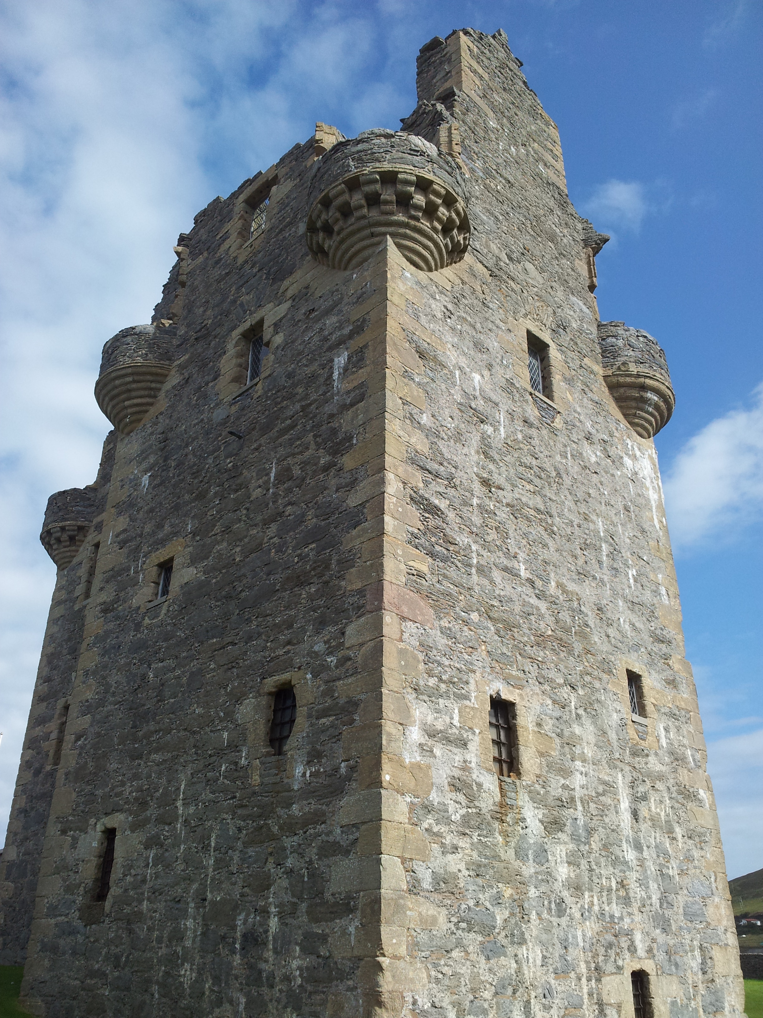
Scalloway Castle

Scalloway Castle is a tower house in Scalloway, on the Shetland Mainland, the largest island in the Shetland Islands of Scotland. The tower was built in...

East Burra

East Burra (Scots: East Burra; Old Norse: "Barrey") is one of the Scalloway Islands, a subgroup of the Shetland Islands in Scotland. It is connected by...

Papa, Shetland

Papa (Scots: Papa; Old Norse: Papey, meaning "the island of the priests") is an uninhabited island in the Scalloway Islands, Shetland, Scotland. Papa lies...

Nearby Amenities

Located within 500m of 60.115337,-1.2916933
Power: pole
Lat/Long: 60.1112021/-1.2926102
Power: pole
Lat/Long: 60.1117501/-1.2924224
Power: pole
Lat/Long: 60.1128059/-1.2920469
Power: pole
Lat/Long: 60.1135865/-1.2918511
Power: pole
Lat/Long: 60.1142093/-1.2916902
Power: pole
Lat/Long: 60.1149096/-1.2914836
Power: pole
Lat/Long: 60.1156393/-1.2909821
Power: pole
Lat/Long: 60.1163729/-1.2904242
Power: pole
Lat/Long: 60.117148/-1.289869
Power: pole
Lat/Long: 60.1177374/-1.2896785
Power: pole
Lat/Long: 60.1182024/-1.2894961
Power: pole
Lat/Long: 60.1187155/-1.2893137
Power: pole
Lat/Long: 60.119361/-1.2890911
Power: pole
Lat/Long: 60.1158228/-1.2963852
Power: pole
Lat/Long: 60.1161099/-1.2949426
Power: pole
Lat/Long: 60.1163475/-1.2937858
Power: pole
Lat/Long: 60.1166196/-1.2924654
Power: pole
Lat/Long: 60.1168826/-1.2911404
Power: pole
Lat/Long: 60.1171868/-1.2890826
Power: pole
Lat/Long: 60.1172316/-1.2881055
The data included in this document is from www.openstreetmap.org. The data is made available under ODbL.

Have you been to Trondra?

Leave your review of Trondra below (or comments, questions and feedback).