The Burrier
Island in Shetland
Scotland
The Burrier
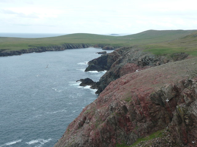
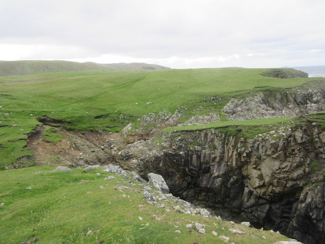
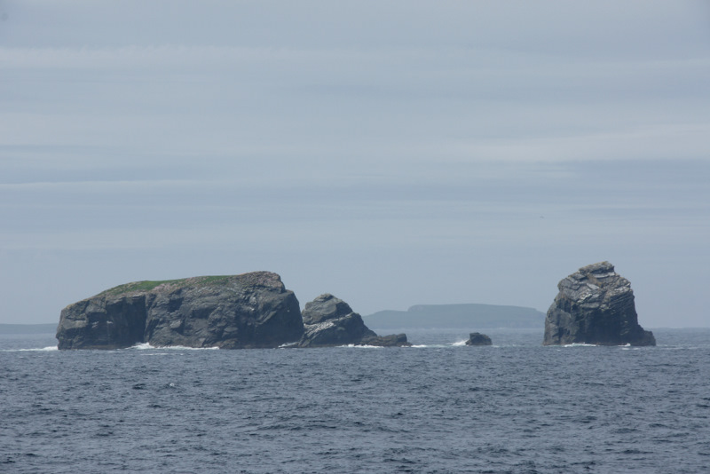
The Burrier is a small island located in the Shetland archipelago, which is part of Scotland. It is situated off the west coast of Mainland Shetland, the largest island in the group. The Burrier covers an area of around 0.15 square kilometers and is predominantly made up of rugged cliffs and rocky outcrops.
This uninhabited island is known for its diverse birdlife, with numerous species of seabirds calling it home. Visitors to The Burrier can witness colonies of puffins, guillemots, and razorbills nesting on the cliffs. The island also provides an important habitat for other marine birds, such as fulmars and kittiwakes.
Access to The Burrier is primarily by boat, with visitors often taking guided tours or joining birdwatching excursions. Its remote location and untouched natural beauty make it a popular destination for nature enthusiasts and photographers. The island offers breathtaking views of the surrounding sea and coastline, providing ample opportunities for capturing stunning landscapes.
Due to its protected status, camping and overnight stays are not permitted on The Burrier. This ensures the preservation of the island's fragile ecosystem and allows the birds to breed undisturbed. However, day trips are encouraged, allowing visitors to experience the unique wildlife and tranquility of this remote Shetland island.
Overall, The Burrier is a haven for bird lovers and those seeking a peaceful retreat in the midst of nature's beauty. Its untouched landscapes and abundant birdlife make it a must-visit destination for anyone exploring the Shetland Islands.
If you have any feedback on the listing, please let us know in the comments section below.
The Burrier Images
Images are sourced within 2km of 60.615709/-1.4284428 or Grid Reference HU3192. Thanks to Geograph Open Source API. All images are credited.


The Burrier is located at Grid Ref: HU3192 (Lat: 60.615709, Lng: -1.4284428)
Unitary Authority: Shetland Islands
Police Authority: Highlands and Islands
What 3 Words
///avoid.lifeboats.trains. Near Ulsta, Shetland Islands
Nearby Locations
Related Wikis

Uyea, Northmavine
Uyea (Scots: Öya in Shetland dialect spelling) is an uninhabited tidal island located to the northwest of Mainland, Shetland. Uyea lies off the Northmavine...

North Roe
North Roe is a village, and protected area at the northern tip in the large Northmavine peninsula of the Mainland of Shetland, Scotland. It is a small...

Fethaland
Fethaland or Fedeland (pronounced [ˈfeɪdələnd]) is an abandoned settlement at the extreme north end of Mainland, Shetland. It was the site of the largest...

Lang Ayre
The Lang Ayre is a beach on the west side of Ronas Hill, Northmavine, Shetland. At 1 kilometre (0.6 mi) in length it is the archipelago's longest. It is...

Gruney
Gruney is a small, uninhabited island in Shetland, Scotland. It lies north of the Northmavine peninsula of the Shetland Mainland, from which it is separated...
Ramna Stacks
The Ramna Stacks are a group of skerries in the Shetland islands. They are north of the northern tip of Mainland, and along with nearby Gruney they are...

Ronas Hill
Ronas Hill (or Rönies Hill) is a hill in Shetland, Scotland. It is classed as a Marilyn, and is the highest point in the Shetland Islands at an elevation...

Muckle Holm, Yell Sound
Muckle Holm is a small island in Shetland. It is in Yell Sound, near the Northmavine. It is 23 metres (75 ft) at its highest point. There is a lighthouse...
Have you been to The Burrier?
Leave your review of The Burrier below (or comments, questions and feedback).