The Holm
Coastal Feature, Headland, Point in Shetland
Scotland
The Holm

The Holm is a prominent coastal feature located in the Shetland Islands, an archipelago off the northeast coast of Scotland. It is specifically situated on the western coast of the mainland Shetland, near the village of Walls.
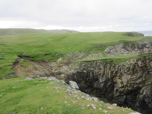
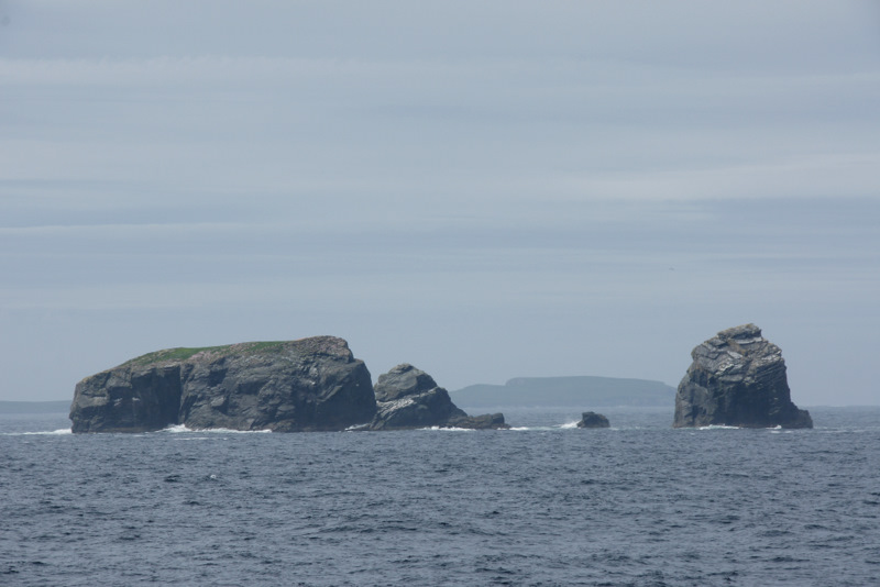
The Holm is classified as a headland or point, which refers to a narrow strip of land that extends out into the sea. It is characterized by its rugged and rocky terrain, with towering cliffs that overlook the North Atlantic Ocean. The cliffs are composed of various geological formations, including sandstone and shale, which have been shaped by years of erosion caused by the relentless crashing waves.
Atop The Holm, visitors can enjoy breathtaking panoramic views of the surrounding landscape. To the north, they can witness the vast expanse of the ocean, while to the south, they can admire the picturesque coastline with its pristine beaches and charming fishing villages. The area is also rich in wildlife, providing opportunities for birdwatching enthusiasts to spot a variety of seabirds, including puffins, kittiwakes, and fulmars.
The Holm is not only a natural attraction but also holds historical significance. It was once home to an Iron Age fort, serving as a defensive structure for the ancient inhabitants of Shetland. Today, remnants of this fort can still be seen, adding an intriguing archaeological element to the site.
Overall, The Holm is a captivating coastal feature that showcases the raw beauty and rich history of the Shetland Islands.
If you have any feedback on the listing, please let us know in the comments section below.
The Holm Images
Images are sourced within 2km of 60.616714/-1.417975 or Grid Reference HU3192. Thanks to Geograph Open Source API. All images are credited.


The Holm is located at Grid Ref: HU3192 (Lat: 60.616714, Lng: -1.417975)
Unitary Authority: Shetland Islands
Police Authority: Highlands and Islands
What 3 Words
///verb.prepare.shifters. Near Ulsta, Shetland Islands
Nearby Locations
Related Wikis

Uyea, Northmavine
Uyea (Scots: Öya in Shetland dialect spelling) is an uninhabited tidal island located to the northwest of Mainland, Shetland. Uyea lies off the Northmavine...

North Roe
North Roe is a village, and protected area at the northern tip in the large Northmavine peninsula of the Mainland of Shetland, Scotland. It is a small...

Fethaland
Fethaland or Fedeland (pronounced [ˈfeɪdələnd]) is an abandoned settlement at the extreme north end of Mainland, Shetland. It was the site of the largest...

Gruney
Gruney is a small, uninhabited island in Shetland, Scotland. It lies north of the Northmavine peninsula of the Shetland Mainland, from which it is separated...

Lang Ayre
The Lang Ayre is a beach on the west side of Ronas Hill, Northmavine, Shetland. At 1 kilometre (0.6 mi) in length it is the archipelago's longest. It is...
Ramna Stacks
The Ramna Stacks are a group of skerries in the Shetland islands. They are north of the northern tip of Mainland, and along with nearby Gruney they are...

Muckle Holm, Yell Sound
Muckle Holm is a small island in Shetland. It is in Yell Sound, near the Northmavine. It is 23 metres (75 ft) at its highest point. There is a lighthouse...

Ronas Hill
Ronas Hill (or Rönies Hill) is a hill in Shetland, Scotland. It is classed as a Marilyn, and is the highest point in the Shetland Islands at an elevation...
Have you been to The Holm?
Leave your review of The Holm below (or comments, questions and feedback).