Isle of Gunnister

Island in Shetland

Scotland

Isle of Gunnister

Gunnister Voe
Gunnister Voe Credit: David Purchase

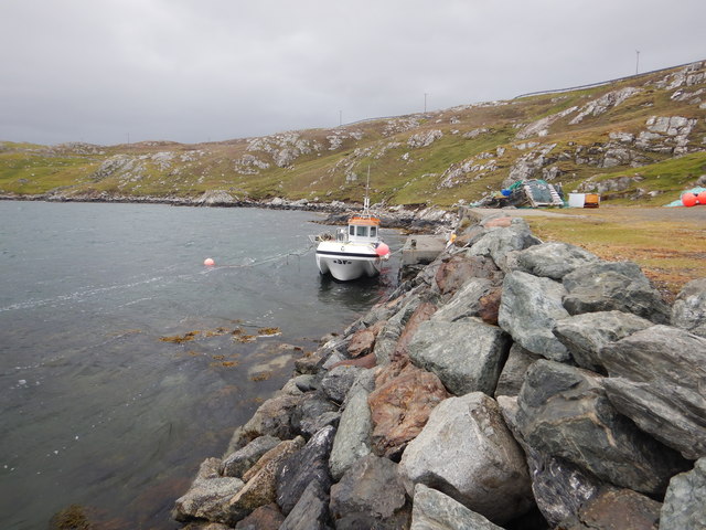
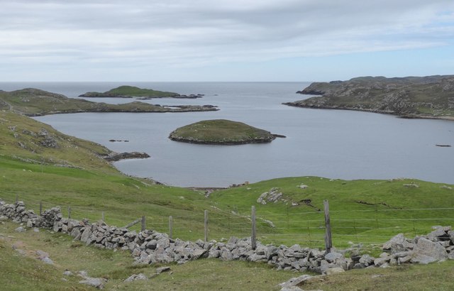
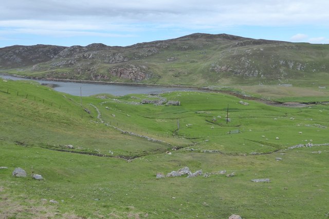
The Isle of Gunnister is a small island located in the Shetland archipelago, which lies off the northeastern coast of Scotland. It is situated in the North Atlantic Ocean, approximately 50 miles north of the Scottish mainland. The island is only accessible by boat, and it covers an area of around 0.4 square miles.

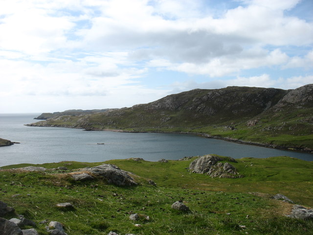
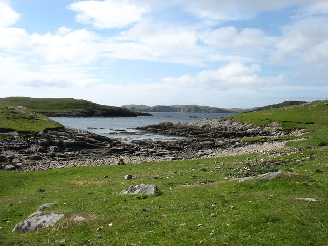
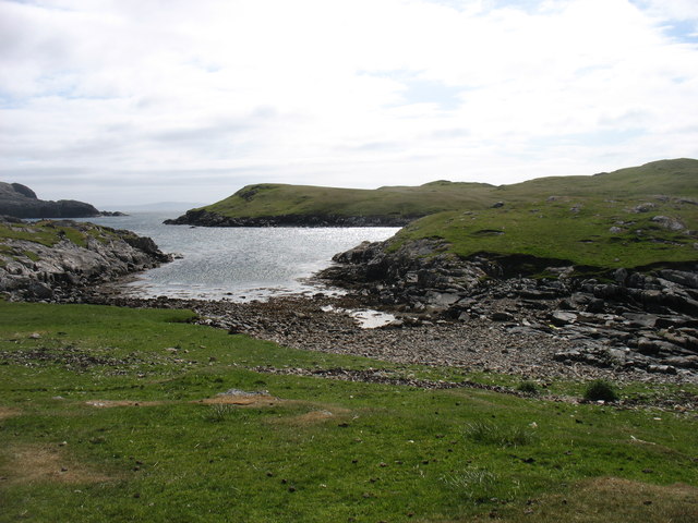
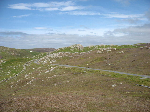
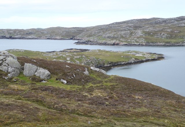
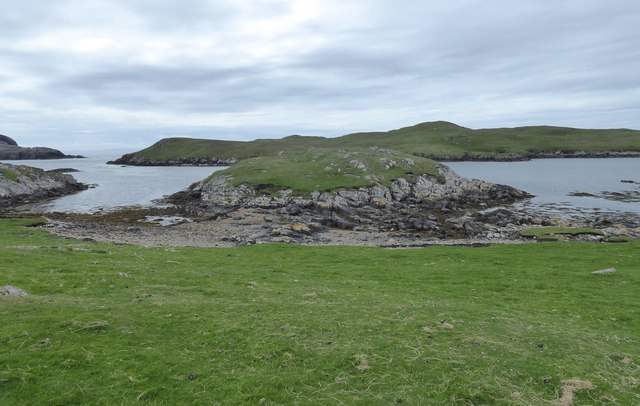
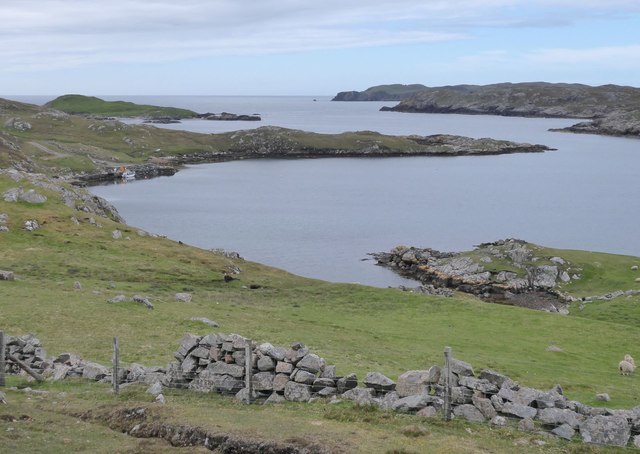
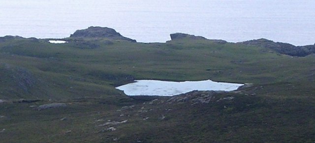
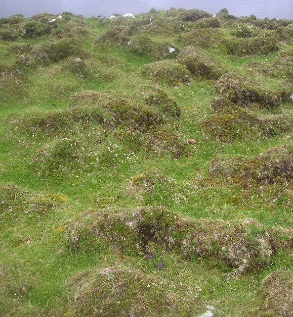
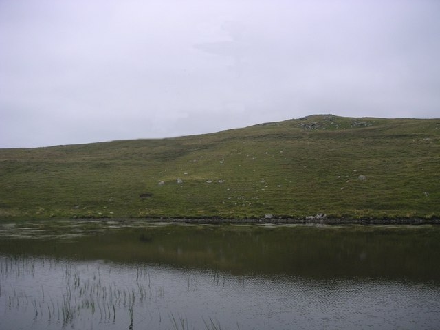
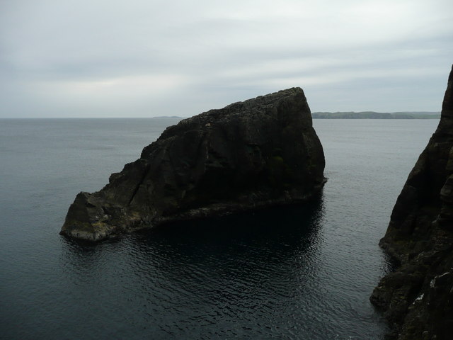
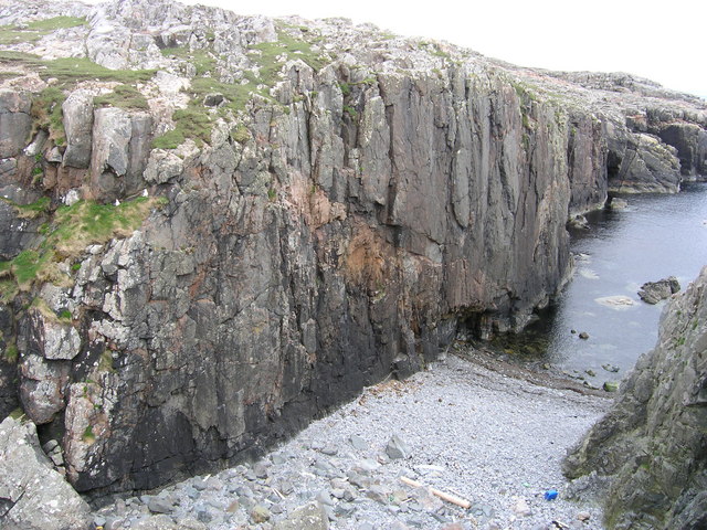
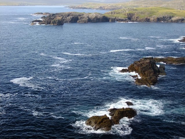
Gunnister Island is known for its rugged and unspoiled natural beauty. It features a diverse landscape, including rocky cliffs, sandy beaches, and rolling hills. The island is home to a variety of wildlife, such as seabirds, seals, and otters. The surrounding waters are rich in marine life and are popular among anglers and divers.

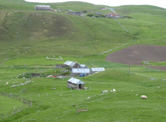
The island has a rich history, with evidence of human habitation dating back thousands of years. The most notable historical site on the Isle of Gunnister is the Gunnister Man, a well-preserved 17th-century body found in a peat bog. The island is also home to the ruins of an ancient chapel and a Viking burial ground, showcasing its Norse heritage.

Today, the Isle of Gunnister is a popular destination for those seeking a tranquil and remote getaway. Visitors can enjoy walking along the island's scenic trails, exploring its archaeological sites, and experiencing the unique flora and fauna. The island offers a sense of seclusion and tranquility, making it a haven for nature lovers and those seeking a peaceful retreat.

If you have any feedback on the listing, please let us know in the comments section below.

Isle of Gunnister Images

Images are sourced within 2km of 60.446205/-1.4546107 or Grid Reference HU3073. Thanks to Geograph Open Source API. All images are credited.

Gunnister Voe
Gunnister Voe
North Sound, Nibon The northern end of the Isle of Nibon is on the left, with the Ness of Hillswick in the distance.
North Sound, Nibon
The northern end of the Isle of Nibon is on the left, with the Ness of Hillswick in the distance.
The Isle of Nibon With South Sound to the left of the photo.
The Isle of Nibon
With South Sound to the left of the photo.
The lane from Nibon One of many minor cul-de-sacs branching off from the A970, the main road running north/south along the spine of Shetland Mainland.
The lane from Nibon
One of many minor cul-de-sacs branching off from the A970, the main road running north/south along the spine of Shetland Mainland.
Fish farm boat, Gunnista Voe A rather steep and rough track (I'd have attempted it in a Mini in my youth, but rather more circumspect in middle age, high clearance 4-wheel drive seemed a better idea) reaches this small quay on Gunnista Voe, which is occupied by fish farming installations. We were prospecting for a place to put on with sea kayaks, and this seemed a little too awkward, though it was the only place near the water with adequate parking in the vicinity.
Fish farm boat, Gunnista Voe
A rather steep and rough track (I'd have attempted it in a Mini in my youth, but rather more circumspect in middle age, high clearance 4-wheel drive seemed a better idea) reaches this small quay on Gunnista Voe, which is occupied by fish farming installations. We were prospecting for a place to put on with sea kayaks, and this seemed a little too awkward, though it was the only place near the water with adequate parking in the vicinity.
Valliers Ness In Gunnister Voe.
Valliers Ness
In Gunnister Voe.
Holm of Nibon At low tide, with the Isle of Nibon beyond the South Sound.
Holm of Nibon
At low tide, with the Isle of Nibon beyond the South Sound.
Field at Snowbuil On Gunnister Voe.
Field at Snowbuil
On Gunnister Voe.
Looking down Gunnister Voe Holm of Gunnister in the centre.
Looking down Gunnister Voe
Holm of Gunnister in the centre.
Gruna A deserted croft at the head of Gunnister Voe.
Gruna
A deserted croft at the head of Gunnister Voe.
Gunnister At the head of Gunnister Voe.
In a green and sheltered valley.
Gunnister
At the head of Gunnister Voe. In a green and sheltered valley.
Snapa Water Shallow weedy lochan.
Snapa Water
Shallow weedy lochan.
Weathered Peat West Mill loch of Hamar, peculiar weathered peat formation.
Weathered Peat
West Mill loch of Hamar, peculiar weathered peat formation.
West Mill loch of Hamar View from west bay with reeds and weed beds
West Mill loch of Hamar
View from west bay with reeds and weed beds
Moo Stack, Nibon There's some great climbing on the crags where the photographer is climbing.
Moo Stack, Nibon
There's some great climbing on the crags where the photographer is climbing.
Medusa Walls, Hamar Medusa isn't the local name for the geo, it doesn't appear to have one. The wall was named Medusa from the name of a climb that takes the wall just above the start of the beach at the sea line. It was first climbed in 2005 on the day this photo was taken.
Medusa Walls, Hamar
Medusa isn't the local name for the geo, it doesn't appear to have one. The wall was named Medusa from the name of a climb that takes the wall just above the start of the beach at the sea line. It was first climbed in 2005 on the day this photo was taken.
Oe Stack from the south If you go to the edge of the cliff and sit with your legs dangling over the edge, it is possible to get the geograph!
Oe Stack from the south
If you go to the edge of the cliff and sit with your legs dangling over the edge, it is possible to get the geograph!
Salmon Farms at Gunnister Voe Sea farming at Gunnister voe, Northmavine, viewed from the South across to the hill of birkavid
Salmon Farms at Gunnister Voe
Sea farming at Gunnister voe, Northmavine, viewed from the South across to the hill of birkavid
Show me another place!

Isle of Gunnister is located at Grid Ref: HU3073 (Lat: 60.446205, Lng: -1.4546107)

Unitary Authority: Shetland Islands

Police Authority: Highlands and Islands

What 3 Words

///pool.crescendo.roosters. Near Brae, Shetland Islands

Related Wikis

Gunnister

Gunnister is a small 'abandoned' village at the North-West Mainland in Shetland, Scotland. It is most commonly known for the Gunnister Man - the remains...

Punds Water

Punds Water is a freshwater loch near Mangaster in Northmavine, Shetland. It also gives its name to a nearby Neolithic heel-shaped cairn. == Heel-shaped... ==

Hillswick

Hillswick is a small village in Northmavine, on the shore of the Atlantic Ocean and lies to the north-north west of Mainland, Shetland, the most northerly...

The Drongs

The Drongs are a group of sea stacks off the coast of Hillswick Ness, Northmavine, Shetland, Scotland. They lie to the west of the Isle of Westerhouse...

Sullom

Sullom is a village on the Shetland peninsula of Northmavine, between Haggrister and Bardister. It lies on the northwest side of Sullom Voe, to which it...

Eela Water

Eela Water is a freshwater loch (lake) in Northmavine, part of the mainland of Shetland in Scotland. Besides being a freshwater fishing location, the site...

Assater

Assater (also spelled Assetter) is a hamlet on Mainland, in Shetland, Scotland. Assater is situated in the parish of Northmaven. It is about 1.3 miles...

Mavis Grind

Mavis Grind (Old Norse: Mæfeiðs grind or Mæveiðs grind, meaning "gate of the narrow isthmus") is a narrow isthmus joining the Northmavine peninsula to...

Have you been to Isle of Gunnister?

Leave your review of Isle of Gunnister below (or comments, questions and feedback).