Vementry

Island in Shetland

Scotland

Vementry

Northra Voe A boat heads back out into Northra Voe after dropping off a passenger at the small floating pontoon. The WW1 guns on Swarbacks Head can be seen in the distance.
Northra Voe Credit: David Nicolson

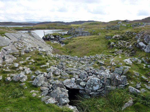
Vementry is a small island located in the Shetland archipelago, off the northeast coast of Scotland. It is situated between the islands of Whalsay and Yell, and covers an area of approximately 2.5 square kilometers. The island is characterized by its rugged and hilly terrain, with its highest point reaching about 88 meters above sea level.

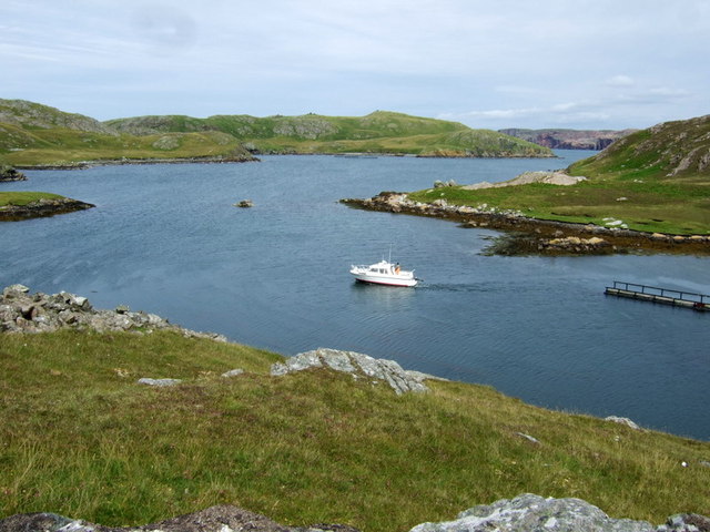
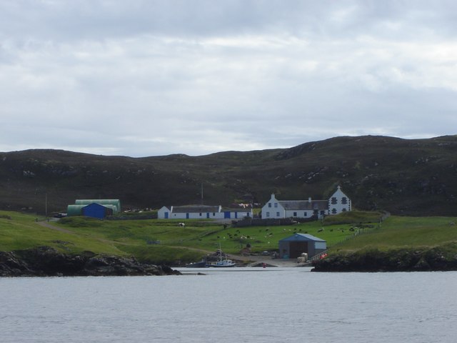
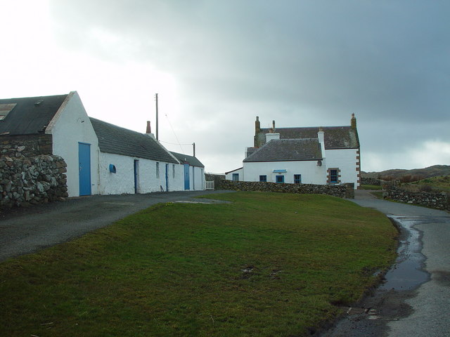
Vementry is mostly uninhabited, with only a few scattered houses and farms. The island has a small population that primarily engages in farming and fishing activities. The coastline of Vementry is indented with several small bays and inlets, providing ample opportunities for boating and fishing enthusiasts.

The island is known for its rich wildlife and natural beauty. It is home to a variety of bird species, including puffins, guillemots, and fulmars, making it a popular destination for birdwatching. Seals and otters can also be spotted along the shores of Vementry.

Access to Vementry is primarily by boat, as there are no bridges or regular ferry services connecting it to the mainland. The nearest ferry terminal is in the neighboring island of Yell, from where visitors can arrange private boat trips to Vementry.

Overall, Vementry offers a tranquil and secluded retreat for nature lovers and those seeking to explore the unspoiled beauty of the Shetland Islands. Its untouched landscapes, abundant wildlife, and peaceful atmosphere make it a hidden gem in this remote corner of Scotland.

If you have any feedback on the listing, please let us know in the comments section below.

Vementry Images

Images are sourced within 2km of 60.327188/-1.4643642 or Grid Reference HU2960. Thanks to Geograph Open Source API. All images are credited.

Northra Voe A boat heads back out into Northra Voe after dropping off a passenger at the small floating pontoon. The WW1 guns on Swarbacks Head can be seen in the distance.
Northra Voe
A boat heads back out into Northra Voe after dropping off a passenger at the small floating pontoon. The WW1 guns on Swarbacks Head can be seen in the distance.
Un-named loch, Vementry Isle A perfect loch, with Cow Head, the Holms of Uyea Sound, and the coastline of Shetland Mainland in the background, as seen from the chambered cairn, Vementry.
Un-named loch, Vementry Isle
A perfect loch, with Cow Head, the Holms of Uyea Sound, and the coastline of Shetland Mainland in the background, as seen from the chambered cairn, Vementry.
Chambered Cairn, Muckle Ward, Vementry Isle This looks like any other cairn from this angle, but see another picture I have posted which shows the chamber.
Chambered Cairn, Muckle Ward, Vementry Isle
This looks like any other cairn from this angle, but see another picture I have posted which shows the chamber.
Chambered Cairn entrance, Vementry Isle Apparently the body of the deceased was laid OUTSIDE the chamber, for the eagles to consume the flesh, and the bones were then placed inside the chamber.  The original eco-burial.
Chambered Cairn entrance, Vementry Isle
Apparently the body of the deceased was laid OUTSIDE the chamber, for the eagles to consume the flesh, and the bones were then placed inside the chamber. The original eco-burial.
Northra Voe from Muckle Ward, Vementry Isle Across the Voe you can see the western section of the island of Vementry, and beyond it, on the horizon, the island of Papa Stour.
Northra Voe from Muckle Ward, Vementry Isle
Across the Voe you can see the western section of the island of Vementry, and beyond it, on the horizon, the island of Papa Stour.
Swarbacks Head from Muckla Ward, Vementry Isle Note the black dots on the horizon - these are guns dating from the First World War.
Swarbacks Head from Muckla Ward, Vementry Isle
Note the black dots on the horizon - these are guns dating from the First World War.
Swarbacks Skerry The northern tip of Vementry Isle.
Swarbacks Skerry
The northern tip of Vementry Isle.
Weedy Vementry Lochan Small weedy lochan at HU 286 611 on Vementry.
Weedy Vementry Lochan
Small weedy lochan at HU 286 611 on Vementry.
Ness at Scarva Clett, Vementry Isle
South Voe, with ruined building Vementry Isle is no longer inhabited, but here is an example of evidence that people lived here relatively recently.
South Voe, with ruined building
Vementry Isle is no longer inhabited, but here is an example of evidence that people lived here relatively recently.
Beach at Scarva Clett, Vementry Isle The cairn on Cow Head can also be seen.
Beach at Scarva Clett, Vementry Isle
The cairn on Cow Head can also be seen.
Holms of Uyea Sound The northern part of Cow Head is on the left, with the islands to the centre and right of the image.
Holms of Uyea Sound
The northern part of Cow Head is on the left, with the islands to the centre and right of the image.
Beach at Lamba Wick, Vementry Isle
Gruna Isle Looking out Southra Voe on Vementry to the small isle of Gruna with the Face of the Neaans behind it.
Gruna Isle
Looking out Southra Voe on Vementry to the small isle of Gruna with the Face of the Neaans behind it.
Maa Loch brig A fine stone brig over the short outflow burn from the Maa Loch into sheltered Peerie Voe.
Maa Loch brig
A fine stone brig over the short outflow burn from the Maa Loch into sheltered Peerie Voe.
Buildings at Vementry, Shetland These buildings are on the Shetland Mainland.  The uninhabited Isle of Vementry is close by, across the sound.
Buildings at Vementry, Shetland
These buildings are on the Shetland Mainland. The uninhabited Isle of Vementry is close by, across the sound.
Vementry, Shetland Farmhouse and farmbuildings at Vementry.
Vementry, Shetland
Farmhouse and farmbuildings at Vementry.
North Loch of Hostigates, Shetland There are two neighbouring lochs shown as 'Lochs of Hostigates' at Braewick, near Aith. This is the more northerly of the two.
North Loch of Hostigates, Shetland
There are two neighbouring lochs shown as 'Lochs of Hostigates' at Braewick, near Aith. This is the more northerly of the two.
Show me another place!

Vementry is located at Grid Ref: HU2960 (Lat: 60.327188, Lng: -1.4643642)

Unitary Authority: Shetland Islands

Police Authority: Highlands and Islands

What 3 Words

///glider.booms.cabs. Near Aith, Shetland Islands

Related Wikis

Vementry

Vementry (Old Norse: "Vemunðarey") is an uninhabited Scottish island in Shetland on the north side of the West Mainland, lying south of Muckle Roe. �...

Linga (near Vementry)

Linga is one of the Shetland Islands, near Vementry. It is one of many islands in Shetland called Linga. The island is uninhabited. == Geography and... ==

Brindister, West Mainland

Brindister is a settlement on the West Mainland of Shetland, Scotland. It is within the parish of Sandsting, and on the western shore of Brindister Voe...

Clousta

Clousta is a hamlet on Mainaland, in the island's west, Shetland, Scotland. Approximately seventy people live here, many of whom are commuters, but local...

Nearby Amenities

Located within 500m of 60.327188,-1.4643642
Wreck
Lat/Long: 60.3271666/-1.4661259
The data included in this document is from www.openstreetmap.org. The data is made available under ODbL.

Have you been to Vementry?

Leave your review of Vementry below (or comments, questions and feedback).