Barwick

Settlement in Hertfordshire East Hertfordshire

England

Barwick

The A10 The A10 runs 161 miles from London to King's Lynn. via Cambridge and Ely. 
<span class="nowrap"><a title="http://www.sabre-roads.org.uk/wiki/index.php?title=A10" rel="nofollow ugc noopener" href="http://www.sabre-roads.org.uk/wiki/index.php?title=A10">Link</a><img style="margin-left:2px;" alt="External link" title="External link - shift click to open in new window" src="https://s1.geograph.org.uk/img/external.png" width="10" height="10"/></span>
The A10 Credit: N Chadwick

Barwick is a small village located in the county of Hertfordshire, England. Situated approximately 20 miles north of London, the village is nestled in the green and picturesque countryside that characterizes this region. With a population of around 500 residents, Barwick maintains a close-knit and friendly community atmosphere.

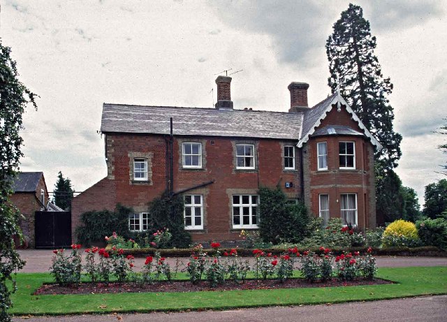
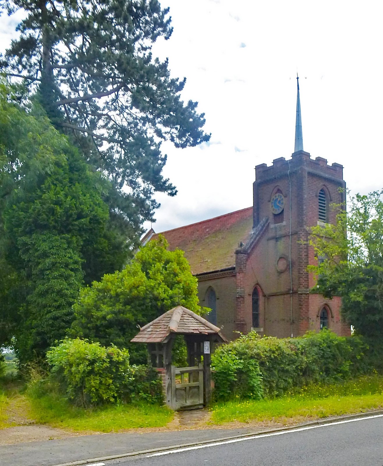
The village is known for its historic charm and beautiful architecture, with many buildings dating back to the 18th and 19th centuries. The St. Mary's Church, a prominent landmark in Barwick, is a stunning example of medieval architecture and attracts visitors interested in history and heritage.

Although small in size, Barwick offers several amenities to its residents. The village has a local pub, The Rose and Crown, which serves as a popular meeting place for locals and visitors alike. Additionally, there is a village hall that hosts various community events and gatherings throughout the year.

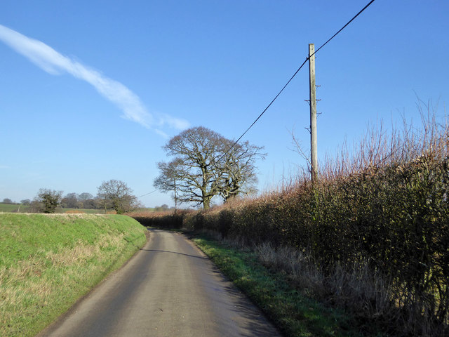
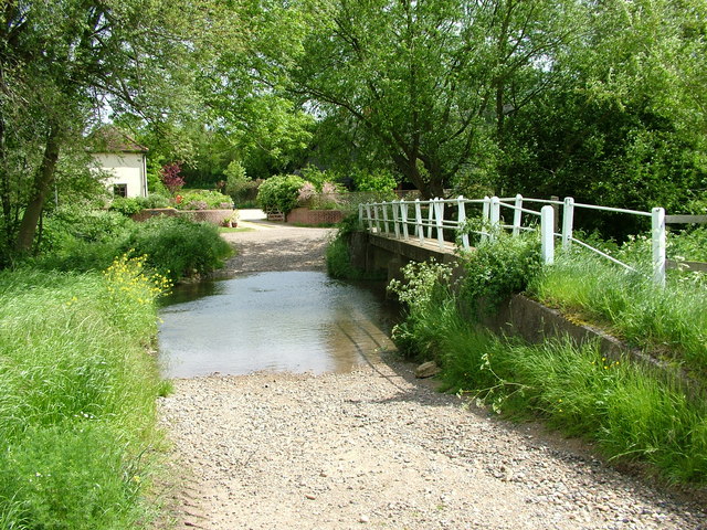
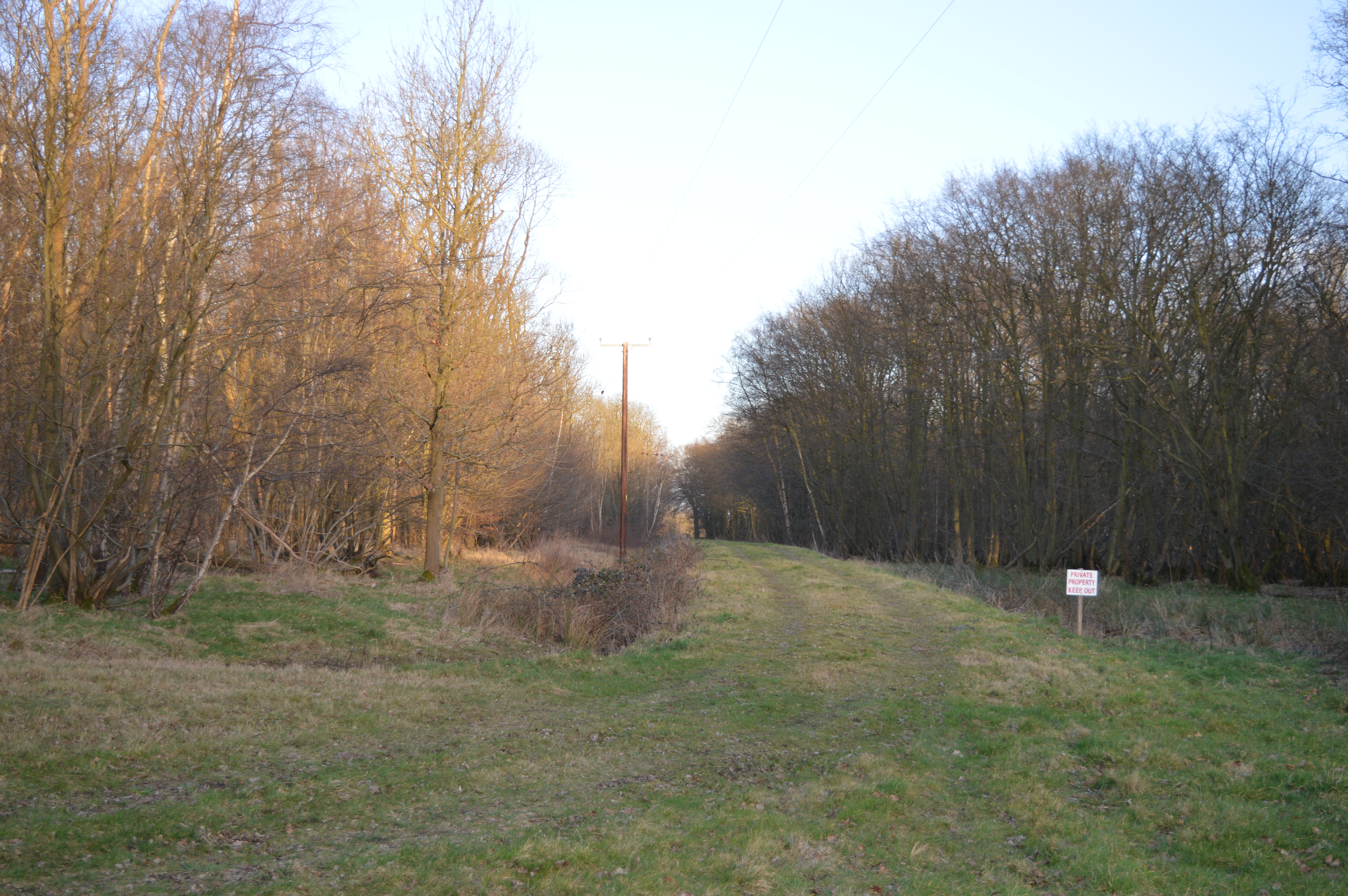
Surrounded by rolling hills and lush green fields, Barwick offers a tranquil and scenic environment for nature lovers. The village is surrounded by beautiful countryside, providing ample opportunities for outdoor activities such as hiking, cycling, and exploring the nearby nature reserves.

Barwick's proximity to larger towns and cities like Hertford and Hatfield ensures that residents have access to a wider range of amenities, including schools, shopping centers, and healthcare facilities.

In summary, Barwick is a picturesque village in Hertfordshire, offering a peaceful and close-knit community atmosphere, stunning architecture, and access to beautiful countryside.

If you have any feedback on the listing, please let us know in the comments section below.

Barwick Images

Images are sourced within 2km of 51.855629/0.008209 or Grid Reference TL3819. Thanks to Geograph Open Source API. All images are credited.

The A10 The A10 runs 161 miles from London to King's Lynn. via Cambridge and Ely. 
<span class="nowrap"><a title="http://www.sabre-roads.org.uk/wiki/index.php?title=A10" rel="nofollow ugc noopener" href="http://www.sabre-roads.org.uk/wiki/index.php?title=A10">Link</a><img style="margin-left:2px;" alt="External link" title="External link - shift click to open in new window" src="https://s1.geograph.org.uk/img/external.png" width="10" height="10"/></span>
The A10
The A10 runs 161 miles from London to King's Lynn. via Cambridge and Ely. LinkExternal link
A10, southbound The A10 runs 161 miles from London to King's Lynn. via Cambridge and Ely. 
<span class="nowrap"><a title="http://www.sabre-roads.org.uk/wiki/index.php?title=A10" rel="nofollow ugc noopener" href="http://www.sabre-roads.org.uk/wiki/index.php?title=A10">Link</a><img style="margin-left:2px;" alt="External link" title="External link - shift click to open in new window" src="https://s1.geograph.org.uk/img/external.png" width="10" height="10"/></span>
A10, southbound
The A10 runs 161 miles from London to King's Lynn. via Cambridge and Ely. LinkExternal link
Houses on Ermine Street, Colliers End These are the first houses coming in from the north. This is the original Roman road now bypassed by the newer A10.
Houses on Ermine Street, Colliers End
These are the first houses coming in from the north. This is the original Roman road now bypassed by the newer A10.
St Mary's Church, Colliers End Redundant. According to this <span class="nowrap"><a title="https://hertfordshirechurches.wordpress.com/2013/05/12/st-mary-colliers-end/" rel="nofollow ugc noopener" href="https://hertfordshirechurches.wordpress.com/2013/05/12/st-mary-colliers-end/">Link</a><img style="margin-left:2px;" alt="External link" title="External link - shift click to open in new window" src="https://s1.geograph.org.uk/img/external.png" width="10" height="10"/></span> the church dates from 1910, and was built to the designs of "the donor of the land Ernest Wickham and the builder Mr C. Pritlove of nearby Wadesmill."
St Mary's Church, Colliers End
Redundant. According to this LinkExternal link the church dates from 1910, and was built to the designs of "the donor of the land Ernest Wickham and the builder Mr C. Pritlove of nearby Wadesmill."
Colliers End village hall Mid 19th-century village hall. Built in 1862 as a Church of England school - as reported at this <span class="nowrap"><a title="http://www.british-history.ac.uk/vch/herts/vol3/pp347-366" rel="nofollow ugc noopener" href="http://www.british-history.ac.uk/vch/herts/vol3/pp347-366">Link</a><img style="margin-left:2px;" alt="External link" title="External link - shift click to open in new window" src="https://s1.geograph.org.uk/img/external.png" width="10" height="10"/></span>.
Colliers End village hall
Mid 19th-century village hall. Built in 1862 as a Church of England school - as reported at this LinkExternal link.
Farmhouse at Fisher's Farm, Colliers End Grade II listed weatherboarded farmhouse: architectural description at this <span class="nowrap"><a title="https://historicengland.org.uk/listing/the-list/list-entry/1102358" rel="nofollow ugc noopener" href="https://historicengland.org.uk/listing/the-list/list-entry/1102358">Link</a><img style="margin-left:2px;" alt="External link" title="External link - shift click to open in new window" src="https://s1.geograph.org.uk/img/external.png" width="10" height="10"/></span>.
Farmhouse at Fisher's Farm, Colliers End
Grade II listed weatherboarded farmhouse: architectural description at this LinkExternal link.
The A10, Colliers End
Layby on the A10, Colliers End
The A10, Colliers End
Northbound A10 Roadworks in the fast lane of the other carriageway.
Northbound A10
Roadworks in the fast lane of the other carriageway.
Lane from Barwick to Puckeridge
Old Milestone by Ermine Street, Colliers End, Standon parish Metal plate attached to stone post by the former A10, in parish of STANDON (EAST HERTFORDSHIRE District), Colliers End, near 'Lamb and Flag' PH, in pavement adjacent to telephone kiosk, on West side of road. Wadesmill plate, erected by the Wadesmill turnpike trust in the 19th century. 

Inscription reads:-
LONDON
25
WARE
4
BUNTINGFORD
6

Grade II listed.  
List Entry Number: 1347490 <span class="nowrap"><a title="https://historicengland.org.uk/listing/the-list/list-entry/1347490" rel="nofollow ugc noopener" href="https://historicengland.org.uk/listing/the-list/list-entry/1347490">Link</a><img style="margin-left:2px;" alt="External link" title="External link - shift click to open in new window" src="https://s1.geograph.org.uk/img/external.png" width="10" height="10"/></span>

Milestone Society National ID: HE_LK25.
Old Milestone by Ermine Street, Colliers End, Standon parish
Metal plate attached to stone post by the former A10, in parish of STANDON (EAST HERTFORDSHIRE District), Colliers End, near 'Lamb and Flag' PH, in pavement adjacent to telephone kiosk, on West side of road. Wadesmill plate, erected by the Wadesmill turnpike trust in the 19th century. Inscription reads:- LONDON 25 WARE 4 BUNTINGFORD 6 Grade II listed. List Entry Number: 1347490 LinkExternal link Milestone Society National ID: HE_LK25.
Arches Hall, Standon, Essex The 1980 winner of The Oaks, Bireme, ridden by Willie Carson, trained by Dick Hern and owned by Richard Hollingsworth was still living when I visited in 2001.  At 2:34:33 she was a very fast runner.
Arches Hall, Standon, Essex
The 1980 winner of The Oaks, Bireme, ridden by Willie Carson, trained by Dick Hern and owned by Richard Hollingsworth was still living when I visited in 2001. At 2:34:33 she was a very fast runner.
Latchford Ford A little used road in the village of Latchford crossing the River Rib.
Latchford Ford
A little used road in the village of Latchford crossing the River Rib.
Dowsett's Farm from Colliers End View across farmland.  Foreground farm equipment draws the eye towards the farm in the distance.  Between, in a cutting, runs the new A10, bypassing wadesmill, High Cross and Colliers End.
Dowsett's Farm from Colliers End
View across farmland. Foreground farm equipment draws the eye towards the farm in the distance. Between, in a cutting, runs the new A10, bypassing wadesmill, High Cross and Colliers End.
Colliers End Village Hall This building, which bears a date of 1862, appears to be a village hall - despite the bell on the roof.  The village church is further down the road.  If anyone has further info - please let me know!
Colliers End Village Hall
This building, which bears a date of 1862, appears to be a village hall - despite the bell on the roof. The village church is further down the road. If anyone has further info - please let me know!
Fishers Farm Farm Buildings adjacent to Ermine Street in Colliers End.
Fishers Farm
Farm Buildings adjacent to Ermine Street in Colliers End.
Show me another place!

Barwick is located at Grid Ref: TL3819 (Lat: 51.855629, Lng: 0.008209)

Administrative County: Hertfordshire

District: East Hertfordshire

Police Authority: Hertfordshire

What 3 Words

///hill.encounter.edges. Near Puckeridge, Hertfordshire

Related Wikis

Barwick, Hertfordshire

Barwick, Great Barwick, and Little Barwick (Berewyk 14th century, and Barrack 19th century) are hamlets in the civil parish of Standon in Hertfordshire...

Plashes Wood

Plashes Wood is a 71.9-hectare (178-acre) biological Site of Special Scientific Interest south of Standon in Hertfordshire. The local planning authority...

Colliers End

Colliers End is a village in the civil parish of Standon, in the East Hertfordshire district, in Hertfordshire, England. It lies upon what was the A10...

Standon Green End

Standon Green End is a hamlet situated just off the A10 road between Ware and Puckeridge in Hertfordshire. At the 2011 Census the population of the hamlet...

Nearby Amenities

Located within 500m of 51.855629,0.008209
Barwick
Created By: YahooApplet 1.0
Place: village
Wikidata: Q4865963
Lat/Long: 51.8566073/0.0078535
Post Box
Collection Times: Mo-Fr 16:45; Sa 11:30
Ref: SG11 89
Lat/Long: 51.856162/0.008642
Addr City: Barwick, Near Ware
Addr Housename: Gunpowder Factory Farm
Lat/Long: 51.8565859/0.0091289
Material: wood
Power: pole
Lat/Long: 51.8587729/0.013159
Material: wood
Power: pole
Lat/Long: 51.8583074/0.0130007
Power: pole
Lat/Long: 51.8528487/0.0113163
Power: pole
Lat/Long: 51.8520484/0.0116247
Power: pole
Lat/Long: 51.8559434/0.0101361
Power: pole
Lat/Long: 51.8547893/0.010577
Power: pole
Lat/Long: 51.8564288/0.0110024
Power: pole
Lat/Long: 51.8569721/0.0118929
Power: pole
Lat/Long: 51.8536188/0.011049
Power: pole
Lat/Long: 51.8543925/0.0107271
The data included in this document is from www.openstreetmap.org. The data is made available under ODbL.

Have you been to Barwick?

Leave your review of Barwick below (or comments, questions and feedback).