Blo Stack

Island in Shetland

Scotland

Blo Stack

Ness of Hillwick Taken from the B9078 between Burnside and Eshaness, Shetland, I am looking across Sand Wick to the Ness of Hillswick. The Isle of Westerhouse is visible just off the Pund of Grevasand to the west of the Ness.
Ness of Hillwick Credit: Carroll Pierce

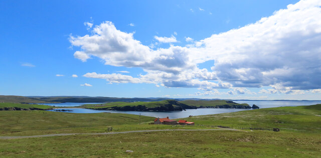
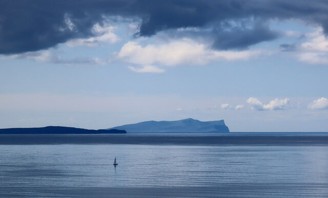
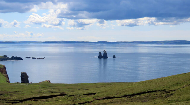
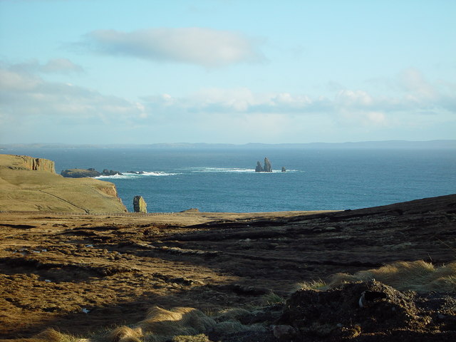
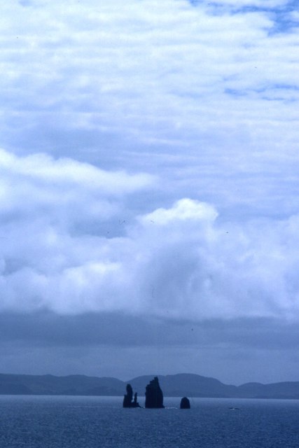
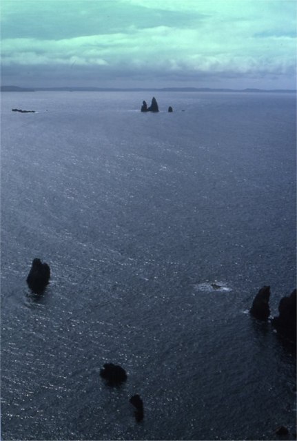
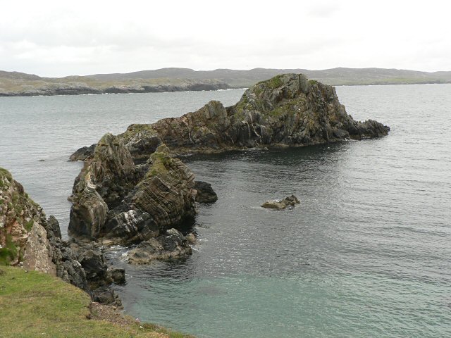
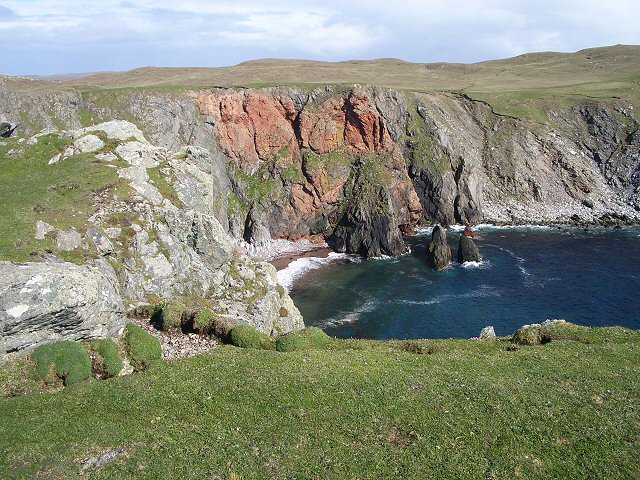
Blo Stack is a prominent natural landmark located on the island of Shetland in Scotland. It is a sea stack that stands tall and solitary, offering a breathtaking sight for visitors. The stack is situated on the western coast of the main island, about 2 kilometers northeast of the village of Hamnavoe.

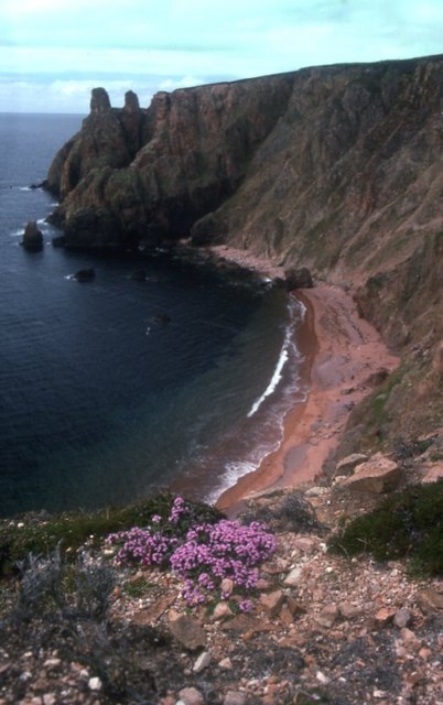
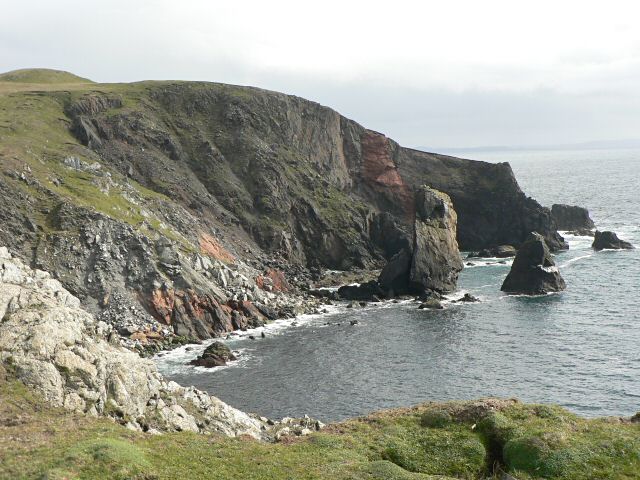
Rising to a height of approximately 60 meters, Blo Stack is composed of rugged, weathered sandstone. Its unique formation is the result of years of erosion caused by the relentless waves of the North Sea. Over time, the stack has become separated from the mainland, creating a distinct and awe-inspiring feature along the coastline.

The area surrounding Blo Stack is rich in biodiversity, with diverse marine life inhabiting the waters below. Seabirds, such as puffins, guillemots, and razorbills, also find sanctuary in the cliffs nearby, making it a popular spot for birdwatchers and nature enthusiasts.

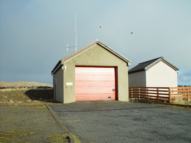
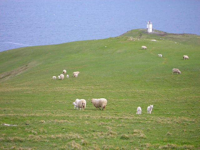
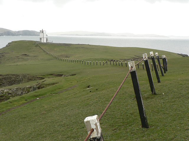
Access to Blo Stack can be reached by road, with parking available nearby. From the designated parking area, visitors can take a short walk along a well-maintained path to a viewing platform that provides an excellent vantage point to admire the stack and its surroundings.

Blo Stack has become an iconic symbol of Shetland's natural beauty and is often photographed and featured in various promotional materials. Its striking appearance and scenic location make it a must-visit destination for those exploring the stunning landscapes of the Shetland Islands.

If you have any feedback on the listing, please let us know in the comments section below.

Blo Stack Images

Images are sourced within 2km of 60.464476/-1.5197474 or Grid Reference HU2675. Thanks to Geograph Open Source API. All images are credited.

Ness of Hillwick Taken from the B9078 between Burnside and Eshaness, Shetland, I am looking across Sand Wick to the Ness of Hillswick. The Isle of Westerhouse is visible just off the Pund of Grevasand to the west of the Ness.
Ness of Hillwick
Taken from the B9078 between Burnside and Eshaness, Shetland, I am looking across Sand Wick to the Ness of Hillswick. The Isle of Westerhouse is visible just off the Pund of Grevasand to the west of the Ness.
Papa Stour and Foula Taken on the B9078 between Burnside and Eshaness, Shetland, I am looking out towards the islands of Papa Stour (left of shot) and Foula beyond.
Papa Stour and Foula
Taken on the B9078 between Burnside and Eshaness, Shetland, I am looking out towards the islands of Papa Stour (left of shot) and Foula beyond.
The Drongs Taken from the B9078 between Burnside and Eshaness, Shetland, I am looking across Sand Wick to the sea stacks known at The Drongs. Papa Stour can be seen in the distance.
The Drongs
Taken from the B9078 between Burnside and Eshaness, Shetland, I am looking across Sand Wick to the sea stacks known at The Drongs. Papa Stour can be seen in the distance.
Hillswick Fire Station, Shetland With local retained firefighters the Hillswick Fire Station is little more than a large garage, just big enough to house the small appliance based on a large van.
Hillswick Fire Station, Shetland
With local retained firefighters the Hillswick Fire Station is little more than a large garage, just big enough to house the small appliance based on a large van.
View over Heads of Grocken, Eshaness, Shetland Looking out over the Heads of Grocken with 'The Drongs' the sea stacks in the distance.
View over Heads of Grocken, Eshaness, Shetland
Looking out over the Heads of Grocken with 'The Drongs' the sea stacks in the distance.
The Drongs Taken from the Heads of Grocken.
The Drongs
Taken from the Heads of Grocken.
Heads of Grocken Small sea-stacks off the Heads of Grocken, with the Drongs in the distance.
Heads of Grocken
Small sea-stacks off the Heads of Grocken, with the Drongs in the distance.
Beach between Heads of Grocken and the Neap
The Quilse
The Quilse
Gordi Stack This is the stack seen edge on. From other directions it looks much wider. In the distance to the right are the Drongs - another dramatic rock formation. See <a href="https://www.geograph.org.uk/photo/550985">HU2675 : The Drongs</a> for an telephoto view.
Gordi Stack
This is the stack seen edge on. From other directions it looks much wider. In the distance to the right are the Drongs - another dramatic rock formation. See HU2675 : The Drongs for an telephoto view.
The Drongs This is an amazing rock formation, as seen from Gordi Stack.
The Drongs
This is an amazing rock formation, as seen from Gordi Stack.
Cliffs and stack The view south from this point is spectacular.

(The stack and the point to the right lie in this grid square, while the cliff to the left is in <a href="https://www.geograph.org.uk/gridref/HU2775">HU2775</a>).
Cliffs and stack
The view south from this point is spectacular. (The stack and the point to the right lie in this grid square, while the cliff to the left is in HU2775).
Sheep near Baa Taing Looking down the sheep pasture towards the lighthouse.
Sheep near Baa Taing
Looking down the sheep pasture towards the lighthouse.
Baa Taing light A rope handrail provides safe access to the light in bad weather. The headland is wide and flat, so the conditions that might require the safety rail defy imagination.
Baa Taing light
A rope handrail provides safe access to the light in bad weather. The headland is wide and flat, so the conditions that might require the safety rail defy imagination.
Lochan and cliffs Looking across the lochan at the south end of Hillswick Ness, backed by the cliffs above Queen Geos.
Lochan and cliffs
Looking across the lochan at the south end of Hillswick Ness, backed by the cliffs above Queen Geos.
Opposite a red cliff Looking across the short turf of this promontory at a red cliff across the bay.
Opposite a red cliff
Looking across the short turf of this promontory at a red cliff across the bay.
Marsh marigolds Looking across a marshy area towards Hillswick. The marsh marigolds currently in flower will be succeeded by the yellow flags behind them, not yet in bud.
Marsh marigolds
Looking across a marshy area towards Hillswick. The marsh marigolds currently in flower will be succeeded by the yellow flags behind them, not yet in bud.
Sheep above Hillswick Looking down on Hillswick from the sheep pasture on Hillswick Ness
Sheep above Hillswick
Looking down on Hillswick from the sheep pasture on Hillswick Ness
Show me another place!

Blo Stack is located at Grid Ref: HU2675 (Lat: 60.464476, Lng: -1.5197474)

Unitary Authority: Shetland Islands

Police Authority: Highlands and Islands

What 3 Words

///sprouts.cuddled.books. Near Brae, Shetland Islands

Related Wikis

The Drongs

The Drongs are a group of sea stacks off the coast of Hillswick Ness, Northmavine, Shetland, Scotland. They lie to the west of the Isle of Westerhouse...

Hillswick

Hillswick is a small village in Northmavine, on the shore of the Atlantic Ocean and lies to the north-north west of Mainland, Shetland, the most northerly...

Tangwick Haa

Tangwick Haa is an historic house and museum in Esha Ness, Northmavine, Shetland. The building has two stories in a rectangular layout and along with the...

Braehoulland

Braehoulland is a hamlet on Mainland, in Shetland, Scotland. Braehoulland is situated within the parish of Northmaven. Eshaness Community Centre is located...

Have you been to Blo Stack?

Leave your review of Blo Stack below (or comments, questions and feedback).