Whittingham Carr

Island in Northumberland

England

Whittingham Carr

Newton Point - former US Navy LORAN site
Newton Point - former US Navy LORAN site Credit: J M Briscoe

Whittingham Carr is a small island located off the coast of Northumberland, England. It is situated in the North Sea, approximately 2 miles east of the town of Whittingham. The island covers an area of around 10 acres and is accessible by boat from the mainland.

Whittingham Carr is known for its stunning natural beauty and diverse wildlife. The island is home to a variety of bird species, including puffins, guillemots, and razorbills, making it a popular destination for birdwatching enthusiasts. Seals can also be spotted along the island's rocky shores.

The landscape of Whittingham Carr is characterized by rugged cliffs, sandy beaches, and lush vegetation. The island boasts a range of habitats, including grasslands, heathlands, and salt marshes, providing a haven for a wide range of flora and fauna.

Visitors to the island can enjoy scenic walks along its coastal paths, taking in breathtaking views of the surrounding sea and mainland. The island is also a great spot for fishing, with an abundance of fish species found in the waters around it.

Whittingham Carr has limited facilities, with no permanent residents or accommodation options. It is primarily a nature reserve, managed by local conservation organizations to protect its unique ecosystem.

Overall, Whittingham Carr offers visitors a peaceful retreat, where they can immerse themselves in the beauty of nature and observe a diverse array of wildlife in their natural habitat.

If you have any feedback on the listing, please let us know in the comments section below.

Whittingham Carr Images

Images are sourced within 2km of 55.531392/-1.6118676 or Grid Reference NU2426. Thanks to Geograph Open Source API. All images are credited.

Newton Point - former US Navy LORAN site
Tern Colony, Beadnell Sand Dunes Beadnell Bay, a sandy beach stretching 3 km (1.8 miles) to the south of the village of Beadnell, contains a nationally-important colony of Little Tern and the largest mainland colony of Arctic Tern in the United Kingdom. The beach was awarded the Blue Flag rural beach award in 2005.
The beach is backed by a series of sand dunes.
Tern Colony, Beadnell Sand Dunes
Beadnell Bay, a sandy beach stretching 3 km (1.8 miles) to the south of the village of Beadnell, contains a nationally-important colony of Little Tern and the largest mainland colony of Arctic Tern in the United Kingdom. The beach was awarded the Blue Flag rural beach award in 2005. The beach is backed by a series of sand dunes.
Beadnell Bay Beach Beadnell Bay, a sandy beach stretching 3 km (1.8 miles) to the south of the village of Beadnell, contains a nationally-important colony of Little Tern and the largest mainland colony of Arctic Tern in the United Kingdom. The beach was awarded the Blue Flag rural beach award in 2005.
The beach is backed by a series of sand dunes.
Beadnell Bay Beach
Beadnell Bay, a sandy beach stretching 3 km (1.8 miles) to the south of the village of Beadnell, contains a nationally-important colony of Little Tern and the largest mainland colony of Arctic Tern in the United Kingdom. The beach was awarded the Blue Flag rural beach award in 2005. The beach is backed by a series of sand dunes.
Embryo Dunes, Beadnell dunes Part of the extensive dune network on the NE coastline
Embryo Dunes, Beadnell dunes
Part of the extensive dune network on the NE coastline
Beadnell Dunes Beadnell Bay, a sandy beach stretching 3 km (1.8 miles) to the south of the village of Beadnell, contains a nationally-important colony of Little Tern and the largest mainland colony of Arctic Tern in the United Kingdom. The beach was awarded the Blue Flag rural beach award in 2005.
The beach is backed by a series of sand dunes.
Beadnell Dunes
Beadnell Bay, a sandy beach stretching 3 km (1.8 miles) to the south of the village of Beadnell, contains a nationally-important colony of Little Tern and the largest mainland colony of Arctic Tern in the United Kingdom. The beach was awarded the Blue Flag rural beach award in 2005. The beach is backed by a series of sand dunes.
Newton Haven Taken from just South of Newton Point (NU245251) with Embleton Bay and Dunstanborough Castle in the distance.
Newton Haven
Taken from just South of Newton Point (NU245251) with Embleton Bay and Dunstanborough Castle in the distance.
Southern half of Beadnell Bay This huge bay takes up nearly three grid squares. Dunstanborough Castle can just be made out on the horizon
Southern half of Beadnell Bay
This huge bay takes up nearly three grid squares. Dunstanborough Castle can just be made out on the horizon
Runners on Beadnell beach On holiday and didn't fancy joining the race so I took a photo instead !
Runners on Beadnell beach
On holiday and didn't fancy joining the race so I took a photo instead !
Football Hole Bay Photo taken from the North end of the bay just South of Beadnell Bay
Football Hole Bay
Photo taken from the North end of the bay just South of Beadnell Bay
Football Hole Bay View from the South near Newton Point.  On this day a flock of Goldeneye were riding the waves in the bay.
Football Hole Bay
View from the South near Newton Point. On this day a flock of Goldeneye were riding the waves in the bay.
St Marys Church, Low Newton St Mary's church, which dates from the end of the 19th century, is an unusual building. The church, originally purchased in kit form, is constructed from corrugated steel sheeting and features pretty stained glass windows. Used both as church and village hall in times past, the building was extensively refurbished a few years ago and continues to be in regular use.
St Marys Church, Low Newton
St Mary's church, which dates from the end of the 19th century, is an unusual building. The church, originally purchased in kit form, is constructed from corrugated steel sheeting and features pretty stained glass windows. Used both as church and village hall in times past, the building was extensively refurbished a few years ago and continues to be in regular use.
Cattle in a field A common sight in North Northumberland
Cattle in a field
A common sight in North Northumberland
Disused Quarry One of mamy quarries in the Whin Sill in this part of Northumberland
Disused Quarry
One of mamy quarries in the Whin Sill in this part of Northumberland
High Newton Farm
High Newton Farm
Cyclists on a rural byway
Snook Point Rocks exposed at low tide at the end of a headland called Snook. Snook is a popular name around here for a headland.
Snook Point
Rocks exposed at low tide at the end of a headland called Snook. Snook is a popular name around here for a headland.
Newton Links sand Dunes Part of an extensive dune complex owned by the National Trust.
Newton Links sand Dunes
Part of an extensive dune complex owned by the National Trust.
Young cattle and their mothers
Show me another place!

Whittingham Carr is located at Grid Ref: NU2426 (Lat: 55.531392, Lng: -1.6118676)

Unitary Authority: Northumberland

Police Authority: Northumbria

What 3 Words

///enacted.commutes.lifts. Near Beadnell, Northumberland

Nearby Locations

Whittingham Carr

Related Wikis

Newton-by-the-Sea

Newton-by-the-Sea is a civil parish in the county of Northumberland in Northern England. The parish is about 8 miles northwest of Alnwick, and lies on...

Benthall, Northumberland

Benthall is a village in Northumberland, England. It is about 6 kilometres (4 mi) south east of Bamburgh, on the North Sea coast, and 1 kilometre (⅔ mi...
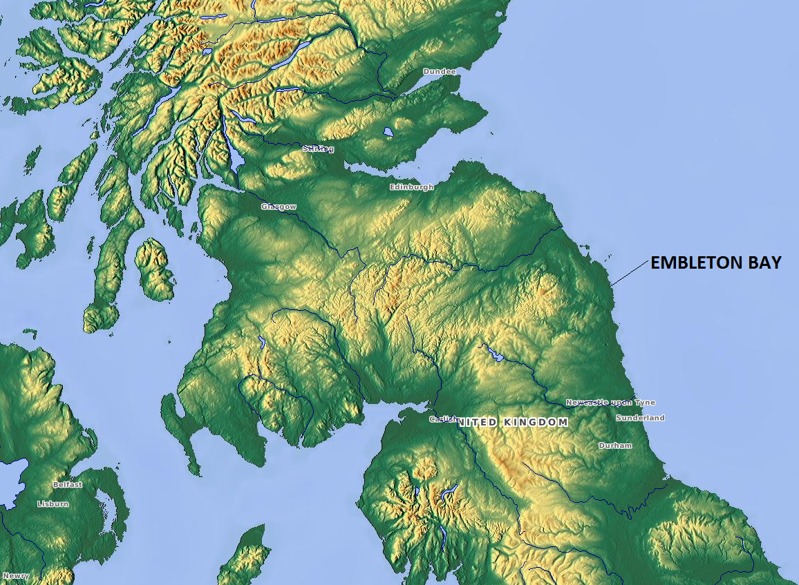
Embleton Bay

Embleton Bay is a bay on the North Sea, located to the east of the village of Embleton, Northumberland, England. It lies just to the south of Newton-by...

Beadnell

Beadnell is a village and civil parish in Northumberland, England. It is situated about 4 miles (6.4 km) south-east of Bamburgh, on the North Sea coast...

Related Videos

Belford to Fenwick, Northumberland Coast Path – Stage 5.

Walking the magnificent Northumberland Coast Path from Cresswell to Berwick-upon-Tweed. This is episode 5 of 6. Produced in ...

Beadnell - May Bank Holiday stroll in this popular seaside destination

Inspired by the beautiful sunshine albeit combined with a bitterly cold North wind, follow me as I stroll down to the Harbour and ...

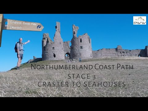
Craster to Seahouses, Northumberland Coast Path – Stage 3.

This is episode 3 of 6. Walking the magnificent Northumberland Coast Path from Cresswell to Berwick-upon-Tweed. Produced in ...

Nearby Amenities

Located within 500m of 55.531392,-1.6118676
Snook Point
Place: locality
Lat/Long: 55.529069/-1.6110089
Whittingham Carr
Place: locality
Lat/Long: 55.5318042/-1.6116605
The data included in this document is from www.openstreetmap.org. The data is made available under ODbL.

Have you been to Whittingham Carr?

Leave your review of Whittingham Carr below (or comments, questions and feedback).