Skerry of Lambaness

Island in Shetland

Scotland

Skerry of Lambaness

Storm Beach These boulders, thrown up by the waves to form a storm beach 30 metres above the sea, demonstrate the power of the seas which pound the exposed north side of Papa Stour
Storm Beach Credit: Anne Burgess

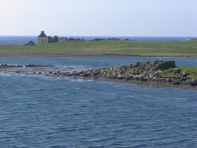
Skerry of Lambaness is a picturesque island located off the coast of Shetland, Scotland. With a total area of approximately 5 hectares, it is a relatively small but stunning destination for nature enthusiasts and birdwatchers.

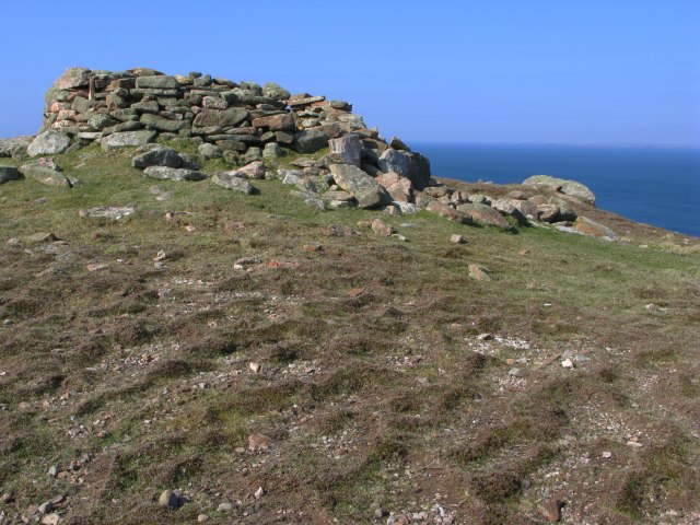
The island is characterized by its rugged cliffs and rocky terrain, providing a perfect habitat for a variety of seabirds. Visitors to Skerry of Lambaness can witness large colonies of Atlantic puffins, guillemots, razorbills, and kittiwakes nesting on the cliffs. The island is especially renowned for its puffins, with their distinctive colorful beaks and comical appearance.

Access to Skerry of Lambaness is limited due to its remote location, making it a secluded and tranquil spot for wildlife observation. It is recommended to visit the island by boat or organized tour, as there are no facilities or accommodations on the island itself.

Aside from its abundant birdlife, Skerry of Lambaness also offers breathtaking panoramic views of the surrounding sea and neighboring islands. On clear days, visitors can catch glimpses of seals and dolphins swimming in the waters, adding to the island's natural beauty.

Skerry of Lambaness is a protected area, designated as a Site of Special Scientific Interest (SSSI), to preserve its unique ecosystem and ensure the conservation of its diverse bird species. It serves as an important nesting ground and breeding site for several seabirds, contributing to the overall biodiversity of the region.

In summary, Skerry of Lambaness is a remote and enchanting island in Shetland, offering visitors a chance to immerse themselves in the awe-inspiring beauty of nature and witness a thriving seabird colony.

If you have any feedback on the listing, please let us know in the comments section below.

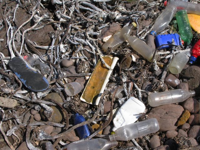
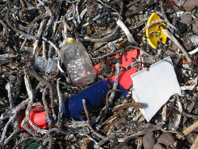
Skerry of Lambaness Images

Images are sourced within 2km of 60.345574/-1.7017803 or Grid Reference HU1662. Thanks to Geograph Open Source API. All images are credited.

Storm Beach These boulders, thrown up by the waves to form a storm beach 30 metres above the sea, demonstrate the power of the seas which pound the exposed north side of Papa Stour
Storm Beach
These boulders, thrown up by the waves to form a storm beach 30 metres above the sea, demonstrate the power of the seas which pound the exposed north side of Papa Stour
Ruined Meal Mills Several traditional mills straddle this little burn. Inside the building was a fixed lower millstone, and a rotating upper millstone driven by the water falling on to the paddles below, which were mounted at 45º to the vertical drive shaft.
Ruined Meal Mills
Several traditional mills straddle this little burn. Inside the building was a fixed lower millstone, and a rotating upper millstone driven by the water falling on to the paddles below, which were mounted at 45º to the vertical drive shaft.
The Loch that Ebbs and Flows The interior of Papa Stour is mainly moorland, though there are several lochans in the central part. This one's curious name reflects its closeness to the sea, from which it is cut off only by an ayre or shingle spit.
The Loch that Ebbs and Flows
The interior of Papa Stour is mainly moorland, though there are several lochans in the central part. This one's curious name reflects its closeness to the sea, from which it is cut off only by an ayre or shingle spit.
Lang Geo One of the many inlets typical of the north coast of Papa Stour.
Lang Geo
One of the many inlets typical of the north coast of Papa Stour.
The Wall This is the wall which cuts across the whole island. The west side (left) has a steep face to prevent animals climbing over it. The east (right) side has a sloping face so that any animals which have managed to cross it can easily be driven back on to the pasture land.
The Wall
This is the wall which cuts across the whole island. The west side (left) has a steep face to prevent animals climbing over it. The east (right) side has a sloping face so that any animals which have managed to cross it can easily be driven back on to the pasture land.
Robie's Noust This is a very dull shot of a square which would certainly have yielded a more interesting image if we had had time to explore it before the ferry left.
Robie's Noust
This is a very dull shot of a square which would certainly have yielded a more interesting image if we had had time to explore it before the ferry left.
The Dales As with the next-door square, HU1861 would certainly have yielded a more interesting shot if we had not had to rush to catch the ferry!
The Dales
As with the next-door square, HU1861 would certainly have yielded a more interesting shot if we had not had to rush to catch the ferry!
Remains of Observation Post The concrete and iron are the only remains of a World War Two observation post that used to stand here.  As can be seen from the image, in good visibility this location provides an excellent view of the surrounding area.
Remains of Observation Post
The concrete and iron are the only remains of a World War Two observation post that used to stand here. As can be seen from the image, in good visibility this location provides an excellent view of the surrounding area.
Rocky coastline
Rocky coastline
View from North Ness The view here is from North Ness towards the highest point on the island.

The ground shown in the foreground is typical of this rather barren area.
View from North Ness
The view here is from North Ness towards the highest point on the island. The ground shown in the foreground is typical of this rather barren area.
Oystercatcher nest with eggs This nest was located in the pebbles at the high-point of the beach.  The eggs are camouflaged to be hard to see amongst the pebbles - although thankfully these were just noticeable enough to escape being trodden on.

The oystercatchers seem to be surviving relatively well on the island, whilst the previously abundant tern population has been largely destroyed by the skuas.
Oystercatcher nest with eggs
This nest was located in the pebbles at the high-point of the beach. The eggs are camouflaged to be hard to see amongst the pebbles - although thankfully these were just noticeable enough to escape being trodden on. The oystercatchers seem to be surviving relatively well on the island, whilst the previously abundant tern population has been largely destroyed by the skuas.
Natural Arch by Sholma Wick The map marks this as a Natural Arch - one of many arches, subterranean passages or caves to be found on the island.
Natural Arch by Sholma Wick
The map marks this as a Natural Arch - one of many arches, subterranean passages or caves to be found on the island.
Plastic beach The beach had a depressingly large amount of plastic waste which had been washed up onto it.  This largely comprised plastic bottles , footwear, floats/buoys etc.

Most identifyable items originated in the UK, but a large subset were from Spain, Norway and Iceland.  This latter set probably represents the boats fishing in these waters and the manufacturers supplying those boats.
Plastic beach
The beach had a depressingly large amount of plastic waste which had been washed up onto it. This largely comprised plastic bottles , footwear, floats/buoys etc. Most identifyable items originated in the UK, but a large subset were from Spain, Norway and Iceland. This latter set probably represents the boats fishing in these waters and the manufacturers supplying those boats.
Plastic Beach A further selection of the plastic contamination in this area.
Plastic Beach
A further selection of the plastic contamination in this area.
Ruined meal mill The image shows the rear of one of the two mills at this location.  The image was taken from channel, now waterless, which fed water into the mill.
Ruined meal mill
The image shows the rear of one of the two mills at this location. The image was taken from channel, now waterless, which fed water into the mill.
Ruined mill The image shows a view of the front of the mill shown in <a href="https://www.geograph.org.uk/photo/799075">HU1660 : Ruined meal mill</a>.
Ruined mill
The image shows a view of the front of the mill shown in HU1660 : Ruined meal mill.
Ruins beside Hamna Voe There are no inhabited buildings left on this side of the island
Ruins beside Hamna Voe
There are no inhabited buildings left on this side of the island
Summit shelter The well constructed circular stone wall surrounds the triangulation pillar at the highest point on Papa Stour.  The wall provides excellent shelter from the inevitable Atlantic winds.
Summit shelter
The well constructed circular stone wall surrounds the triangulation pillar at the highest point on Papa Stour. The wall provides excellent shelter from the inevitable Atlantic winds.
Show me another place!

Skerry of Lambaness is located at Grid Ref: HU1662 (Lat: 60.345574, Lng: -1.7017803)

Unitary Authority: Shetland Islands

Police Authority: Highlands and Islands

What 3 Words

///strumming.pencil.shaver. Near Walls, Shetland Islands

Related Wikis

Papa Stour

Papa Stour (Scots: Papa Stour) is one of the Shetland Islands in Scotland, with a population of under fifteen people, some of whom immigrated after an...

Biggings

Biggings is a village on the island of Papa Stour, in Shetland, Scotland. Papa Stour's church is situated at the south of Biggings. A homestead of Duke...

Maiden Stack

The Maiden Stack or Frau Stack is a tiny stack in the western Shetland Islands to the north of Brei Holm and east of Housa Voe in Papa Stour. It is so...

Brei Holm

Brei Holm is a tiny tidal islet in the western Shetland Islands. It is due east of Papa Stour, to which it is connected at low tide, just outside Housa...

Have you been to Skerry of Lambaness?

Leave your review of Skerry of Lambaness below (or comments, questions and feedback).