Kinglya

Island in Shetland

Scotland

Kinglya

The croft of Harrier 1964 The skuas did not attack if you were on the island road, but it was always useful to carry a long bonxie stick, and wave it in the air above your head when they sized you up.
The croft of Harrier 1964 Credit: Julian Paren

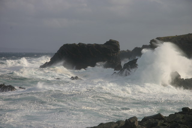
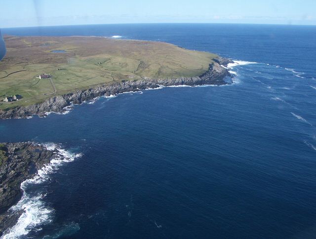
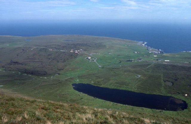
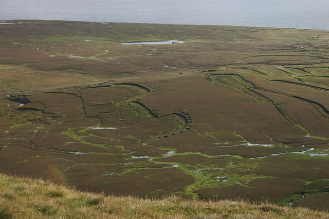
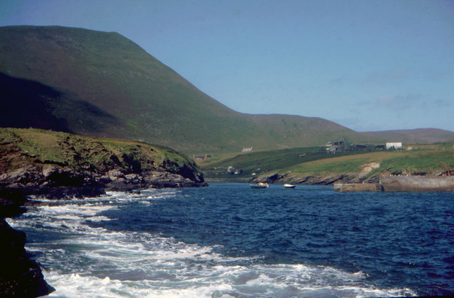
Kinglya is a small island located in the Shetland archipelago, situated off the northeastern coast of Scotland. It is part of the Shetland Islands Council area and is roughly 2.5 miles long and 1.5 miles wide. The island is characterized by rugged coastlines, beautiful sandy beaches, and rolling hills.

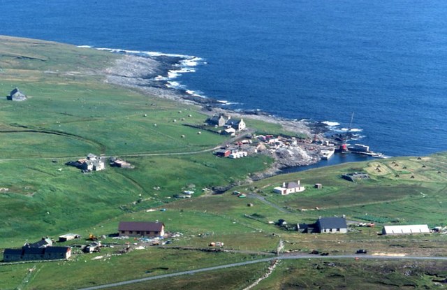
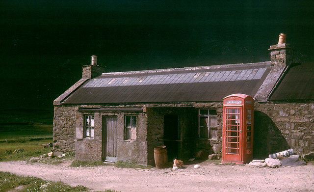
Despite its small size, Kinglya has a rich history dating back to the Viking era. The island is home to several archaeological sites, including ancient burial grounds and remains of Viking settlements. These historical remnants attract visitors interested in exploring the island's past.

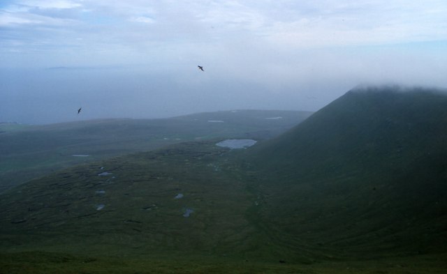
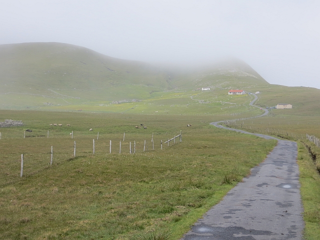
The island's landscape is dominated by lush green pastures, with grazing sheep dotting the countryside. Kinglya boasts a diverse range of flora and fauna, with wildflowers, seabirds, and seals being common sights around the island.

There are no permanent residents on Kinglya, and the island is mostly uninhabited. However, it does offer a tranquil retreat for those seeking solitude and a connection with nature. It is often used by locals and tourists for camping, birdwatching, and beachcombing.

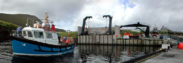
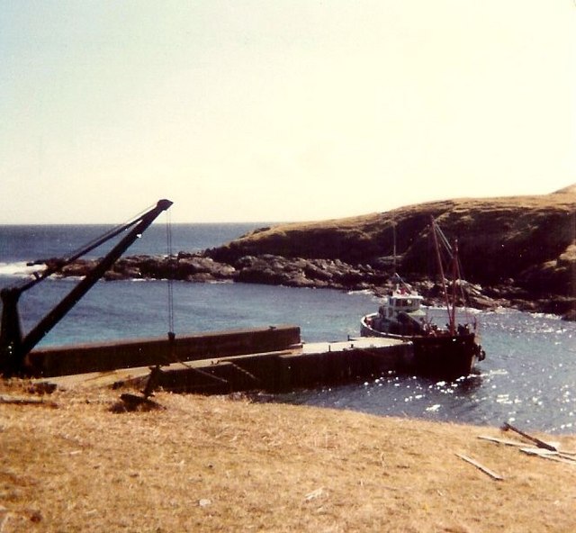
Access to Kinglya is primarily by boat, and visitors can arrange private charters or utilize the local ferry services. The island's remote location and untouched beauty make it an appealing destination for nature enthusiasts and those looking to escape the hustle and bustle of everyday life.

Overall, Kinglya is a picturesque island with a fascinating history and abundant natural beauty, offering visitors a peaceful and immersive experience in the heart of the Shetland Islands.

If you have any feedback on the listing, please let us know in the comments section below.

Kinglya Images

Images are sourced within 2km of 60.14266/-2.042047 or Grid Reference HT9739. Thanks to Geograph Open Source API. All images are credited.

The croft of Harrier 1964 The skuas did not attack if you were on the island road, but it was always useful to carry a long bonxie stick, and wave it in the air above your head when they sized you up.
The croft of Harrier 1964
The skuas did not attack if you were on the island road, but it was always useful to carry a long bonxie stick, and wave it in the air above your head when they sized you up.
Hiorawick and Strem Ness A storm prevented our leaving by boat or plane but created massive breakers in Hiorawick Bay
Hiorawick and Strem Ness
A storm prevented our leaving by boat or plane but created massive breakers in Hiorawick Bay
South Harrier Rough and improved grazings at South Harrier.  The hill at extreme left is The Kame, the second highest seacliffs in UK.
South Harrier
Rough and improved grazings at South Harrier. The hill at extreme left is The Kame, the second highest seacliffs in UK.
Da Baas o Stremness Waves were reaching tops of cliffs on this stormy day
Da Baas o Stremness
Waves were reaching tops of cliffs on this stormy day
Cliffs NE coast of Foula Stunted, salt-sprayed clifftop vegetation meets cliffs
Cliffs NE coast of Foula
Stunted, salt-sprayed clifftop vegetation meets cliffs
Foula ferry The 'New Advance' ferry leaves Foula for the Shetland mainland
Foula ferry
The 'New Advance' ferry leaves Foula for the Shetland mainland
Da Head o da Taing Taking off northwards from the airstrip, this is the last view of Foula from the plane. The small loch is Rossie's Loch.
Da Head o da Taing
Taking off northwards from the airstrip, this is the last view of Foula from the plane. The small loch is Rossie's Loch.
Hamnafield, Foula Hamnafield from the Sneug.
Hamnafield, Foula
Hamnafield from the Sneug.
Mill Loch, Foula With Ham beyond.
Mill Loch, Foula
With Ham beyond.
Ham, Foula The main settlement on the island. The breakwater at Ham Voe is under construction.
Ham, Foula
The main settlement on the island. The breakwater at Ham Voe is under construction.
Foula Post Office in 1964 The deeply shadowed Hamnafjeld is the background to the Post Office.
The Post Office and telephone box in 2013 have been photographed for Geograph by Richard Webb, <a href="https://www.geograph.org.uk/photo/3553344">HT9638 : Former post office, Foula</a>.
Foula Post Office in 1964
The deeply shadowed Hamnafjeld is the background to the Post Office. The Post Office and telephone box in 2013 have been photographed for Geograph by Richard Webb, HT9638 : Former post office, Foula.
Foula pier 1981 View of the pier at Ham, Foula, in 1981 with the cargo vessel 'Spes Clara' unloading water pipes and materials for the Foula water scheme.
Foula pier 1981
View of the pier at Ham, Foula, in 1981 with the cargo vessel 'Spes Clara' unloading water pipes and materials for the Foula water scheme.
Active peat cuttings at Lioag, Foula The 24 or so residents of Foula make extensive use of peat for fuel. A hydro scheme producing electricity uses the pressure of water from Ouvrafandal Loch, behind the photographer's position, coming down a pipe to the east, more or less where I sat to photograph
Active peat cuttings at Lioag, Foula
The 24 or so residents of Foula make extensive use of peat for fuel. A hydro scheme producing electricity uses the pressure of water from Ouvrafandal Loch, behind the photographer's position, coming down a pipe to the east, more or less where I sat to photograph
The Voe, Foula This inlet serves as a harbour for Foula.  Behind the head of the bay can be seen the Post Office and telephone box.  The few houses form the settlement of Ham.  Behind the hill of Hamnafield provides a good viewpoint over Ham and the rest of the island.
The Voe, Foula
This inlet serves as a harbour for Foula. Behind the head of the bay can be seen the Post Office and telephone box. The few houses form the settlement of Ham. Behind the hill of Hamnafield provides a good viewpoint over Ham and the rest of the island.
Aerial view, Stremness, Harrier
Skiordar Memorial And Seat A modest ridge in the N of the island of Foula in Shetland, Skiordar rises to around 75m (246 feet) 1¼ miles (2 km) north northwest of Ham. Extending out from the steep slopes characteristic of the west of the island, it is crossed by the road which runs to the north of the island. There is a memorial at its summit.
A great view today towards Gaada Stack.
Skiordar Memorial And Seat
A modest ridge in the N of the island of Foula in Shetland, Skiordar rises to around 75m (246 feet) 1¼ miles (2 km) north northwest of Ham. Extending out from the steep slopes characteristic of the west of the island, it is crossed by the road which runs to the north of the island. There is a memorial at its summit. A great view today towards Gaada Stack.
Northern end of the Foula Road Heading for Da North Toons on a foggy morning.
Northern end of the Foula Road
Heading for Da North Toons on a foggy morning.
Road, South Harrier Hopes were high that the mist would lift, it did not.
Road, South Harrier
Hopes were high that the mist would lift, it did not.
Show me another place!

Kinglya is located at Grid Ref: HT9739 (Lat: 60.14266, Lng: -2.042047)

Unitary Authority: Shetland Islands

Police Authority: Highlands and Islands

What 3 Words

///latest.fight.narrating. Near Walls, Shetland Islands

Related Wikis

Foula

Foula (), located in the Shetland archipelago of Scotland, is one of the United Kingdom's most remote permanently inhabited islands. Owned since the turn...

Foula Airfield

Foula Airfield (IATA: FOA) is an airfield located on the remote island of Foula, part of the Shetland Islands in the north of Scotland. == History == The...

RMS Oceanic (1899)

RMS Oceanic was a transatlantic ocean liner built for the White Star Line. She sailed on her maiden voyage on 6 September 1899 and was the largest ship...

Nearby Amenities

Located within 500m of 60.14266,-2.042047
Da Swaa
Place: locality
Source: OS_OpenData_StreetView
Lat/Long: 60.1449822/-2.0448663
Da Heoag
Place: locality
Source: OS_OpenData_StreetView
Lat/Long: 60.1417919/-2.0458072
The data included in this document is from www.openstreetmap.org. The data is made available under ODbL.

Have you been to Kinglya?

Leave your review of Kinglya below (or comments, questions and feedback).