Da Stack o da Gaads

Coastal Feature, Headland, Point in Shetland

Scotland

Da Stack o da Gaads

The croft of Harrier 1964 The skuas did not attack if you were on the island road, but it was always useful to carry a long bonxie stick, and wave it in the air above your head when they sized you up.
The croft of Harrier 1964 Credit: Julian Paren

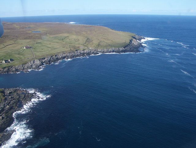
Da Stack o da Gaads is a prominent coastal feature located in the Shetland Islands, an archipelago in Scotland. This impressive geological formation is classified as a stack, which is a column of rock standing in the sea, detached from the mainland cliffs. It is situated on the eastern side of the mainland, near the village of Eshaness.

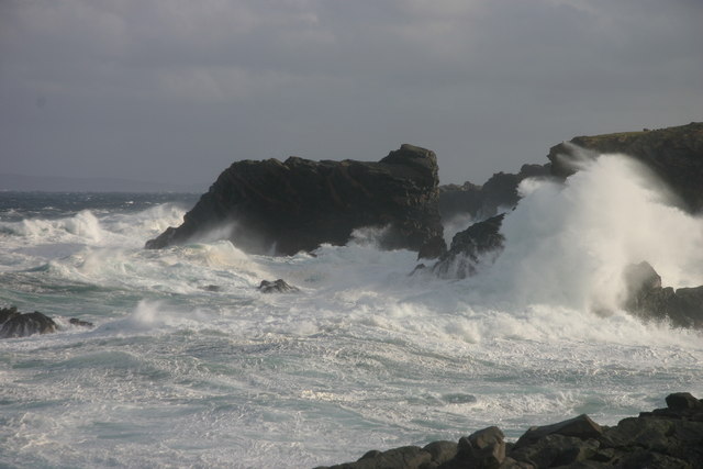
Rising majestically from the tumultuous North Atlantic Ocean, Da Stack o da Gaads reaches a height of approximately 60 meters (200 feet). Composed mainly of volcanic rock, the stack's rugged and sheer sides showcase the powerful forces of erosion and weathering that have shaped this coastal landscape over millennia.

The stack's name, "Da Stack o da Gaads," reflects the local Shetland dialect. "Da Stack" means "the stack," while "da gaads" translates to "the goats." This name is believed to have originated from the wild goats that once roamed the area, using the stack as a place of refuge.

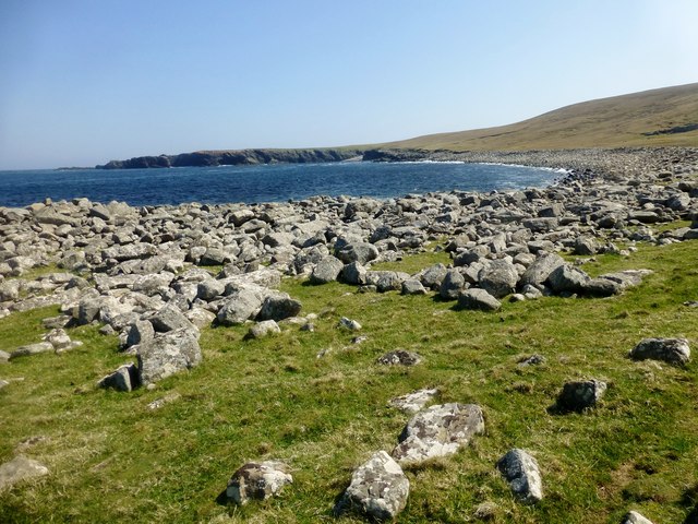
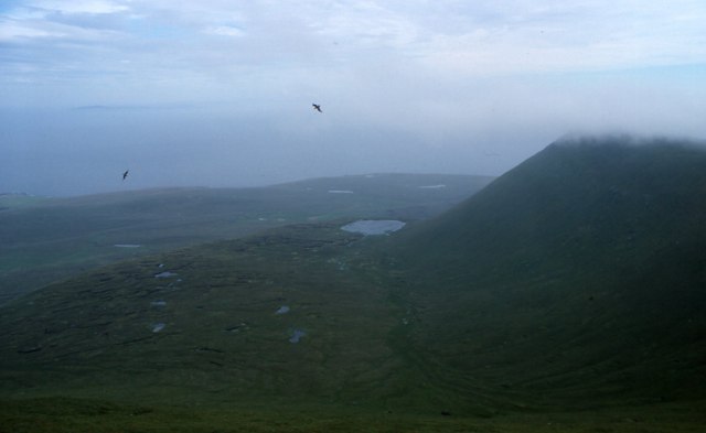
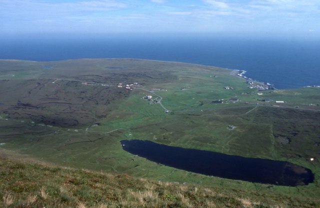
The surrounding area of Da Stack o da Gaads is characterized by dramatic cliffs, including the Eshaness Cliffs, which offer breathtaking views of the stack and the surrounding coastline. These cliffs are composed of layered rock formations, showcasing different geological periods and providing insights into the region's geological history.

Due to its striking beauty and geological significance, Da Stack o da Gaads has become a popular attraction for tourists and nature enthusiasts. Visitors can marvel at the stack's imposing presence and witness the impressive power of the ocean as waves crash against its base. It is also a haven for seabirds, with colonies of puffins, fulmars, and guillemots often seen nesting on its ledges.

If you have any feedback on the listing, please let us know in the comments section below.

Da Stack o da Gaads Images

Images are sourced within 2km of 60.14379/-2.0452535 or Grid Reference HT9739. Thanks to Geograph Open Source API. All images are credited.

The croft of Harrier 1964 The skuas did not attack if you were on the island road, but it was always useful to carry a long bonxie stick, and wave it in the air above your head when they sized you up.
The croft of Harrier 1964
The skuas did not attack if you were on the island road, but it was always useful to carry a long bonxie stick, and wave it in the air above your head when they sized you up.
Hiorawick and Strem Ness A storm prevented our leaving by boat or plane but created massive breakers in Hiorawick Bay
Hiorawick and Strem Ness
A storm prevented our leaving by boat or plane but created massive breakers in Hiorawick Bay
South Harrier Rough and improved grazings at South Harrier.  The hill at extreme left is The Kame, the second highest seacliffs in UK.
South Harrier
Rough and improved grazings at South Harrier. The hill at extreme left is The Kame, the second highest seacliffs in UK.
Da Baas o Stremness Waves were reaching tops of cliffs on this stormy day
Da Baas o Stremness
Waves were reaching tops of cliffs on this stormy day
Cliffs NE coast of Foula Stunted, salt-sprayed clifftop vegetation meets cliffs
Cliffs NE coast of Foula
Stunted, salt-sprayed clifftop vegetation meets cliffs
Aerial view, Stremness, Harrier
Hiorawick Coastal View Foula (population: 30) is one of Britain's most remote inhabited islands and leaves a lasting impression on everyone who visits.  Foula's natural heritage is exceptionally rich and diverse for such a small area. The name means 'Bird Island' in Old Norse and Foula is designated as a Special Protection Area (SPA) for birds, a National Scenic Area and a Site of Special Scientific Interest (SSSI) for its plants, birds and geology.
Hiorawick Coastal View
Foula (population: 30) is one of Britain's most remote inhabited islands and leaves a lasting impression on everyone who visits. Foula's natural heritage is exceptionally rich and diverse for such a small area. The name means 'Bird Island' in Old Norse and Foula is designated as a Special Protection Area (SPA) for birds, a National Scenic Area and a Site of Special Scientific Interest (SSSI) for its plants, birds and geology.
Skiordar Memorial And Seat A modest ridge in the N of the island of Foula in Shetland, Skiordar rises to around 75m (246 feet) 1¼ miles (2 km) north northwest of Ham. Extending out from the steep slopes characteristic of the west of the island, it is crossed by the road which runs to the north of the island. There is a memorial at its summit.
A great view today towards Gaada Stack.
Skiordar Memorial And Seat
A modest ridge in the N of the island of Foula in Shetland, Skiordar rises to around 75m (246 feet) 1¼ miles (2 km) north northwest of Ham. Extending out from the steep slopes characteristic of the west of the island, it is crossed by the road which runs to the north of the island. There is a memorial at its summit. A great view today towards Gaada Stack.
Northern end of the Foula Road Heading for Da North Toons on a foggy morning.
Northern end of the Foula Road
Heading for Da North Toons on a foggy morning.
Road, South Harrier Hopes were high that the mist would lift, it did not.
Road, South Harrier
Hopes were high that the mist would lift, it did not.
Harrier Ruined farm at the north end of Foula.
Harrier
Ruined farm at the north end of Foula.
Planticrub, Mucklegrind A tiny wooded patch, protected within a stone enclosure. Planticrubs were used to protect vegetable crops from the sheep and wind.
Planticrub, Mucklegrind
A tiny wooded patch, protected within a stone enclosure. Planticrubs were used to protect vegetable crops from the sheep and wind.
Croft land, Da Nort Toons The north side of Foula.
Croft land, Da Nort Toons
The north side of Foula.
Ristie and Gaada Stack The stack is just visible through the clag.
Ristie and Gaada Stack
The stack is just visible through the clag.
Foula ferry The 'New Advance' ferry leaves Foula for the Shetland mainland
Foula ferry
The 'New Advance' ferry leaves Foula for the Shetland mainland
Da Head o da Taing Taking off northwards from the airstrip, this is the last view of Foula from the plane. The small loch is Rossie's Loch.
Da Head o da Taing
Taking off northwards from the airstrip, this is the last view of Foula from the plane. The small loch is Rossie's Loch.
Hamnafield, Foula Hamnafield from the Sneug.
Hamnafield, Foula
Hamnafield from the Sneug.
Mill Loch, Foula With Ham beyond.
Mill Loch, Foula
With Ham beyond.
Show me another place!

Da Stack o da Gaads is located at Grid Ref: HT9739 (Lat: 60.14379, Lng: -2.0452535)

Unitary Authority: Shetland Islands

Police Authority: Highlands and Islands

What 3 Words

///donor.universe.cooked. Near Walls, Shetland Islands

Related Wikis

Foula

Foula (), located in the Shetland archipelago of Scotland, is one of the United Kingdom's most remote permanently inhabited islands. Owned since the turn...

Foula Airfield

Foula Airfield (IATA: FOA) is an airfield located on the remote island of Foula, part of the Shetland Islands in the north of Scotland. == History == The...

RMS Oceanic (1899)

RMS Oceanic was a transatlantic ocean liner built for the White Star Line. She sailed on her maiden voyage on 6 September 1899 and was the largest ship...

Nearby Amenities

Located within 500m of 60.14379,-2.0452535
Da Swaa
Place: locality
Source: OS_OpenData_StreetView
Lat/Long: 60.1449822/-2.0448663
Nort Veedal
Place: locality
Source: OS_OpenData_StreetView
Lat/Long: 60.1470902/-2.0513218
Da Sukkamires
Place: locality
Source: OS_OpenData_StreetView
Lat/Long: 60.1416581/-2.051935
Da Heoag
Place: locality
Source: OS_OpenData_StreetView
Lat/Long: 60.1417919/-2.0458072
The data included in this document is from www.openstreetmap.org. The data is made available under ODbL.

Have you been to Da Stack o da Gaads?

Leave your review of Da Stack o da Gaads below (or comments, questions and feedback).